National Register of Historic Places listings in Cascade County, Montana
This is a list of the National Register of Historic Places listings in Cascade County, Montana. It is intended to be a complete list of the properties and districts on the National Register of Historic Places in Cascade County, Montana, United States. The locations of National Register properties and districts for which the latitude and longitude coordinates are included below, may be seen in a map.[1]
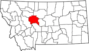
Location of Cascade County in Montana
There are 47 properties and districts listed on the National Register in the county, including 3 National Historic Landmarks.
- This National Park Service list is complete through NPS recent listings posted January 29, 2021.[2]
Listings county-wide
| [3] | Name on the Register | Image | Date listed[4] | Location | City or town | Description |
|---|---|---|---|---|---|---|
| 1 | J. C. Adams Stone Barn | 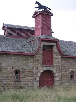 J. C. Adams Stone Barn |
January 12, 1979 (#79001399) |
Northeast of Sun River off U.S. Route 89 47°32′25″N 111°41′11″W |
Sun River | |
| 2 | Arvon Block | 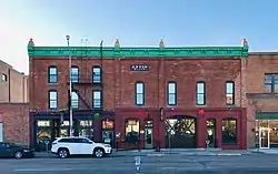 Arvon Block |
September 26, 1991 (#91001446) |
114-116 1st Ave., S. 47°30′14″N 111°18′15″W |
Great Falls | |
| 3 | Belt Commercial Historic District | 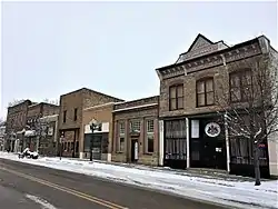 Belt Commercial Historic District |
December 23, 2004 (#04001380) |
Castner St. 47°23′12″N 110°55′39″W |
Belt | |
| 4 | Belt Jail | 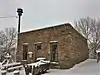 Belt Jail |
March 10, 1980 (#80002400) |
Castner St. 47°23′08″N 110°55′40″W |
Belt | |
| 5 | Burlingame School | June 1, 1992 (#92000575) |
Address Restricted |
Belt | ||
| 6 | Cascade County Courthouse | 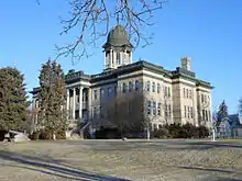 Cascade County Courthouse |
April 16, 1980 (#80002401) |
415 2nd Ave., N. 47°30′29″N 111°17′58″W |
Great Falls | |
| 7 | Chicago, Milwaukee and St. Paul Passenger Depot | _2002-05.jpg.webp) Chicago, Milwaukee and St. Paul Passenger Depot |
October 13, 1988 (#88001119) |
River Dr., N. 47°30′25″N 111°18′29″W |
Great Falls | |
| 8 | Timothy Edwards Collins Mansion | 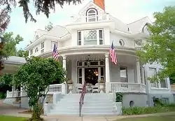 Timothy Edwards Collins Mansion |
August 27, 1980 (#80002402) |
1003-1017 2nd Ave., NW. 47°30′36″N 111°19′43″W |
Great Falls | |
| 9 | Crocker-Jarvi Homestead | June 1, 1992 (#92000572) |
Address Restricted |
Belt | ||
| 10 | East Side Neighborhood Historic District |  East Side Neighborhood Historic District |
April 19, 2016 (#16000185) |
Central Ave. and 1st Ave. between 15th and 16th Sts. 47°30′21″N 111°16′51″W |
Great Falls | |
| 11 | First Peoples Buffalo Jump | 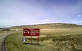 First Peoples Buffalo Jump |
July 21, 2015 (#15000623) |
First Peoples Buffalo Jump State Park 47°28′46″N 111°31′27″W |
Ulm vicinity | Either the largest buffalo jump in North America, or the world; and maybe the most utilized. |
| 12 | First United Methodist Church Parsonage | _-_Cascade_County%252C_Montana.png.webp) First United Methodist Church Parsonage |
December 23, 2003 (#03001329) |
113 6th St., N. 47°30′26″N 111°17′47″W |
Great Falls | |
| 13 | Lee M. Ford House | 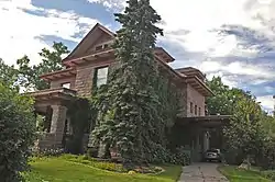 Lee M. Ford House |
August 10, 1990 (#90001215) |
401 4th Ave., N. 47°30′37″N 111°18′00″W |
Great Falls | |
| 14 | Fort Shaw Historic District and Cemetery |  Fort Shaw Historic District and Cemetery |
January 11, 1985 (#85000065) |
1 mile northwest of Fort Shaw 47°30′36″N 111°49′13″W |
Fort Shaw | |
| 15 | Great Falls Central Business Historic District | 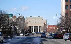 Great Falls Central Business Historic District |
August 20, 2004 (#04000374) |
2nd Ave., N., 1st Ave., N., Central Ave., and 1st Ave., S. 47°30′21″N 111°17′54″W |
Great Falls | |
| 16 | Great Falls Central High School | 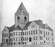 Great Falls Central High School |
September 1, 1976 (#76001120) |
1400 1st Ave., N. 47°30′21″N 111°16′55″W |
Great Falls | |
| 17 | Great Falls High School Historic District | _-_Cascade_County%252C_Montana.png.webp) Great Falls High School Historic District |
March 20, 2013 (#13000097) |
1900 2nd Ave., S. 47°30′05″N 111°16′29″W |
Great Falls | |
| 18 | Great Falls Northside Residential Historic District | 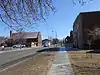 Great Falls Northside Residential Historic District |
April 1, 1991 (#91000355) |
200-900 blocks of 4th Ave., N., the 100-900 blocks of 3rd Ave., N., and the 500-900 blocks of 2nd Ave., N. 47°30′32″N 111°17′50″W |
Great Falls | |
| 19 | Great Falls Portage | 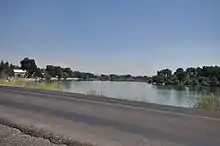 Great Falls Portage |
October 15, 1966 (#66000429) |
Southeast of Great Falls at the junction of U.S. Routes 87, 89, and 91 47°31′52″N 111°09′05″W |
Great Falls | |
| 20 | Great Falls Railroad Historic District | 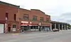 Great Falls Railroad Historic District |
February 19, 1993 (#93000038) |
Park and River Drs., the 100-400 blocks of 2nd St., S., the 100-200 blocks of 1st and 2nd Aves., S., and the 100-300 blocks of 3rd St., S. 47°30′14″N 111°17′48″W |
Great Falls | |
| 21 | Great Falls West Bank Historic District |  Great Falls West Bank Historic District |
August 30, 2010 (#10000587) |
300 and 400 blocks of 3rd Ave. NW 47°30′44″N 111°18′58″W |
Great Falls | |
| 22 | Hardy Bridge | 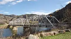 Hardy Bridge |
January 4, 2010 (#09001180) |
Milepost 6 on Old U.S. Route 91 47°10′01″N 111°50′04″W |
Cascade | |
| 23 | Heikkila-Mattila Homestead | June 1, 1992 (#92000573) |
Address Restricted |
Belt | ||
| 24 | Kraftenberg Homestead | June 1, 1992 (#92000574) |
Address Restricted |
Belt | ||
| 25 | Lewis-Nevala Homestead | June 1, 1992 (#92000576) |
Address Restricted |
Belt | ||
| 26 | Margaret Block | 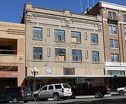 Margaret Block |
August 2, 1984 (#84002447) |
413-415 Central Ave. 47°30′20″N 111°17′57″W |
Great Falls | |
| 27 | Masonic Temple | 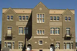 Masonic Temple |
December 28, 2000 (#00001568) |
821 Central Ave. 47°30′26″N 111°17′32″W |
Great Falls | |
| 28 | Monarch Depot Historic District | November 12, 2020 (#100005745) |
10 Montana Ave. 47°05′57″N 110°50′18″W |
Monarch | ||
| 29 | Mullan Road | Mullan Road |
March 13, 1975 (#75001080) |
North of Great Falls in the Benton Lake National Wildlife Refuge 47°41′49″N 111°19′10″W |
Great Falls | Extends into Benewah and Kootenai counties in Idaho |
| 30 | Neihart School | March 7, 2003 (#03000089) |
200 S. Main St. 46°55′45″N 110°43′51″W |
Neihart | ||
| 31 | Northern Montana State Fairground Historic District | 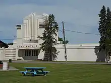 Northern Montana State Fairground Historic District |
January 13, 1989 (#88003143) |
3rd St., NW. 47°30′40″N 111°19′03″W |
Great Falls | |
| 32 | Old U.S. Highway 91 Historic District |  Old U.S. Highway 91 Historic District |
August 27, 2013 (#13000624) |
Between I-15 Spring Cr. (Exit 219) & Hardy Cr. (Exit 247) Interchanges 46°55′19″N 112°07′21″W |
Wolf Creek vicinity | Alignment of Old United States Route 91 along Missouri River. |
| 33 | Harry E. Randall House | 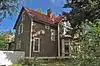 Harry E. Randall House |
March 27, 1986 (#86000583) |
1003 4th Ave., N. 47°30′36″N 111°17′21″W |
Great Falls | |
| 34 | Roberts Building | _-_Cascade_County%252C_Montana.png.webp) Roberts Building |
September 12, 1985 (#85002165) |
520-526 Central Ave. 47°30′18″N 111°17′49″W |
Great Falls | |
| 35 | Charles M. Russell House and Studio | 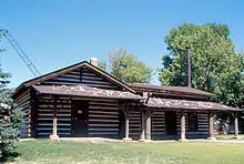 Charles M. Russell House and Studio |
October 15, 1966 (#66000430) |
1217-1219 4th Ave., N. 47°30′36″N 111°17′05″W |
Great Falls | |
| 36 | Charlie and Nancy Russell Honeymoon Cabin | December 16, 2005 (#05001408) |
20 Russell Dr., S. 47°16′12″N 111°41′53″W |
Cascade | ||
| 37 | St. Peter's Mission Church and Cemetery | 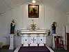 St. Peter's Mission Church and Cemetery |
August 3, 1984 (#84002452) |
West of Cascade 47°18′02″N 111°55′14″W |
Cascade | |
| 38 | Stone Homestead | June 1, 1992 (#92000577) |
Address Restricted |
Belt | ||
| 39 | Tenth Street Bridge | .jpg.webp) Tenth Street Bridge |
April 25, 1996 (#96000480) |
10th St. across the Missouri River 47°31′20″N 111°17′22″W |
Great Falls | |
| 40 | Tower Rock | _-_Cascade_County%252C_Montana.png.webp) Tower Rock |
March 18, 2002 (#02000213) |
8 miles south of Cascade at Interstate 15 interchange 247 47°11′00″N 111°48′51″W |
Cascade | |
| 41 | Ulm Pishkun | 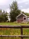 Ulm Pishkun |
December 17, 1974 (#74001093) |
Address Restricted |
Ulm | |
| 42 | Union Bethel African Methodist Episcopal Church | _-_Cascade_County%252C_Montana.png.webp) Union Bethel African Methodist Episcopal Church |
September 11, 2003 (#03000924) |
916 5th Ave., S. 47°29′58″N 111°17′25″W |
Great Falls | |
| 43 | Ursuline Academy | _-_Cascade_County%252C_Montana.png.webp) Ursuline Academy |
September 26, 1991 (#91001447) |
2300 Central Ave. 47°30′15″N 111°15′58″W |
Great Falls | |
| 44 | US Post Office and Courthouse-Great Falls | _-_Cascade_County%252C_Montana.png.webp) US Post Office and Courthouse-Great Falls |
March 14, 1986 (#86000681) |
215 1st Ave., N. 47°30′24″N 111°18′11″W |
Great Falls | |
| 45 | Robert Vaughn Homestead |  Robert Vaughn Homestead |
June 14, 1982 (#82003160) |
Vaughn Cemetery Rd. (Cascade County Rd.) 47°32′58″N 111°33′14″W |
Vaughn | |
| 46 | O.S. Warden Bridge | O.S. Warden Bridge |
March 26, 2012 (#12000168) |
10th Ave. S. across Missouri River 47°29′36″N 111°18′46″W |
Great Falls | part of the Montana's Steel Stringer and Steel Girder Bridges Multiple Property Submission |
| 47 | Wargelin-Warila Homestead | June 1, 1992 (#92000578) |
Address Restricted |
Belt |
Former listings
| [3] | Name on the Register | Image | Date listed | Date removed | Location | City or town | Summary |
|---|---|---|---|---|---|---|---|
| 1 | YMCA Building | 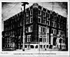 YMCA Building |
October 31, 1985 (#85003399) | June 3, 1986 | 101 First Ave. N |
Great Falls | Building torn down, replaced by a fast food franchise |
See also
| Wikimedia Commons has media related to National Register of Historic Places in Cascade County, Montana. |
References
- The latitude and longitude information provided in this table was derived originally from the National Register Information System, which has been found to be fairly accurate for about 99% of listings. Some locations in this table may have been corrected to current GPS standards.
- "National Register of Historic Places: Weekly List Actions". National Park Service, United States Department of the Interior. Retrieved on January 29, 2021.
- Numbers represent an alphabetical ordering by significant words. Various colorings, defined here, differentiate National Historic Landmarks and historic districts from other NRHP buildings, structures, sites or objects.
- The eight-digit number below each date is the number assigned to each location in the National Register Information System database, which can be viewed by clicking the number.
| Topics | |
|---|---|
| Lists by state |
|
| Lists by insular areas | |
| Lists by associated state | |
| Other areas | |
| Related | |
| |
Municipalities and communities of Cascade County, Montana, United States | ||
|---|---|---|
| City | Cascade County map | |
| Towns | ||
| CDPs | ||
| Unincorporated community | ||
| Indian reservation | ||
| ||
This article is issued from Wikipedia. The text is licensed under Creative Commons - Attribution - Sharealike. Additional terms may apply for the media files.