National Register of Historic Places listings in Kootenai County, Idaho
This is a list of the National Register of Historic Places listings in Kootenai County, Idaho.
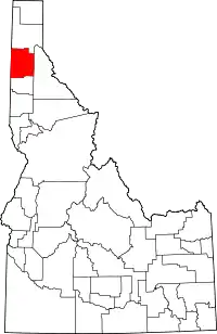
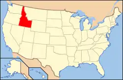
Location of Kootenai County in Idaho
This is intended to be a complete list of the properties and districts on the National Register of Historic Places in Kootenai County, Idaho, United States. Latitude and longitude coordinates are provided for many National Register properties and districts; these locations may be seen together in a map.[1]
There are 43 properties and districts listed on the National Register in the county, including 1 National Historic Landmark. More may be added; properties and districts nationwide are added to the Register weekly.[2]
- This National Park Service list is complete through NPS recent listings posted January 29, 2021.[3]
Current listings
| [4] | Name on the Register[5] | Image | Date listed[6] | Location | City or town | Description |
|---|---|---|---|---|---|---|
| 1 | Bayview School II | September 12, 1985 (#85002090) |
Careywood Rd. 47°59′02″N 116°33′46″W |
Bayview | ||
| 2 | Bellgrove School II | 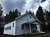 Bellgrove School II |
September 12, 1985 (#85002091) |
Hamaker Rd. 47°31′53″N 116°54′54″W |
Rockford Bay | |
| 3 | Cataldo Mission | 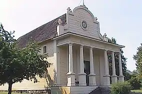 Cataldo Mission |
October 15, 1966 (#66000312) |
Off Interstate 90 47°32′55″N 116°21′30″W |
Cataldo | |
| 4 | Cave Lake School |  Cave Lake School |
September 12, 1985 (#85002092) |
State Highway 3 47°25′20″N 116°36′32″W |
Medimont | |
| 5 | Cedar Mountain School | _NRHP_85002093_Kootenai_County%252C_ID.jpg.webp) Cedar Mountain School |
September 12, 1985 (#85002093) |
Parks and Lewellyn Creek Rd. 47°55′34″N 116°38′06″W |
Athol | |
| 6 | Clark House | 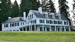 Clark House |
December 12, 1978 (#78001070) |
On Hayden Lake 47°45′22″N 116°43′34″W |
Clarksville | |
| 7 | Coeur d'Alene City Hall | 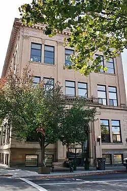 Coeur d'Alene City Hall |
August 3, 1979 (#79000792) |
5th and Sherman Sts. 47°40′23″N 116°46′48″W |
Coeur d'Alene | |
| 8 | Coeur d'Alene Federal Building | 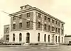 Coeur d'Alene Federal Building |
December 16, 1977 (#77000461) |
4th and Lakeside 47°40′28″N 116°46′53″W |
Coeur d'Alene | |
| 9 | Coeur d'Alene Masonic Temple |  Coeur d'Alene Masonic Temple |
May 22, 1978 (#78001071) |
525 Sherman Ave. 47°40′23″N 116°46′43″W |
Coeur d'Alene | |
| 10 | Cougar Gulch School III | 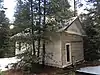 Cougar Gulch School III |
September 12, 1985 (#85002094) |
Cougar Gulch Rd. 47°38′12″N 116°55′20″W |
Post Falls | |
| 11 | Silas W. and Elizabeth Crane House | 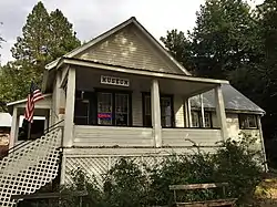 Silas W. and Elizabeth Crane House |
December 9, 1999 (#99001476) |
201 S. Coeur d'Alene Ave. 47°27′12″N 116°47′09″W |
Harrison | |
| 12 | Harvey M. Davey House | 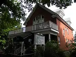 Harvey M. Davey House |
May 23, 1985 (#85001126) |
315 Wallace Ave. 47°40′37″N 116°46′54″W |
Coeur d'Alene | |
| 13 | East Hayden Lake School II | September 12, 1985 (#85002095) |
Hayden Lake Rd. 47°47′11″N 116°40′32″W |
Camp Mivoden | ||
| 14 | John A. Finch Caretaker's House | John A. Finch Caretaker's House |
September 14, 1987 (#87001562) |
2160 Finch Rd. 47°45′30″N 116°45′23″W |
Hayden Lake | |
| 15 | First United Methodist Church | 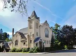 First United Methodist Church |
June 18, 1979 (#79000793) |
618 Wallace Ave. 47°40′35″N 116°46′37″W |
Coeur d'Alene | |
| 16 | Fort Sherman Buildings | 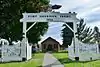 Fort Sherman Buildings |
October 25, 1979 (#79000794) |
North Idaho College campus 47°40′38″N 116°47′51″W |
Coeur d'Alene | |
| 17 | John P. and Stella Gray House | 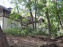 John P. and Stella Gray House |
March 31, 1988 (#88000272) |
521 S. 13th St. 47°40′08″N 116°46′06″W |
Coeur d'Alene | |
| 18 | Harrison Commercial Historic District | 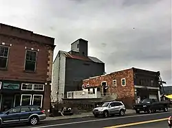 Harrison Commercial Historic District |
December 20, 1996 (#96001505) |
Roughly bounded by N. Lake Ave., W. Harrison St., N. Coeur d'Alene., and Pine St. 47°27′15″N 116°47′11″W |
Harrison | |
| 19 | Indian Springs School II | 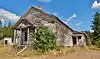 Indian Springs School II |
September 12, 1985 (#85002096) |
State Highway 3 47°25′20″N 116°37′23″W |
Medimont | |
| 20 | Inland Empire Electric Railway Substation | 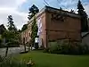 Inland Empire Electric Railway Substation |
June 27, 1975 (#75000633) |
Mullan Rd. and Northwest Boulevard 47°40′32″N 116°47′19″W |
Coeur d'Alene | |
| 21 | Kootenai County Courthouse |  Kootenai County Courthouse |
December 23, 1977 (#77000462) |
501 Government Way 47°40′38″N 116°47′12″W |
Coeur d'Alene | |
| 22 | Kootenai County Jail | 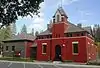 Kootenai County Jail |
August 10, 2001 (#01000834) |
802 2nd St. 47°48′40″N 116°53′40″W |
Rathdrum | |
| 23 | Lane School II | .jpg.webp) Lane School II |
September 12, 1985 (#85002097) |
Lanz Rd. 47°30′25″N 116°32′05″W |
Lane | |
| 24 | McGuires School | 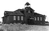 McGuires School |
September 12, 1985 (#85002098) |
Corbin Rd. and Old Highway 10 47°43′01″N 116°59′29″W |
McGuire | Destroyed by fire in 1987.[7] |
| 25 | Mooney–Dahlberg Farmstead | 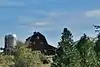 Mooney–Dahlberg Farmstead |
December 30, 2009 (#09001163) |
5803 Riverview Dr. 47°41′23″N 116°50′59″W |
Coeur d'Alene | |
| 26 | Mullan Road |  Mullan Road |
April 5, 1990 (#90000548) |
3 segments: between Alder Creek and Cedar Creek; Fourth of July Pass between Interstate 80 and old U.S. Route 10; Heyburn State Park 47°37′10″N 116°31′06″W |
Coeur d'Alene | Extends into Benewah County |
| 27 | Pen d'Oreille City |  Pen d'Oreille City |
November 19, 2019 (#100004674) |
Address Restricted |
Athol | |
| 28 | Pleasant View School II | 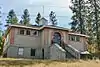 Pleasant View School II |
September 12, 1985 (#85002099) |
Pleasant View Rd. 47°41′27″N 117°00′09″W |
Pleasant View | |
| 29 | Post Falls Community United Presbyterian Church | 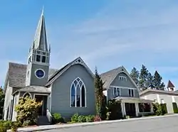 Post Falls Community United Presbyterian Church |
September 7, 1984 (#84003851) |
4th and William Sts. 47°42′41″N 116°56′43″W |
Post Falls | |
| 30 | Prairie School II | 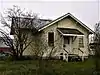 Prairie School II |
September 12, 1985 (#85002100) |
Prairie Ave. 47°44′40″N 116°51′33″W |
Coeur d'Alene | |
| 31 | Rathdrum State Bank | 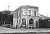 Rathdrum State Bank |
November 8, 1974 (#74000742) |
Main and Mill Sts. 47°48′41″N 116°53′49″W |
Rathdrum | Building no longer exists. |
| 32 | Roosevelt School | 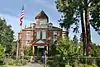 Roosevelt School |
July 30, 1976 (#76000676) |
1st and Wallace Sts. 47°40′38″N 116°47′06″W |
Coeur d'Alene | |
| 33 | Rose Lake School II | 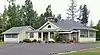 Rose Lake School II |
September 12, 1985 (#85002101) |
Queen St. and State Highway 3 47°32′19″N 116°28′25″W |
Rose Lake | |
| 34 | St. Stanislaus Kostka Mission | 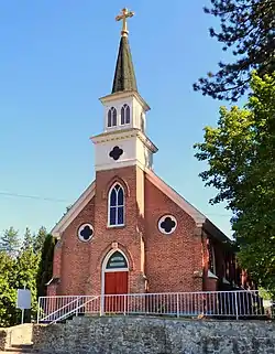 St. Stanislaus Kostka Mission |
November 17, 1977 (#77000464) |
McCartney and 2nd Sts. 47°48′38″N 116°53′43″W |
Rathdrum | |
| 35 | St. Thomas Catholic Church | 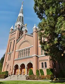 St. Thomas Catholic Church |
October 5, 1977 (#77000463) |
919 Indiana Ave. 47°40′34″N 116°46′25″W |
Coeur d'Alene | |
| 36 | Sherman Park Addition | 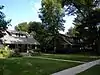 Sherman Park Addition |
April 27, 1992 (#92000418) |
Bounded by Garden Ave., Hubbard St., Lakeshore Dr., and Park Dr. 47°40′33″N 116°47′36″W |
Coeur d'Alene | |
| 37 | Spirit Lake Historic District | 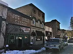 Spirit Lake Historic District |
February 8, 1979 (#79000795) |
Maine St. 47°57′55″N 116°52′13″W |
Spirit Lake | |
| 38 | Spokane Valley Land and Water Company Canal | 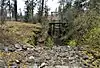 Spokane Valley Land and Water Company Canal |
March 20, 2003 (#03000124) |
Diverts in Falls Park, 4th St. 47°42′44″N 116°57′20″W |
Post Falls | |
| 39 | Jacob and Cristina Thunborg House | September 12, 1985 (#85002156) |
Chicken Point 47°46′51″N 116°40′59″W |
Hayden Lake | ||
| 40 | Treaty Rock | 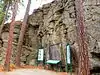 Treaty Rock |
April 30, 1992 (#92000420) |
North of Interstate 90, northeast of the Spokane River falls 47°42′48″N 116°57′06″W |
Post Falls | |
| 41 | Upper Twin Lakes School |  Upper Twin Lakes School |
September 12, 1985 (#85002102) |
Twin Lakes Rd. 47°53′40″N 116°54′43″W |
Silver Sands Beach | |
| 42 | Washington Water Power Bridges | 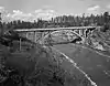 Washington Water Power Bridges |
December 20, 1996 (#96001507) |
0.5 miles west of the junction of Spokane and 4th Sts. 47°42′40″N 116°57′12″W 47°42′41″N 116°57′22″W |
Post Falls | |
| 43 | Samuel and Ann Young House | 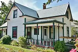 Samuel and Ann Young House |
July 9, 1997 (#97000765) |
120 4th Ave. 47°42′39″N 116°56′49″W |
Post Falls |
See also
| Wikimedia Commons has media related to National Register of Historic Places in Kootenai County, Idaho. |
References
- The latitude and longitude information provided in this table was derived originally from the National Register Information System, which has been found to be fairly accurate for about 99% of listings. Some locations in this table may have been corrected to current GPS standards.
- "National Register of Historic Places: Weekly List Actions". National Park Service. Retrieved March 29, 2009.
- "National Register of Historic Places: Weekly List Actions". National Park Service, United States Department of the Interior. Retrieved on January 29, 2021.
- Numbers represent an alphabetical ordering by significant words. Various colorings, defined here, differentiate National Historic Landmarks and historic districts from other NRHP buildings, structures, sites or objects.
- "National Register Information System". National Register of Historic Places. National Park Service. April 24, 2008.
- The eight-digit number below each date is the number assigned to each location in the National Register Information System database, which can be viewed by clicking the number.
- Post Falls School District History (PDF), Post Falls School District, December 2010, archived from the original (PDF) on April 14, 2015, retrieved April 7, 2015.
| Topics | |
|---|---|
| Lists by state |
|
| Lists by insular areas | |
| Lists by associated state | |
| Other areas | |
| Related | |
| |
Municipalities and communities of Kootenai County, Idaho, United States | ||
|---|---|---|
| Cities | Map of Idaho highlighting Kootenai County | |
| CDPs | ||
| Unincorporated communities | ||
| Indian reservation | ||
| Footnotes | ‡This populated place also has portions in an adjacent county or counties | |
| ||
This article is issued from Wikipedia. The text is licensed under Creative Commons - Attribution - Sharealike. Additional terms may apply for the media files.