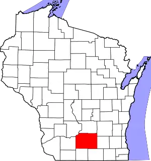
National Register of Historic Places listings in Dane County, Wisconsin
This is a list of the National Register of Historic Places listings in Dane County, Wisconsin. It aims to provide a comprehensive listing of buildings, sites, structures, districts, and objects in Dane County, Wisconsin listed on the National Register of Historic Places.
The locations of National Register properties for which the latitude and longitude coordinates are included below may be seen in a map.[1]
There are 248 properties and districts listed on the National Register in Dane County, including 10 National Historic Landmarks. 152 of these properties and districts, including 8 of the National Historic Landmarks, are located in the city of Madison; these are listed separately, while the remaining 96 properties and districts are listed below. An additional site was once listed on the National Register but has been removed.
- This National Park Service list is complete through NPS recent listings posted January 29, 2021.[2]
Current listings
| [3] | Name on the Register | Image | Date listed[4] | Location | City or town | Description |
|---|---|---|---|---|---|---|
| 1 | Francis Marian Ames Farmstead | 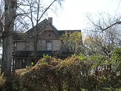 Francis Marian Ames Farmstead |
November 5, 1992 (#92001555) |
221 US 14 42°51′26″N 89°20′40″W |
Rutland | Queen Anne-style house decorated with bargeboards, spindled porch and lead glass windows, built in 1892, and some outbuildings. |
| 2 | Bedrud-Olson Farmstead | 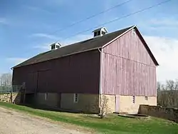 Bedrud-Olson Farmstead |
April 1, 1999 (#99000429) |
996 E. Church Rd. 42°57′12″N 89°05′14″W |
Christiana | Largely intact tobacco and dairy farm, with 1883 dairy barn, three tobacco-curing sheds built around 1890, and a tobacco-stripping shed built in 1910. |
| 3 | Belleville Illinois Central Railroad Depot | 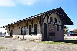 Belleville Illinois Central Railroad Depot |
December 6, 2016 (#16000831) |
109 S. Park St. 42°51′31″N 89°31′58″W |
Belleville | Italianate-styled depot built in 1887-88 by the Illinois Central Railroad. Passenger service stopped in 1931 - freight in 1943. |
| 4 | Bram Mound Group |  Bram Mound Group |
March 25, 1993 (#93000216) |
Address Restricted |
Dunn | 3 linear mounds and 1 low conical mound near Lake Waubesa.[5][6] |
| 5 | Brown-Sewell House |  Brown-Sewell House |
April 22, 2003 (#03000307) |
101 S. Fifth St. 42°55′05″N 89°12′59″W |
Stoughton | Greek Revival-styled house built in 1859 for Lyman Brown. Later owned by Rev. Robert Sewell and Elizabeth, of First Congregational Church. |
| 6 | Cambridge Public School and High School |  Cambridge Public School and High School |
June 23, 1998 (#98000708) |
103 South St. 43°00′06″N 89°00′54″W |
Cambridge | 2-story red brick Georgian Revival/Romanesque Revival school built in 1906, after the previous wooden school burned. |
| 7 | Chase Grain Elevator |  Chase Grain Elevator |
August 12, 2010 (#10000540) |
123 Railroad St. 43°10′43″N 89°12′53″W |
Sun Prairie | Small-town grain storage structure built along a rail line in 1922. The previous wooden elevator on this site burned, so the silos of this elevator were rebuilt of tile, aiming to avoid another fire. |
| 8 | Jens and Ingeborg Cold House |  Jens and Ingeborg Cold House |
March 26, 2003 (#03000169) |
111 S Fifth St. 42°55′05″N 89°12′58″W |
Stoughton | The side-gabled, 1.5-story section was built in 1858. The 2-story Queen Anne-styled section with the tower was added in 1892, when that style was in vogue. |
| 9 | College Hills Historic District |  College Hills Historic District |
December 9, 2002 (#02001518) |
Roughly bounded by Colombia Rd., Amherst Dr., Bowdoin Rd., Corporate Limit, University Bay, and Harvard Dr. 43°04′45″N 89°26′20″W |
Shorewood Hills | Residential neighborhood developed starting in 1914, with views of Lake Mendota and the UW campus, with most homes in Prairie School, Craftsman, and period revival styles. |
| 10 | Dr. Charles G. Crosse House | 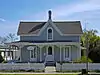 Dr. Charles G. Crosse House |
February 24, 1993 (#93000029) |
133 W. Main St. 43°10′59″N 89°12′54″W |
Sun Prairie | Carpenter Gothic-style house with ornate bargeboards built ca. 1865. Charles was an early doctor, newspaper-man, civic leader, and state legislator. |
| 11 | Henry L. and Sarah Dahle House | 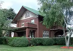 Henry L. and Sarah Dahle House |
November 26, 2003 (#03001218) |
312 S. Fourth St. 43°00′16″N 89°44′07″W |
Mount Horeb | Prairie style home with wide eaves and brick and stucco exterior, designed by Claude and Starck and built in 1916. Henry was involved in his family's businesses. |
| 12 | Herman B. and Anne Marie Dahle House | 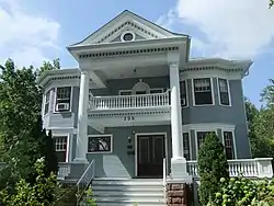 Herman B. and Anne Marie Dahle House |
November 26, 2003 (#03001217) |
200 N. Second St. 43°00′39″N 89°44′19″W |
Mount Horeb | Grand Classical Revival home with porch framed in 2-story columns and pediment, designed by James O. Gordon and built in 1911. Herman and his brothers ran a general store and bank in Mount Horeb. |
| 13 | Onon B. and Betsy Dahle House | 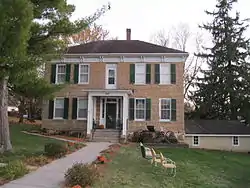 Onon B. and Betsy Dahle House |
April 16, 2008 (#08000322) |
10779 Evergreen Ave. 42°54′57″N 89°48′56″W |
Perry | Greek Revival/Italianate-style home built in 1864 by the Norwegian immigrant for whom Daleyville is named. Onon started the first general store there and became a civic leader. |
| 14 | John Sweet Donald Farmstead | 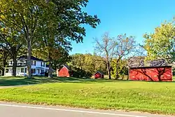 John Sweet Donald Farmstead |
June 7, 1984 (#84003633) |
1972 WI 92 42°57′52″N 89°41′08″W |
Springdale | Farm begun in 1855 by Presbyterian minister and his family. His grandson John later ran the farm while serving in the state legislature as a Progressive Republican and an agriculture educator. |
| 15 | Adam Dunlap Farmstead | 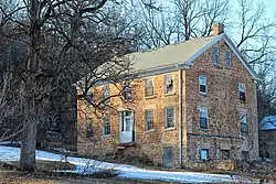 Adam Dunlap Farmstead |
November 15, 2001 (#01001242) |
9646 Dunlap Hollow Rd. 43°12′28″N 89°43′53″W |
Mazomanie | Early farm begun in 1846 by Yankees from New York state. Stone structures survive that were built around 1848: the Greek Revival-styled house, a barn, and an ice house/spring house. |
| 16 | Dunroven House | 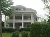 Dunroven House |
November 28, 1980 (#80000120) |
7801 Dunroven Rd. 43°17′04″N 89°28′23″W |
Dane | Tobacco/dairy farm begun around 1870 by Abram Asa Boyce, who later served in the state legislature. About 1910 E.W. de Bower expanded the house to grand Colonial Revival style. Sandstone powerhouse stands behind.[7][8] |
| 17 | East End Historic District | 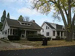 East End Historic District |
July 25, 2003 (#03000699) |
7002-7016 Hubbard Ave., 1812-1916 Park St. (even only) 7002-7227,7233,7235,7237 Elmwood Ave. 43°05′45″N 89°30′12″W |
Middleton | Neighborhood of modest houses built from the 1920s to 1950s in styles of that era - mostly period revival with a few bungalows. |
| 18 | East Park Historic District | 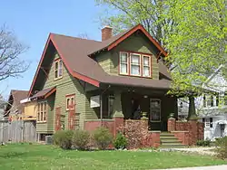 East Park Historic District |
May 1, 2003 (#03000335) |
108-324 S. Lynn St., 700-816 Park St., and East Park 42°55′02″N 89°12′41″W |
Stoughton | Neighborhood of modest homes, mostly built from 1913 to 1921, and mostly bungalows or Craftsman-styled. |
| 19 | East Side Historic District |  East Side Historic District |
January 9, 1997 (#96001577) |
Roughly bounded by Ridge, Henry, Vernon, and Academy Sts. 42°55′06″N 89°12′31″W |
Stoughton | Neighborhood of stylish homes built mostly from 1890 to 1915, with the majority styled Queen Anne. |
| 20 | First Lutheran Church | 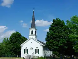 First Lutheran Church |
June 16, 1988 (#88000728) |
Pleasant View Rd. at Old Sauk Rd. 43°04′31″N 89°32′11″W |
Middleton | Gothic Revival-styled church built by a German congregation in 1866, with its steeple expanded in 1885. |
| 21 | First National Bank | .JPG.webp) First National Bank |
October 16, 2007 (#07001096) |
113 N. Main St. 42°55′36″N 89°23′04″W |
Oregon | Small Neoclassical-styled bank built in 1914, which operated until 1929 when it closed after the stock market crash that led to the Great Depression. |
| 22 | First Unitarian Society Meeting House | 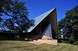 First Unitarian Society Meeting House |
April 11, 1973 (#73000076) |
900 University Bay Dr. 43°04′34″N 89°26′04″W |
Shorewood Hills | Dramatic building designed by Frank Lloyd Wright for his own Unitarian congregation. Built 1949-51. |
| 23 | Fort Blue Mounds | 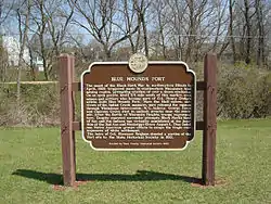 Fort Blue Mounds |
September 24, 2001 (#01001044) |
Address Restricted |
Blue Mounds | Site where in 1832 Colonel Ebenezer Brigham and residents of Blue Mounds, on hearing events of the Black Hawk War, threw up an oak stockade for refuge. |
| 24 | Fox Hall | 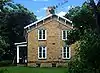 Fox Hall |
December 1, 1983 (#83004273) |
5183 County Hwy. M 42°56′57″N 89°24′01″W |
Fitchburg | Intact grand farmhouse built in 1856 for Irish immigrant George Fox, with walls of local sandstone and an unusual frieze-bracket-window arrangement under the eaves. Stayed in the Fox family for many generations.[9][10][11] |
| 25 | Frey School |  Frey School |
July 14, 2011 (#11000461) |
8847 County Road Y 43°14′58″N 89°40′19″W |
Roxbury | Intact one-room school with sandstone walls built in 1870. |
| 26 | John Fritz Farmstead | 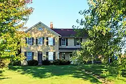 John Fritz Farmstead |
July 15, 1998 (#98000879) |
642 Fritz Rd. 42°53′24″N 89°35′46″W |
Montrose | Early farm begun by Bavarian immigrant Fritz and his family. Still extant are the 1853 farmhouse, a basement barn from the late 1800s, and a granary built around 1900. |
| 27 | Fuhremann Canning Company Factory |  Fuhremann Canning Company Factory |
September 15, 2004 (#04001003) |
151 Market St. 43°10′51″N 89°12′40″W |
Sun Prairie | 3-story utilitarian-styled factory built of wood in 1912, and clad in brick in 1943, where locally-grown peas and corn were graded, picked, canned, and many shipped out on the nearby Milwaukee Road. Operated until 2000.[12][13] |
| 28 | John and Flora Gilbert House | 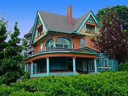 John and Flora Gilbert House |
September 6, 2007 (#07000933) |
357 N. Main St. 42°55′54″N 89°23′02″W |
Oregon | Classic Queen Anne-style house built in 1906 by retired farmer John Gilbert. |
| 29 | Sereno W. Graves House | 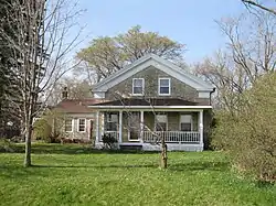 Sereno W. Graves House |
September 29, 1982 (#82000651) |
4006 Old Stage Rd. 42°51′49″N 89°18′50″W |
Rutland | Greek Revival-styled house with limestone walls built by Vermont-native Graves in 1845 for his own family. Graves was later a state legislator. |
| 30 | Nicholas Haight Farmstead |  Nicholas Haight Farmstead |
October 29, 1993 (#93001162) |
4926 Haight Farm Rd. 43°00′08″N 89°22′42″W |
Fitchburg | Edwin Spooner of Massachusetts started the farm in 1852, building the first section of the Greek Revival-styled house around 1855. Haight bought the farm in 1867 and added the smokehouse, barn, corn crib and granary before 1900.[14][15] |
| 31 | Samuel Hall House |  Samuel Hall House |
December 23, 1993 (#93001445) |
974 Hillside Rd. 42°54′03″N 89°02′31″W |
Albion | Greek Revival-style house with limestone walls built in 1856 for Hall, an English immigrant, Primitive Methodist, and farmer. |
| 32 | Hauge Log Church |  Hauge Log Church |
December 31, 1974 (#74000071) |
1 mi (1.6 km). north of Daleyville on CR Z 42°55′48″N 89°49′13″W |
Daleyville | Simple church built in 1852 by two competing strains of Norwegian Lutherans. Cooperation didn't last long. It was the first Norwegian Lutheran Church built in western Wisconsin. |
| 33 | Heim Mound |  Heim Mound |
March 31, 2004 (#04000254) |
Address Restricted 43°05′38″N 89°29′21″W |
Middleton | Large effigy of a fox or wolf.[16] |
| 34 | Heiney's Meat Market | 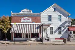 Heiney's Meat Market |
September 27, 1984 (#84003642) |
1221 Mills St. 43°08′16″N 89°44′52″W |
Black Earth | Victorian house built in 1869, to which David Heiney added a one story brick store for his meat market in 1911. |
| 35 | Hoff Department Store |  Hoff Department Store |
February 14, 1989 (#89000005) |
101-103 Main St. 43°00′30″N 89°44′16″W |
Mount Horeb | Block-long brick store built by Andrew Hoff 1916-17. |
| 36 | Hornung Mound Group |  Hornung Mound Group |
April 26, 1996 (#96000497) |
Address Restricted |
Roxbury | Group of effigy mounds including a bird, a bear, and water spirits - unusual because not near a large body of water.[17][18] |
| 37 | Samuel Hunt House | 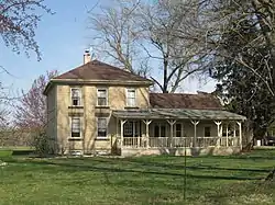 Samuel Hunt House |
September 30, 1982 (#82000652) |
632 Center Rd. 42°52′51″N 89°18′35″W |
Rutland | Italianate-styled house with walls of coursed sandstone, built in 1855, probably designed by Sereno Graves. |
| 38 | Gaute Ingebretson Loft House | 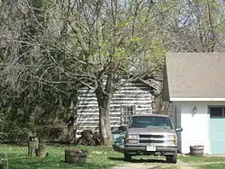 Gaute Ingebretson Loft House |
March 13, 1987 (#87000437) |
1212 Pleasant Hill Rd. 42°54′47″N 89°10′12″W |
Stoughton | Traditional Norwegian log house with dovetail joints and cantilevered loft, built around 1844, right after Gaute Ingebretson immigrated. |
| 39 | Iverson-Johnson House |  Iverson-Johnson House |
January 21, 1988 (#87002501) |
327 E. Washington St. 42°55′02″N 89°13′00″W |
Stoughton | Queen Anne-style home with unusual Nordic dragon-heads decorating the gable peaks, built in 1898 for a Norwegian-immigrant physician. |
| 41 | Gulbrand and Bertha Jensvold House | 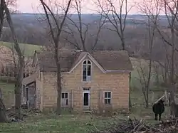 Gulbrand and Bertha Jensvold House |
April 30, 2008 (#08000370) |
1033 WI 78 42°54′44″N 89°49′01″W |
Perry | Limestone-walled farmhouse with elements of Gothic Revival style, built in 1869 just across from Perry Lutheran church for its teacher and "klokker." |
| 42 | Kehl Winery |  Kehl Winery |
January 2, 1976 (#76000056) |
East of Prairie du Sac on WI 188 43°17′19″N 89°42′27″W |
Roxbury | Structures from German immigrant Peter Kehl's pioneer vineyard overlooking the Wisconsin River: 1857 barrel-vaulted wine cellar,[19] 1858 house with fine stonework,[20] and 1859 Italianate-styled brewery.[21] Frost killed all Kehl's vines in 1899. Wollersheims restarted the winery in 1972.[22] |
| 43 | John and Margarethe Kemp Cabin | 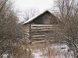 John and Margarethe Kemp Cabin |
December 10, 2008 (#08001187) |
6950 WI Hwy. 78 43°13′51″N 89°43′35″W |
Mazomanie | Rustic log cabin built by a family of Prussian immigrants in 1863 on their homestead near the Wisconsin River. |
| 44 | Friederich Kohlmann House | 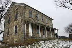 Friederich Kohlmann House |
December 27, 1974 (#74000075) |
West of Springfield Corners off WI 19 43°11′10″N 89°38′22″W |
Springfield Corners | Farmhouse built by a German immigrant in 1867, with walls of fieldstone carried in by Indians. |
| 45 | Robert M. LaFollette House | .jpg.webp) Robert M. LaFollette House |
October 15, 1966 (#66000020) |
733 Lakewood Blvd. 43°06′57″N 89°22′22″W |
Maple Bluff | Italianate-styled home occupied in later life by the Wisconsin governor and Progressive reformer. |
| 46 | Lewis Mound Group (47-Da-74) |  Lewis Mound Group (47-Da-74) |
December 15, 1984 (#84000809) |
Burma Road, in Indian Mound Park Coordinates missing |
McFarland | Mounds created by Late Woodland people overlooking Lake Waubesa, including a bear effigy, a hook-shaped mound, and some geometric shapes.[23][24] |
| 47 | Library Park | 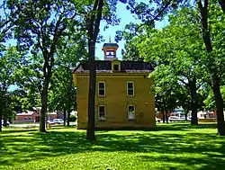 Library Park |
January 26, 1981 (#81000038) |
Bounded by Vine, Main, Park and Pearl Sts. 42°51′33″N 89°32′00″W |
Belleville | Multi-purpose village hall built in 1894 on Belleville's village green. |
| 48 | Aslak Lie Cabin |  Aslak Lie Cabin |
April 3, 1986 (#86000622) |
3022 County Trunk P 43°01′14″N 89°40′05″W |
Mount Horeb | Two-story cabin built in 1848 by an immigrant master craftsman, mixing Norwegian folk construction with more modern American techniques. |
| 49 | Lincoln Street Historic District | 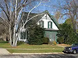 Lincoln Street Historic District |
April 12, 2006 (#06000276) |
W. Lincoln St., bet. Main St. and Market St. 42°55′55″N 89°23′04″W |
Oregon | Neighborhood of five intact historic homes built from 1871 to 1900. |
| 50 | Little Norway | 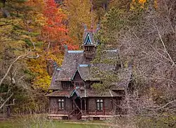 Little Norway |
March 16, 1998 (#98000169) |
3576 CTH JG 43°01′32″N 89°47′44″W |
Blue Mounds | Private living history museum portraying a Norwegian farm. Closed in 2012. |
| 51 | Lockwood Barn | 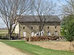 Lockwood Barn |
September 29, 1982 (#82000653) |
Old Stage Rd 42°51′54″N 89°19′22″W |
Rutland | Stone-walled bank barn built in 1855, designed by Sereno Graves. |
| 52 | Lower Mud Lake Archeological Complex | Lower Mud Lake Archeological Complex |
March 31, 2004 (#04000253) |
Address Restricted |
Dunn | Three sites on the Yahara River: the Skare/Kouba site, where early Paleo-Indians settled;[25][26][27] the remains of an Indian fish weir;[28] and the 1840-1860 Douglas corduroy dam.[29][30] |
| 53 | Main Street Historic District | 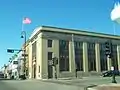 Main Street Historic District |
March 5, 2019 (#100003457) |
100-225 E. Main St., 102 & 200-205 W. Main St., 103-105 S. 2nd St., and 102 S. 3rd St. 43°00′31″N 89°44′19″W |
Mount Horeb | 29 contributing buildings from the old downtown built from 1867 to 1948,[31] including the 1889 Boomtown-style Kittleson & Co Hardware Store,[32] the 1892 Mt. Horeb Bank,[33] the 1919 Wolf Blacksmith Shop,[34] and the 1924 Parkway Theater.[35] |
| 53 | John Mann House | 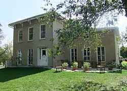 John Mann House |
July 8, 1982 (#82000655) |
6261 Nesbitt Rd. 43°00′34″N 89°28′44″W |
Fitchburg | Italianate-styled farmhouse built in 1856. Now Quivey's Grove restaurant. |
| 54 | Maple Bluff Boy Scout Cabin | 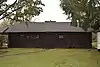 Maple Bluff Boy Scout Cabin |
November 6, 2017 (#100001783) |
296 Woodland Cir. 43°06′39″N 89°21′54″W |
Maple Bluff | Log structure in Fireman's Park, built in 1943 during WWII by the community of Maple Bluff for its Boy Scout troop.[36] |
| 55 | Mazomanie Downtown Historic District | 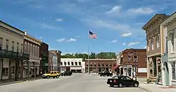 Mazomanie Downtown Historic District |
August 19, 1992 (#92000406) |
1-118 Brodhead, 2-46 Hudson, 37-105 Crescent and 113 E. Exchange Sts. 43°10′32″N 89°47′36″W |
Mazomanie | The old downtown, including the 1857 railroad depot, the 1857 Lynch and Walker Flouring Mill, the 1865 Parman blacksmith shop, the 1908 Hamm livery stable, the 1936 Community building, a few houses, and a lot of stores. |
| 56 | Mazomanie Town Hall | 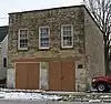 Mazomanie Town Hall |
October 22, 1980 (#80000126) |
51 Crescent St. 43°10′34″N 89°47′33″W |
Mazomanie | Simple 2-story municipal building with walls of cut fieldstone blocks, built in 1878. Housed the fire department, town meeting hall, town clerk's office, dances, suppers and fund-raisers.[37][38] |
| 57 | McCoy Farmhouse | 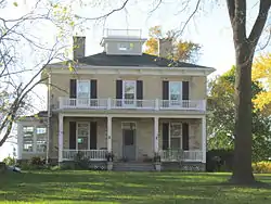 McCoy Farmhouse |
May 29, 1980 (#80000124) |
South of Madison at 2925 Syene Rd. 43°00′51″N 89°23′49″W |
Fitchburg | Italianate farmhouse built in 1861 on one of Wisconsin's first tobacco farms. |
| 58 | McFarland House | 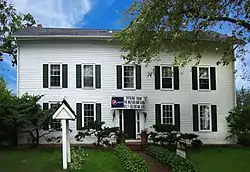 McFarland House |
November 3, 1988 (#88002228) |
5923 Exchange St. 43°00′48″N 89°17′19″W |
McFarland | Large, simple Greek Revival house built in 1857 by William McFarland, who worked for the railroad then but settled down to be a community leader in the town that was named for him. |
| 59 | Middleton Depot, Chicago, Milwaukee, and St. Paul Railroad | 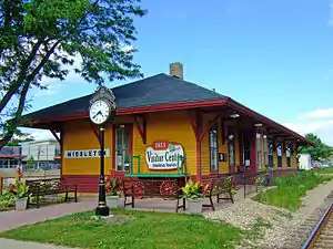 Middleton Depot, Chicago, Milwaukee, and St. Paul Railroad |
April 29, 1999 (#99000520) |
1811 Parmenter St. 43°05′42″N 89°30′40″W |
Middleton | Wooden late Victorian-styled depot designed under J. U. Nettenstrom and built in 1895. |
| 60 | Monona Mound (47DA275) | 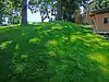 Monona Mound (47DA275) |
December 1, 1989 (#89002064) |
Address Restricted |
Monona | water spirit effigy mound, 800-1100 |
| 61 | Moore Mound Group | Moore Mound Group |
August 5, 1993 (#93000809) |
Address Restricted |
Dunn | |
| 62 | Mt. Horeb Opera Block | 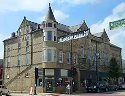 Mt. Horeb Opera Block |
February 23, 1989 (#89000068) |
109-117 E. Main St. 43°00′30″N 89°44′19″W |
Mount Horeb | 3-story Queen Anne-styled opera house built in 1895, which hosted plays, dances, theatrical troupes, political rallies, graduations, and movies. |
| 63 | Mount Horeb Public School | 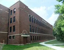 Mount Horeb Public School |
May 28, 2010 (#10000298) |
207 Academy St. 43°00′13″N 89°44′13″W |
Mount Horeb | Prairie style school building designed by Claude & Starck and built in 1918. |
| 64 | Jens Naeset House |  Jens Naeset House |
March 14, 1985 (#85000577) |
126 E. Washington 42°55′04″N 89°13′09″W |
Stoughton | Italianate-style house with Second Empire mansard roof, built in 1878 by Norwegian immigrant Naeset for his own family. |
| 65 | Northwest Side Historic District |  Northwest Side Historic District |
March 5, 1998 (#98000221) |
Roughly bounded by Van Buren, Clyde, Grant, and Main Sts. 42°55′09″N 89°13′36″W |
Stoughton | Old neighborhood with 251 contributing buildings built from 1854 to 1930, in various styles. |
| 66 | Oregon High School | 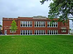 Oregon High School |
April 23, 1998 (#98000406) |
220 N. Main St. 42°55′41″N 89°22′58″W |
Oregon | Two-story public school designed in Collegiate Gothic style by Edward Tough and built in 1922. |
| 67 | Oregon Masonic Lodge | 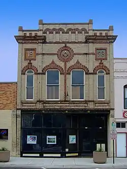 Oregon Masonic Lodge |
June 18, 1992 (#92000803) |
117-119 S. Main St. 42°55′33″N 89°23′06″W |
Oregon | 1898 store with Masons' hall in second story, with front elegantly decorated in multi-colored brick and red sandstone. |
| 68 | Oregon Water Tower and Pump House | 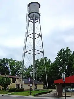 Oregon Water Tower and Pump House |
October 16, 2007 (#07001097) |
134 Janesville St. 42°55′31″N 89°23′01″W |
Oregon | 100-foot steel water tower and brick pumphouse built in 1899 to address concerns over fire protection and water supply. |
| 69 | Outlet Mound |  Outlet Mound |
October 9, 2003 (#03001022) |
Junction of Ridgewood and Midwood Aves. 43°03′06″N 89°20′05″W |
Monona | Conical burial mound seven feet high, built perhaps 2,000 years ago at the outlet of Lake Monona. |
| 70 | Paoli Mills | 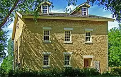 Paoli Mills |
March 30, 1979 (#79000337) |
6890 Sun Valley Pkwy. 42°55′47″N 89°31′31″W |
Paoli | 4 mill buildings on a 5-acre (20,000 m2) site along the Sugar River, including remains of an 1849 sawmill and a fairly intact flouring mill built in the 1860s. |
| 71 | Daniel Pond Farmhouse | 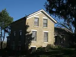 Daniel Pond Farmhouse |
June 30, 1980 (#80000128) |
East of Brooklyn on U.S. 14 42°50′58″N 89°20′02″W |
Brooklyn | Limestone-walled farmhouse probably built in the late 1840s for one of the first settlers in Rutland. |
| 72 | Ole K. Roe House |  Ole K. Roe House |
September 7, 1984 (#84003652) |
404 S. 5th St. 42°54′56″N 89°13′01″W |
Stoughton | Large brick Queen Anne-style house with corner tower, built in 1892 by one of Stoughton's leading tobacco merchants. |
| 73 | Dr. Newman C. Rowley House | 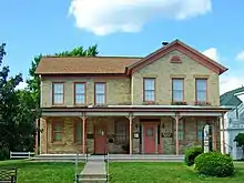 Dr. Newman C. Rowley House |
April 29, 1999 (#99000518) |
7410 Hubbard Ave. 43°05′43″N 89°30′32″W |
Middleton | Fine brick house built in 1867 by Middleton's first doctor. Now a museum. |
| 74 | Rutland United Brethren in Christ Meeting House and Cemetery |  Rutland United Brethren in Christ Meeting House and Cemetery |
September 15, 2004 (#04001002) |
687 US 14 42°52′59″N 89°21′05″W |
Rutland | Simple frame church with some Greek Revival details, built in 1852. This is where the United Brethren in Christ denomination organized in Wisconsin, in 1858. |
| 75 | St. Peter's Roman Catholic Church | 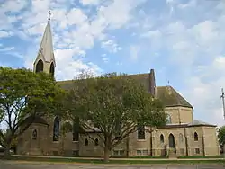 St. Peter's Roman Catholic Church |
September 23, 1980 (#80000130) |
W I K 43°08′23″N 89°32′27″W |
Ashton | Large Neogothic-styled church with rose window, apses, and steeple, built in 1901 in a small farming community. |
| 76 | Frederick Schumann Farmstead | 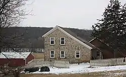 Frederick Schumann Farmstead |
December 10, 1993 (#93001426) |
8313 WI 19 43°11′40″N 89°37′49″W |
Berry | Well-preserved saltbox-shaped stone house built in 1878 by a German immigrant farm family. |
| 77 | Shorewood Historic District | 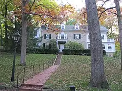 Shorewood Historic District |
November 29, 2002 (#02001432) |
Roughly bounded by Lake Mendota Dr., Tallyho Ln., Shorewood Blvd., and the Blackhawk Country Club 43°04′50″N 89°26′48″W |
Shorewood Hills | Large neighborhood, with 247 contributing homes built between 1922 to 1963, including many Colonial Revival and Tudor Revival. |
| 78 | Siggelkow Park Mound Group (47-Da-504) | 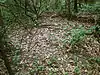 Siggelkow Park Mound Group (47-Da-504) |
March 14, 1985 (#85000576) |
Address Restricted |
McFarland | 1 linear mound and remnants of 2 others.[39] |
| 79 | Eric and Jerome Skindrud Farm | 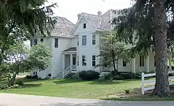 Eric and Jerome Skindrud Farm |
September 26, 1994 (#94001156) |
3070 Town Hall Rd. 43°01′19″N 89°41′18″W |
Springdale | Farm started in 1856, with an 1876 dairy barn that was progressive for its day. The farm is in a valley and retains early erosion-control structures installed by the ASC and CCCs in the 1930s. |
| 80 | Adam and Mary Smith House |  Adam and Mary Smith House |
April 30, 1998 (#98000434) |
south corner of Smith's Crossing and Leopold Way 43°09′47″N 89°15′53″W |
Sun Prairie | Italianate house built in 1872 by Adam, an early carpenter, innkeeper, farmer, and civic leader. |
| 81 | South Main Street Historic District |  South Main Street Historic District |
June 15, 2000 (#00000699) |
S. Main St., junction with Jefferson and Janesville Sts. 42°55′33″N 89°23′05″W |
Oregon | 11 surviving commercial buildings built from 1877 to 1915, plus the 1920 WWI memorial. |
| 82 | South School |  South School |
September 12, 1985 (#85002319) |
1009 Summit Ave. 42°54′37″N 89°13′08″W |
Stoughton | 2.5-story public elementary school built in 1900, designed by Alan Darst Conover with a rather residential form and Queen Anne style to fit into the surrounding neighborhood. Now apartments.[40][41] |
| 83 | Southwest Side Historic District |  Southwest Side Historic District |
December 22, 1997 (#97001554) |
Roughly bounded by Lowell, S. Monroe, W. Main and S. Page Sts. 42°54′52″N 89°13′31″W |
Stoughton | Residential neighborhood with over 100 contributing properties in various styles built as early as 1856. 1884 Ovren House is pictured. |
| 84 | Stoughton High School | 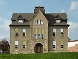 Stoughton High School |
January 17, 2002 (#01001476) |
211 N. Forrest St. 42°55′09″N 89°13′07″W |
Stoughton | Romanesque Revival-styled public high school built in 1892-93. |
| 85 | Stoughton Main Street Commercial Historic District | 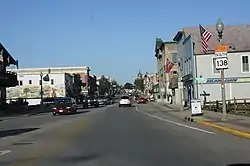 Stoughton Main Street Commercial Historic District |
October 21, 1982 (#82001842) |
Main St. from the Yahara River to Forest St. 42°55′01″N 89°13′14″W |
Stoughton | 36 historic business structures in the old downtown, ranging from the 1869 Masonic Hall, to the 6 matching Italianate stores built together after the fire of 1889, to the 1907 Neoclassical-styled Citizen's State Bank. |
| 86 | Stoughton Universalist Church | 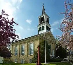 Stoughton Universalist Church |
September 30, 1982 (#82000659) |
324 S. Page St. 42°54′58″N 89°13′25″W |
Stoughton | Greek Revival-styled church built in 1858 by Universalist congregation which had a woman pastor already in 1869. |
| 87 | Stricker Pond I Site (47 DA 424) |  Stricker Pond I Site (47 DA 424) |
July 16, 1979 (#79000069) |
Address Restricted |
Middleton | Late Woodland village site.[42] |
| 88 | Sun Prairie Downtown Historic District | 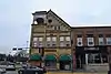 Sun Prairie Downtown Historic District |
May 21, 2019 (#100003955) |
100-245 E. Main St. 43°11′00″N 89°12′46″W |
Sun Prairie | The core of the old downtown, including the 1887 Hein-Dott building,[43] the 1889 Lewis Pharmacy,[44] the 1891 Dott tavern,[45] the 1895 Romanesque Revival City Hall[46] (pictured), the 1896 Hotel Kleiner,[47] the 1909 Neoclassical Lohneis-Weisensel Block,[48] and the 1924 Georgian Revival Public Library.[49] |
| 88 | Sun Prairie Water Tower | 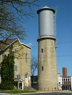 Sun Prairie Water Tower |
April 6, 2000 (#00000360) |
Junction of Columbus, Church and Cliff Sts. 43°11′14″N 89°12′39″W |
Sun Prairie | Tower with 60-foot stone base built in 1899 by Frank Stegerwald & Lessner. The original wooden tank was replaced with a steel one around 1912. |
| 89 | Sure Johnson Mound Group |  Sure Johnson Mound Group |
May 26, 1994 (#94000537) |
Address Restricted |
McFarland | Nine linear and conical mounds remaining from a group between McFarland and Mud Lake.[50][51] |
| 90 | Tompkins-Brindler Mound Group |  Tompkins-Brindler Mound Group |
October 9, 2003 (#03001023) |
Monona Dr. 43°03′18″N 89°19′28″W |
Monona | 2 linear mounds remaining from a larger group.[52] |
| 91 | Waubesa School | 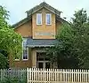 Waubesa School |
July 17, 1997 (#97000806) |
3579 Sigglekow Rd. 43°01′34″N 89°16′38″W |
Blooming Grove | Brick-clad, Bungalow/Craftsman-styled one-room school designed by Louis A. Harrison and built in 1920.[53][54] |
| 92 | Waunakee Railroad Depot | 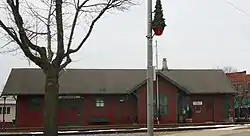 Waunakee Railroad Depot |
February 14, 1978 (#78000092) |
South and Main Sts. 43°11′30″N 89°27′15″W |
Waunakee | Small wooden depot of the Chicago and North Western Railway built in 1896. |
| 93 | West School |  West School |
January 22, 1992 (#91001992) |
404 Garfield St. 42°54′52″N 89°13′30″W |
Stoughton | 2.5-story Romanesque Revival-styled brick school built in 1886 and expanded in 1905.[55][56] |
| 94 | Wisconsin Heights Battlefield |  Wisconsin Heights Battlefield |
January 31, 2002 (#01001553) |
0.4 mi (0.64 km) southeast of the junction of County Rd. Y and WI 78 43°14′41″N 89°43′05″W |
Roxbury | Ridges and swamps along the Wisconsin River where the next-to-last battle of the Black Hawk War was fought. |
| 95 | Wisconsin Industrial School for Girls | 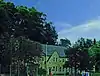 Wisconsin Industrial School for Girls |
September 13, 1991 (#91001391) |
5212 WI M 42°57′42″N 89°22′39″W |
Fitchburg | Reform facility for wayward or delinquent girls, moved from Milwaukee in 1941. Each girl had her own room in a large "cottage" under the guidance of a matron. |
Former listing
| [3] | Name on the Register | Image | Date listed | Date removed | Location | City or town | Summary |
|---|---|---|---|---|---|---|---|
| 1 | Savage House | September 17, 1980 (#80000392) | November 2, 2012 | SR 1 42°50′47″N 89°14′25″W |
Stoughton | Built in 1848; burned in 1996.[57] |
See also
| Wikimedia Commons has media related to National Register of Historic Places in Dane County, Wisconsin. |
References
- The latitude and longitude information provided is primarily from the National Register Information System, and has been found to be fairly accurate for about 99% of listings. For 1%, the location info may be way off. We seek to correct the coordinate information wherever it is found to be erroneous. Please leave a note in the Discussion page for this article if you believe any specific location is incorrect.
- "National Register of Historic Places: Weekly List Actions". National Park Service, United States Department of the Interior. Retrieved on January 29, 2021.
- Numbers represent an alphabetical ordering by significant words. Various colorings, defined here, differentiate National Historic Landmarks and historic districts from other NRHP buildings, structures, sites or objects.
- The eight-digit number below each date is the number assigned to each location in the National Register Information System database, which can be viewed by clicking the number.
- Khitsun, Andrew. "Goodland County Park". WisconsinMounds.com. Retrieved 2018-12-19.
- "Bram Mound Group". Wisconsin Historical Society. Retrieved 2018-12-19.
- "Dunroven House". Wisconsin Historical Society. Retrieved 2019-01-16.
- Mike Koop (May 1980). "NRHP Inventory/Nomination: Dunroven House". National Park Service. Retrieved 2019-01-16. With one photo.
- "Fox Hall". National or State Register of Historic Places. Wisconsin Historical Society. Retrieved 2019-01-25.
- "Fox Hall". Architecture and History Inventory. Wisconsin Historical Society. Retrieved 2019-01-25.
- Carol Lohry Cartwright (1983-08-08). "NRHP Inventory/Nomination: Fox Hall". National Park Service. Retrieved 2019-01-25. With two photos.
- "Fuhremann Canning Company Factory". Wisconsin Historical Society. Retrieved 2019-01-25.
- Timothy F. Heggland (2004-03-18). "NRHP Inventory/Nomination: Fuhremann Canning Company Factory". National Park Service. Retrieved 2019-01-25. With 14 photos.
- "Haight, Nicholas, Farmstead". Wisconsin Historical Society. Retrieved 2019-01-29.
- "Haight, Nicholas, Farmstead - house". Wisconsin Historical Society. Retrieved 2019-01-29.
- Brown, Charles E. (January 1938). "The Heim Effigy Mound". The Wisconsin Archeologist. 18 (2): 39–41. Retrieved 2019-01-29.
- Birmingham, Robert A.; Leslie E. Eisenberg (2000). Indian Mounds of Wisconsin. Madison, WI: University of Wisconsin Press. p. 20. ISBN 9780299168742.
- Khitsun, Andrew. "Town of Roxbury Mounds (Hornung Group)". Wisconsin Mounds. Retrieved 2019-02-04. Includes photos!
- "Kehl Winery - wine cave". Wisconsin Historical Society. Retrieved 2019-02-17.
- "Kehl Winery - Peter Kehl House". Wisconsin Historical Society. Retrieved 2019-02-17.
- "Kehl Winery - brewery". Wisconsin Historical Society. Retrieved 2019-02-17.
- Biruta Erdmann; Richard Cleary (1975-08-20). "NRHP Inventory/Nomination: Kehl Winery". National Park Service. Retrieved 2019-02-17. With four photos.
- Birmingham, Robert A.; Leslie E. Eisenberg (2000). Indian Mounds of Wisconsin. Madison, WI: University of Wisconsin Press. p. 198. ISBN 9780299168742.
- Kittner, Gena. "Plan to Restore Indian Mounds in McFarland". Madison.com. Capital Newspapers. Retrieved 2019-02-24.
- Barton, David F. (1996). "Skare Site Projectile Points". The Wisconsin Archeologist. 77 (1): 82.
- Ritzenthaler, Robert (December 1966). "The Kouba Site: Paleo-Indians in Wisconsin". The Wisconsin Archeologist. 47 (4): 171–187.
- Ritzenthaler, Robert (1967). "A Cache of Paleo-Indian Gravers from the Kouba Site". The Wisconsin Archeologist. 48 (3): 261–262.
- Barton, David F. (1996). "The Dyreson Fish Weir in the Yahara River: a Preliminary Report". The Wisconsin Archeologist. 77 (1): 78–81.
- "The Cultural Heritage of the Yahara Corridor" (PDF). Wisconsin Historical Society. Retrieved 2019-02-17.
- "Yahara Lake Level Advisory Group 2 Minutes" (PDF). UW-Extension - Dane County Office. 2011-09-29. Retrieved 2019-02-27.
- "Wisconsin Historical Society Placed the Mount Horeb Main Street Historic District on the State Register of Historic Places". Wisconsin Historical Society. Retrieved 2019-03-16.
- "Kittleson & Company Hardware Store". Wisconsin Historical Society. Retrieved 2019-03-16.
- "Mt. Horeb Bank". Wisconsin Historical Society. Retrieved 2019-03-16.
- "Wolf, John, Blacksmith Shop". Wisconsin Historical Society. Retrieved 2019-03-16.
- "Parkway Theater". Wisconsin Historical Society. Retrieved 2019-03-16.
- "Maple Bluff Boy Scout Cabin". Wisconsin Historical Society. Retrieved 2019-03-10.
- "Mazomanie Town Hall". Wisconsin Historical Society. Retrieved 2019-03-10.
- Terry L. Shoptaugh (1980-03-12). "NRHP Inventory/Nomination: Mazomanie Town Hall". National Park Service. Retrieved 2019-03-10. With one photo.
- Khitsun, Andrew. "Goodland County Park". WisconsinMounds.com. Retrieved 2019-04-16.
- "South School". Wisconsin Historical Society. Retrieved 2019-04-29.
- Jodi Rubin (June 1985). "NRHP Inventory/Nomination: South School". National Park Service. Retrieved 2019-04-29. With 17 photos.
- Birmingham, Robert (April 1989). The Late Woodland Stage in Archaeological Region 8 (AD 650-1300). State Historical Society of Wisconsin. Retrieved 2019-05-12.
- "John & William Hein-J. F. Dott & Co. Building". Wisconsin Historical Society. Retrieved 2019-06-01.
- "Dr. Ledyard V. Lewis Pharmacy Building". Wisconsin Historical Society. Retrieved 2019-06-01.
- "Matthew Dott Building". Wisconsin Historical Society. Retrieved 2019-06-01.
- "Sun Prairie City Hall". Wisconsin Historical Society. Retrieved 2019-06-01.
- "Hotel Kleiner". Wisconsin Historical Society. Retrieved 2019-06-01.
- "Lohneis-Weisensel Block". Wisconsin Historical Society. Retrieved 2019-06-01.
- "Sun Prairie Public Library". Wisconsin Historical Society. Retrieved 2019-06-01.
- McLachlan, W.G. (January 1914). "The Mounds of the Lake Waubesa Region". The Wisconsin Archeologist. 12 (4): 111–113.
- Khitsun, Andrew. "Mounds on Private Property". WisconsinMounds.com. Retrieved 2019-05-12.
- Khitsun, Andrew. "Woodland Park Mounds (Tompkins-Brindler Group)". WisconsinMounds.com. Retrieved 2019-05-12.
- "Waubesa School". Wisconsin Historical Society. Retrieved 2019-05-12.
- Elizabeth L. Miller (1996-10-01). "NRHP Inventory/Nomination: Waubesa School". National Park Service. Retrieved 2019-05-12. With 14 photos.
- "West School". Wisconsin Historical Society. Retrieved 2019-05-12.
- Dennis Kolb (1991-04-13). "NRHP Inventory/Nomination: West School". National Park Service. Retrieved 2019-05-12. With five photos.
- "Savage House". Wisconsin Historical Society. Retrieved 2019-02-24.
External links
| Topics | |
|---|---|
| Lists by state |
|
| Lists by insular areas | |
| Lists by associated state | |
| Other areas | |
| Related | |
| |