National Register of Historic Places listings in Denali National Park and Preserve
This is a list of the National Register of Historic Places listings in Denali National Park and Preserve.
This is intended to be a complete list of the properties and districts on the National Register of Historic Places in Denali National Park and Preserve, Alaska, United States. The locations of National Register properties and districts for which the latitude and longitude coordinates are included below, may be seen in a Google map.[1]
There are 18 properties and districts listed on the National Register in the park.
- This National Park Service list is complete through NPS recent listings posted February 5, 2021.[2]
Current listings
| [3] | Name on the Register | Image | Date listed[4] | Location | City or town | Description |
|---|---|---|---|---|---|---|
| 1 | Ewe Creek Ranger Cabin No. 8 | 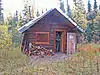 Ewe Creek Ranger Cabin No. 8 |
November 25, 1986 (#86003217) |
5 miles (8.0 km) downstream on the Savage River from Park Highway near Ewe Creek 63°48′04″N 149°20′59″W |
Denali National Park and Preserve | |
| 2 | Igloo Creek Cabin No. 25 | 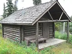 Igloo Creek Cabin No. 25 |
November 25, 1986 (#86003208) |
Near Igloo Creek at Mile 34.1 north of Park Rd. 63°36′33″N 149°35′02″W |
Denali National Park and Preserve | |
| 3 | Kantishna Roadhouse | 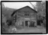 Kantishna Roadhouse |
August 14, 2018 (#100002780) |
Approx .1 mi. W of mi. 91 of Denali Park Rd. 63°31′31″N 150°57′39″W |
Denali National Park and Preserve | |
| 4 | Lower East Fork Ranger Cabin No. 9 | 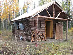 Lower East Fork Ranger Cabin No. 9 |
November 25, 1986 (#86003214) |
25 miles (40 km) downstream on the eastern fork of the Toklat River from Park Rd. 63°48′00″N 149°58′59″W |
Denali National Park and Preserve | |
| 5 | Lower Toklat River Ranger Cabin No. 18 | 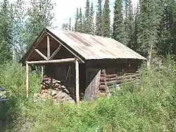 Lower Toklat River Ranger Cabin No. 18 |
November 25, 1986 (#86003222) |
30 miles (48 km) north on the Toklat River from Park Rd. 63°47′46″N 150°15′10″W |
Denali National Park and Preserve | |
| 6 | Lower Windy Creek Ranger Cabin No. 15 | 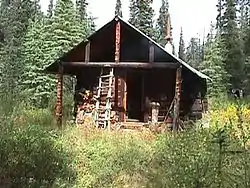 Lower Windy Creek Ranger Cabin No. 15 |
November 25, 1986 (#86003229) |
East of Mile 324 on the Alaska Railroad 63°26′23″N 148°53′09″W |
Denali National Park and Preserve | |
| 7 | Moose Creek Ranger Cabin No. 19 | 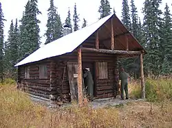 Moose Creek Ranger Cabin No. 19 |
November 25, 1986 (#86003231) |
5 miles (8.0 km) north of Mile 73.8 on Park Rd. 63°29′06″N 150°37′22″W |
Denali National Park and Preserve | |
| 8 | Mount McKinley National Park Headquarters District | 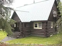 Mount McKinley National Park Headquarters District |
October 23, 1987 (#87000975) |
Mile 3.4 on the McKinley Park Highway 63°43′16″N 148°57′56″W |
Denali National Park and Preserve | |
| 9 | Mount McKinley National Park Road Historic District | 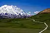 Mount McKinley National Park Road Historic District |
June 30, 2020 (#100004070) |
Mile 237.3 George Parks Hwy. (AK 3) 63°30′24″N 150°03′10″W |
Denali National Park and Preserve | |
| 10 | Fannie Quigley House | Fannie Quigley House |
December 13, 2019 (#100004765) |
Mile 92 of Denali Park Rd., approx. 270 ft. NE of terminus at the Kantishna Airstrip 63°32′23″N 150°59′20″W |
Denali National Park and Preserve | |
| 11 | Riley Creek Ranger Cabin No. 20 |  Riley Creek Ranger Cabin No. 20 |
November 25, 1986 (#86003225) |
5 miles (8.0 km) cross-country and west of Mile 336 on the Alaska Railroad 63°34′55″N 148°57′32″W |
Denali National Park and Preserve | |
| 12 | Sanctuary River Cabin No. 31 | 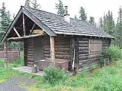 Sanctuary River Cabin No. 31 |
November 25, 1986 (#86003206) |
On the Sanctuary River at Mile 22.7 south of Park Rd. 63°43′22″N 149°28′24″W |
Denali National Park and Preserve | |
| 13 | Sushana River Ranger Cabin No. 17 | 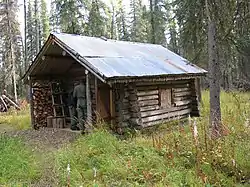 Sushana River Ranger Cabin No. 17 |
November 25, 1986 (#86003227) |
10 miles (16 km) cross-country and north of Mile 25 on Park Rd. 63°47′57″N 149°45′01″W |
Denali National Park and Preserve | |
| 14 | Teklanika Archeological District |  Teklanika Archeological District |
January 31, 1976 (#76000171) |
Address restricted[5] |
Denali National Park and Preserve | |
| 15 | Toklat Ranger Station-Pearson Cabin No. 4 | 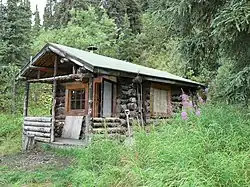 Toklat Ranger Station-Pearson Cabin No. 4 |
November 25, 1986 (#86003207) |
Near the main branch of the Toklat River at Mile 53.8 west of Park Rd. 63°31′06″N 150°02′44″W |
Denali National Park and Preserve | |
| 16 | Upper East Fork Cabin No. 29 | 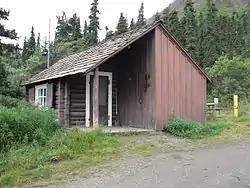 Upper East Fork Cabin No. 29 |
November 25, 1986 (#86003209) |
Near the eastern fork of the Toklat River at Mile 43 south of Park Rd. 63°33′30″N 149°46′41″W |
Denali National Park and Preserve | |
| 17 | Upper Toklat River Cabin No. 24 | Upper Toklat River Cabin No. 24 |
November 25, 1986 (#86003211) |
Near the main branch of the Toklat River at Mile 53.7 west of Park Rd. 63°31′09″N 150°02′45″W |
Denali National Park and Preserve | |
| 18 | Upper Windy Creek Ranger Cabin No. 7 | 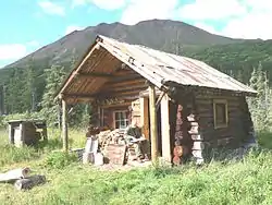 Upper Windy Creek Ranger Cabin No. 7 |
November 25, 1986 (#86003219) |
6 miles (9.7 km) west of Cantwell and south of Windy Creek 63°26′11″N 149°01′25″W |
Denali National Park and Preserve |
See also
References
| Wikimedia Commons has media related to National Register of Historic Places in Denali National Park and Preserve. |
- Evans, Gail. National Register of Historic Places Inventory – Nomination Form: Patrol Cabins: Mount McKinley National Park. National Park Service 1985
- The latitude and longitude information provided in this table was derived originally from the National Register Information System, which has been found to be fairly accurate for about 99% of listings. Some locations in this table may have been corrected to current GPS standards.
- "National Register of Historic Places: Weekly List Actions". National Park Service, United States Department of the Interior. Retrieved on February 5, 2021.
- Numbers represent an alphabetical ordering by significant words. Various colorings, defined here, differentiate National Historic Landmarks and historic districts from other NRHP buildings, structures, sites or objects.
- The eight-digit number below each date is the number assigned to each location in the National Register Information System database, which can be viewed by clicking the number.
- Federal and state laws and practices restrict general public access to information regarding the specific location of this resource. In some cases, this is to protect archeological sites from vandalism, while in other cases it is restricted at the request of the owner. See: Knoerl, John; Miller, Diane; Shrimpton, Rebecca H. (1990), Guidelines for Restricting Information about Historic and Prehistoric Resources, National Register Bulletin, National Park Service, U.S. Department of the Interior, OCLC 20706997.
| Topics | |
|---|---|
| Lists by state |
|
| Lists by insular areas | |
| Lists by associated state | |
| Other areas | |
| Related | |
| |
This article is issued from Wikipedia. The text is licensed under Creative Commons - Attribution - Sharealike. Additional terms may apply for the media files.