National Register of Historic Places listings in Everglades National Park
This is a list of the National Register of Historic Places listings in Everglades National Park.
This is intended to be a complete list of the properties and districts on the National Register of Historic Places in Everglades National Park, Florida, United States. The locations of National Register properties and districts for which the latitude and longitude coordinates are included below, may be seen in a Google map.[1]
There are eleven properties and districts listed on the National Register in the park, one of which is a National Historic Landmark.
- This National Park Service list is complete through NPS recent listings posted February 5, 2021.[2]
Current listings
| [3] | Name on the Register | Image | Date listed[4] | Location | City or town | Description |
|---|---|---|---|---|---|---|
| 1 | Anhinga Trail | 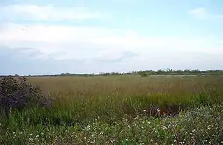 Anhinga Trail |
November 5, 1996 (#96001178) |
Address Restricted 25°22′54″N 80°36′35″W |
Homestead | Part of the Archeological Resources of Everglades National Park MPS |
| 2 | Bear Lake Mounds Archeological District | November 5, 1996 (#96001182) |
Address Restricted |
Flamingo | Part of the Archeological Resources of Everglades National Park MPS | |
| 3 | Cane Patch | November 5, 1996 (#96001179) |
Address Restricted |
Everglades City | Part of the Archeological Resources of Everglades National Park MPS | |
| 4 | Monroe Lake Archeological District | November 5, 1996 (#96001184) |
Address Restricted |
Homestead | Part of the Archeological Resources of Everglades National Park MPS | |
| 5 | Mud Lake Canal | 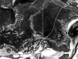 Mud Lake Canal |
September 20, 2006 (#06000979) |
Cape Sable in Everglades National Park 25°10′26″N 80°56′17″W |
Flamingo | |
| 6 | Nike Missile Site HM-69 | 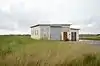 Nike Missile Site HM-69 |
July 27, 2004 (#04000758) |
Long Pine Key Road 25°22′11″N 80°41′05″W |
Homestead | |
| 7 | Rookery Mound | November 5, 1996 (#96001183) |
Address Restricted |
Everglades City | Part of the Archeological Resources of Everglades National Park MPS | |
| 8 | Shark River Slough Archeological District |  Shark River Slough Archeological District |
November 5, 1996 (#96001181) |
Address Restricted |
Homestead | Part of the Archeological Resources of Everglades National Park MPS |
| 9 | Ted Smallwood Store | 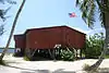 Ted Smallwood Store |
July 24, 1974 (#74000612) |
State Road 29 25°48′34″N 81°21′45″W |
Chokoloskee | |
| 10 | Ten Thousand Islands Archeological District |  Ten Thousand Islands Archeological District |
November 5, 1996 (#96001180) |
Address Restricted |
Everglades City | Part of the Archeological Resources of Everglades National Park MPS |
| 11 | Turner River Site |  Turner River Site |
December 14, 1978 (#78000263) |
Address Restricted |
Ochopee |
See also
- National Register of Historic Places listings in Collier County, Florida
- National Register of Historic Places listings in Miami-Dade County, Florida
- National Register of Historic Places listings in Monroe County, Florida
- List of National Historic Landmarks in Florida
- National Register of Historic Places listings in Florida
- Archeological Resources of Everglades National Park MPS
References
- Schwadron, Margo. National Register of Historic Places Multiple Property Documentation Form: Archeological Resources of Everglades National Park. National Park Service April 1996 https://npgallery.nps.gov/NRHP/GetAsset/NRHP/64500094_text
- The latitude and longitude information provided in this table was derived originally from the National Register Information System, which has been found to be fairly accurate for about 99% of listings. Some locations in this table may have been corrected to current GPS standards.
- "National Register of Historic Places: Weekly List Actions". National Park Service, United States Department of the Interior. Retrieved on February 5, 2021.
- Numbers represent an alphabetical ordering by significant words. Various colorings, defined here, differentiate National Historic Landmarks and historic districts from other NRHP buildings, structures, sites or objects.
- The eight-digit number below each date is the number assigned to each location in the National Register Information System database, which can be viewed by clicking the number.
| Topics | |
|---|---|
| Lists by state |
|
| Lists by insular areas | |
| Lists by associated state | |
| Other areas | |
| Related | |
| |
| Wikimedia Commons has media related to National Register of Historic Places in Everglades National Park. |
This article is issued from Wikipedia. The text is licensed under Creative Commons - Attribution - Sharealike. Additional terms may apply for the media files.