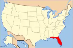
National Register of Historic Places listings in Miami-Dade County, Florida
This is a list of the National Register of Historic Places listings in Miami-Dade County, Florida.
This is intended to be a complete list of the properties and districts on the National Register of Historic Places in Miami-Dade County, Florida, United States. The locations of National Register properties and districts for which the latitude and longitude coordinates are included below, may be seen in a map.[1]
There are 187 properties and districts listed on the National Register in Miami-Dade County, including 6 National Historic Landmarks. The parts outside the city of Miami include 113 of these properties and districts, including 1 National Historic Landmark; they are listed here, while the properties in Miami are listed separately. One property, the Venetian Causeway, is split between Miami and Miami Beach, and is thus included on both lists. Another property was once listed but has been removed.
- This National Park Service list is complete through NPS recent listings posted February 5, 2021.[2]
| Alachua - Baker - Bay - Bradford - Brevard - Broward - Calhoun - Charlotte - Citrus - Clay - Collier - Columbia - DeSoto - Dixie - Duval - Escambia - Flagler - Franklin - Gadsden - Gilchrist - Glades - Gulf - Hamilton - Hardee - Hendry - Hernando - Highlands - Hillsborough (Tampa) - Holmes - Indian River - Jackson - Jefferson - Lafayette - Lake - Lee - Leon - Levy - Liberty - Madison - Manatee - Marion - Martin - Miami-Dade (Miami) - Monroe - Nassau - Okaloosa - Okeechobee - Orange - Osceola - Palm Beach - Pasco - Pinellas - Polk - Putnam - St. Johns - St. Lucie - Santa Rosa - Sarasota - Seminole - Sumter - Suwannee - Taylor - Union - Volusia - Wakulla - Walton - Washington |
Current listings
| [3] | Name on the Register[4] | Image | Date listed[5] | Location | City or town | Description |
|---|---|---|---|---|---|---|
| 1 | Carl G. Adams House | 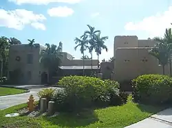 Carl G. Adams House |
November 1, 1985 (#85003464) |
31 Hunting Lodge Court 25°48′54″N 80°17′48″W |
Miami Springs | Part of the Country Club Estates TR |
| 2 | Hervey Allen Study | 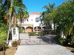 Hervey Allen Study |
May 7, 1974 (#74002256) |
8251 Southwest 52nd Avenue 25°41′47″N 80°16′36″W |
South Miami | |
| 3 | William Anderson General Merchandise Store | 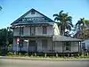 William Anderson General Merchandise Store |
October 18, 1977 (#77000402) |
15700 Southwest 232nd Street, Southwest 25°33′00″N 80°26′45″W |
Goulds | |
| 4 | Anhinga Trail | 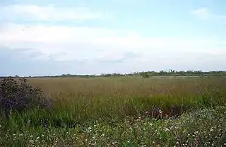 Anhinga Trail |
November 5, 1996 (#96001178) |
Address Restricted 25°22′54″N 80°36′35″W |
Homestead | Part of the Archeological Resources of Everglades National Park MPS |
| 5 | Arch Creek Historic and Archeological Site |  Arch Creek Historic and Archeological Site |
July 15, 1986 (#86001700) |
Address Restricted 25°54′04″N 80°09′41″W |
North Miami | |
| 6 | Baird House | 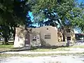 Baird House |
August 17, 1987 (#87001313) |
401 Dunad Avenue 25°54′11″N 80°15′22″W |
Opa-locka | Part of the Opa-locka TR |
| 7 | Barry University Historic District | Barry University Historic District |
December 23, 2019 (#100004782) |
11300 NE Second Ave. 25°52′45″N 80°11′40″W |
Miami Shores | |
| 8 | Beth Jacob Social Hall and Congregation | 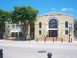 Beth Jacob Social Hall and Congregation |
October 16, 1980 (#80000946) |
301 and 311 Washington Avenue 25°46′20″N 80°08′04″W |
Miami Beach | |
| 9 | Boca Chita Key Historic District | 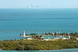 Boca Chita Key Historic District |
August 1, 1997 (#97000795) |
Northwestern section of Boca Chita Key, roughly bounded by Biscayne Bay and a stone wall 25°31′29″N 80°10′34″W |
Biscayne National Park | |
| 10 | Lily Lawrence Bow Library | 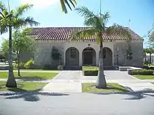 Lily Lawrence Bow Library |
August 5, 1996 (#96000823) |
212 Northwest 1st Avenue 25°28′17″N 80°28′47″W |
Homestead | Part of the Homestead MPS |
| 11 | Building at 107 Northeast 96th Street | 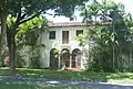 Building at 107 Northeast 96th Street |
November 14, 1988 (#88002094) |
107 Northeast 96th Street 25°51′49″N 80°11′44″W |
Miami Shores | Part of the Miami Shores TR |
| 12 | Building at 121 Northeast 100th Street | 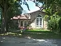 Building at 121 Northeast 100th Street |
November 14, 1988 (#88002107) |
121 Northeast 100th Street 25°52′00″N 80°12′05″W |
Miami Shores | Part of the Miami Shores TR |
| 13 | Building at 145 Northeast 95th Street | 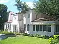 Building at 145 Northeast 95th Street |
November 14, 1988 (#88002093) |
145 Northeast 95th Street 25°51′44″N 80°11′40″W |
Miami Shores | Part of the Miami Shores TR |
| 14 | Building at 253 Northeast 99th Street | 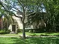 Building at 253 Northeast 99th Street |
November 14, 1988 (#88002103) |
253 Northeast 99th Street 25°51′57″N 80°11′33″W |
Miami Shores | Part of the Miami Shores TR |
| 15 | Building at 257 Northeast 91st Street | 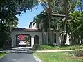 Building at 257 Northeast 91st Street |
November 14, 1988 (#88002086) |
257 Northeast 91st Street 25°51′31″N 80°11′31″W |
Miami Shores | Part of the Miami Shores TR |
| 16 | Building at 262 Northeast 96th Street | 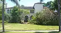 Building at 262 Northeast 96th Street |
November 14, 1988 (#88002095) |
262 Northeast 96th Street 25°51′49″N 80°11′33″W |
Miami Shores | Part of the Miami Shores TR |
| 17 | Building at 273 Northeast 98th Street | 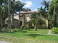 Building at 273 Northeast 98th Street |
November 14, 1988 (#88002101) |
273 Northeast 98th Street 25°51′54″N 80°11′33″W |
Miami Shores | Part of the Miami Shores TR |
| 18 | Building at 276 Northeast 98th Street | 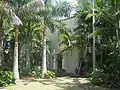 Building at 276 Northeast 98th Street |
November 14, 1988 (#88002102) |
276 Northeast 98th Street 25°51′55″N 80°11′32″W |
Miami Shores | Part of the Miami Shores TR |
| 19 | Building at 284 Northeast 96th Street | Building at 284 Northeast 96th Street |
November 14, 1988 (#88002096) |
284 Northeast 96th Street 25°51′49″N 80°11′32″W |
Miami Shores | Part of the Miami Shores TR |
| 20 | Building at 287 Northeast 96th Street | 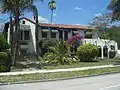 Building at 287 Northeast 96th Street |
November 14, 1988 (#88002097) |
287 Northeast 96th Street 25°51′49″N 80°11′30″W |
Miami Shores | Part of the Miami Shores TR |
| 21 | Building at 310 Northeast 99th Street | 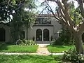 Building at 310 Northeast 99th Street |
November 14, 1988 (#88002105) |
310 Northeast 99th Street 25°51′58″N 80°11′29″W |
Miami Shores | Part of the Miami Shores TR |
| 22 | Building at 353 Northeast 91st Street | 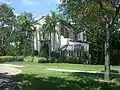 Building at 353 Northeast 91st Street |
November 14, 1988 (#88002087) |
353 Northeast 91st Street 25°51′31″N 80°11′26″W |
Miami Shores | Part of the Miami Shores TR |
| 23 | Building at 357 Northeast 92nd Street | 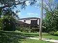 Building at 357 Northeast 92nd Street |
November 14, 1988 (#88002088) |
357 Northeast 92nd Street 25°51′34″N 80°11′26″W |
Miami Shores | Part of the Miami Shores TR |
| 24 | Building at 361 Northeast 97th Street | 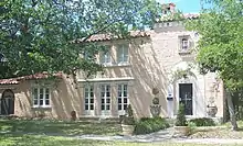 Building at 361 Northeast 97th Street |
November 14, 1988 (#88002100) |
361 Northeast 97th Street 25°51′52″N 80°11′26″W |
Miami Shores | Part of the Miami Shores TR |
| 25 | Building at 384 Northeast 94th Street | 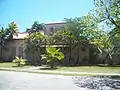 Building at 384 Northeast 94th Street |
November 14, 1988 (#88002091) |
384 Northeast 94th Street 25°51′41″N 80°11′24″W |
Miami Shores | Part of the Miami Shores TR |
| 26 | Building at 389 Northeast 99th Street | 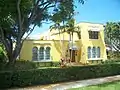 Building at 389 Northeast 99th Street |
November 14, 1988 (#88002106) |
389 Northeast 99th Street 25°51′58″N 80°11′25″W |
Miami Shores | Part of the Miami Shores TR |
| 27 | Building at 431 Northeast 94th Street |  Building at 431 Northeast 94th Street |
November 14, 1988 (#88002092) |
431 Northeast 94th Street 25°51′42″N 80°11′20″W |
Miami Shores | Part of the Miami Shores TR |
| 28 | Building at 477 Northeast 92nd Street |  Building at 477 Northeast 92nd Street |
November 14, 1988 (#88002089) |
477 Northeast 92nd Street 25°51′34″N 80°11′17″W |
Miami Shores | Part of the Miami Shores TR |
| 29 | Building at 540 Northeast 96th Street |  Building at 540 Northeast 96th Street |
November 14, 1988 (#88002098) |
540 Northeast 96th Street 25°51′49″N 80°11′12″W |
Miami Shores | Part of the Miami Shores TR |
| 30 | Building at 553 Northeast 101st Street |  Building at 553 Northeast 101st Street |
November 14, 1988 (#88002108) |
553 Northeast 101st Street 25°52′03″N 80°11′12″W |
Miami Shores | Part of the Miami Shores TR |
| 31 | Building at 561 Northeast 101st Street | 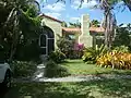 Building at 561 Northeast 101st Street |
November 14, 1988 (#88002109) |
561 Northeast 101st Street 25°52′04″N 80°11′11″W |
Miami Shores | Part of the Miami Shores TR |
| 32 | Building at 577 Northeast 96th Street | 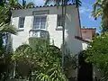 Building at 577 Northeast 96th Street |
November 14, 1988 (#88002099) |
577 Northeast 96th Street 25°51′49″N 80°11′10″W |
Miami Shores | Part of the Miami Shores TR |
| 33 | Building at 1291 Northeast 102nd Street | 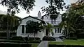 Building at 1291 Northeast 102nd Street |
November 14, 1988 (#88002110) |
1291 Northeast 102nd Street 25°52′07″N 80°10′46″W |
Miami Shores | Part of the Miami Shores TR |
| 34 | Building at 10108 Northeast 1st Avenue | 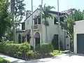 Building at 10108 Northeast 1st Avenue |
November 14, 1988 (#88002111) |
10108 Northeast 1st Avenue 25°52′03″N 80°11′45″W |
Miami Shores | Part of the Miami Shores TR |
| 35 | Cadillac Hotel | 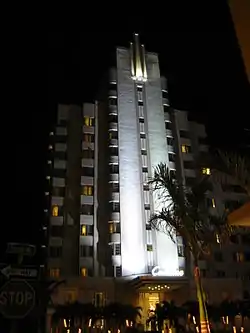 Cadillac Hotel |
October 5, 2005 (#05001117) |
3925 Collins Ave. 25°48′48″N 80°07′22″W |
Miami Beach | |
| 36 | Cape Florida Lighthouse | 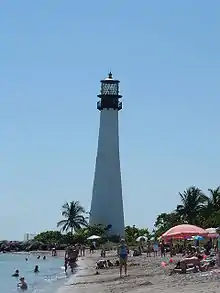 Cape Florida Lighthouse |
September 29, 1970 (#70000180) |
Southeast tip of Key Biscayne off U.S. Route 1 25°39′58″N 80°09′22″W |
Key Biscayne | |
| 37 | Cla-Reina Hotel | April 22, 2020 (#100004971) |
116 Alhambra Circle 25°45′09″N 80°15′29″W |
Coral Gables | ||
| 38 | Clune Building | 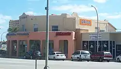 Clune Building |
November 1, 1985 (#85003467) |
45 Curtiss Parkway 25°49′17″N 80°16′53″W |
Miami Springs | Part of the Country Club Estates TR |
| 39 | Coco Plum Woman's Club | 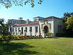 Coco Plum Woman's Club |
June 17, 2005 (#05000598) |
1375 Sunset Drive (SW 72nd Street) 25°42′24″N 80°16′49″W |
Coral Gables | Part of the Clubhouses of Florida's Woman's Clubs MPS |
| 40 | Collins Waterfront Architectural District | 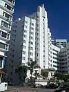 Collins Waterfront Architectural District |
December 15, 2011 (#11000905) |
Bounded by 24th St., Atlantic Ocean, Indian Creek Dr., Pine Tree Dr. & Collins Canal 25°47′43″N 80°07′53″W |
Miami Beach | |
| 41 | Coral Castle | 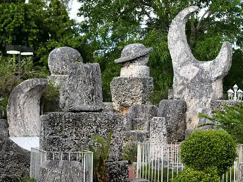 Coral Castle |
May 10, 1984 (#84000840) |
28655 South Federal Highway 25°30′00″N 80°26′34″W |
Homestead | |
| 42 | Coral Gables City Hall | 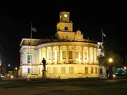 Coral Gables City Hall |
July 24, 1974 (#74000616) |
405 Biltmore Way 25°44′55″N 80°15′49″W |
Coral Gables | |
| 43 | Coral Gables Congregational Church | 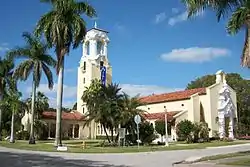 Coral Gables Congregational Church |
October 10, 1978 (#78000937) |
3010 DeSoto Boulevard 25°44′33″N 80°16′44″W |
Coral Gables | |
| 44 | Coral Gables Elementary School | 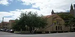 Coral Gables Elementary School |
June 30, 1988 (#88000750) |
105 Minorca Avenue 25°45′13″N 80°15′28″W |
Coral Gables | |
| 45 | Coral Gables House | 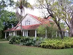 Coral Gables House |
April 13, 1973 (#73000573) |
907 Coral Way 25°44′56″N 80°16′26″W |
Coral Gables | |
| 46 | Coral Gables Police and Fire Station | 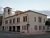 Coral Gables Police and Fire Station |
November 6, 1984 (#84000354) |
2325 Salzedo Street 25°45′00″N 80°15′39″W |
Coral Gables | |
| 47 | Coral Gables Woman's Club |  Coral Gables Woman's Club |
March 27, 1990 (#90000423) |
1001 East Ponce de Leon Boulevard 25°45′40″N 80°15′28″W |
Coral Gables | |
| 48 | Cravero House | 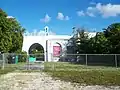 Cravero House |
August 17, 1987 (#87001315) |
1011 Sharar Avenue 25°54′28″N 80°15′05″W |
Opa-locka | Part of the Opa-locka TR |
| 49 | Crouse House | 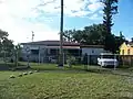 Crouse House |
August 17, 1987 (#87001316) |
1156 Peri Street 25°54′33″N 80°14′56″W |
Opa-locka | Part of the Opa-locka TR |
| 50 | Glenn Curtiss House | 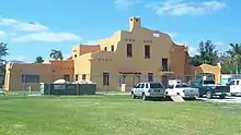 Glenn Curtiss House |
December 21, 2001 (#85003579) |
500 Deer Run 25°48′35″N 80°17′01″W |
Miami Springs | Part of the Country Club Estates TR |
| 51 | Lua Curtiss House I | 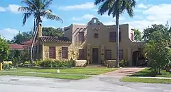 Lua Curtiss House I |
November 1, 1985 (#85003465) |
85 Deer Run 25°49′01″N 80°17′17″W |
Miami Springs | Part of the Country Club Estates TR |
| 52 | Lua Curtiss House II | 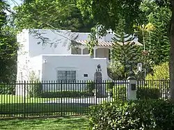 Lua Curtiss House II |
November 1, 1985 (#85003466) |
150 Hunting Lodge 25°49′05″N 80°17′30″W |
Miami Springs | Part of the Country Club Estates TR |
| 53 | Charles Deering Estate | 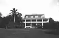 Charles Deering Estate |
March 11, 1986 (#86000325) |
Southwest One Hundred Sixty-seventh Street and Old Cutler Road 25°36′57″N 80°18′38″W |
Cutler | |
| 54 | Douglas Entrance | 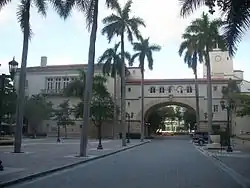 Douglas Entrance |
September 22, 1972 (#72000305) |
Junction of Douglas Road and 8th Street Southwest 25°45′49″N 80°15′21″W |
Coral Gables | |
| 55 | Entrance to Central Miami | 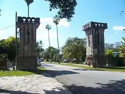 Entrance to Central Miami |
January 19, 1989 (#88003199) |
West of Red Road between Southwest 34th and Southwest 35th Streets 25°44′10″N 80°17′06″W |
Coral Gables | |
| 56 | Etheredge House | 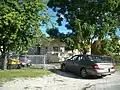 Etheredge House |
August 17, 1987 (#87001317) |
915 Sharar Avenue 25°54′27″N 80°15′09″W |
Opa-locka | Part of the Opa-locka TR |
| 57 | Thomas Faust House | 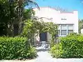 Thomas Faust House |
September 27, 1996 (#96001034) |
69 Northwest 4th Street 25°28′23″N 80°28′44″W |
Homestead | Part of the Homestead MPS |
| 58 | Florida Pioneer Museum | 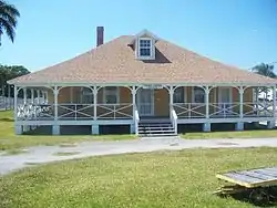 Florida Pioneer Museum |
August 14, 1973 (#73000574) |
½ mile south of Lucy Street on State Road 27 (Krome Avenue) 25°27′20″N 80°28′40″W |
Florida City | |
| 59 | Fontainebleau Hotel | 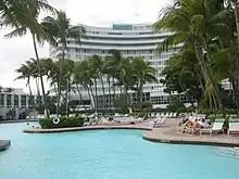 Fontainebleau Hotel |
December 22, 2008 (#08001318) |
4441 Collins Avenue 25°49′05″N 80°07′23″W |
Miami Beach | |
| 60 | Fowey Rocks Light | 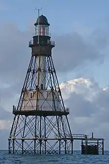 Fowey Rocks Light |
January 26, 2011 (#10001181) |
Offshore in Straits of Florida 6.3 miles south southeast of Cape Florida on Key Biscayne, Florida 25°35′26″N 80°05′48″W |
Key Biscayne | (Light Stations of the United States MPS) |
| 61 | Fuchs Bakery | 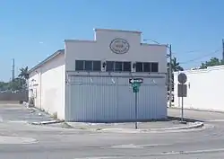 Fuchs Bakery |
November 15, 1996 (#96001335) |
102 South Krome Street 25°28′07″N 80°28′42″W |
Homestead | Part of the Homestead MPS |
| 62 | Fulford by the Sea Entrance | 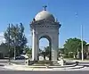 Fulford by the Sea Entrance |
November 29, 2010 (#10000937) |
Intersection of NE 172 Street and NE 23 Avenue 25°56′05″N 80°09′15″W |
North Miami Beach | |
| 63 | Giller Building | _1.jpg.webp) Giller Building |
March 29, 2018 (#100002291) |
975 W 41st St. 25°48′48″N 80°08′07″W |
Miami Beach | |
| 64 | Grand Concourse Apartments | 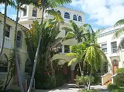 Grand Concourse Apartments |
December 2, 1985 (#85003060) |
421 Grand Concourse 25°51′50″N 80°11′21″W |
Miami Shores | |
| 65 | Griffiths House | 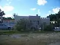 Griffiths House |
August 17, 1987 (#87001318) |
826 Superior Street 25°53′53″N 80°15′04″W |
Opa-locka | Part of the Opa-locka TR |
| 66 | Haislip House | 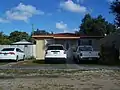 Haislip House |
August 17, 1987 (#87001319) |
1141 Jann Avenue 25°54′31″N 80°14′57″W |
Opa-locka | Part of the Opa-locka TR |
| 67 | Helm Stores and Apartments | 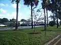 Helm Stores and Apartments |
August 17, 1987 (#87001321) |
1217 Sharazad Boulevard 25°54′18″N 80°14′53″W |
Opa-locka | Part of the Opa-locka TR |
| 68 | Helms House | 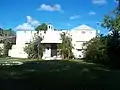 Helms House |
August 17, 1987 (#87001320) |
721 Sharar Avenue 25°54′24″N 80°15′17″W |
Opa-locka | Part of the Opa-locka TR |
| 69 | Hialeah Park Race Track | 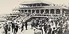 Hialeah Park Race Track |
March 5, 1979 (#79000664) |
East 4th Avenue 25°50′31″N 80°16′27″W |
Hialeah | Determined to be eligible for National Historic Landmark status on January 12, 1988, but not made one (refnum 88003477). |
| 70 | Hialeah Seaboard Air Line Railway Station | 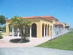 Hialeah Seaboard Air Line Railway Station |
July 14, 1995 (#95000854) |
1200 Southeast 10th Court 25°48′43″N 80°15′33″W |
Hialeah | |
| 71 | Higgins Duplex | 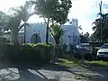 Higgins Duplex |
August 17, 1987 (#87001322) |
1210–1212 Sesame Street 25°54′20″N 80°14′53″W |
Opa-locka | Part of the Opa-locka TR |
| 72 | Homestead Historic Downtown District |  Homestead Historic Downtown District |
November 19, 2007 (#07001199) |
Bounded by Northwest 4th Street, South Railroad Avenue, Southeast 1st Road, and N. Krome Drive 25°28′12″N 80°28′37″W |
Homestead | |
| 73 | Homestead Public School-Neva King Cooper School | 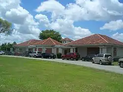 Homestead Public School-Neva King Cooper School |
December 4, 1985 (#85003112) |
520 Northwest First Avenue 25°28′28″N 80°28′48″W |
Homestead | |
| 74 | Homestead Town Hall | 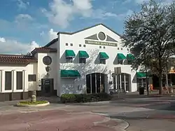 Homestead Town Hall |
November 7, 1997 (#97001327) |
43 North Krome Avenue 25°28′09″N 80°28′39″W |
Homestead | Part of the Homestead MPS |
| 75 | Harry Hurt Building | 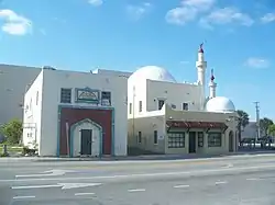 Harry Hurt Building |
March 22, 1982 (#82004795) |
490 Ali-Baba Avenue 25°54′05″N 80°15′04″W |
Opa-locka | Part of the Opa-locka TR |
| 76 | Jones Family Historic District |  Jones Family Historic District |
October 23, 2013 (#13000846) |
Biscayne National Park 25°22′37″N 80°14′29″W |
Islandia | |
| 77 | King Trunk Factory and Showroom | 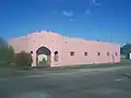 King Trunk Factory and Showroom |
August 17, 1987 (#87001323) |
951 Superior Street 25°53′55″N 80°14′54″W |
Opa-locka | Part of the Opa-locka TR |
| 78 | Lincoln Road Mall | 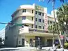 Lincoln Road Mall |
May 16, 2011 (#11000287) |
400-1100 Lincoln Road, Washington Avenue to Alton Road 25°47′26″N 80°08′11″W |
Miami Beach | |
| 79 | Lindeman-Johnson House | 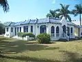 Lindeman-Johnson House |
November 15, 1996 (#96001332) |
906 North Krome Avenue 25°28′43″N 80°28′40″W |
Homestead | Part of the Homestead MPS |
| 80 | Long House | 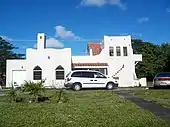 Long House |
August 17, 1987 (#87001324) |
613 Sharar Avenue 25°54′21″N 80°15′20″W |
Opa-locka | Part of the Opa-locka TR |
| 81 | MacFarlane Homestead Historic District | 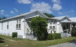 MacFarlane Homestead Historic District |
May 26, 1994 (#94000533) |
Roughly bounded by Jefferson Street, Frow Avenue, Brooker Street, and Grand Avenue 25°43′40″N 80°15′32″W |
Coral Gables | |
| 82 | McMinn-Horne House | 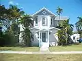 McMinn-Horne House |
August 30, 1996 (#96000943) |
25 Northeast 12th Street 25°28′54″N 80°28′39″W |
Homestead | Part of the Homestead MPS |
| 83 | Miami Beach Architectural District |  Miami Beach Architectural District |
May 14, 1979 (#79000667) |
Roughly bounded by the Atlantic Ocean, Miami Beach Boulevard, Alton Road, and the Collins Canal 25°47′02″N 80°07′52″W |
Miami Beach | |
| 84 | Miami-Biltmore Hotel | 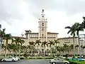 Miami-Biltmore Hotel |
September 27, 1972 (#72000306) |
1210 Anastasia Avenue 25°44′28″N 80°16′45″W |
Coral Gables | |
| 85 | Millard-McCarty House | 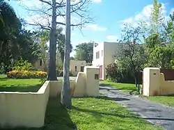 Millard-McCarty House |
April 22, 1986 (#86000872) |
424 Hunting Lodge 25°49′04″N 80°17′43″W |
Miami Springs | Part of the Country Club Estates TR |
| 86 | Monroe Lake Archeological District | November 5, 1996 (#96001184) |
Address Restricted |
Homestead | Part of the Archeological Resources of Everglades National Park MPS | |
| 87 | Monticello Hotel | _1.jpg.webp) Monticello Hotel |
October 11, 2017 (#100001737) |
210 W. 63rd St. 25°50′40″N 80°07′17″W |
Miami Beach | |
| 88 | Nike Missile Site HM-69 | Nike Missile Site HM-69 |
July 27, 2004 (#04000758) |
Long Pine Key Road 25°22′11″N 80°41′05″W |
Homestead | |
| 89 | Normandy Isles Historic District | 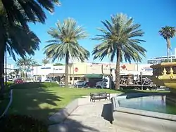 Normandy Isles Historic District |
November 12, 2008 (#08001041) |
Roughly by Normandy Shores Golf Course, Indian Creek, Biscayne Bay, Rue Versailles, 71st., and Rue Notre Dame 25°51′18″N 80°07′52″W |
Miami Beach | |
| 90 | North Shore Historic District | 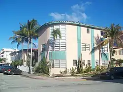 North Shore Historic District |
November 18, 2009 (#09000926) |
Roughly by 87th Street, Collins Avenue, 73rd Street, and Hawthorne Avenue 25°51′50″N 80°07′29″W |
Miami Beach | |
| 91 | Ocean Spray Hotel | 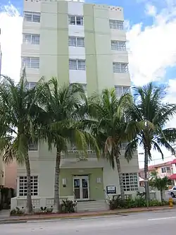 Ocean Spray Hotel |
June 2, 2004 (#04000564) |
4130 Collins Avenue 25°48′54″N 80°07′12″W |
Miami Beach | |
| 92 | Offshore Reefs Archeological District | August 24, 1984 (#84000838) |
Address Restricted |
Homestead | ||
| 93 | Old Spanish Monastery | 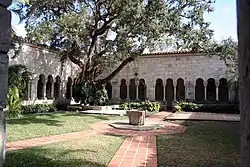 Old Spanish Monastery |
November 9, 1972 (#72000307) |
16711 West Dixie Highway 25°55′45″N 80°09′17″W |
North Miami Beach | |
| 94 | Opa-locka Bank | 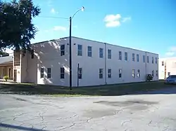 Opa-locka Bank |
May 19, 1983 (#83001420) |
940 Caliph Street 25°54′21″N 80°15′01″W |
Opa-locka | Part of the Opa-locka TR |
| 95 | Opa-locka Company Administration Building | 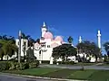 Opa-locka Company Administration Building |
March 22, 1982 (#82004796) |
777 Sharazad Boulevard 25°54′17″N 80°15′11″W |
Opa-locka | Part of the Opa-locka TR |
| 96 | Opa-locka Railroad Station | 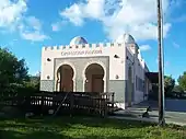 Opa-locka Railroad Station |
June 25, 1987 (#87000998) |
490 Ali Baba Avenue 25°54′01″N 80°15′12″W |
Opa-locka | Part of the Opa-locka TR |
| 97 | Osceola Apartment Hotel | 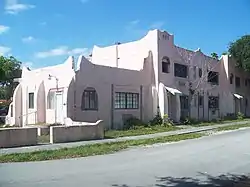 Osceola Apartment Hotel |
November 1, 1985 (#85003469) |
200 Azure Way 25°49′08″N 80°17′08″W |
Miami Springs | Part of the Country Club Estates TR |
| 98 | Parrot Jungle Historic District |  Parrot Jungle Historic District |
October 17, 2011 (#11000735) |
11000 SW 57th Avenue 25°40′10″N 80°17′09″W |
Pinecrest | |
| 99 | Populo | 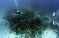 Populo |
June 15, 2006 (#06000498) |
Biscayne National Park 25°21′51″N 80°09′41″W |
Homestead | Part of the 1733 Spanish Plate Fleet Shipwrecks MPS |
| 100 | Root Building | 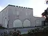 Root Building |
August 17, 1987 (#87001326) |
111 Perviz Avenue 25°54′15″N 80°15′14″W |
Opa-locka | Part of the Opa-locka TR |
| 101 | Seminole Cafe and Hotel | 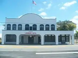 Seminole Cafe and Hotel |
July 10, 2008 (#08000641) |
55 South Flagler Avenue 25°28′10″N 80°28′35″W |
Homestead | |
| 102 | Shark River Slough Archeological District |  Shark River Slough Archeological District |
November 5, 1996 (#96001181) |
Address Restricted |
Homestead | Part of the Archeological Resources of Everglades National Park MPS |
| 103 | Silver Palm Schoolhouse | 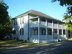 Silver Palm Schoolhouse |
July 2, 1987 (#87000581) |
Silver Palm Drive and Newton Road 25°33′03″N 80°26′43″W |
Goulds | |
| 104 | Sunshine State Arch | 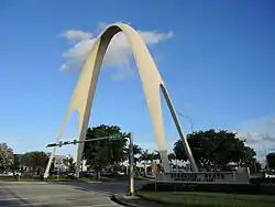 Sunshine State Arch |
May 19, 2014 (#14000210) |
Jct. of NW. 13th Ave. and NW. 167th St. 25°55′37″N 80°13′18″W |
Miami Gardens | |
| 105 | Sweeting Homestead | September 19, 1997 (#97001088) |
Address Restricted |
Biscayne National Park | ||
| 106 | Taber Duplex | 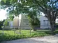 Taber Duplex |
August 17, 1987 (#87001327) |
1214–1216 Sesame Street 25°54′21″N 80°14′52″W |
Opa-locka | Part of the Opa-locka TR |
| 107 | Arden "Doc" Thomas House | 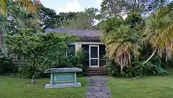 Arden "Doc" Thomas House |
June 13, 2014 (#14000320) |
5530 Sunset Dr. 25°42′14″N 80°17′03″W |
South Miami | |
| 108 | Tinsman House | 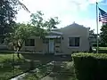 Tinsman House |
August 17, 1987 (#87001328) |
1110 Peri Street 25°54′34″N 80°15′00″W |
Opa-locka | Part of the Opa-locka TR |
| 109 | Tooker House |  Tooker House |
August 17, 1987 (#87001329) |
811 Dunad Avenue 25°54′23″N 80°15′12″W |
Opa-locka | Part of the Opa-locka TR |
| 110 | Venetian Causeway |  Venetian Causeway |
July 13, 1989 (#89000852) |
Northeast 15th Street and Dade Boulevard 25°47′21″N 80°11′21″W |
Miami Beach | Extends into Miami |
| 111 | Venetian Pool |  Venetian Pool |
August 20, 1981 (#81000193) |
2701 De Soto Boulevard 25°44′46″N 80°16′27″W |
Coral Gables | |
| 112 | Vizcaya | 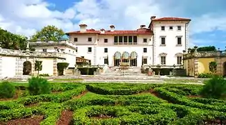 Vizcaya |
September 29, 1970 (#70000181) |
3251 South Miami Avenue 25°44′40″N 80°12′38″W |
Miami | Historic house and grounds |
| 113 | Wheeler House | 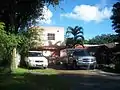 Wheeler House |
August 17, 1987 (#87001330) |
1035 Dunad Avenue 25°54′24″N 80°15′01″W |
Opa-locka | Part of the Opa-locka TR |
Former listing
| [3] | Name on the Register | Image | Date listed | Date removed | Location | City or town | Summary |
|---|---|---|---|---|---|---|---|
| 1 | Hequembourg House |  Hequembourg House |
November 1, 1985 (#85003468) | January 18, 2011 | 851 Hunting Lodge 25°48′45″N 80°17′51″W |
Miami Springs | Part of the Country Club Estates TR |
See also
References
| Wikimedia Commons has media related to National Register of Historic Places in Miami-Dade County, Florida. |
- The latitude and longitude information provided in this table was derived originally from the National Register Information System, which has been found to be fairly accurate for about 99% of listings. Some locations in this table may have been corrected to current GPS standards.
- "National Register of Historic Places: Weekly List Actions". National Park Service, United States Department of the Interior. Retrieved on February 5, 2021.
- Numbers represent an alphabetical ordering by significant words. Various colorings, defined here, differentiate National Historic Landmarks and historic districts from other NRHP buildings, structures, sites or objects.
- "National Register Information System". National Register of Historic Places. National Park Service. March 13, 2009.
- The eight-digit number below each date is the number assigned to each location in the National Register Information System database, which can be viewed by clicking the number.
Municipalities and communities of Miami-Dade County, Florida, United States | ||
|---|---|---|
| Cities | | |
| Towns | ||
| Villages | ||
| CDPs |
| |
| Unincorporated communities | ||
| Ghost town | ||
| Indian reservation | ||
| Footnotes | ‡This populated place also has portions in an adjacent county or counties | |
| ||