National Register of Historic Places listings in Jackson County, South Dakota
This is a list of the National Register of Historic Places listings in Jackson County, South Dakota.
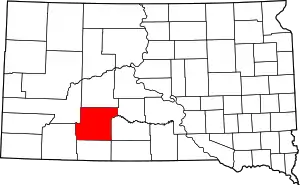
Location of Jackson County in South Dakota
This is intended to be a complete list of the properties and districts on the National Register of Historic Places in Jackson County, South Dakota, United States. The locations of National Register properties and districts for which the latitude and longitude coordinates are included below, may be seen in a map.[1]
There are 8 properties and districts listed on the National Register in the county.
- This National Park Service list is complete through NPS recent listings posted January 29, 2021.[2]
Current listings
| [3] | Name on the Register[4] | Image | Date listed[5] | Location | City or town | Description |
|---|---|---|---|---|---|---|
| 1 | Chicago, Milwaukee, and St. Paul Railroad Depot | 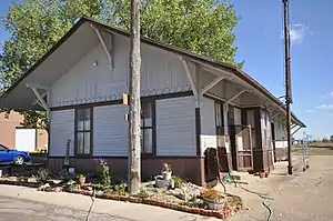 Chicago, Milwaukee, and St. Paul Railroad Depot |
August 13, 1986 (#86001478) |
Southern end of Kadoka adjacent to the former Chicago, Milwaukee, St. Paul and Pacific railroad line 43°49′55″N 101°30′34″W |
Kadoka | |
| 2 | Tom Jones Ranch | October 25, 1990 (#90001653) |
5½ miles south of Midland 43°59′34″N 101°10′58″W |
Midland | ||
| 3 | Lip's Camp | June 11, 1975 (#75002104) |
Address Restricted |
Wanblee | ||
| 4 | Minuteman Missile National Historic Site | 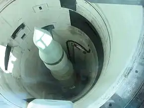 Minuteman Missile National Historic Site |
November 29, 1999 (#01000275) |
Off of Interstate 90, north of Rapid City 43°55′52″N 102°09′38″W |
Rapid City | A National Historic Site; extends into Pennington County |
| 5 | Mt. Moriah Masonic Lodge No. 155 | 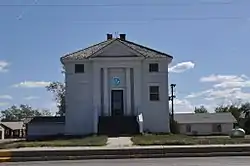 Mt. Moriah Masonic Lodge No. 155 |
July 28, 2004 (#04000765) |
101 Main St., S. 43°50′11″N 101°30′35″W |
Kadoka | |
| 6 | Pearl Hotel | 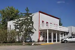 Pearl Hotel |
June 14, 2007 (#07000587) |
South Main 43°50′02″N 101°30′38″W |
Kadoka | |
| 7 | Prairie Homestead | 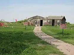 Prairie Homestead |
January 11, 1974 (#74001891) |
21070 South Dakota Highway 240 43°48′04″N 101°54′23″W |
Interior | |
| 8 | Triangle Ranch | June 3, 1994 (#94000563) |
On the south fork of the Bad River, about 11 miles southwest of Philip 43°55′56″N 101°47′24″W |
Philip |
See also
| Wikimedia Commons has media related to National Register of Historic Places in Jackson County, South Dakota. |
References
- The latitude and longitude information provided in this table was derived originally from the National Register Information System, which has been found to be fairly accurate for about 99% of listings. Some locations in this table may have been corrected to current GPS standards.
- "National Register of Historic Places: Weekly List Actions". National Park Service, United States Department of the Interior. Retrieved on January 29, 2021.
- Numbers represent an alphabetical ordering by significant words. Various colorings, defined here, differentiate National Historic Landmarks and historic districts from other NRHP buildings, structures, sites or objects.
- "National Register Information System". National Register of Historic Places. National Park Service. April 24, 2008.
- The eight-digit number below each date is the number assigned to each location in the National Register Information System database, which can be viewed by clicking the number.
| Topics | |
|---|---|
| Lists by state |
|
| Lists by insular areas | |
| Lists by associated state | |
| Other areas | |
| Related | |
| |
Municipalities and communities of Jackson County, South Dakota, United States | ||
|---|---|---|
| City | | |
| Towns | ||
| CDP | ||
| Former CDP | ||
| Unincorporated communities | ||
| Indian reservation | ||
| Ghost town | ||
| Footnotes | ‡This populated place also has portions in an adjacent county or counties | |
| ||
This article is issued from Wikipedia. The text is licensed under Creative Commons - Attribution - Sharealike. Additional terms may apply for the media files.