National Register of Historic Places listings in Madison County, Illinois
This is a list of the National Register of Historic Places listings in Madison County, Illinois.
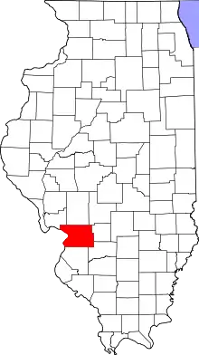
Location of Madison County in Illinois
This is intended to be a complete list of the properties and districts on the National Register of Historic Places in Madison County, Illinois, United States. Latitude and longitude coordinates are provided for many National Register properties and districts; these locations may be seen together in a map.[1]
There are 42 properties and districts listed on the National Register in the county, including 2 National Historic Landmarks. Another two properties were once listed but have been removed.
- This National Park Service list is complete through NPS recent listings posted February 5, 2021.[2]
Current listings
| [3] | Name on the Register | Image | Date listed[4] | Location | City or town | Description |
|---|---|---|---|---|---|---|
| 1 | Alton Chapter House | 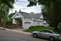 Alton Chapter House |
November 28, 1980 (#80001388) |
509 Beacon St. 38°53′35″N 90°11′24″W |
Alton | |
| 2 | Alton Gas & Electric Power House | 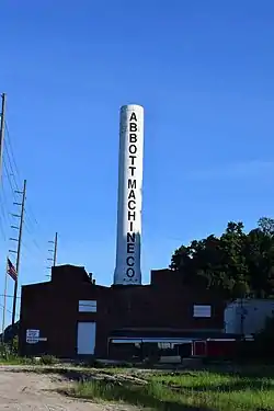 Alton Gas & Electric Power House |
August 28, 2019 (#100004309) |
700 W. Broadway 38°53′39″N 90°11′47″W |
Alton | |
| 3 | Alton Military Prison Site | 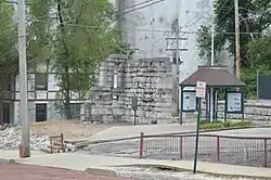 Alton Military Prison Site |
December 31, 1974 (#74000766) |
Inside the block bounded by Broadway and William, 4th, and Mill Sts.[5] 38°53′29″N 90°11′22″W |
Alton | |
| 4 | Alton National Cemetery | 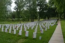 Alton National Cemetery |
May 5, 2011 (#11000245) |
600 Pearl St. 38°53′26″N 90°09′48″W |
Alton | |
| 5 | Berleman House | 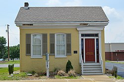 Berleman House |
March 27, 1980 (#80001391) |
115 S. Main St. 38°48′39″N 89°57′21″W |
Edwardsville | |
| 6 | Bethalto Village Hall | 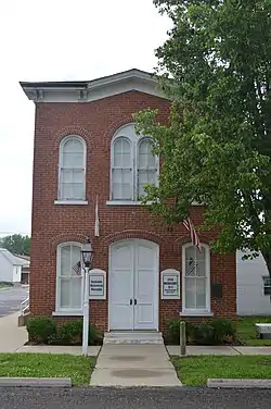 Bethalto Village Hall |
December 2, 1987 (#87002049) |
124 Main St. 38°54′36″N 90°02′31″W |
Bethalto | |
| 7 | Brooks Catsup Bottle Water Tower | 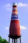 Brooks Catsup Bottle Water Tower |
August 13, 2002 (#02000847) |
800 South Morrison Ave. 38°39′46″N 89°58′56″W |
Collinsville | |
| 8 | Cahokia Mounds | 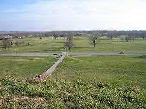 Cahokia Mounds |
October 15, 1966 (#66000899) |
7850 Collinsville Rd., Cahokia Mounds State Park 38°39′36″N 90°03′44″W |
Collinsville | World Heritage Site. Extends into St. Clair County |
| 9 | John Carney House | 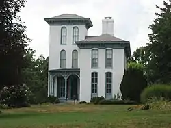 John Carney House |
July 28, 1983 (#83000327) |
306 E. Market St. 38°43′44″N 89°52′44″W |
Troy | |
| 10 | Chain of Rocks Bridge | 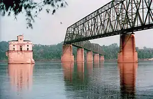 Chain of Rocks Bridge |
December 1, 2006 (#06001091) |
West Chain of Rocks Rd. 38°45′41″N 90°10′26″W |
Madison | |
| 11 | Christian Hill Historic District | 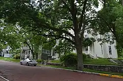 Christian Hill Historic District |
May 22, 1978 (#78001165) |
Roughly bounded by Broadway, Belle, 7th, Cliff, Bluff, and State Sts. 38°53′42″N 90°11′32″W |
Alton | |
| 12 | Daniel Dove Collins House | 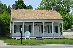 Daniel Dove Collins House |
November 21, 2002 (#02001385) |
621 W. Main St. 38°40′04″N 89°59′37″W |
Collinsville | |
| 13 | Collinsville City Hall and Fire Station | 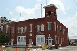 Collinsville City Hall and Fire Station |
August 20, 2004 (#04000865) |
125 S. Center St. 38°40′09″N 89°59′10″W |
Collinsville | |
| 14 | Collinsville Masonic Temple Lodge No. 712 A.F. & A.M. | 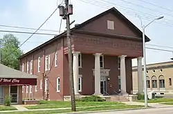 Collinsville Masonic Temple Lodge No. 712 A.F. & A.M. |
May 22, 2005 (#05000430) |
213 W. Clay St. 38°40′14″N 89°59′19″W |
Collinsville | |
| 15 | Edwardsville Chapter House | 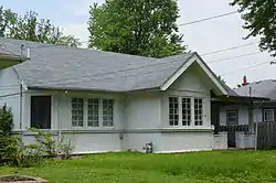 Edwardsville Chapter House |
November 28, 1980 (#80001392) |
515 W. High St. 38°48′51″N 89°57′43″W |
Edwardsville | |
| 16 | Emmert-Zippel House | 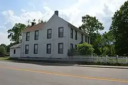 Emmert-Zippel House |
May 2, 1996 (#96000511) |
3279 Maryville Rd., 2 miles (3.2 km) north of Illinois Route 162 38°43′20″N 90°06′14″W |
Granite City | |
| 17 | Glen Carbon Grade School | 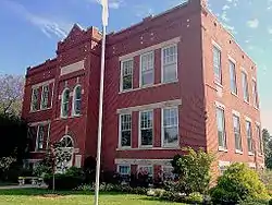 Glen Carbon Grade School |
August 25, 2014 (#14000507) |
124 School St. 38°44′55″N 89°58′43″W |
Glen Carbon | |
| 18 | Glen Carbon Village Hall and Firehouse | April 19, 2018 (#100002326) |
180 Summit Ave. 38°44′56″N 89°58′46″W |
Glen Carbon | ||
| 19 | Benjamin Godfrey Memorial Chapel | 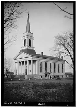 Benjamin Godfrey Memorial Chapel |
May 10, 1979 (#79000856) |
Godfrey Rd. 38°57′01″N 90°11′29″W |
Godfrey | |
| 20 | Granite City YMCA | .jpg.webp) Granite City YMCA |
September 5, 2017 (#100001564) |
2001 Edison Ave. 38°42′06″N 90°08′56″W |
Granite City | |
| 21 | Guertler House |  Guertler House |
July 30, 1974 (#74000767) |
101 Blair St. 38°54′03″N 90°10′58″W |
Alton | |
| 22 | Haskell Playhouse | 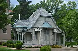 Haskell Playhouse |
July 30, 1974 (#74000768) |
Henry St. in Haskell Park 38°53′55″N 90°10′33″W |
Alton | |
| 23 | Horseshoe Lake Mound and Village Site | 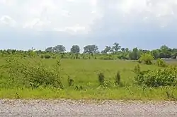 Horseshoe Lake Mound and Village Site |
November 26, 1980 (#80001396) |
Southwest of the junction of Illinois Route 111 and Horseshoe Lake Rd.[6] 38°42′15″N 90°04′07″W |
Granite City | |
| 24 | Hotel Stratford | 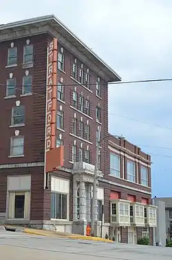 Hotel Stratford |
January 27, 2000 (#99001709) |
229 Market St. 38°53′27″N 90°11′06″W |
Alton | |
| 25 | William W. Jarvis House | 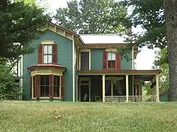 William W. Jarvis House |
February 3, 1988 (#87002514) |
317 E. Center St. 38°43′36″N 89°52′36″W |
Troy | |
| 26 | Kuhn Station Site |  Kuhn Station Site |
November 25, 1980 (#80001393) |
Rosewood Hills Dr.[7] 38°47′11″N 89°51′38″W |
Edwardsville | |
| 27 | LeClaire Historic District | 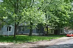 LeClaire Historic District |
August 8, 1979 (#79000855) |
Roughly bounded by the railroad tracks, Wolf St., and Hadley and Madison 38°48′00″N 89°57′00″W |
Edwardsville | |
| 28 | Marine Chapter House | 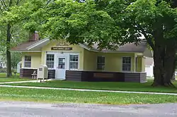 Marine Chapter House |
November 28, 1980 (#80001397) |
Silver St. 38°47′20″N 89°46′36″W |
Marine | |
| 29 | Middletown Historic District | 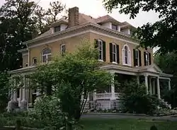 Middletown Historic District |
July 11, 1978 (#78001166) |
Roughly bounded by Broadway, Market, Alton, Franklin, Common, Liberty, Humboldt, and Plum Sts.; also 3rd St. between Market and Piasa St. 38°53′41″N 90°10′28″W |
Alton | Second set of boundaries represents a boundary increase of September 16, 1982 |
| 30 | Miners Institute Building | 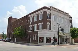 Miners Institute Building |
August 29, 1985 (#85001913) |
204 W. Main 38°40′10″N 89°59′15″W |
Collinsville | |
| 31 | Mitchell Archeological Site | 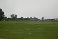 Mitchell Archeological Site |
February 7, 1978 (#78001168) |
Western end of University Dr.[8] 38°45′32″N 90°05′10″W |
Mitchell | |
| 32 | Mount Lookout | 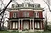 Mount Lookout |
June 17, 1980 (#80001389) |
2018 Alby Street 38°54′21″N 90°11′01″W |
Alton | |
| 33 | Narodni Sin | 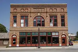 Narodni Sin |
November 21, 2002 (#02001353) |
209-211 E. Vandalia 38°48′49″N 89°57′13″W |
Edwardsville | |
| 34 | Post House | 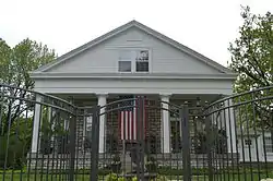 Post House |
May 28, 1980 (#80001390) |
1516 State St. 38°54′22″N 90°11′43″W |
Alton | |
| 35 | Salem Baptist Church |  Salem Baptist Church |
December 31, 2013 (#13001004) |
2001 Seiler Rd. 38°58′01″N 90°07′21″W |
Alton | |
| 36 | St. Louis Street Historic District | _and_Ralph_Griffin_(705)_Houses.jpg.webp) St. Louis Street Historic District |
May 9, 1983 (#83000328) |
603-1306 St. Louis St. 38°48′39″N 89°58′07″W |
Edwardsville | |
| 37 | State Bank Building | 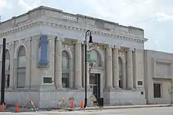 State Bank Building |
April 23, 2010 (#09000233) |
102 W. Main St. 38°48′25″N 89°57′09″W |
Collinsville | |
| 38 | Benjamin Stephenson House | .JPG.webp) Benjamin Stephenson House |
May 31, 1980 (#80001395) |
409 S. Buchanan St. 38°48′25″N 89°57′09″W |
Edwardsville | |
| 39 | Lyman Trumbull House | 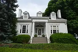 Lyman Trumbull House |
May 15, 1975 (#75000667) |
1105 Henry St. 38°53′51″N 90°10′34″W |
Alton | |
| 40 | Upper Alton Historic District | 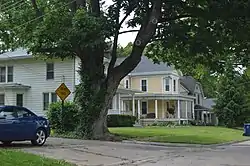 Upper Alton Historic District |
May 2, 1978 (#78001167) |
Seminary St., College, Leverett, and Evergreen Aves. 38°54′17″N 90°08′34″W |
Alton | |
| 41 | John Weir House | 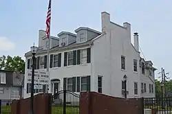 John Weir House |
May 9, 1983 (#83000329) |
715 N. Main St. 38°48′59″N 89°57′42″W |
Edwardsville | |
| 42 | Yakel House and Union Brewery | 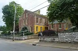 Yakel House and Union Brewery |
May 11, 1982 (#82002585) |
1421-1431 Pearl St. 38°53′35″N 90°09′51″W |
Alton |
Former listing
| [3] | Name on the Register | Image | Date listed | Date removed | Location | City or town | Summary |
|---|---|---|---|---|---|---|---|
| 1 | Madison County Sheriff's House and Jail | 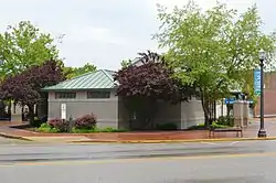 Madison County Sheriff's House and Jail |
May 31, 1980 (#80001394) | January 2, 2020 | 210 N. Main St. 38°48′48″N 89°57′27″W |
Edwardsville | |
| 2 | Rutherford House | March 19, 1982 (#82002584) | December 8, 1995 | 1006 Pearl St. |
Alton |
See also
| Wikimedia Commons has media related to National Register of Historic Places in St. Clair County, Illinois. |
References
- The latitude and longitude information provided in this table was derived originally from the National Register Information System, which has been found to be fairly accurate for about 99% of listings. Some locations in this table may have been corrected to current GPS standards.
- "National Register of Historic Places: Weekly List Actions". National Park Service, United States Department of the Interior. Retrieved on February 5, 2021.
- Numbers represent an alphabetical ordering by significant words. Various colorings, defined here, differentiate National Historic Landmarks and historic districts from other NRHP buildings, structures, sites or objects.
- The eight-digit number below each date is the number assigned to each location in the National Register Information System database, which can be viewed by clicking the number.
- Means, Ruth, and P.H. Poehner. National Register of Historic Places Inventory/Nomination: Alton Military Prison Site. National Park Service, 1973-11-30, 10.
- Wagner, Mark. National Register of Historic Places Inventory/Nomination: Horseshoe Lake Mound and Village Site. National Park Service, 1980-08-18, 6.
- van Hartesveldt, Eric N. National Register of Historic Places Inventory/Nomination: Kuhn Station Site. National Park Service, 1980-07-25, 6.
- Bodner, Connie. National Register of Historic Places Inventory/Nomination: Mitchell Archeological Site. National Park Service, 1976-08, 5.
| Topics | |
|---|---|
| Lists by state |
|
| Lists by insular areas | |
| Lists by associated state | |
| Other areas | |
| Related | |
| |
Municipalities and communities of Madison County, Illinois, United States | ||
|---|---|---|
| Cities | Map of Illinois highlighting Madison County | |
| Villages | ||
| Townships | ||
| CDPs | ||
| Other unincorporated communities | ||
| Footnotes | ‡This populated place also has portions in an adjacent county or counties | |
| ||
This article is issued from Wikipedia. The text is licensed under Creative Commons - Attribution - Sharealike. Additional terms may apply for the media files.