National Register of Historic Places listings in New River Gorge National Park and Preserve
This is a list of the National Register of Historic Places listings in New River Gorge National Park and Preserve.
This is intended to be a complete list of the properties and districts on the National Register of Historic Places in New River Gorge National Park and Preserve, West Virginia, United States. The locations of National Register properties and districts for which the latitude and longitude coordinates are included below, may be seen in a Google map.[1]
There are nine properties and districts listed on the National Register in the park, and one location outside the boundaries of the park, used as an administrative and interpretive site..
- This National Park Service list is complete through NPS recent listings posted January 29, 2021.[2]
Current listings
| [3] | Name on the Register | Image | Date listed[4] | Location | City or town | Description |
|---|---|---|---|---|---|---|
| 1 | Bank of Glen Jean | 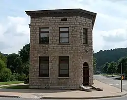 Bank of Glen Jean |
February 10, 1983 (#83003236) |
Main St. 37°55′42″N 81°09′19″W |
Glen Jean | In a detached part of the park |
| 2 | Kay Moor | 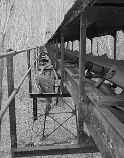 Kay Moor |
November 8, 1990 (#90001641) |
Along the New River south of U.S. Route 19 38°02′52″N 81°03′53″W |
Fayetteville | |
| 3 | New Deal Resources in Babcock State Park Historic District | March 5, 2020 (#100003518) |
486 Babcock Rd. 37°59′43″N 80°57′14″W |
Clifftop | ||
| 4 | New River Gorge Bridge | New River Gorge Bridge |
August 14, 2013 (#13000603) |
US 19 over New River 38°04′06″N 81°05′00″W |
Fayetteville | |
| 5 | Nuttallburg Coal Mining Complex and Town Historic District |  Nuttallburg Coal Mining Complex and Town Historic District |
August 22, 2007 (#07000846) |
County Route 85/2 38°03′02″N 81°02′33″W |
Edmond | |
| 6 | Prince Brothers General Store-Berry Store | 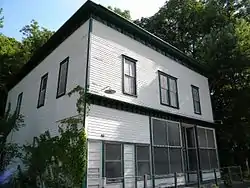 Prince Brothers General Store-Berry Store |
April 17, 1986 (#86000810) |
WV 41 37°51′22″N 81°03′49″W |
Prince | |
| 7 | St. Colman's Roman Catholic Church and Cemetery | 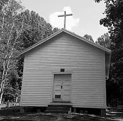 St. Colman's Roman Catholic Church and Cemetery |
August 23, 1984 (#84003658) |
County Route 26 37°45′57″N 80°55′16″W |
Dillon | |
| 8 | Thurmond Historic District | 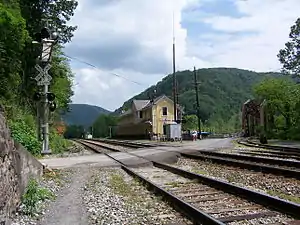 Thurmond Historic District |
January 27, 1984 (#84003520) |
County Route 25/2 at New River 37°57′29″N 81°04′40″W |
Thurmond | |
| 9 | Trump-Lilly Farmstead | 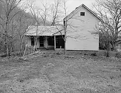 Trump-Lilly Farmstead |
November 8, 1990 (#90001640) |
County Route 26/3, 2.5 miles from County Route 26 37°41′54″N 80°54′01″W |
Hinton | Extends into Summers County |
See also
- National Register of Historic Places listings in Fayette County, West Virginia
- National Register of Historic Places listings in Raleigh County, West Virginia
References
- The latitude and longitude information provided in this table was derived originally from the National Register Information System, which has been found to be fairly accurate for about 99% of listings. Some locations in this table may have been corrected to current GPS standards.
- "National Register of Historic Places: Weekly List Actions". National Park Service, United States Department of the Interior. Retrieved on January 29, 2021.
- Numbers represent an alphabetical ordering by significant words. Various colorings, defined here, differentiate National Historic Landmarks and historic districts from other NRHP buildings, structures, sites or objects.
- The eight-digit number below each date is the number assigned to each location in the National Register Information System database, which can be viewed by clicking the number.
| Topics | |
|---|---|
| Lists by state |
|
| Lists by insular areas | |
| Lists by associated state | |
| Other areas | |
| Related | |
| |
| Wikimedia Commons has media related to National Register of Historic Places in New River Gorge National Park. |
This article is issued from Wikipedia. The text is licensed under Creative Commons - Attribution - Sharealike. Additional terms may apply for the media files.