National Register of Historic Places listings in Organ Pipe Cactus National Monument
This is a list of the National Register of Historic Places listings in Organ Pipe Cactus National Monument.
This is intended to be a complete list of the properties and districts on the National Register of Historic Places in Organ Pipe Cactus National Monument, Arizona, United States. The locations of National Register properties and districts for which the latitude and longitude coordinates are included below, may be seen in a Google map.[1]
There are eight properties and districts listed on the National Register in the park.
- This National Park Service list is complete through NPS recent listings posted January 29, 2021.[2]
Current listings
| [3] | Name on the Register | Image | Date listed[4] | Location | City or town | Description |
|---|---|---|---|---|---|---|
| 1 | Bates Well Ranch | 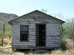 Bates Well Ranch |
May 20, 1994 (#94000493) |
Eastern side of Bates Well Rd. 32°10′06″N 112°57′01″W |
Ajo | |
| 2 | Bull Pasture | September 1, 1978 (#78000380) |
East of Lukeville in the Organ Pipe Cactus National Monument 32°00′49″N 112°41′42″W |
Lukeville | ||
| 3 | Dos Lomitas Ranch | 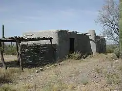 Dos Lomitas Ranch |
May 6, 1994 (#94000426) |
Organ Pipe Cactus National Monument 31°51′29″N 112°44′25″W |
Ajo | |
| 4 | Gachado Well and Line Camp | 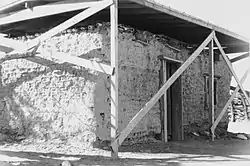 Gachado Well and Line Camp |
November 2, 1978 (#78000348) |
East of Lukeville in the Organ Pipe Cactus National Monument 31°52′18″N 112°47′08″W |
Lukeville | |
| 5 | Growler Mine Area | November 14, 1978 (#78000350) |
North of Lukeville 32°10′10″N 112°58′05″W |
Lukeville | ||
| 6 | I'itoi Mo'o-Montezuma's Head and 'Oks Daha-Old Woman Sitting | May 2, 1994 (#94000399) |
Organ Pipe Cactus National Monument 32°07′02″N 112°42′19″W |
Ajo | ||
| 7 | Milton Mine | September 1, 1978 (#78000351) |
Northwest of Lukeville 31°58′08″N 112°53′20″W |
Lukeville | ||
| 8 | Victoria Mine | 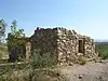 Victoria Mine |
September 1, 1978 (#78000349) |
North of Lukeville 31°55′46″N 112°50′11″W |
Lukeville |
See also
References
- The latitude and longitude information provided in this table was derived originally from the National Register Information System, which has been found to be fairly accurate for about 99% of listings. Some locations in this table may have been corrected to current GPS standards.
- "National Register of Historic Places: Weekly List Actions". National Park Service, United States Department of the Interior. Retrieved on January 29, 2021.
- Numbers represent an alphabetical ordering by significant words. Various colorings, defined here, differentiate National Historic Landmarks and historic districts from other NRHP buildings, structures, sites or objects.
- The eight-digit number below each date is the number assigned to each location in the National Register Information System database, which can be viewed by clicking the number.
| Topics | |
|---|---|
| Lists by state |
|
| Lists by insular areas | |
| Lists by associated state | |
| Other areas | |
| Related | |
| |
| Wikimedia Commons has media related to National Register of Historic Places in Organ Pipe Cactus National Monument. |
This article is issued from Wikipedia. The text is licensed under Creative Commons - Attribution - Sharealike. Additional terms may apply for the media files.