National Register of Historic Places listings in Pima County, Arizona
This is a list of the National Register of Historic Places listings in Pima County, Arizona.
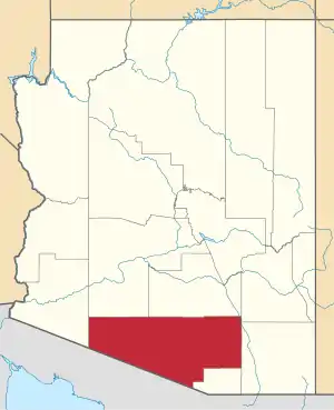
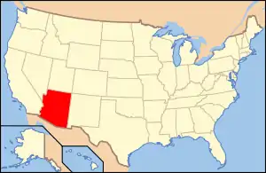
Location of Pima County in Arizona
This is intended to be a complete list of the properties and districts on the National Register of Historic Places in Pima County, Arizona, United States. The locations of National Register properties and districts for which the latitude and longitude coordinates are included below, may be seen in a map.[1]
There are 194 properties and districts listed on the National Register in the county, including 4 that are also National Historic Landmarks. Three properties formerly listed have been removed from the National Register.
- This National Park Service list is complete through NPS recent listings posted February 5, 2021.[2]
Current listings
| [3] | Name on the Register | Image | Date listed[4] | Location | City or town | Description |
|---|---|---|---|---|---|---|
| 1 | James P. and Sarah Adams House | August 30, 2011 (#11000568) |
5201 N. Camino Escuela 32°18′05″N 110°56′08″W |
Tucson | ||
| 2 | Agua Caliente Ranch Rural Historic Landscape |  Agua Caliente Ranch Rural Historic Landscape |
July 9, 2009 (#04001246) |
12325 E. Roger Rd. 32°16′54″N 110°44′00″W |
Tucson | |
| 3 | Air Force Facility Missile Site 8 (571-7) Military Reservation | 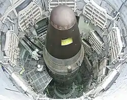 Air Force Facility Missile Site 8 (571-7) Military Reservation |
December 3, 1992 (#92001234) |
1580 W. Duval Mine Rd. 31°54′11″N 110°59′54″W |
Green Valley | Titan Missile Museum |
| 4 | Ajo Townsite Historic District | 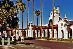 Ajo Townsite Historic District |
November 30, 2001 (#01000877) |
Blocks 1 through 31 32°22′20″N 112°51′48″W |
Ajo | |
| 5 | Aldea Linda Residential Historic District | June 9, 2009 (#09000371) |
4700-5000 blocks of E. Calle Jabali, E. 22nd St., and the 1100 block of S. Swan Rd. 32°12′32″N 110°53′15″W |
Tucson | Developed ca. 1947 by future state governor Sam Goddard. Large lots, houses set back from street.[5] | |
| 6 | Arthur Olaf and Helen S. Anderson House | March 13, 2017 (#12001101) |
5505 N. Camino Escuela 32°18′22″N 110°55′51″W |
Tucson | ||
| 7 | Arivaca Schoolhouse |  Arivaca Schoolhouse |
April 16, 2012 (#12000199) |
17180 W. 4th St. 31°34′34″N 111°19′46″W |
Arivaca | Oldest standing schoolhouse in Arizona, built by rancher Pedro Aguirre in 1879. Currently a center for community activities. |
| 8 | Arizona Daily Star Building | 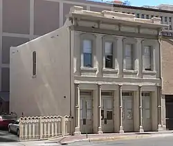 Arizona Daily Star Building |
February 22, 2002 (#02000033) |
30 N. Church Ave. 32°13′20″N 110°58′20″W |
Tucson | |
| 9 | Arizona Hotel | Arizona Hotel |
September 12, 2003 (#03000902) |
31-47 N. 6th Ave., 135 E. 10th St. 32°13′21″N 110°58′08″W |
Tucson | |
| 10 | Arizona Inn | 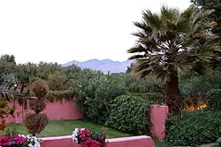 Arizona Inn |
April 5, 1988 (#88000240) |
2200 E. Elm St. 32°14′31″N 110°56′19″W |
Tucson | Historic hotel |
| 11 | Armory Park Historic Residential District | 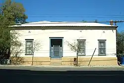 Armory Park Historic Residential District |
July 30, 1976 (#76000378) |
E. 12th St. to 19th St., Stone Ave. to 2nd Ave.; also roughly 19th, 20th, and 21st Sts. from Stone Ave. to Jacobus Ave. 32°12′56″N 110°57′58″W |
Tucson | Second set of boundaries represents a boundary increase of July 5, 1996 |
| 12 | Barrio Anita | 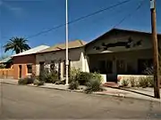 Barrio Anita |
September 23, 2011 (#11000682) |
Roughly bounded by W. Speedway Blvd., Union Pacific Railroad, N. Granada Ave., St. Mary's Rd. & I-10 32°13′59″N 110°58′47″W |
Tucson | Originally McKinley Park subdivision, recorded 1903. Named after Annie Hughes, sister of Sam Hughes.[6] |
| 13 | Barrio El Hoyo Historic District | 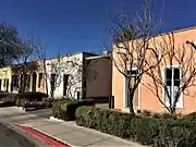 Barrio El Hoyo Historic District |
August 13, 2008 (#08000763) |
Roughly bounded by W. Cushing St. on the north, W. 18th St. on the south, S. 11th Ave. on the east, and S. Samaniego Ave. on the west 32°12′53″N 110°58′30″W |
Tucson | |
| 14 | Barrio El Membrillo Historic District | 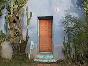 Barrio El Membrillo Historic District |
August 5, 2009 (#09000583) |
Bounded by W. Granada St. on the north, W. Simpson St. on the south, and the right-of-way of the former El Paso and Southwestern railroad line on the east 32°12′58″N 110°58′42″W |
Tucson | |
| 15 | Barrio Libre | .jpg.webp) Barrio Libre |
October 18, 1978 (#78000565) |
Roughly bounded by 14th, 19th, Stone and Osborne Sts. 32°12′46″N 110°58′23″W |
Tucson | |
| 16 | Barrio Santa Rosa | 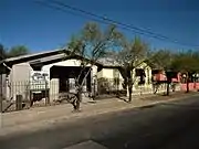 Barrio Santa Rosa |
September 23, 2011 (#11000683) |
Roughly bounded by W. 18th St., S. Russell Ave., W. 22nd St., S. 9th Ave., & S. Meyer Ave. 32°12′34″N 110°58′15″W |
Tucson | |
| 17 | Bates Well Ranch | 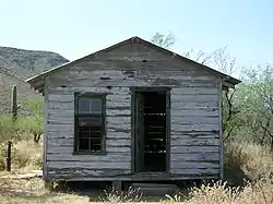 Bates Well Ranch |
May 20, 1994 (#94000493) |
Eastern side of Bates Well Rd. 32°10′06″N 112°57′01″W |
Ajo | |
| 18 | Jean and Paul Bauder House | October 2, 2017 (#100001661) |
4775 N. Camino Antonio 32°17′43″N 110°55′38″W |
Tucson | Boundary increases approved September 5, 2019 and May 22, 2020. | |
| 19 | Binghampton Rural Historic Landscape | May 1, 2003 (#03000316) |
Approximately at the junction of N. Dodge Boulevard and E. River Rd. 32°16′45″N 110°55′01″W |
Tucson | ||
| 20 | Blenman-Elm Historic District | 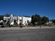 Blenman-Elm Historic District |
October 29, 2003 (#03000318) |
Bounded by Grant, Country Club, Speedway, and Campbell 32°14′38″N 110°56′00″W |
Tucson | |
| 21 | Boudreaux-Robison House | _from_E_1.JPG.webp) Boudreaux-Robison House |
March 30, 1992 (#92000253) |
101 N. Bella Vista Dr. 32°13′17″N 110°59′43″W |
Tucson | |
| 22 | Bray-Valenzuela House | _from_SE_1.JPG.webp) Bray-Valenzuela House |
March 30, 1992 (#92000255) |
203 N. Grande Ave. 32°13′25″N 110°59′21″W |
Tucson | |
| 23 | Grace and Elliot Brown House | 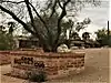 Grace and Elliot Brown House |
January 24, 2017 (#100000550) |
5025 N. Camino Escuela 32°17′52″N 110°56′13″W |
Tucson | |
| 24 | Bull Pasture | September 1, 1978 (#78000380) |
East of Lukeville in the Organ Pipe Cactus National Monument 32°00′49″N 112°41′42″W |
Lukeville | ||
| 25 | Erskine P. Caldwell House | September 9, 2010 (#10000747) |
1915 E. Camino Miraval 32°18′28″N 110°56′29″W |
Tucson | ||
| 26 | Dr. William Austin Cannon House | 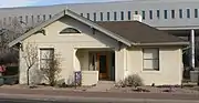 Dr. William Austin Cannon House |
October 25, 1982 (#82001663) |
1189 E. Speedway 32°14′11″N 110°57′15″W |
Tucson | |
| 27 | Canoa Ranch Headquarters Historic District | 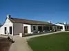 Canoa Ranch Headquarters Historic District |
February 16, 2016 (#04001158) |
5555 S AZ 19 31°47′25″N 111°01′21″W |
Green Valley vicinity | |
| 28 | Casa Juan Paisano | July 31, 2013 (#13000545) |
3300 E. Camino Juan Paisano 32°18′47″N 110°55′14″W |
Tucson | Home of developer John W. Murphey; designed by Mexican architect Juan Worner y Blas; built 1961.[7] | |
| 29 | Catalina Foothills Estates Apartments | September 8, 2015 (#15000568) |
2600 E. Skyline Dr. 32°19′22″N 110°55′56″W |
Tucson | ||
| 30 | Catalina Foothills Estates Job 265 House | March 7, 2017 (#100000705) |
5276 N. Camino Real 32°18′08″N 110°55′50″W |
Tucson | ||
| 31 | Catalina Foothills Estates Job No. 399 House | December 4, 2018 (#100003145) |
4950 N Calle Colmado 32°17′54″N 110°55′58″W |
Tucson | ||
| 32 | Catalina Townhouses Historic District | May 26, 2020 (#100005226) |
6240 North Campbell Ave. 32°19′11″N 110°55′49″W |
Tucson | ||
| 33 | Catalina Vista Historic District | .jpg.webp) Catalina Vista Historic District |
October 29, 2003 (#03000317) |
Bounded by Grant, Tucson Boulevard, Elm St., and Campbell Ave. 32°14′53″N 110°56′23″W |
Tucson | |
| 34 | Catalina American Baptist Church | _from_S_1.JPG.webp) Catalina American Baptist Church |
May 23, 2008 (#08000430) |
1900 N. Country Club Rd. 32°14′43″N 110°55′36″W |
Tucson | |
| 35 | Cavalry Corrals | 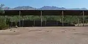 Cavalry Corrals |
December 13, 1978 (#78003359) |
N. Craycroft Boulevard 32°15′44″N 110°52′28″W |
Tucson | |
| 36 | Cienega Bridge | 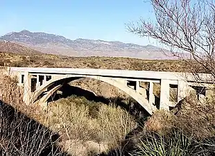 Cienega Bridge |
September 30, 1988 (#88001642) |
5.3 miles (8.5 km) southeast of Vail on Marsh Station Rd. 32°01′11″N 110°38′43″W |
Vail | |
| 37 | Cocoraque Butte Archaeological District | 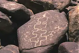 Cocoraque Butte Archaeological District |
October 10, 1975 (#75000355) |
Address Restricted |
Tucson | |
| 38 | Colonia Solana Residential Historic District | 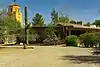 Colonia Solana Residential Historic District |
January 4, 1989 (#88002963) |
Roughly bounded by Broadway Boulevard, S. Randolph Way, Camino Campestre, and S. Country Club 32°13′03″N 110°55′18″W |
Tucson | |
| 39 | Colossal Cave Preservation Park Historic District | July 10, 1992 (#92000850) |
Junction of Old Spanish Trail and Colossal Cave Rd. 32°03′25″N 110°38′11″W |
Vail | ||
| 40 | Stephen and Persis Hart Browne Congdon House | January 16, 2018 (#100001956) |
2928 N. Orlando St. 32°15′35″N 110°53′18″W |
Tucson | ||
| 41 | Copper Bell Bed and Breakfast | 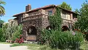 Copper Bell Bed and Breakfast |
March 30, 1992 (#92000254) |
25 N. Westmoreland Ave. 32°13′13″N 110°59′34″W |
Tucson | |
| 42 | John P. and Helena S. Corcoran House | August 30, 2011 (#11000569) |
2200 E. Calle Lustre 32°18′18″N 110°56′28″W |
Tucson | ||
| 43 | Cordova House | _from_SE_1.JPG.webp) Cordova House |
May 4, 1972 (#72000198) |
173-177 N. Meyer Ave. 32°13′26″N 110°58′29″W |
Tucson | |
| 44 | Coronado Hotel | 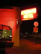 Coronado Hotel |
November 30, 1982 (#82001622) |
410 E. 9th St. 32°13′25″N 110°57′52″W |
Tucson | |
| 45 | George C. Craig House | June 26, 2017 (#100001230) |
5005 N. Calle La Vela 32°17′52″N 110°56′33″W |
Tucson | ||
| 46 | Curley School | January 31, 2008 (#07001464) |
201 W. Esperanza Ave. 32°22′20″N 112°51′50″W |
Ajo | ||
| 47 | Deep Well Ranch |  Deep Well Ranch |
October 1, 2004 (#04001072) |
13001 E. Redington Rd. 32°15′24″N 110°42′53″W |
Tucson | |
| 48 | DeGrazia Gallery in the Sun Historic District | 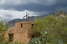 DeGrazia Gallery in the Sun Historic District |
October 12, 2006 (#06000932) |
6300 N. Swan Rd. 32°19′47″N 110°53′30″W |
Tucson | Ettore DeGrazia's studio and home |
| 49 | Desert Laboratory | 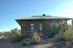 Desert Laboratory |
October 15, 1966 (#66000190) |
West of Tucson off W. Anklam Rd. on Tumamoc Hill 32°12′59″N 111°00′33″W |
Tucson | |
| 50 | Dodson-Esquivel House | _from_SE_1.JPG.webp) Dodson-Esquivel House |
March 30, 1992 (#92000252) |
1004 W. Alameda St. 32°13′21″N 110°59′20″W |
Tucson | |
| 51 | Don Martin Apartment House | Don Martin Apartment House |
September 9, 2010 (#10000748) |
605 E. 9th St. 32°13′27″N 110°57′44″W |
Tucson | |
| 52 | Dos Lomitas Ranch | 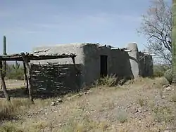 Dos Lomitas Ranch |
May 6, 1994 (#94000426) |
Organ Pipe Cactus National Monument 31°51′29″N 112°44′25″W |
Ajo | |
| 53 | Drexel House | 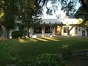 Drexel House |
June 26, 2017 (#100001231) |
5535 N. Camino Real 32°18′24″N 110°55′37″W |
Tucson | |
| 54 | Paul Laurence Dunbar School | 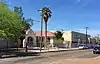 Paul Laurence Dunbar School |
October 18, 2018 (#100003013) |
300 W 2nd St. 32°13′57″N 110°58′38″W |
Tucson | |
| 55 | El Camino Del Diablo | 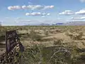 El Camino Del Diablo |
December 1, 1978 (#78000560) |
Northwest of Lukeville 32°04′20″N 113°23′12″W |
Lukeville | |
| 56 | El Conquistador Water Tower | _top_from_ESE_1.JPG.webp) El Conquistador Water Tower |
June 20, 1980 (#80000771) |
Broadway and Randolph Way 32°13′14″N 110°55′09″W |
Tucson | |
| 57 | El Encanto Apartments | _3.JPG.webp) El Encanto Apartments |
December 30, 1994 (#94001181) |
2820 E. 6th St. 32°13′39″N 110°55′47″W |
Tucson | |
| 58 | El Encanto Estates Residential Historic District |  El Encanto Estates Residential Historic District |
January 29, 1988 (#87002284) |
Roughly bounded by Country Club Rd., Broadway Boulevard, 5th St., and Jones St.; also roughly bounded by E. Speedway Boulevard, N. Country Club Rd., E. Broadway Boulevard, and N. Campbell Ave. 32°13′30″N 110°55′22″W |
Tucson | Developed ca. 1928.[8] Second set of boundaries represents a boundary increase of September 29, 1994, the Sam Hughes Neighborhood Historic District |
| 59 | El Montevideo Historic District |  El Montevideo Historic District |
September 12, 1994 (#94001070) |
3700 and 3800 blocks of streets between Broadway and 5th St.; also the 3700 and 3800 blocks of Camino Del Norte; also roughly bounded by 5th St., Broadway Boulevard, Alvernon Way, and Ridge Dr. 32°13′31″N 110°54′37″W |
Tucson | Second and third sets of boundaries represent boundary increases of December 1, 2000 and December 29, 2007 |
| 60 | El Paso and Southwestern Railroad Depot | _emblem.JPG.webp) El Paso and Southwestern Railroad Depot |
March 12, 2004 (#03000903) |
419 W. Congress St. 32°13′13″N 110°58′40″W |
Tucson | The depot opened in 1912.[9] |
| 61 | El Presidio Historic District |  El Presidio Historic District |
September 27, 1976 (#76000379) |
Roughly bounded by W. 6th and W. Alameda Sts. and N. Stone and Granada Aves. 32°13′30″N 110°58′30″W |
Tucson | |
| 62 | El Tiradito | El Tiradito |
November 19, 1971 (#71000115) |
221 S. Main St. 32°12′58″N 110°58′29″W |
Tucson | |
| 63 | The Eleven Arches | The Eleven Arches |
September 9, 2010 (#10000740) |
5201 N. Hacienda Del Sol 32°18′06″N 110°55′08″W |
Tucson | |
| 64 | Empire Ranch | 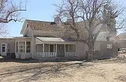 Empire Ranch |
May 30, 1975 (#75000354) |
6 miles (9.7 km) east of Greaterville 31°47′07″N 110°38′33″W |
Greaterville | Centerpiece of Las Cienegas National Conservation Area |
| 65 | Empirita Cattle Ranch Rural Historic District | January 8, 2009 (#04001247) |
Between Vail and Benson, south of Interstate 10 31°57′26″N 110°31′40″W |
Benson | ||
| 66 | Feldman's Historic District | 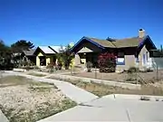 Feldman's Historic District |
September 21, 1989 (#89001460) |
Roughly bounded by Lee St., Park Ave., Speedway Boulevard, 7th Ave., Drachman St., and 2nd Ave. Also, generally north of E. Speedway Boulevard, west of N. Park Ave., south of E. Lee St., and east of N. 7th St. 32°14′18″N 110°57′45″W |
Tucson | Name changed from Speedway-Drachman Historic District.[10] Named after Alther M. Feldman, homesteader and photographer.[11] |
| 67 | George W. Ferguson House | May 21, 2018 (#100002476) |
6441 N Treasure Dr 32°19′29″N 110°58′43″W |
Tucson | ||
| 68 | First Hittinger Block | 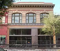 First Hittinger Block |
September 12, 2003 (#03000904) |
120 E. Congress St.[12] 32°13′18″N 110°58′09″W |
Tucson | |
| 69 | First Joesler House | First Joesler House |
September 9, 2010 (#10000741) |
3408 E. Fairmount St. 32°14′22″N 110°55′11″W |
Tucson | |
| 70 | P.W. Fletcher House | August 30, 2011 (#11000570) |
4850 N. Campbell Ave. 32°17′46″N 110°56′23″W |
Tucson | ||
| 71 | Fort Lowell Park | Fort Lowell Park |
December 13, 1978 (#78003358) |
N. Craycroft Boulevard 32°15′37″N 110°52′29″W |
Tucson | Owned by the Catalina Council of the Boy Scouts of America from 1945 to 1957.[13] |
| 72 | Fourth Avenue Commercial Historic District | .jpg.webp) Fourth Avenue Commercial Historic District |
October 12, 2017 (#100001726) |
4th Ave. from approx. 4th to 9th Sts. 32°13′40″N 110°57′56″W |
Tucson | |
| 73 | Fourth Avenue Underpass | Fourth Avenue Underpass |
September 30, 1988 (#88001654) |
4th Ave. 32°13′23″N 110°57′57″W |
Tucson | Rebuilt in 2009;[14] may no longer retain historic integrity. |
| 74 | Fox Commercial Building | _from_SW_1.JPG.webp) Fox Commercial Building |
April 6, 2004 (#04000258) |
27 W. Congress St. 32°13′25″N 110°58′18″W |
Tucson | |
| 75 | Fox Theatre |  Fox Theatre |
September 12, 2003 (#03000905) |
17 W. Congress St. 32°13′19″N 110°58′18″W |
Tucson | |
| 76 | Gabel House | 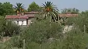 Gabel House |
September 9, 2010 (#10000742) |
5445 N. Camino Escuela 32°18′19″N 110°55′55″W |
Tucson | |
| 77 | Gachado Well and Line Camp | 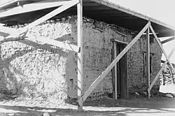 Gachado Well and Line Camp |
November 2, 1978 (#78000348) |
East of Lukeville in the Organ Pipe Cactus National Monument 31°52′18″N 112°47′08″W |
Lukeville | |
| 78 | Ghost Ranch Lodge | _sign_from_E_1.JPG.webp) Ghost Ranch Lodge |
May 30, 2012 (#12000296) |
801 W. Miracle Mile Rd. 32°15′37″N 110°59′06″W |
Tucson | |
| 79 | Gist Residence | 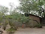 Gist Residence |
December 4, 2009 (#09000960) |
5626 E. Burns St. 32°13′27″N 110°52′21″W |
Tucson | |
| 80 | John and Isabella Greenway House | February 23, 1998 (#98000052) |
1 Greenway House Dr. 32°21′59″N 112°52′09″W |
Ajo | ||
| 81 | Growler Mine Area | November 14, 1978 (#78000350) |
North of Lukeville 32°10′10″N 112°58′05″W |
Lukeville | ||
| 82 | Gunsight Mountain Archeological District | June 21, 1991 (#90000996) |
Address Restricted |
Three Points | ||
| 83 | Arthur C. and Helen Neel Hall House | Arthur C. and Helen Neel Hall House |
August 30, 2011 (#11000571) |
4875 N. Campbell Ave. 32°17′44″N 110°56′28″W |
Tucson | |
| 84 | Lewis D.W. Hall House | Lewis D.W. Hall House |
August 30, 2011 (#11000572) |
3160 E. Via Celeste 32°18′09″N 110°55′30″W |
Tucson | |
| 85 | Dr. Howard Paul Harrenstein House | August 22, 2019 (#100004292) |
6450 North Calle De Estevan 32°19′27″N 110°57′27″W |
Tucson | ||
| 86 | Haynes Building | _from_N_2.JPG.webp) Haynes Building |
September 9, 2010 (#10000743) |
312-314 E. Sixth St. 32°13′39″N 110°58′00″W |
Tucson | |
| 87 | Hecker House |  Hecker House |
September 9, 2010 (#10000744) |
2635 N. Camino Principal 32°15′21″N 110°51′06″W |
Tucson | |
| 88 | Hotel Congress |  Hotel Congress |
September 12, 2003 (#03000906) |
303-311 E. Congress St. 32°13′27″N 110°58′00″W |
Tucson | Historic hotel; |
| 89 | I'itoi Mo'o-Montezuma's Head and 'Oks Daha-Old Woman Sitting | May 2, 1994 (#94000399) |
Organ Pipe Cactus National Monument 32°07′02″N 112°42′19″W |
Ajo | ||
| 90 | Indian House Community Residential Historic District | October 28, 2001 (#01001173) |
Roughly bounded by 5th St., E. Wash, Kane Estates, and Sahura St. 32°13′41″N 110°51′52″W |
Tucson | ||
| 91 | Indian Ridge Historic District | July 16, 2010 (#10000467) |
Northwest of Sabino Canyon and Tanque Verde 32°15′29″N 110°50′43″W |
Tucson | ||
| 92 | Iron Horse Expansion Historic District |  Iron Horse Expansion Historic District |
June 19, 1986 (#86001347) |
Roughly bounded by 8th St., Euclid Ave., Hughes, and 10th Sts., and N. 4th and Hoff Aves. 32°13′25″N 110°57′42″W |
Tucson | |
| 93 | J. C. Penney-Chicago Store | J. C. Penney-Chicago Store |
September 12, 2003 (#03000907) |
130 E. Congress St. 32°13′18″N 110°58′08″W |
Tucson | |
| 94 | Jefferson Park Historic District |  Jefferson Park Historic District |
May 1, 2012 (#12000241) |
Roughly bounded by Euclid, Grant, Campbell & alley south of Lester. 32°14′48″N 110°57′08″W |
Tucson | Several streets given tree names by landowner Anna Lester.[15] |
| 95 | Donald S. and Elizabeth E. Johnson House | October 18, 2018 (#100003014) |
5165 N Camino St. 32°18′02″N 110°56′01″W |
Tucson | ||
| 96 | Julian-Drew Building | Julian-Drew Building |
March 29, 1996 (#96000306) |
182 E. Broadway 32°13′15″N 110°58′02″W |
Tucson | |
| 97 | Kentucky Camp Historic District | 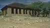 Kentucky Camp Historic District |
November 22, 1995 (#95001312) |
Address Restricted |
Sonoita | Ghost town and former mining camp |
| 98 | Lemmon Rock Lookout House | 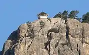 Lemmon Rock Lookout House |
January 28, 1988 (#87002465) |
Coronado National Forest 32°26′06″N 110°47′22″W |
Tucson | Historic fire lookout |
| 99 | Los Robles Archaeological District | 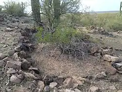 Los Robles Archaeological District |
May 11, 1989 (#89000337) |
Address Restricted |
Red Rock | |
| 100 | Lowell Ranger Station | Lowell Ranger Station |
June 10, 1993 (#93000529) |
Off Sabino Canyon Rd. northeast of Tucson in the Coronado National Forest 32°18′39″N 110°49′04″W |
Tucson | |
| 101 | Manning Cabin | 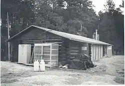 Manning Cabin |
March 31, 1975 (#75000169) |
10 miles (16 km) east of Tucson in the Saguaro National Park 32°12′27″N 110°33′09″W |
Tucson | |
| 102 | Levi H. Manning House | _from_SE_1.JPG.webp) Levi H. Manning House |
July 27, 1979 (#79000421) |
9 Paseo Redondo 32°13′24″N 110°58′44″W |
Tucson | |
| 103 | Marist College Historic District | _from_NE_1.JPG.webp) Marist College Historic District |
October 25, 2011 (#11000760) |
72 W. Ochoa St. 32°13′11″N 110°58′19″W |
Tucson | |
| 104 | Antonio Matus House and Property | 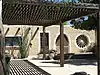 Antonio Matus House and Property |
July 22, 1991 (#91000900) |
856 W. Calle Santa Ana 32°14′53″N 110°59′09″W |
Tucson | |
| 105 | Phillip G. McFadden House | August 30, 2011 (#11000573) |
5130 Camino Real 32°18′00″N 110°56′02″W |
Tucson | ||
| 106 | Men's Gymnasium, University of Arizona | 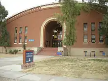 Men's Gymnasium, University of Arizona |
October 4, 1990 (#90001526) |
E. 4th St., University of Arizona campus 32°13′51″N 110°56′58″W |
Tucson | Bear Down Gym |
| 107 | Menlo Park Historic District | 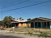 Menlo Park Historic District |
April 23, 2010 (#10000201) |
13 Subdivisions irregularly bounded around Grande Ave. and W. Congress St. intersection 32°13′12″N 110°59′18″W |
Tucson | |
| 108 | Milton Mine | September 1, 1978 (#78000351) |
Northwest of Lukeville 31°58′08″N 112°53′20″W |
Lukeville | ||
| 109 | Miracle Mile Historic District |  Miracle Mile Historic District |
December 11, 2017 (#100001208) |
Alignment of Miracle Mile, Oracle Rd., Drachman St. & Stone Ave 32°15′40″N 110°58′45″W |
Tucson | Historic stretch of old U.S. Route 80 and U.S. Route 89, lined with historic hotels and businesses with iconic neon signs.[16] |
| 110 | Officer's Quarters |  Officer's Quarters |
December 13, 1978 (#78003366) |
N. Craycroft Boulevard 32°15′29″N 110°52′28″W |
Tucson | Includes Commanding Officer's quarters (photo, now restored) at old Fort Lowell |
| 111 | Old Adobe Patio | Old Adobe Patio |
June 3, 1971 (#71000117) |
40 W. Broadway 32°13′15″N 110°58′19″W |
Tucson | Also known as Charles O. Brown House[17] |
| 112 | Old Library Building | Old Library Building |
November 28, 1979 (#79000422) |
University of Arizona campus 32°13′56″N 110°57′18″W |
Tucson | Now Arizona State Museum, north building |
| 113 | Old Main, University of Arizona |  Old Main, University of Arizona |
April 13, 1972 (#72000199) |
University of Arizona campus 32°13′55″N 110°57′10″W |
Tucson | |
| 114 | Old Vail Post Office | Old Vail Post Office |
February 22, 2011 (#11000044) |
13105 E. Colossal Cave Rd. 32°02′52″N 110°42′45″W |
Vail | |
| 115 | Owen Homesite | January 9, 2013 (#12001142) |
1415 E. Prince Rd. 32°16′24″N 110°56′59″W |
Tucson | ||
| 116 | Pascua Cultural Plaza |  Pascua Cultural Plaza |
September 22, 2004 (#04001032) |
785 W. Sahuaro St. 32°14′56″N 110°59′05″W |
Tucson | |
| 117 | Pie Allen Historic District | June 20, 1996 (#96000648) |
Roughly bounded by N. Euclid Ave., E. 6th St., N. Park Ave., and E. 10th St.; also 829, 835/837, 841, 841, 843, 903, 905, 907 E. 6th St. 32°13′31″N 110°57′29″W |
Tucson | Second set of addresses represent a boundary decrease February 4, 2015 | |
| 118 | Pima County Courthouse | 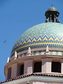 Pima County Courthouse |
June 23, 1978 (#78000566) |
115 N. Church St. 32°13′23″N 110°58′21″W |
Tucson | |
| 119 | Post Trader's Store and Riallito House | 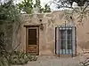 Post Trader's Store and Riallito House |
December 13, 1978 (#78003367) |
5425 E. Fort Lowell Rd. 32°15′38″N 110°52′37″W |
Tucson | |
| 120 | Post Trader's Storehouse | 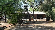 Post Trader's Storehouse |
December 13, 1978 (#78003368) |
5354 E. Fort Lowell Rd. 32°15′40″N 110°52′41″W |
Tucson | |
| 121 | Quartermaster Storehouse | 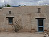 Quartermaster Storehouse |
December 13, 1978 (#78003369) |
5479 E. Fort Lowell Rd. 32°15′44″N 110°52′33″W |
Tucson | |
| 122 | Quartermaster's Corrals | December 13, 1978 (#78003370) |
N. Craycroft Rd. 32°15′44″N 110°52′28″W |
Tucson | ||
| 123 | Ramada House | _2.JPG.webp) Ramada House |
September 24, 2006 (#06000832) |
2801 E Camino Norberto 32°18′20″N 110°55′47″W |
Tucson | |
| 124 | Rebeil Block | 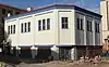 Rebeil Block |
March 12, 2004 (#03000910) |
72 E. Congress 32°13′18″N 110°58′12″W |
Tucson | |
| 125 | Rialto Building | Rialto Building |
September 12, 2003 (#03000908) |
300-320 E. Congress St. 32°13′19″N 110°58′01″W |
Tucson | |
| 126 | Rialto Theatre | Rialto Theatre |
September 12, 2003 (#03000909) |
318 E. Congress St. 32°13′19″N 110°57′59″W |
Tucson | |
| 127 | Rillito Race Track Historic District | 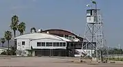 Rillito Race Track Historic District |
June 12, 1986 (#86001322) |
4502 N. 1st Ave. 32°17′23″N 110°57′24″W |
Tucson | Originally listed as "Rillito Racetrack-Chute"; current name represents a boundary increase of February 6, 2012 |
| 128 | Rincon Heights Historic District | 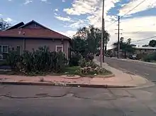 Rincon Heights Historic District |
January 23, 2013 (#12001190) |
Roughly bounded by 6th Street, Broadway Boulevard, Campbell Avenue, and Fremont Avenue 32°13′28″N 110°56′52″W |
Tucson | |
| 129 | Rincon Mountain Foothills Archeological District | October 16, 1979 (#79000252) |
Address Restricted |
Tucson | ||
| 130 | Robles Ranch House | September 3, 2010 (#04001157) |
16130 West Ajo Highway 32°04′43″N 111°18′36″W |
Robles Junction vicinity | Ranch established 1882 by brothers Bernabe and Jesus Robles.[18] | |
| 131 | Ronstadt House | _from_SE_1.JPG.webp) Ronstadt House |
February 26, 1979 (#79000423) |
607 N. 6th Ave. 32°13′46″N 110°58′08″W |
Tucson | |
| 132 | Ronstadt-Sims Adobe Warehouse | Ronstadt-Sims Adobe Warehouse |
May 11, 1989 (#88002133) |
911 N. 13th Ave. 32°13′59″N 110°58′47″W |
Tucson | part of the John Spring MRA |
| 133 | Sabedra-Huerta House | 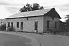 Sabedra-Huerta House |
November 10, 1988 (#88002132) |
1036–1038 N. 13th Ave. 32°14′07″N 110°58′45″W |
Tucson | part of the John Spring MRA; no longer exists |
| 134 | St. Philip's in the Hills Episcopal Church | St. Philip's in the Hills Episcopal Church |
December 17, 2004 (#04001347) |
4440 N. Campbell Ave. 32°17′17″N 110°56′36″W |
Tucson | |
| 135 | San Clemente Historic District | February 4, 2005 (#04001156) |
Southeastern corner of the intersection of Alvernon and Broadway 32°13′08″N 110°54′19″W |
Tucson | ||
| 136 | San Pedro Chapel | _from_NE_1.JPG.webp) San Pedro Chapel |
April 28, 1993 (#93000306) |
5230 E. Ft. Lowell Rd. 32°15′39″N 110°52′51″W |
Tucson | |
| 137 | San Rafael Estates | January 23, 2013 (#12001189) |
Northeast corner of Broadway Boulevard and Wilmont Road 32°13′23″N 110°51′20″W |
Tucson | ||
| 138 | San Xavier del Bac | 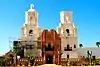 San Xavier del Bac |
October 15, 1966 (#66000191) |
9 miles (14 km) south of Tucson via Mission Rd. 32°06′24″N 111°00′22″W |
Tucson | |
| 139 | Santa Ana del Chiquiburitac Mission Site | September 18, 1975 (#75000357) |
Address Restricted |
Tucson | ||
| 140 | Santa Cruz Catholic Church | _from_E_2.JPG.webp) Santa Cruz Catholic Church |
October 7, 1994 (#94001196) |
1220 S. 6th Ave. 32°12′23″N 110°58′08″W |
Tucson | |
| 141 | Schwalen-Gomez House | _from_E_1.JPG.webp) Schwalen-Gomez House |
March 30, 1992 (#92000250) |
217 N. Melwood Ave. 32°13′27″N 110°59′16″W |
Tucson | |
| 142 | Shrine of Santa Rita in the Desert | December 9, 2015 (#14001231) |
13260 E. Colossal Cave Rd. 32°02′50″N 110°42′44″W |
Vail | ||
| 143 | Site No. HD 4-8A | December 13, 1978 (#78003374) |
E. Fort Lowell Rd. 32°15′43″N 110°52′39″W |
Tucson | ||
| 144 | Site No. HD 5-26 |  Site No. HD 5-26 |
December 13, 1978 (#78003360) |
5495 E. Fort Lowell Rd. 32°15′44″N 110°52′33″W |
Tucson | |
| 145 | Site Nos. HD 5-28/5-25 |  Site Nos. HD 5-28/5-25 |
December 13, 1978 (#78003364) |
3031 N. Craycroft Boulevard 32°15′47″N 110°52′32″W |
Tucson | |
| 146 | Site No. HD 7-0A | December 13, 1978 (#78003361) |
5429 E. Fort Lowell Rd. 32°15′44″N 110°52′33″W |
Tucson | ||
| 147 | Site No. HD 7-13 | December 13, 1978 (#78003365) |
5531 E. Fort Lowell Rd. 32°15′43″N 110°52′28″W |
Tucson | ||
| 148 | Site Nos. HD 9-11/9-2 | December 13, 1978 (#78003362) |
5651 E. Fort Lowell Rd. 32°15′48″N 110°52′21″W |
Tucson | ||
| 149 | Site No. HD 9-28 | December 13, 1978 (#78003363) |
5668 E. Fort Lowell Rd. 32°15′42″N 110°52′14″W |
Tucson | ||
| 150 | Site Nos. HD 12-4/12-8 | December 13, 1978 (#78003375) |
E. Fort Lowell Rd. 32°15′44″N 110°52′33″W |
Tucson | ||
| 151 | Site No. HD 13-4 | December 13, 1978 (#78003376) |
N. Craycroft Boulevard 32°15′36″N 110°52′35″W |
Tucson | ||
| 152 | Site No. HD 13-11 | December 13, 1978 (#78003373) |
E. Fort Lowell Rd. 32°15′41″N 110°52′38″W |
Tucson | ||
| 153 | Site No. HD 13-13 | December 13, 1978 (#78003372) |
E. Fort Lowell Rd. 32°15′38″N 110°52′37″W |
Tucson | ||
| 154 | Sixth Avenue Underpass | 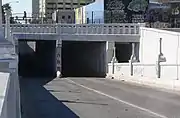 Sixth Avenue Underpass |
September 30, 1988 (#88001655) |
6th Ave. 32°13′31″N 110°58′07″W |
Tucson | |
| 155 | Professor George E. P. Smith House | Professor George E. P. Smith House |
June 3, 1982 (#82002090) |
1195 E. Speedway 32°14′10″N 110°57′14″W |
Tucson | |
| 156 | Sosa-Carrillo-Fremont House | Sosa-Carrillo-Fremont House |
June 3, 1971 (#71000116) |
145-153 S. Main St. 32°13′10″N 110°58′28″W |
Tucson | |
| 157 | Southern Pacific Railroad Locomotive No. 1673 | _3.JPG.webp) Southern Pacific Railroad Locomotive No. 1673 |
January 9, 1992 (#91001918) |
Southern Arizona Transportation Museum, 414 N. Toole Ave.[19] 32°13′26″N 110°58′02″W |
Tucson | |
| 158 | John Spring Neighborhood Historic District | 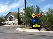 John Spring Neighborhood Historic District |
May 11, 1989 (#88002131) |
Roughly bounded by W. Speedway Boulevard, N. 9th Ave., W. 5th St., N. Main Ave., W. 2nd St., and N. 10th Ave. 32°13′55″N 110°58′27″W |
Tucson | part of the John Spring MRA |
| 159 | Steam Pump Ranch | 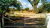 Steam Pump Ranch |
September 2, 2009 (#09000668) |
10901 Oracle Rd. 32°24′18″N 110°57′03″W |
Oro Valley | |
| 160 | Stone Avenue Underpass | _from_S_4.JPG.webp) Stone Avenue Underpass |
September 30, 1988 (#88001656) |
Stone Ave. 32°13′38″N 110°58′18″W |
Tucson | |
| 161 | Sunshine Mile Historic District | May 26, 2020 (#100005229) |
Broadway Blvd. between Euclid & Country Club Rds. 32°13′17″N 110°56′39″W |
Tucson | ||
| 162 | Sutherland Wash Archeological District | August 15, 1988 (#88000228) |
Address Restricted |
Tucson | ||
| 163 | Sutherland Wash Rock Art District | October 19, 1993 (#93001107) |
Address Restricted |
Tucson | ||
| 164 | Charles S. Todd House | 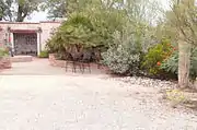 Charles S. Todd House |
January 26, 2001 (#00001673) |
11511 E. Speedway Boulevard 32°14′12″N 110°44′45″W |
Tucson | |
| 165 | Tucson Community Center Historic District | 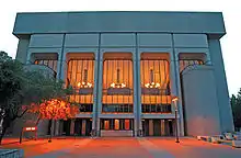 Tucson Community Center Historic District |
September 8, 2015 (#15000569) |
180-260 S. Church Ave. 32°13′08″N 110°58′26″W |
Tucson | Now known as the Tucson Convention Center |
| 166 | Tucson Veterans Administration Hospital Historic District | August 28, 2012 (#12000548) |
3601 S. 6th Ave. 32°10′52″N 110°57′56″W |
Tucson | part of the United States Second Generation Veterans Hospitals MPS | |
| 167 | Tucson Warehouse Historic District | 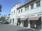 Tucson Warehouse Historic District |
October 15, 1999 (#97000886) |
Roughly bounded by 6th St., 4th Ave., and Toole Ave. 32°13′19″N 110°58′10″W |
Tucson | Historic Amtrak Station located at 400 N. Toole Ave. in the Tucson Warehouse Historic District. |
| 168 | The Tumamoc Hill Archeological District | 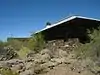 The Tumamoc Hill Archeological District |
April 5, 2010 (#10000109) |
1675 W. Anklam Rd./NE corner Greasewood Rd & 22nd St. 32°12′50″N 111°00′21″W |
Tucson | |
| 169 | Type A at 2101 E. Water St | 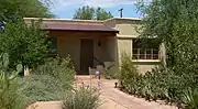 Type A at 2101 E. Water St |
September 9, 2010 (#10000745) |
2101 E. Water St. 32°15′08″N 110°56′27″W |
Tucson | |
| 170 | Type B at 2019 E. Water St | 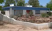 Type B at 2019 E. Water St |
September 9, 2010 (#10000746) |
2019 E. Water St. 32°15′09″N 110°56′30″W |
Tucson | |
| 171 | U.S. Post Office and Courthouse | 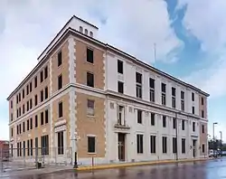 U.S. Post Office and Courthouse |
February 10, 1983 (#83002995) |
55 E. Broadway 32°13′17″N 110°58′10″W |
Tucson | |
| 172 | University Heights Elementary School | University Heights Elementary School |
October 6, 1983 (#83003494) |
1201 N. Park Ave. 32°14′16″N 110°57′26″W |
Tucson | |
| 173 | University Indian Ruin Archeological Research District | October 17, 2012 (#12000854) |
2799 N. Indian Ruins Rd. 32°15′26″N 110°50′53″W |
Tucson vicinity | ||
| 174 | University of Arizona Campus Historic District | .JPG.webp) University of Arizona Campus Historic District |
June 13, 1986 (#86001254) |
Roughly bounded by E. 2nd St., N. Cherry Ave., E. 4th St., and Park Ave. 32°13′46″N 110°57′04″W |
Tucson | |
| 175 | Upper Davidson Canyon Archeological District | January 3, 1992 (#91001891) |
Address Restricted |
Sonoita | ||
| 176 | USDA Tucson Plant Materials Center | 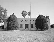 USDA Tucson Plant Materials Center |
July 2, 1997 (#97000592) |
3241 N. Romero Rd. 32°15′59″N 111°00′12″W |
Tucson | |
| 177 | U.S. Inspection Station-Sasabe, Arizona | 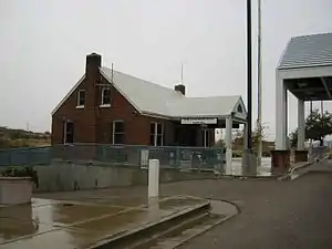 U.S. Inspection Station-Sasabe, Arizona |
May 22, 2014 (#14000243) |
AZ 286 31°29′00″N 111°32′40″W |
Sasabe | Part of the U.S. Border Inspection Stations |
| 178 | Valencia Site (BB:13:15;BB:13:74) | May 17, 1984 (#84000762) |
Address Restricted |
Tucson | ||
| 179 | Valley National Bank Building | _from_SW_1.JPG.webp) Valley National Bank Building |
September 12, 2003 (#03000911) |
27 S. Stone Ave. 32°13′18″N 110°58′15″W |
Tucson | |
| 180 | Valley of the Moon | July 28, 2011 (#11000480) |
2544 E. Allen Rd. 32°16′30″N 110°56′02″W |
Tucson | ||
| 181 | Nellie Mae Kellogg Van Schaick House | Nellie Mae Kellogg Van Schaick House |
August 30, 2011 (#11000575) |
4141 N. Pontatoc Rd. 32°16′56″N 110°54′12″W |
Tucson | |
| 182 | Velasco House | Velasco House |
March 5, 1974 (#74000460) |
471-475-477 S. Stone Ave. and 522 S. Russell St. 32°12′55″N 110°58′12″W |
Tucson | |
| 183 | Ventana Cave | 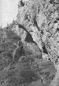 Ventana Cave |
October 15, 1966 (#66000189) |
Southern end of Window Mountain[20] |
Santa Rosa | |
| 184 | Victoria Mine | 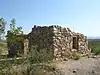 Victoria Mine |
September 1, 1978 (#78000349) |
North of Lukeville 31°55′46″N 112°50′11″W |
Lukeville | |
| 185 | Viewpoint | February 1, 2021 (#100006082) |
2840 North Sunrock Ln. 32°15′04″N 111°03′17″W |
Tucson | ||
| 186 | Villa Catalina | Villa Catalina |
December 22, 2009 (#09001114) |
3000-3034 E. 6th St. and 521-525 N. Country Club Rd. 32°13′39″N 110°55′40″W |
Tucson | |
| 187 | Solomon Warner House and Mill | 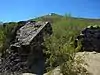 Solomon Warner House and Mill |
June 3, 1976 (#76000380) |
350 S. Grand Ave. 32°12′52″N 110°59′16″W |
Tucson | Mission Flouring Mill, built 1875 by Solomon Warner[21] |
| 188 | West University Historic District | 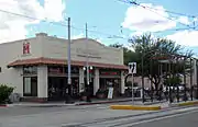 West University Historic District |
December 10, 1980 (#80004240) |
Roughly bounded by Speedway Boulevard, 6th St., and Park and Stone Aves.; also S side of E 5th St. between N 5th & N 7th Aves. 32°13′50″N 110°57′41″W |
Tucson | Second set of addresses represent a boundary increase approved September 27, 2018. |
| 189 | Betty-Jean Wilson House | February 23, 2016 (#16000024) |
2322 E. Calle Lustre 32°18′17″N 110°56′20″W |
Tucson | ||
| 190 | Winterhaven Historic District | December 28, 2005 (#05001466) |
Bounded by Prince, Country Club, Ft. Lowell, and Tucson Boulevard 32°16′10″N 110°55′49″W |
Tucson | ||
| 191 | Woodrow House | May 24, 2018 (#100001957) |
8649 E Woodland 32°15′08″N 110°48′31″W |
Tucson | ||
| 192 | Herbert and Irma Woollen House | March 13, 2017 (#12001108) |
4925 N. Camino Antonio 32°17′48″N 110°55′33″W |
Tucson | ||
| 193 | Harold Bell Wright Estate | January 18, 1985 (#85000081) |
850 N. Barbara Worth 32°14′07″N 110°51′11″W |
Tucson | ||
| 194 | Harold Bell Wright Estates | 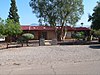 Harold Bell Wright Estates |
March 14, 2011 (#11000082) |
Roughly bounded by N. Wilmot Rd. on the west, E. Speedway Blvd. on north, El Dorado Hills subdivision on the east 32°13′55″N 110°51′11″W |
Tucson | Developed in 1950, on former estate of author Harold Bell Wright.[22] |
Former listings
| [3] | Name on the Register | Image | Date listed | Date removed | Location | City or town | Summary |
|---|---|---|---|---|---|---|---|
| 1 | Blixt-Avitia House | _from_S_2.JPG.webp) Blixt-Avitia House |
March 30, 1992 (#92000251) | May 17, 2018 | 830 W. Alameda St. 32°13′22″N 110°59′06″W |
Tucson | |
| 2 | Hotel Heidel | 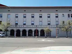 Hotel Heidel |
July 15, 1982 (#82002089) | December 13, 1983 | 345 Toole Ave. |
Tucson | Renamed "MacArthur Building" |
| 3 | Canoa Ranch Headquarters Historic District | Canoa Ranch Headquarters Historic District |
May 30, 2007 (#04001158) | November 26, 2014 | 5555 S. State Route 19 32°14′10″N 110°57′13″W |
Green Valley |
See also
| Wikimedia Commons has media related to National Register of Historic Places in Pima County, Arizona. |
References
- The latitude and longitude information provided in this table was derived originally from the National Register Information System, which has been found to be fairly accurate for about 99% of listings. Some locations in this table may have been corrected to current GPS standards.
- "National Register of Historic Places: Weekly List Actions". National Park Service, United States Department of the Interior. Retrieved on February 5, 2021.
- Numbers represent an alphabetical ordering by significant words. Various colorings, defined here, differentiate National Historic Landmarks and historic districts from other NRHP buildings, structures, sites or objects.
- The eight-digit number below each date is the number assigned to each location in the National Register Information System database, which can be viewed by clicking the number.
- Leighton, David. "Street Smarts: Midtown neighborhood one of Tucson's most unusual". Arizona Daily Star. November 16, 2015.
- Leighton, David. "Street Smarts: 'Well, I hardly knew what to think of the place' was Tucsonan's first impression". Arizona Daily Star. April 15, 2014. Retrieved April 17, 2016.
- Leighton, David. "Street Smarts: Foothills street name honors one of Tucson's most important builders". Arizona Daily Star. March 25, 2014. Retrieved April 17, 2016.
- Leighton, David. "Street Smarts: Contest named streets of El Encanto Estates". Arizona Daily Star. September 1, 2014. Retrieved April 17, 2016.
- Leighton, David. "Street Smarts: Railroad extension made Tucson a 'metropolis'. Arizona Daily Star. Mar 9, 2015. Retrieved Feb. 6, 2017.
- NRHP name change nomination form, NRHP recent listings for 15 August 2008.
- Leighton, David. "Street Smarts: Feldman brought family to Tucson after 1870s economic crash". Arizona Daily Star. July 9, 2013. Retrieved April 17, 2016.
- Listed in the National Register as 116 E. Congress St.: see illustrated article at "Historic Hittinger building in Downtown Tucson sells for $1.09M". Address apparently changed to 120 E. Congress: compare illustrations at Teya Vitu, "Vitu: Old facades could give downtown a new face", Tucson Citizen, May 27, 2008, and "Downtown move thrills firm workers", Tucson Citizen, November 11, 2009, both of which give the 120 address for the building illustrated.
- Leighton, David. "Street Smarts: Boy Scouts had a long connection to Fort Lowell". Arizona Daily Star. Feb. 5, 2017. Retrieved Feb. 6, 2017.
- See photo of sign at north end
- Leighton, David. "Street Smarts: If it bears name of a tree, chances are she named it". Arizona Daily Star. March 5, 2013. Retrieved April 17, 2016.
- "Tucson's Miracle Mile listed in the National Register of Historic Places". Tucson Historic Preservation Foundation. December 2017. Retrieved 24 August 2018.
- "Charles O. Brown House". Downtown Tucson. Retrieved 2012-02-14.
- Leighton, David. "Street Smarts: Rancher was one of early Tucson's largest land owners". Arizona Daily Star. September 8, 2014. Retrieved April 17, 2014.
- "Visit the Southern Arizona Transportation Museum". Southern Arizona Transportation Museum website. Retrieved 2012-02-09.
- Location derived from Kurtén, Björn, and Elaine Anderson. Pleistocene mammals of North America, "Ventana Cave". New York City: Columbia UP, 1980. Accessed January 6, 2010. The NRIS lists the site as "Address Restricted".
- Leighton, David. "Street Smarts: Tiny Tucson street bears the name of a major influence on the area". Arizona Daily Star. November 5, 2013. Retrieved April 17, 2016.
- Leighton, David. "Harold Bell Wright the inspiration for Tucson neighborhood". Arizona Daily Star. November 25, 2014. Retrieved April 17, 2016.
 | |||
This article is issued from Wikipedia. The text is licensed under Creative Commons - Attribution - Sharealike. Additional terms may apply for the media files.