National Register of Historic Places listings in Peoria County, Illinois
This is a list of the National Register of Historic Places listings in Peoria County, Illinois.
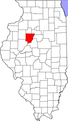
Location of Peoria County in Illinois
This is intended to be a complete list of the properties and districts on the National Register of Historic Places in Peoria County, Illinois, United States. Latitude and longitude coordinates are provided for many National Register properties and districts; these locations may be seen together in a map.[1]
There are 35 properties and districts listed on the National Register in the county.
- This National Park Service list is complete through NPS recent listings posted February 5, 2021.[2]
Current listings
| [3] | Name on the Register | Image | Date listed[4] | Location | City or town | Description |
|---|---|---|---|---|---|---|
| 1 | Central National Bank Building | 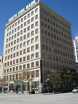 Central National Bank Building |
December 18, 1978 (#78003450) |
103 SW Adams St. 40°41′27″N 89°35′20″W |
Peoria | |
| 2 | Christ Church of Lower Kickapoo | 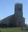 Christ Church of Lower Kickapoo |
February 10, 1983 (#83000333) |
West of Norwood on Christ Church Rd. 40°42′25″N 89°43′00″W |
Norwood | |
| 3 | Cumberland Presbyterian Church | 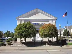 Cumberland Presbyterian Church |
March 18, 1980 (#80001401) |
405 N. Monson St. 40°41′33″N 89°35′46″W |
Peoria | |
| 4 | Downtown Peoria Historic District | 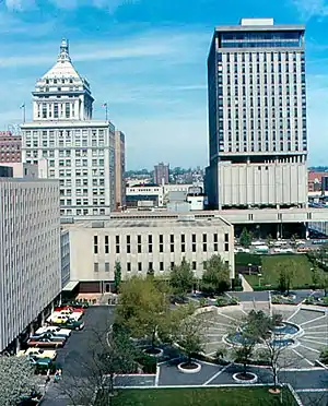 Downtown Peoria Historic District |
December 10, 2018 (#100002825) |
Roughly between N William Kumpf Blvd., Perry Ave., Fulton, Fayette & Water Sts. 40°41′34″N 89°35′26″W |
Peoria | |
| 5 | Judge Flanagan Residence | 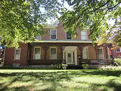 Judge Flanagan Residence |
September 5, 1975 (#75000670) |
942 NE Glen Oak Ave. 40°42′14″N 89°35′07″W |
Peoria | |
| 6 | Judge Jacob Gale House | 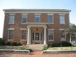 Judge Jacob Gale House |
March 19, 1982 (#82002591) |
403 NE Jefferson St. 40°41′46″N 89°35′08″W |
Peoria | |
| 7 | Grand Army of the Republic Memorial Hall | 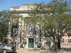 Grand Army of the Republic Memorial Hall |
July 13, 1976 (#76000723) |
416 Hamilton Boulevard 40°41′40″N 89°35′21″W |
Peoria | |
| 8 | Grand View Drive |  Grand View Drive |
September 27, 1996 (#96000399) |
Roughly bounded by N. Prospect Rd., the Illinois River bluffs, Adams St., and the Grand View Dr. W. right of way 40°44′30″N 89°33′52″W |
Peoria and Peoria Heights | |
| 9 | Illinois Waterway Project Office |  Illinois Waterway Project Office |
March 10, 2004 (#04000168) |
257 Grant St. 40°42′16″N 89°33′58″W |
Peoria | |
| 10 | International Harvester Building | 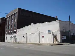 International Harvester Building |
November 15, 2005 (#05001254) |
1301-1309 SW Washington St. 40°40′53″N 89°36′14″W |
Peoria | |
| 11 | Jubilee College |  Jubilee College |
January 4, 1972 (#72000465) |
Northwest of Kickapoo on U.S. Route 150 and Interstate 74 40°49′38″N 89°46′40″W |
Kickapoo | |
| 12 | Kickapoo Building |  Kickapoo Building |
December 31, 2013 (#13001005) |
726 W. Main St. 40°41′48″N 89°35′40″W |
Peoria | |
| 13 | Lincoln Branch Peoria Public Library |  Lincoln Branch Peoria Public Library |
May 28, 2014 (#14000256) |
1312 W. Lincoln Ave. 40°40′53″N 89°36′52″W |
Peoria | Part of the Illinois Carnegie Libraries MPS |
| 14 | Madison Theatre | 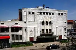 Madison Theatre |
November 21, 1980 (#80001402) |
502 Main St. 40°41′39″N 89°35′29″W |
Peoria | |
| 15 | Marquette Apartments | 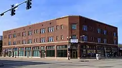 Marquette Apartments |
December 27, 2016 (#16000901) |
701 Main St. 40°41′45″N 89°35′39″W |
Peoria | |
| 16 | North Side Historic District | 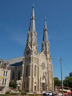 North Side Historic District |
November 21, 1983 (#83003588) |
Roughly bounded by Perry, Caroline, Madison, and Fayette Sts. 40°41′57″N 89°35′02″W |
Peoria | |
| 17 | Peace and Harvest | 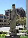 Peace and Harvest |
February 16, 1994 (#87002527) |
Northwestern corner of the junction of Main and Jefferson Sts.[5] 40°41′35″N 89°35′21″W |
Peoria | |
| 18 | Peoria Automobile Club | 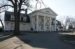 Peoria Automobile Club |
August 4, 1995 (#95000984) |
100 Park Boulevard 40°54′12″N 89°29′24″W |
Chillicothe | |
| 19 | Peoria City Hall | 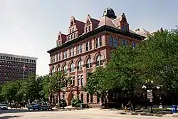 Peoria City Hall |
February 6, 1973 (#73000715) |
419 Fulton St. 40°41′32″N 89°35′33″W |
Peoria | |
| 20 | Peoria Cordage Company | 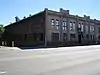 Peoria Cordage Company |
March 19, 1982 (#82002592) |
1506 SW Washington St.[6] 40°40′47″N 89°36′19″W |
Peoria | |
| 21 | Peoria Mineral Springs |  Peoria Mineral Springs |
March 5, 1982 (#82002593) |
701 W. 7th Ave. 40°41′45″N 89°36′18″W |
Peoria | |
| 22 | Peoria State Hospital | 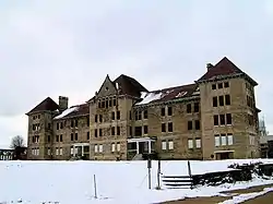 Peoria State Hospital |
February 17, 1982 (#82002590) |
Ricketts Ave. near U.S. Route 24 40°38′04″N 89°39′32″W |
Bartonville | |
| 23 | Peoria Warehouse Historic District | 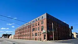 Peoria Warehouse Historic District |
September 17, 2014 (#14000621) |
Roughly along Adams, May, Oak, Persimmon, State, Walnut & Washington Sts. 40°41′08″N 89°35′52″W |
Peoria | |
| 24 | Peoria Waterworks | 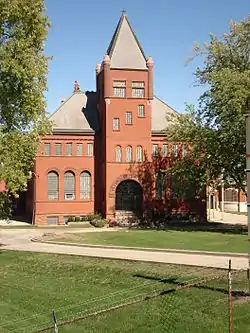 Peoria Waterworks |
March 18, 1980 (#80001403) |
Lorentz Ave. 40°43′28″N 89°33′08″W |
Peoria | |
| 25 | Pere Marquette Hotel | 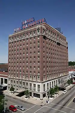 Pere Marquette Hotel |
August 12, 1982 (#82002594) |
501 Main St. 40°41′37″N 89°35′31″W |
Peoria | |
| 26 | Pettingill-Morron House | 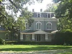 Pettingill-Morron House |
April 2, 1976 (#76000724) |
1212 W. Moss Ave. 40°41′39″N 89°36′41″W |
Peoria | Charles Ulricson, architect |
| 27 | The Pioneers | 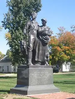 The Pioneers |
May 4, 2001 (#01000117) |
Central Park, N,. Magnolia St. 40°46′45″N 89°58′22″W |
Elmwood | |
| 28 | Pleasant Grove School | 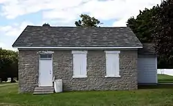 Pleasant Grove School |
May 19, 1994 (#94000435) |
0.6 miles west of Eden Rd. on Pleasant Grove Rd. 40°40′41″N 89°50′43″W |
Eden | |
| 29 | John C. Proctor Recreation Center | 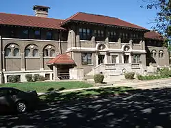 John C. Proctor Recreation Center |
September 6, 1979 (#79000860) |
300 S. Allen St. 40°41′07″N 89°36′58″W |
Peoria | |
| 30 | Rock Island Depot and Freight House | 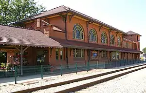 Rock Island Depot and Freight House |
December 22, 1978 (#78001180) |
32 Liberty St. 40°41′17″N 89°35′20″W |
Peoria | River Station |
| 31 | Springdale Cemetery | 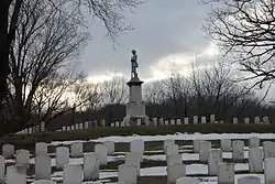 Springdale Cemetery |
December 10, 2004 (#04001303) |
3014 N. Prospect Rd. 40°43′24″N 89°34′30″W |
Peoria | |
| 32 | U.S. Post Office and Courthouse | 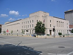 U.S. Post Office and Courthouse |
October 24, 2012 (#12000878) |
100 NE Monroe St. 40°41′42″N 89°35′30″W |
Peoria | |
| 33 | Washington C. Wear House | 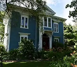 Washington C. Wear House |
August 19, 1993 (#93000838) |
1 mile south and 0.4 miles west of the junction of Illinois Routes 90 and 91 40°54′55″N 89°45′53″W |
Princeville | |
| 34 | West Bluff Historic District | .jpg.webp) West Bluff Historic District |
December 17, 1976 (#76000725) |
Randolph, High, and Moss Sts., east of Western St. 40°41′49″N 89°36′31″W |
Peoria | |
| 35 | YWCA Building | 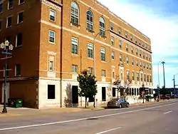 YWCA Building |
May 17, 2007 (#07000147) |
301 NE Jefferson 40°41′40″N 89°35′16″W |
Peoria |
See also
| Wikimedia Commons has media related to National Register of Historic Places in Peoria County, Illinois. |
References
- The latitude and longitude information provided in this table was derived originally from the National Register Information System, which has been found to be fairly accurate for about 99% of listings. Some locations in this table may have been corrected to current GPS standards.
- "National Register of Historic Places: Weekly List Actions". National Park Service, United States Department of the Interior. Retrieved on February 5, 2021.
- Numbers represent an alphabetical ordering by significant words. Various colorings, defined here, differentiate National Historic Landmarks and historic districts from other NRHP buildings, structures, sites or objects.
- The eight-digit number below each date is the number assigned to each location in the National Register Information System database, which can be viewed by clicking the number.
- Sunderland, Glenn W. National Register of Historic Places Inventory/Nomination: Peace and Harvest. National Park Service, 1993-07-28, 1.
- Kenyon, Leslie H., and Larry D. Davis. National Register of Historic Places Inventory/Nomination: Peoria Cordage Company. National Park Service, 1981-04-14, 1.
| Topics | |
|---|---|
| Lists by state |
|
| Lists by insular areas | |
| Lists by associated state | |
| Other areas | |
| Related | |
| |
This article is issued from Wikipedia. The text is licensed under Creative Commons - Attribution - Sharealike. Additional terms may apply for the media files.