National Register of Historic Places listings in Sullivan County, New Hampshire
This is a list of the National Register of Historic Places listings in Sullivan County, New Hampshire.
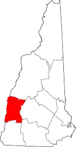
Location of Sullivan County in New Hampshire
This is intended to be a complete list of the properties and districts on the National Register of Historic Places in Sullivan County, New Hampshire, United States. Latitude and longitude coordinates are provided for many National Register properties and districts; these locations may be seen together in a map.[1]
There are 68 properties and districts listed on the National Register in the county, including 2 National Historic Landmarks.
| Belknap - Carroll - Cheshire - Coos - Grafton - Hillsborough - Merrimack - Rockingham - Strafford - Sullivan |
- This National Park Service list is complete through NPS recent listings posted January 29, 2021.[2]
Current listings
| [3] | Name on the Register[4] | Image | Date listed[5] | Location | City or town | Description |
|---|---|---|---|---|---|---|
| 1 | Acworth Congregational Church | 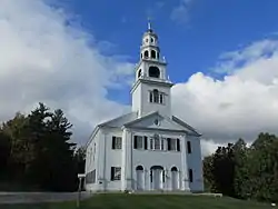 Acworth Congregational Church |
June 13, 1975 (#75000132) |
Northern end of town common 43°13′08″N 72°17′38″W |
Acworth | |
| 2 | Acworth Silsby Library | 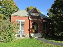 Acworth Silsby Library |
December 8, 1983 (#83004206) |
Intersection of Cold Pond and Lynn Hill Rds. 43°13′06″N 72°17′33″W |
Acworth | |
| 3 | Backside Inn | 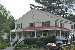 Backside Inn |
June 21, 1985 (#85001308) |
Brook Rd. 43°18′47″N 72°06′51″W |
Goshen | |
| 4 | Blow-Me-Down Covered Bridge | 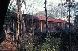 Blow-Me-Down Covered Bridge |
May 19, 1978 (#78000220) |
South of Plainfield off NH 12A 43°31′02″N 72°22′28″W |
Plainfield | Over Blow-me-down Brook |
| 5 | Blow-Me-Down Grange | 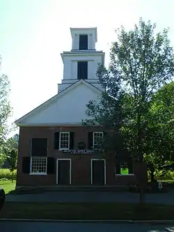 Blow-Me-Down Grange |
March 2, 2001 (#01000205) |
1071 NH 12A 43°32′01″N 72°21′24″W |
Plainfield | |
| 6 | Burford House | 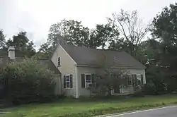 Burford House |
June 21, 1985 (#85001309) |
NH 10 43°17′59″N 72°08′55″W |
Goshen | |
| 7 | Central Business District |  Central Business District |
February 21, 1978 (#78003454) |
Roughly bounded by Crescent, Broad, Pine, and Franklin Sts. 43°22′17″N 72°20′14″W |
Claremont | |
| 8 | Charlestown Main Street Historic District | 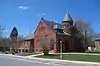 Charlestown Main Street Historic District |
June 10, 1987 (#87000835) |
Main St. 43°14′06″N 72°25′26″W |
Charlestown | |
| 9 | Charlestown Town Hall |  Charlestown Town Hall |
March 15, 1984 (#84003252) |
North of Summer St., off Main St. 43°14′09″N 72°25′26″W |
Charlestown | |
| 10 | Salmon P. Chase Birthplace | 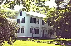 Salmon P. Chase Birthplace |
May 15, 1975 (#75000133) |
8 mi (13 km) north of Claremont 43°27′18″N 72°23′14″W |
Cornish | Birthplace and childhood home of Salmon P. Chase |
| 11 | Claremont City Hall | 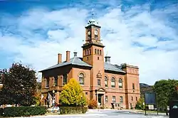 Claremont City Hall |
April 26, 1973 (#73000176) |
Tremont Sq. 43°22′21″N 72°20′15″W |
Claremont | |
| 12 | Claremont Warehouse No. 34 | 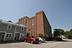 Claremont Warehouse No. 34 |
February 28, 1979 (#79000320) |
43 River St. 43°22′32″N 72°20′42″W |
Claremont | |
| 13 | Cold River Bridge | 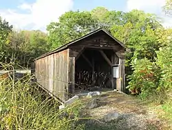 Cold River Bridge |
May 17, 1973 (#73000177) |
East of Langdon on McDermott Rd 43°10′13″N 72°20′46″W |
Langdon | Over Cold River |
| 14 | Cornish–Windsor Covered Bridge | 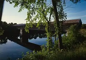 Cornish–Windsor Covered Bridge |
November 21, 1976 (#76000135) |
West of Cornish City 43°28′26″N 72°23′01″W |
Cornish | Over Connecticut River, connecting to Windsor, Vermont |
| 15 | Cote House | 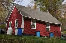 Cote House |
June 21, 1985 (#85001310) |
Goshen Center Rd. 43°17′44″N 72°07′03″W |
Goshen | |
| 16 | Covit House | 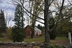 Covit House |
June 21, 1985 (#85001311) |
Goshen Center Rd. 43°17′44″N 72°06′54″W |
Goshen | |
| 17 | David Dexter House |  David Dexter House |
November 29, 1979 (#79000213) |
Dexter Heights 43°22′37″N 72°20′16″W |
Claremont | |
| 18 | Dingleton Hill Covered Bridge |  Dingleton Hill Covered Bridge |
November 8, 1978 (#78000221) |
Off NH 12A 43°27′51″N 72°22′09″W |
Cornish Mills | Over Mill Brook |
| 19 | Durham House |  Durham House |
June 21, 1985 (#85001312) |
Ball Park Rd. 43°16′32″N 72°08′03″W |
Goshen | |
| 20 | English Church |  English Church |
February 1, 1980 (#80000318) |
Old Church Rd. 43°22′59″N 72°22′18″W |
Claremont | |
| 21 | Farwell School | 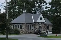 Farwell School |
December 6, 1990 (#90001847) |
NH 12A south of Hope Hill Cemetery 43°18′34″N 72°23′19″W |
Charlestown | |
| 22 | First Baptist Church of Cornish | 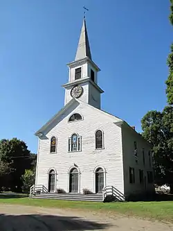 First Baptist Church of Cornish |
February 14, 1978 (#78000222) |
Meriden Stage Rd. and NH 120 43°29′54″N 72°16′48″W |
Cornish Flat | |
| 23 | First Universalist Chapel | 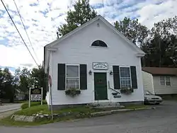 First Universalist Chapel |
December 12, 2006 (#06001130) |
3 2nd New Hampshire Turnpike 43°13′39″N 72°10′43″W |
Lempster | This 1845 building is now the town library. |
| 24 | Garber House | 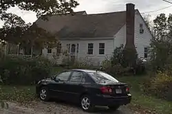 Garber House |
June 21, 1985 (#85001313) |
Willey Hill Rd. 43°16′43″N 72°07′56″W |
Goshen | |
| 25 | Giffin House | 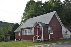 Giffin House |
June 21, 1985 (#85001314) |
NH 10 43°17′56″N 72°08′53″W |
Goshen | |
| 26 | Capt. John Gunnison House | 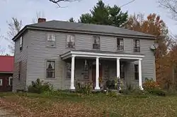 Capt. John Gunnison House |
December 19, 1979 (#79000214) |
East of Goshen on Goshen Center Rd. 43°17′37″N 72°07′38″W |
Goshen | |
| 27 | Hunter Archeological Site | 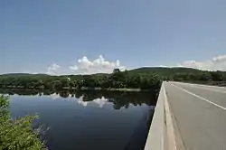 Hunter Archeological Site |
June 7, 1976 (#76000222) |
Near the bridge to Ascutney, Vermont[6] 43°24′11″N 72°24′02″W |
Claremont | Native American archeological site; location of at least three longhouses[6] |
| 28 | Janicke House | 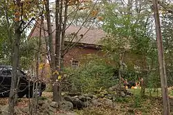 Janicke House |
June 21, 1985 (#85001315) |
Goshen Center Rd. 43°17′47″N 72°06′55″W |
Goshen | |
| 29 | Kenyon Bridge | .jpg.webp) Kenyon Bridge |
May 22, 1978 (#78000223) |
Off NH 12A at Mill Brook and Town House Rd. 43°27′47″N 72°21′13″W |
Cornish City | |
| 30 | Knights-Morey House |  Knights-Morey House |
June 21, 1985 (#85001316) |
Province Rd. 43°19′23″N 72°07′19″W |
Goshen | |
| 31 | Langdon Meeting House | January 9, 2020 (#100004859) |
5 Walker Hill Rd. 43°10′00″N 72°22′47″W |
Langdon | ||
| 32 | Lear House |  Lear House |
June 21, 1985 (#85001317) |
Province Rd. 43°19′47″N 72°06′21″W |
Goshen | |
| 33 | Lempster Meetinghouse | 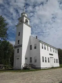 Lempster Meetinghouse |
September 8, 1980 (#80000319) |
Lempster St. 43°14′20″N 72°12′38″W |
Lempster | |
| 34 | Little Red School House 1835 District No. 7 |  Little Red School House 1835 District No. 7 |
December 1, 1980 (#80000320) |
South of Newport on NH 10 43°20′08″N 72°10′06″W |
Newport | |
| 35 | Lower Village District | 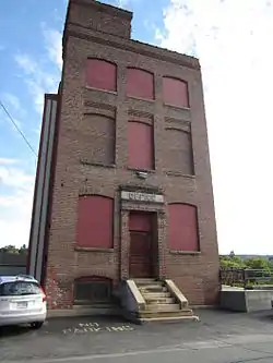 Lower Village District |
February 21, 1978 (#78003455) |
Along Central St. and Main St. on both sides of the Sugar River 43°22′29″N 72°20′34″W |
Claremont | |
| 36 | Meriden Bridge | 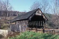 Meriden Bridge |
August 27, 1980 (#80000321) |
Northwest of Meriden 43°33′12″N 72°16′00″W |
Meriden | Over Bloods Brook |
| 37 | Meriden Town Hall | 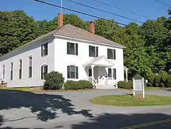 Meriden Town Hall |
December 20, 1998 (#98001548) |
110 Main St. 43°32′54″N 72°15′39″W |
Plainfield | A second town hall, in Plainfield's Meriden section |
| 38 | Monadnock Mills | 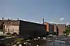 Monadnock Mills |
February 15, 1979 (#79000272) |
Broad, Water, Crescent Sts., and Mill Rd. 43°22′26″N 72°20′17″W |
Claremont | |
| 39 | Mothers' and Daughters' Club House | 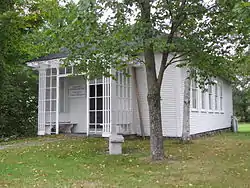 Mothers' and Daughters' Club House |
March 11, 1982 (#82001697) |
Main St. 43°32′10″N 72°21′19″W |
Plainfield | |
| 40 | Nettleton House |  Nettleton House |
November 16, 1977 (#77000164) |
26-30 Central St. 43°21′52″N 72°10′18″W |
Newport | |
| 41 | Newport Downtown Historic District | 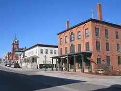 Newport Downtown Historic District |
June 6, 1985 (#85001201) |
Main St. roughly bounded by Depot, Sunapee, Central and West Sts. 43°21′48″N 72°10′20″W |
Newport | |
| 42 | North Charlestown Historic District | 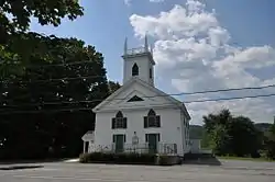 North Charlestown Historic District |
June 9, 2005 (#05000568) |
River Rd. 43°18′33″N 72°23′18″W |
Charlestown | |
| 43 | Pier Bridge | 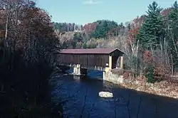 Pier Bridge |
June 10, 1975 (#75000134) |
3 mi (4.8 km) west of Newport on Chandler Rd. over the Sugar River 43°21′43″N 72°14′31″W |
Newport | |
| 44 | Pike House |  Pike House |
June 21, 1985 (#85001318) |
NH 10 43°18′02″N 72°08′52″W |
Goshen | |
| 45 | Plainfield Town Hall |  Plainfield Town Hall |
June 6, 1985 (#85001200) |
NH 12A 43°32′08″N 72°21′17″W |
Plainfield | |
| 46 | Prentiss Bridge |  Prentiss Bridge |
May 24, 1973 (#73000179) |
South of Langdon off Old Cheshire Turnpike 43°09′11″N 72°23′38″W |
Langdon | Over Great Brook |
| 47 | Protectworth Tavern |  Protectworth Tavern |
November 25, 1980 (#80000322) |
NH 4A 43°30′37″N 72°02′03″W |
Springfield | |
| 48 | Purnell House |  Purnell House |
June 21, 1985 (#85001319) |
NH 10 43°18′18″N 72°09′19″W |
Goshen | |
| 49 | Isaac Reed House |  Isaac Reed House |
July 19, 1978 (#78000337) |
30-34 Main St. 43°21′51″N 72°10′21″W |
Newport | |
| 50 | Richards, Dexter, & Sons Woolen Mill |  Richards, Dexter, & Sons Woolen Mill |
January 17, 2017 (#100000468) |
169 Sunapee St. 43°21′58″N 72°09′50″W |
Newport | |
| 51 | Richards Free Library |  Richards Free Library |
September 7, 1984 (#84003257) |
58 N. Main St. 43°22′00″N 72°10′34″W |
Newport | |
| 52 | William Rossiter House |  William Rossiter House |
May 25, 1979 (#79000215) |
11 Mulberry St. 43°22′20″N 72°20′41″W |
Claremont | |
| 53 | Saint-Gaudens National Historic Site | 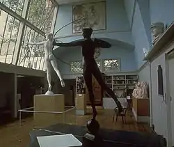 Saint-Gaudens National Historic Site |
October 15, 1966 (#66000120) |
South of Plainfield off NH 12A 43°30′02″N 72°22′08″W |
Cornish | Home and studio of American sculptor Augustus Saint-Gaudens; a National Historic Landmark and National Historic Site; expanded listing in 2013 |
| 54 | Scranton House |  Scranton House |
June 21, 1985 (#85001320) |
711 Brook Rd. 43°18′42″N 72°07′49″W |
Goshen | |
| 55 | Seavey House |  Seavey House |
June 21, 1985 (#85001321) |
NH 10 43°17′53″N 72°08′50″W |
Goshen | |
| 56 | South Congregational Church | 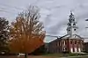 South Congregational Church |
March 30, 1989 (#89000187) |
58 S. Main St. 43°21′40″N 72°10′14″W |
Newport | |
| 57 | Springfield Town Hall and Howard Memorial Methodist Church | 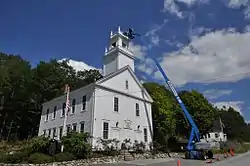 Springfield Town Hall and Howard Memorial Methodist Church |
June 5, 1986 (#86001235) |
Four Corners Rd. southeast of New London Rd. 43°29′43″N 72°02′55″W |
Springfield | |
| 58 | Louis St. Gaudens House and Studio | 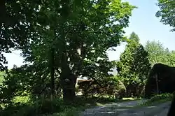 Louis St. Gaudens House and Studio |
November 15, 1972 (#72000111) |
Dingleton Hill and Whitten Rds. 43°30′01″N 72°20′51″W |
Cornish | |
| 59 | Stelljes House | 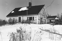 Stelljes House |
June 21, 1985 (#85001322) |
NH 31 43°15′37″N 72°06′58″W |
Goshen | Possibly demolished. |
| 60 | Sullivan County Courthouse | 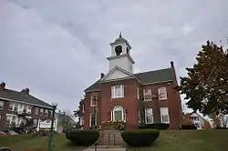 Sullivan County Courthouse |
June 25, 1973 (#73000178) |
Court Sq. 43°21′52″N 72°10′19″W |
Newport | Former (1824) courthouse, on hill behind town hall/current court |
| 61 | Town Hall and Courthouse | 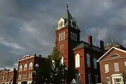 Town Hall and Courthouse |
February 29, 1980 (#80000383) |
20 Main St. 43°21′53″N 72°10′21″W |
Newport | Now the Opera House |
| 62 | Trinity Church | 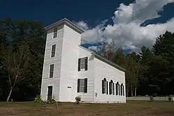 Trinity Church |
July 31, 1978 (#78000419) |
West of Cornish Mills on NH 12A 43°28′01″N 72°23′06″W |
Cornish Mills | |
| 63 | Unity Town Hall | 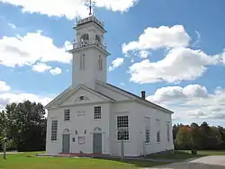 Unity Town Hall |
June 6, 1985 (#85001199) |
Off Unity Rd. and the Old New Hampshire Turnpike 43°17′38″N 72°15′37″W |
Unity | |
| 64 | Washington Common Historic District | 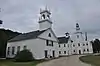 Washington Common Historic District |
March 14, 1986 (#86000345) |
Junction of Half Moon Pond and Millen Pond Rds. 43°10′34″N 72°05′47″W |
Washington | |
| 65 | Welcome Acres | 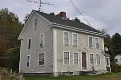 Welcome Acres |
June 21, 1985 (#85001323) |
NH 10 43°18′16″N 72°09′12″W |
Goshen | |
| 66 | Williamson House |  Williamson House |
June 21, 1985 (#85001324) |
Messer Rd. 43°20′02″N 72°06′47″W |
Goshen | |
| 67 | Windswept Acres-Powers House | 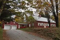 Windswept Acres-Powers House |
June 21, 1985 (#85001325) |
NH 31 43°15′38″N 72°07′11″W |
Goshen | |
| 68 | Wright's Bridge | .jpg.webp) Wright's Bridge |
June 10, 1975 (#75000135) |
East of Claremont off Chandler Rd. on the Sugar River Trail over the Sugar River 43°21′33″N 72°15′34″W |
Newport |
Former listings
| [3] | Name on the Register | Image | Date listed | Date removed | Location | City or town | Summary |
|---|---|---|---|---|---|---|---|
| 1 | Corbin Covered Bridge | 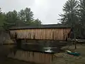 Corbin Covered Bridge |
December 12, 1976 (#76000134) | September 2, 1993 | Corbin Road |
Newport | Destroyed by fire in May 1993 and later rebuilt |
See also
| Wikimedia Commons has media related to National Register of Historic Places in Sullivan County, New Hampshire. |
References
- Starbuck, David (2006). The Archeology of New Hampshire. Durham, NH: University of New Hampshire Press. ISBN 9781584655626.
- The latitude and longitude information provided in this table was derived originally from the National Register Information System, which has been found to be fairly accurate for about 99% of listings. Some locations in this table may have been corrected to current GPS standards.
- "National Register of Historic Places: Weekly List Actions". National Park Service, United States Department of the Interior. Retrieved on January 29, 2021.
- Numbers represent an alphabetical ordering by significant words. Various colorings, defined here, differentiate National Historic Landmarks and historic districts from other NRHP buildings, structures, sites or objects.
- "National Register Information System". National Register of Historic Places. National Park Service. April 24, 2008.
- The eight-digit number below each date is the number assigned to each location in the National Register Information System database, which can be viewed by clicking the number.
- Starbuck, p. 89
| Topics |  | |
|---|---|---|
| Lists by county | ||
| Other lists | ||
| ||
Municipalities and communities of Sullivan County, New Hampshire, United States | ||
|---|---|---|
| City | Map of New Hampshire highlighting Sullivan County | |
| Towns | ||
| CDPs | ||
| Other villages | ||
| ||
This article is issued from Wikipedia. The text is licensed under Creative Commons - Attribution - Sharealike. Additional terms may apply for the media files.