National Register of Historic Places listings in Coös County, New Hampshire
This is a list of the National Register of Historic Places listings in Coös County, New Hampshire.
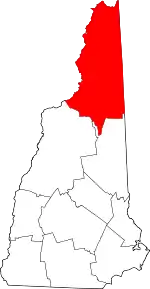
Location of Coös County in New Hampshire
This is intended to be a complete list of the properties and districts on the National Register of Historic Places in Coös County, New Hampshire, United States. Latitude and longitude coordinates are provided for many National Register properties and districts; these locations may be seen together in a map.[1]
There are 31 properties and districts listed on the National Register in the county, including 1 National Historic Landmark.
| Belknap - Carroll - Cheshire - Coos - Grafton - Hillsborough - Merrimack - Rockingham - Strafford - Sullivan |
- This National Park Service list is complete through NPS recent listings posted January 29, 2021.[2]
Current listings
| [3] | Name on the Register[4] | Image | Date listed[5] | Location | City or town | Description |
|---|---|---|---|---|---|---|
| 1 | Benjamin Aldrich Homestead | 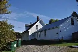 Benjamin Aldrich Homestead |
March 11, 2003 (#03000109) |
Shaw Rd., 0.46 miles east of Piper Hill 44°55′41″N 71°28′35″W |
Colebrook | |
| 2 | The Balsams | 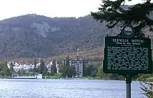 The Balsams |
March 13, 2002 (#02000166) |
NH 26, 10 mi (16 km) east of Colebrook 44°52′08″N 71°18′25″W |
Dixville | |
| 3 | George E. Burgess School-Notre Dame High School | 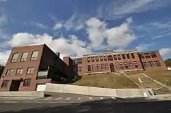 George E. Burgess School-Notre Dame High School |
June 25, 2015 (#15000175) |
411 School St. 44°28′29″N 71°10′29″W |
Berlin | |
| 4 | Columbia Covered Bridge | 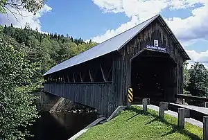 Columbia Covered Bridge |
December 12, 1976 (#76000123) |
Across Connecticut River between U.S. Route 3 and VT 102 44°51′12″N 71°33′05″W |
Columbia | Extends into Lemington, Vermont |
| 5 | Congregational Church | 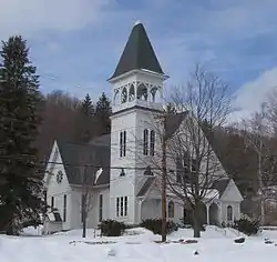 Congregational Church |
January 4, 1980 (#80000282) |
921 Main St. 44°28′40″N 71°10′18″W |
Berlin | |
| 6 | Crawford Depot | 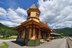 Crawford Depot |
April 29, 1982 (#82001672) |
Off U.S. Route 302 44°13′04″N 71°24′40″W |
Carroll | Restored former train station, now a visitor center at the top of Crawford Notch |
| 7 | Crawford House Artist's Studio | 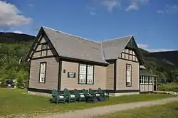 Crawford House Artist's Studio |
September 12, 1985 (#85002193) |
AMC Highland Center, Route 302[6] 44°13′11″N 71°24′40″W |
Carroll | Home and studio of artist Frank Shapleigh, 1877-1893; now part of the Appalachian Mountain Club's Highland Center |
| 8 | Fabyan Guard Station | 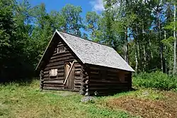 Fabyan Guard Station |
May 14, 2018 (#100002400) |
Cherry Mountain Rd., 0.7 miles (1.1 km) N of US 302 44°16′47″N 71°28′14″W |
Carroll | |
| 9 | Garland Mill | 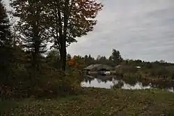 Garland Mill |
November 12, 1982 (#82000616) |
Garland Rd. 44°28′24″N 71°28′50″W |
Lancaster | |
| 10 | Holy Resurrection Orthodox Church | 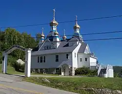 Holy Resurrection Orthodox Church |
May 16, 1979 (#79000196) |
Petrograd St. 44°28′06″N 71°11′30″W |
Berlin | An Orthodox church built by Russian immigrants in 1915 |
| 11 | Indian Stream Schoolhouse | 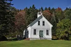 Indian Stream Schoolhouse |
October 11, 2011 (#11000730) |
Tabor Rd. 45°02′47″N 71°26′39″W |
Pittsburg | |
| 12 | Martin Homestead | 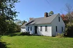 Martin Homestead |
October 30, 1998 (#98001145) |
U.S. Route 3, 3 mi (4.8 km) north of North Stratford 44°46′11″N 71°36′05″W |
North Stratford | |
| 13 | Meadow Bridge | 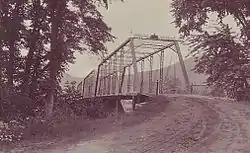 Meadow Bridge |
December 10, 2003 (#03001284) |
Spur of North Rd. in Shelburne across the Androscoggin River 44°24′16″N 71°04′03″W |
Shelburne | Bridge is disassembled beside modern bridge approaches. |
| 14 | Mount Orne Covered Bridge | 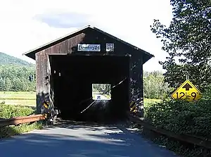 Mount Orne Covered Bridge |
December 12, 1976 (#76000124) |
Over Connecticut River southwest of Lancaster off NH 135 44°27′38″N 71°39′12″W |
Lancaster | Also listed in Lunenburg, Vermont |
| 15 | Mount Washington Hotel | 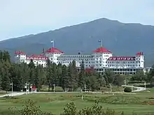 Mount Washington Hotel |
September 27, 1978 (#78000213) |
Off U.S. Route 302 44°15′29″N 71°26′25″W |
Bretton Woods | Spa hotel in the White Mountains; site of 1944 Bretton Woods international monetary conference. |
| 16 | Mountain View House | 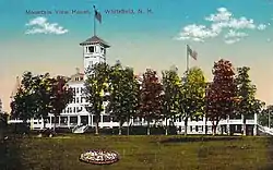 Mountain View House |
June 9, 2004 (#04000588) |
120 Mountain View Rd. 44°23′55″N 71°35′19″W |
Whitefield | |
| 17 | Mt. Jasper Lithic Source |  Mt. Jasper Lithic Source |
May 29, 1992 (#92000631) |
1½ miles northwest of the confluence of the Dead and Androscoggin Rivers 44°29′08″N 71°11′40″W |
Berlin | A prehistoric Native American stone quarry. |
| 18 | Nansen Ski Jump | 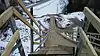 Nansen Ski Jump |
June 20, 2019 (#100004084) |
83 Milan Rd. 44°31′59″N 71°10′12″W |
Milan | |
| 19 | George Washington Noyes House | 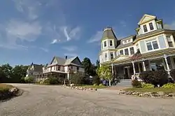 George Washington Noyes House |
September 19, 2016 (#16000643) |
2 Prospect Terrace 44°23′20″N 71°10′18″W |
Gorham | |
| 20 | Philbrook Farm Inn | 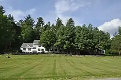 Philbrook Farm Inn |
March 15, 1984 (#84002804) |
North Rd. 44°24′16″N 71°03′08″W |
Shelburne | |
| 21 | St. Anne Church | 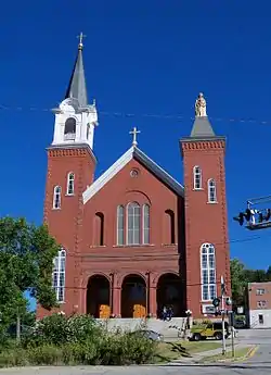 St. Anne Church |
May 29, 1979 (#79000197) |
58 Church St. 44°28′22″N 71°10′41″W |
Berlin | A Catholic church built in 1900 by French immigrants |
| 22 | Saint Anne Historic District | 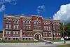 Saint Anne Historic District |
September 18, 2018 (#100002973) |
Bounded by Pleasant/Main, Church, School & Success Sts. 44°28′24″N 71°10′36″W |
Berlin | A Catholic church and associated school and hospital buildings. |
| 23 | Stark Covered Bridge | 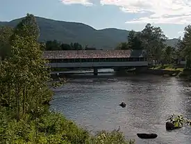 Stark Covered Bridge |
December 1, 1980 (#80000283) |
East of Groveton at NH 110 and Northside Rd. 44°36′03″N 71°24′30″W |
Stark | Over Upper Ammonoosuc River |
| 24 | Stark Union Church | 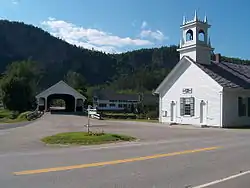 Stark Union Church |
December 8, 1983 (#83004089) |
NH 110 44°36′04″N 71°24′30″W |
Stark | |
| 25 | Tip-Top House | 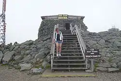 Tip-Top House |
January 11, 1982 (#82001673) |
Mount Washington State Park 44°16′14″N 71°18′14″W |
Sargent's Purchase | |
| 26 | US Post Office-Lancaster Main | 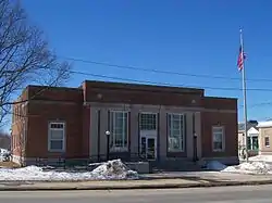 US Post Office-Lancaster Main |
July 17, 1986 (#86002245) |
120 Main St. 44°29′27″N 71°34′13″W |
Lancaster | |
| 27 | Wallace Farm | 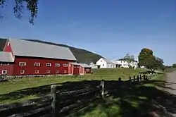 Wallace Farm |
December 13, 2001 (#01001353) |
27 Wallace Rd. 44°51′59″N 71°31′41″W |
Columbia | |
| 28 | Waumbek Cottages Historic District |  Waumbek Cottages Historic District |
March 15, 2006 (#06000142) |
13, 18, 25, and 36 Cottage Rd., and 14 and 38 Starr King Rd. 44°25′01″N 71°28′08″W |
Jefferson | |
| 29 | Weeks Estate | 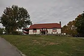 Weeks Estate |
June 6, 1985 (#85001190) |
US 3 44°27′05″N 71°34′15″W |
Lancaster | Now Weeks State Park. |
| 30 | William Dennis Weeks Memorial Library | 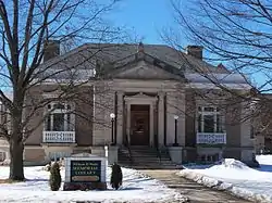 William Dennis Weeks Memorial Library |
December 1, 2000 (#00001464) |
128 Main St. 44°29′27″N 71°34′16″W |
Lancaster | |
| 31 | Wilder-Holton House | 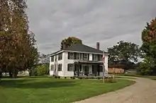 Wilder-Holton House |
June 11, 1975 (#75000231) |
226 Main St. 44°30′11″N 71°34′41″W |
Lancaster |
See also
| Wikimedia Commons has media related to National Register of Historic Places in Coos County, New Hampshire. |
References
- The latitude and longitude information provided in this table was derived originally from the National Register Information System, which has been found to be fairly accurate for about 99% of listings. Some locations in this table may have been corrected to current GPS standards.
- "National Register of Historic Places: Weekly List Actions". National Park Service, United States Department of the Interior. Retrieved on January 29, 2021.
- Numbers represent an alphabetical ordering by significant words. Various colorings, defined here, differentiate National Historic Landmarks and historic districts from other NRHP buildings, structures, sites or objects.
- "National Register Information System". National Register of Historic Places. National Park Service. April 24, 2008.
- The eight-digit number below each date is the number assigned to each location in the National Register Information System database, which can be viewed by clicking the number.
- "Shapleigh Bunkhouse, White Mountains NH - Appalachian Mountain Club Lodging". Outdoors.org. 2012-04-03. Retrieved 2014-05-17.
| Topics | 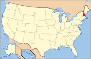 | |
|---|---|---|
| Lists by county | ||
| Other lists | ||
| ||
Municipalities and communities of Coös County, New Hampshire, United States | ||
|---|---|---|
| City | Map of New Hampshire highlighting Coos County | |
| Towns | ||
| Townships |
| |
| CDPs | ||
| Other communities | ||
| ||
This article is issued from Wikipedia. The text is licensed under Creative Commons - Attribution - Sharealike. Additional terms may apply for the media files.