National Register of Historic Places listings in Carroll County, New Hampshire
This is a list of the National Register of Historic Places listings in Carroll County, New Hampshire.
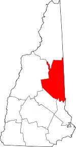
Location of Carroll County in New Hampshire
This is intended to be a complete list of the properties and districts on the National Register of Historic Places in Carroll County, New Hampshire, United States. Latitude and longitude coordinates are provided for many National Register properties and districts; these locations may be seen together in a map.[1]
There are 58 properties and districts listed on the National Register in the county, including 1 National Historic Landmark.
| Belknap - Carroll - Cheshire - Coos - Grafton - Hillsborough - Merrimack - Rockingham - Strafford - Sullivan |
- This National Park Service list is complete through NPS recent listings posted January 29, 2021.[2]
Current listings
| [3] | Name on the Register[4] | Image | Date listed[5] | Location | City or town | Description |
|---|---|---|---|---|---|---|
| 1 | Abenaki Indian Shop and Camp | 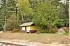 Abenaki Indian Shop and Camp |
February 28, 1991 (#91000218) |
Intervale Crossroad, 1 mi (1.6 km) east of NH 16 44°04′28″N 71°08′11″W |
Conway | Now a town park. |
| 2 | Bartlett Roundhouse | 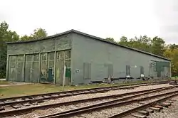 Bartlett Roundhouse |
September 29, 2015 (#15000664) |
S. of US 302 between Pine St. & Albany Ave. 44°04′36″N 71°17′15″W |
Bartlett | |
| 3 | Beede Farm | 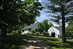 Beede Farm |
August 15, 2012 (#12000502) |
178 Mill Bridge Rd. 43°47′38″N 71°28′40″W |
Sandwich | Part of the Squam MPS[lower-alpha 1] |
| 4 | Bolduc Block | 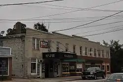 Bolduc Block |
September 20, 2016 (#16000642) |
36 Main St. 43°58′44″N 71°07′12″W |
Conway | |
| 5 | Brewster Memorial Hall | 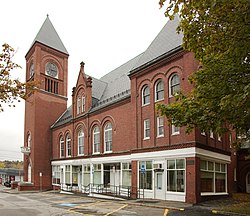 Brewster Memorial Hall |
September 8, 1983 (#83001129) |
S. Main and Union Sts. 43°35′05″N 71°12′37″W |
Wolfeboro | |
| 6 | Brookfield Town Hall | 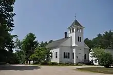 Brookfield Town Hall |
June 6, 1985 (#85001189) |
NH 109 43°33′37″N 71°04′04″W |
Brookfield | |
| 7 | Carroll County Court House | 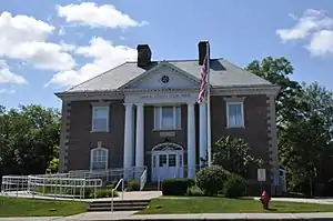 Carroll County Court House |
September 12, 2007 (#07000949) |
20 Courthouse Square 43°41′06″N 71°07′04″W |
Ossipee | |
| 8 | Center Sandwich Historic District |  Center Sandwich Historic District |
December 22, 1983 (#83003997) |
Roughly bounded by Skinner, Grove, Church, Maple and Main Sts., and Creamery Brook and Quimby Field Rds. 43°48′29″N 71°26′22″W |
Sandwich | |
| 9 | Chocorua Lake Basin Historic District |  Chocorua Lake Basin Historic District |
June 9, 2005 (#05000569) |
Parts of NH 16, Chocorua Lake Rd., Philbrick Neighborhood, Fowles, and Washington Hill Roads and Loring, MacGregor, and Bolles Rd 43°54′01″N 71°14′13″W |
Tamworth | |
| 10 | Conway Public Library | 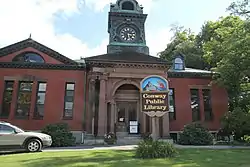 Conway Public Library |
July 17, 2017 (#100001317) |
15 Greenwood Ave. 43°58′43″N 71°07′02″W |
Conway | |
| 11 | Cook Memorial Library |  Cook Memorial Library |
June 25, 1980 (#80000269) |
Main St. 43°51′34″N 71°15′57″W |
Tamworth | |
| 12 | Cotton Mountain Community Church |  Cotton Mountain Community Church |
March 7, 1985 (#85000475) |
Stoneham Rd. 43°36′52″N 71°05′11″W |
Wolfeboro | |
| 13 | District No. 2 Schoolhouse | 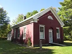 District No. 2 Schoolhouse |
October 3, 1980 (#80000270) |
2851 Wakefield Rd. 43°34′23″N 71°01′58″W |
Wakefield | |
| 14 | Durgin Bridge | 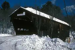 Durgin Bridge |
September 22, 1983 (#83001130) |
Durgin Bridge Rd. 43°51′21″N 71°21′53″W |
Sandwich | Over Cold River |
| 15 | Eagle Cliff | July 5, 2018 (#100002640) |
Address Restricted |
Sandwich | Part of the Squam MPS[lower-alpha 1] | |
| 16 | Eagle Mountain House | 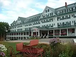 Eagle Mountain House |
December 6, 1990 (#90001848) |
Carter Notch Rd. north of its junction with NH 16A 44°09′23″N 71°11′10″W |
Jackson | |
| 17 | Early Settlers Meeting House | 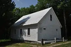 Early Settlers Meeting House |
June 12, 1995 (#95000680) |
Junction of Granite and Foggs Ridge Rds. 43°40′44″N 71°01′44″W |
Leighton Corner | |
| 18 | Eastern Slope Inn | 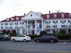 Eastern Slope Inn |
August 10, 1982 (#82004994) |
Main St. 44°03′16″N 71°07′49″W |
North Conway | |
| 19 | William K. Eastman House | 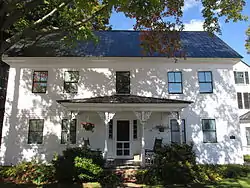 William K. Eastman House |
June 6, 2001 (#01000629) |
100 Main St. 43°58′43″N 71°07′23″W |
Conway | |
| 20 | First Free Will Baptist Church | 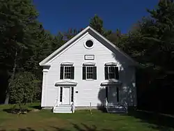 First Free Will Baptist Church |
March 15, 1984 (#84002518) |
Granite Rd. 43°40′27″N 71°01′15″W |
Ossipee | |
| 21 | Fore Point | 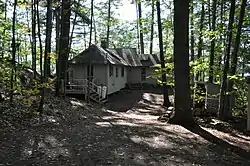 Fore Point |
January 17, 2017 (#100000475) |
Address Restricted |
Sandwich | Part of the Squam MPS[lower-alpha 1] |
| 22 | Freese's Tavern | 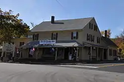 Freese's Tavern |
April 29, 1982 (#82001668) |
Main St. 43°45′17″N 71°23′50″W |
Moultonborough | Now known as the Old Country Store |
| 23 | Great Falls Manufacturing Company Newichawannock Canal Historic District | 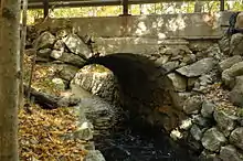 Great Falls Manufacturing Company Newichawannock Canal Historic District |
August 6, 2014 (#14000460) |
Between Great East Lake and Horn Pond 43°34′10″N 70°58′16″W |
Wakefield | Extends into Acton in York County, Maine |
| 24 | Green Pastures | 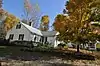 Green Pastures |
April 5, 2016 (#16000145) |
Address restricted |
Sandwich | |
| 25 | Hansen's Annex | 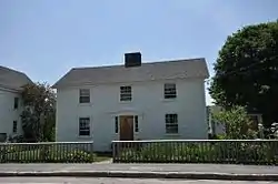 Hansen's Annex |
September 22, 1983 (#83001131) |
Main St. 43°48′26″N 71°26′21″W |
Center Sandwich | |
| 26 | Jackson Falls National Register Historic District | 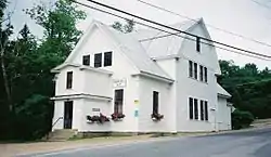 Jackson Falls National Register Historic District |
March 12, 2003 (#03000110) |
Approximately parts of Jackson Village Rd. and Five Mile Circuit Rd. 44°08′52″N 71°10′51″W |
Jackson | |
| 27 | Bradbury Jewell House | 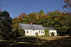 Bradbury Jewell House |
August 27, 1986 (#86002792) |
154 Ferncroft Rd. 43°54′51″N 71°21′45″W |
Sandwich | |
| 28 | Jimmy Point Camp | 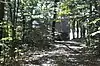 Jimmy Point Camp |
July 5, 2018 (#100002641) |
Address Restricted |
Sandwich | Part of the Squam MPS[lower-alpha 1] |
| 29 | Joy Farm | .jpg.webp) Joy Farm |
November 11, 1971 (#71000048) |
Salter Hill Rd. 43°54′56″N 71°11′01″W |
Madison | Home of poet e. e. cummings |
| 30 | Libby Museum | 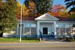 Libby Museum |
June 29, 1998 (#98000690) |
Junction of NH 109 and Lang Pond Rd. 43°36′51″N 71°15′32″W |
Wolfeboro | |
| 31 | Lord's Hill Historic District | 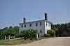 Lord's Hill Historic District |
September 12, 1985 (#85002162) |
NH 153 43°45′49″N 70°59′51″W |
Effingham | |
| 32 | Lower Corner Historic District | 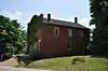 Lower Corner Historic District |
December 1, 1986 (#86003380) |
NH 109 43°47′32″N 71°24′49″W |
Sandwich | |
| 33 | Lucknow | 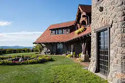 Lucknow |
July 5, 2018 (#100002642) |
455 Old Mountain Rd. 43°43′42″N 71°19′19″W |
Moultonborough | also known as Castle in the Clouds |
| 34 | Madison School, District No. 1 |  Madison School, District No. 1 |
December 11, 1980 (#80000271) |
NH 113 43°53′47″N 71°09′12″W |
Madison | |
| 35 | Moultonborough Town House | 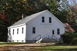 Moultonborough Town House |
December 1, 1989 (#89002057) |
NH 25, 0.3 miles (0.48 km) southwest of NH 109 43°45′07″N 71°24′01″W |
Moultonborough | Now a local history museum |
| 36 | New England Masonic Charitable Institute |  New England Masonic Charitable Institute |
September 19, 2019 (#100004415) |
30 Town House Rd. 43°44′21″N 71°00′42″W |
Effingham | |
| 37 | North Conway 5 and 10 Cent Store | 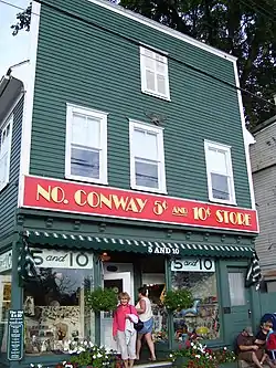 North Conway 5 and 10 Cent Store |
January 5, 2004 (#03001282) |
2683 Main St. 44°03′10″N 71°07′40″W |
North Conway | |
| 38 | North Conway Depot and Railroad Yard | North Conway Depot and Railroad Yard |
August 10, 1979 (#79003792) |
Norcross Circle 44°03′06″N 71°07′44″W |
North Conway | |
| 39 | North Sandwich Meeting House |  North Sandwich Meeting House |
June 5, 1986 (#86001230) |
Quaker-Whiteface Rd. 43°51′41″N 71°21′58″W |
Sandwich | |
| 40 | Pickering House | April 16, 2019 (#100003596) |
116 S. Main St. 43°35′04″N 71°12′32″W |
Wolfeboro | ||
| 41 | Pointfield |  Pointfield |
October 8, 2014 (#14000842) |
14 Sabine Point Road 43°46′42″N 71°28′42″W |
Sandwich | Part of the Squam MPS[lower-alpha 1] |
| 42 | Pratt Family Camps | 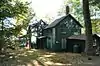 Pratt Family Camps |
August 15, 2012 (#12000503) |
Address Restricted |
Moultonborough | Part of the Squam MPS[lower-alpha 1] |
| 43 | Capt. Enoch Remick House | 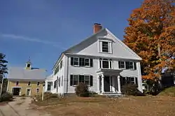 Capt. Enoch Remick House |
June 3, 1996 (#96000616) |
4 Great Hill Rd. 43°51′38″N 71°16′15″W |
Tamworth | Now a local farm museum |
| 44 | Russell-Colbath House | 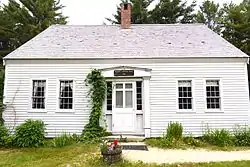 Russell-Colbath House |
April 23, 1987 (#86003416) |
Kancamagus Highway 43°59′47″N 71°20′25″W |
Albany | |
| 45 | St. John's Church, Rectory, and Parish Hall | 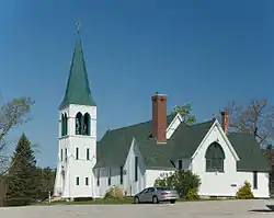 St. John's Church, Rectory, and Parish Hall |
June 7, 1984 (#84002519) |
High St. 43°33′27″N 71°01′45″W |
Wakefield | |
| 46 | Swallow Boathouse | 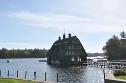 Swallow Boathouse |
August 26, 1980 (#80000272) |
South of Moultonborough 43°41′44″N 71°24′23″W |
Moultonborough | |
| 47 | Town Hall | 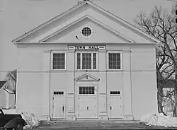 Town Hall |
May 15, 1980 (#80000273) |
Maple St. 43°48′27″N 71°26′18″W |
Center Sandwich | |
| 48 | Tuftonboro United Methodist Church | 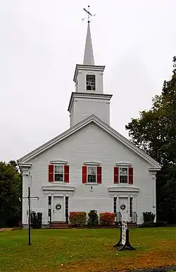 Tuftonboro United Methodist Church |
June 16, 1997 (#97000505) |
Northern side of NH 171, east of its junction with Durgan Rd. 43°41′45″N 71°13′16″W |
Tuftonboro | |
| 49 | Union Church | 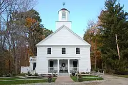 Union Church |
April 29, 1982 (#82001669) |
S. Main St. 43°33′47″N 71°10′38″W |
South Wolfeboro | |
| 50 | Union Hotel | 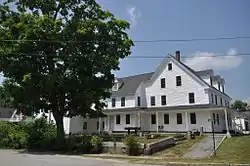 Union Hotel |
December 1, 1989 (#89002055) |
Main St. at Chapel St. 43°29′32″N 71°01′29″W |
Wakefield | |
| 51 | Wakefield House | 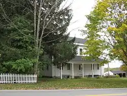 Wakefield House |
June 23, 1983 (#83001133) |
NH 153 at Wakefield Rd. 43°34′05″N 71°01′44″W |
Wakefield | |
| 52 | Wakefield Public Library | 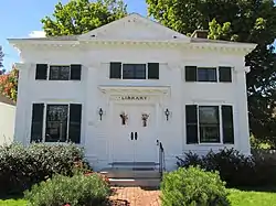 Wakefield Public Library |
September 8, 1983 (#83001132) |
2699 Wakefield Rd. 43°34′09″N 71°01′48″W |
Wakefield | |
| 53 | Wakefield Town Hall and Opera House | 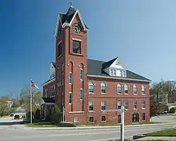 Wakefield Town Hall and Opera House |
June 12, 2007 (#07000550) |
2 High St. 43°33′14″N 71°01′50″W |
Wakefield | |
| 54 | Wakefield Village Historic District | 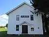 Wakefield Village Historic District |
March 15, 1984 (#84002521) |
Off NH 153 43°34′07″N 71°01′46″W |
Wakefield | |
| 55 | White Meetinghouse | 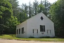 White Meetinghouse |
May 15, 1980 (#80000274) |
South of Eaton Center on Towle Hill Rd. 43°51′31″N 71°04′30″W |
Eaton | |
| 56 | Whittier Bridge | 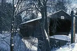 Whittier Bridge |
March 15, 1984 (#84002558) |
Old NH 25 43°49′20″N 71°12′43″W |
West Ossipee | Over Bearcamp River |
| 57 | Windermere | 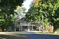 Windermere |
November 14, 1979 (#79000195) |
Southwest of Moultonborough on Long Island 43°38′04″N 71°20′36″W |
Moultonborough | |
| 58 | Wolfeboro Centre Community Church |  Wolfeboro Centre Community Church |
March 15, 1984 (#84002564) |
NH 109 43°37′09″N 71°10′15″W |
Wolfeboro Center |
See also
| Wikimedia Commons has media related to National Register of Historic Places in Carroll County, New Hampshire. |
Notes
- For additional properties that are part of the Squam MPS see National Register of Historic Places listings in Grafton County, New Hampshire.
References
- The latitude and longitude information provided in this table was derived originally from the National Register Information System, which has been found to be fairly accurate for about 99% of listings. Some locations in this table may have been corrected to current GPS standards.
- "National Register of Historic Places: Weekly List Actions". National Park Service, United States Department of the Interior. Retrieved on January 29, 2021.
- Numbers represent an alphabetical ordering by significant words. Various colorings, defined here, differentiate National Historic Landmarks and historic districts from other NRHP buildings, structures, sites or objects.
- "National Register Information System". National Register of Historic Places. National Park Service. April 24, 2008.
- The eight-digit number below each date is the number assigned to each location in the National Register Information System database, which can be viewed by clicking the number.
| Topics |  | |
|---|---|---|
| Lists by county | ||
| Other lists | ||
| ||
Municipalities and communities of Carroll County, New Hampshire, United States | ||
|---|---|---|
| Towns | Map of New Hampshire highlighting Carroll County | |
| Township | ||
| CDPs | ||
| Other villages | ||
| ||
This article is issued from Wikipedia. The text is licensed under Creative Commons - Attribution - Sharealike. Additional terms may apply for the media files.