National Register of Historic Places listings in Cheshire County, New Hampshire
This is a list of the National Register of Historic Places listings in Cheshire County, New Hampshire.
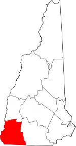
Location of Cheshire County in New Hampshire
This is intended to be a complete list of the properties and districts on the National Register of Historic Places in Cheshire County, New Hampshire, United States. Latitude and longitude coordinates are provided for many National Register properties and districts; these locations may be seen together in a map.[1]
There are 153 properties and districts listed on the National Register in the county, including 1 National Historic Landmark District.
| Belknap - Carroll - Cheshire - Coos - Grafton - Hillsborough - Merrimack - Rockingham - Strafford - Sullivan |
- This National Park Service list is complete through NPS recent listings posted January 29, 2021.[2]
Current listings
| [3] | Name on the Register[4] | Image | Date listed[5] | Location | City or town | Description |
|---|---|---|---|---|---|---|
| 1 | The Acre |  The Acre |
January 14, 1988 (#86003257) |
Main Street at Dublin Road 42°56′12″N 72°05′25″W |
Harrisville | |
| 2 | Adams Farm |  Adams Farm |
January 14, 1988 (#86003246) |
Off MacVeagh Rd. near Fansnacloich 42°55′41″N 72°07′24″W |
Harrisville | |
| 3 | Dr. Daniel Adams House |  Dr. Daniel Adams House |
June 8, 1989 (#89000449) |
324 Main St. 42°55′32″N 72°16′36″W |
Keene | |
| 4 | John Adams Homestead-Wellscroft |  John Adams Homestead-Wellscroft |
January 14, 1988 (#86003250) |
West of Sunset Hill Rd. 42°56′59″N 72°08′57″W |
Harrisville | |
| 5 | Aldworth Manor |  Aldworth Manor |
January 14, 1988 (#86003244) |
Aldworth Drive, on the northern side of Chesham-Harrisville Rd. 42°57′01″N 72°06′55″W |
Harrisville | |
| 6 | Capt. Samuel Allison House |  Capt. Samuel Allison House |
December 18, 1983 (#83004005) |
Keene Rd. 42°54′43″N 72°06′51″W |
Dublin | |
| 7 | Amory Ballroom |  Amory Ballroom |
May 2, 1985 (#85000921) |
Off Old Troy Rd. 42°53′35″N 72°05′45″W |
Dublin | |
| 8 | Amory House |  Amory House |
December 15, 1983 (#83004006) |
Off Old Troy Rd. 42°53′37″N 72°06′01″W |
Dublin | |
| 9 | Amory-Appel Cottage |  Amory-Appel Cottage |
May 2, 1985 (#85000920) |
Off Old Troy Rd. 42°53′36″N 72°05′42″W |
Dublin | |
| 10 | Appleton Farm |  Appleton Farm |
December 18, 1983 (#83004008) |
73 Brush Brook Rd. 42°54′26″N 72°01′24″W |
Dublin | Houses Del Rossi's Trattoria |
| 11 | Appleton-Hannaford House |  Appleton-Hannaford House |
December 15, 1983 (#83004007) |
253 Hancock Rd. 42°54′37″N 72°00′25″W |
Dublin | |
| 12 | Asbury United Methodist Church |  Asbury United Methodist Church |
December 21, 1983 (#83004009) |
NH 63 42°53′17″N 72°28′14″W |
Chesterfield | |
| 13 | Ashuelot Covered Bridge | 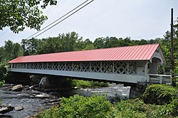 Ashuelot Covered Bridge |
February 20, 1981 (#81000069) |
NH 119 and Bolton Rd. 42°46′35″N 72°25′26″W |
Ashuelot | Over Ashuelot River |
| 14 | Ballou-Newbegin House |  Ballou-Newbegin House |
December 18, 1983 (#83004011) |
Old Marlborough Rd. 42°53′39″N 72°08′38″W |
Dublin | |
| 15 | Timothy Bancroft House |  Timothy Bancroft House |
January 14, 1988 (#86003241) |
Bancroft Rd. 42°57′57″N 72°05′55″W |
Harrisville | |
| 16 | Persia Beal House |  Persia Beal House |
January 14, 1988 (#86003243) |
Northern side of Chesham Rd. 42°56′41″N 72°06′15″W |
Harrisville | Now the Harrisville Inn |
| 17 | Beaver Mills | 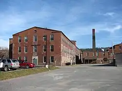 Beaver Mills |
December 9, 1999 (#99001481) |
93-115 Railroad St. 42°55′56″N 72°16′27″W |
Keene | |
| 18 | Beech Hill | 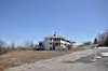 Beech Hill |
December 15, 1983 (#83004012) |
Off New Harrisville Rd. 42°54′39″N 72°04′00″W |
Dublin | |
| 19 | Beech Hill Summer Home District | 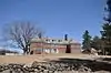 Beech Hill Summer Home District |
January 14, 1988 (#86003079) |
Roughly Venable, Appleton, and Old Harrisville Rds. 42°55′31″N 72°05′11″W |
Harrisville | Six summer properties primarily along Old Harrisville Rd. |
| 20 | Elbridge G. Bemis House | 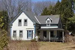 Elbridge G. Bemis House |
January 14, 1988 (#86003247) |
Chesham Rd. 42°56′14″N 72°08′33″W |
Harrisville | |
| 21 | George Bemis House |  George Bemis House |
January 14, 1988 (#86003248) |
Chesham Rd. 42°56′15″N 72°08′31″W |
Harrisville | |
| 22 | Brackett House |  Brackett House |
December 18, 1983 (#83004013) |
High Ridge Rd. 42°52′45″N 71°59′45″W |
Dublin | |
| 23 | Stephen Rowe Bradley House |  Stephen Rowe Bradley House |
December 22, 2005 (#05001445) |
43 Westminster St. 43°04′46″N 72°25′49″W |
Walpole | |
| 24 | Buckminster-Kingsbury Farm |  Buckminster-Kingsbury Farm |
December 30, 2011 (#11000964) |
80 Houghton Ledge Rd. 42°58′30″N 72°12′37″W |
Roxbury | |
| 25 | Burpee Farm |  Burpee Farm |
December 18, 1983 (#83004014) |
Burpee Rd. 42°52′19″N 72°04′15″W |
Dublin | Destroyed by fire in 2013[6] |
| 26 | Louis Cabot House |  Louis Cabot House |
December 18, 1983 (#83004015) |
Windmill Hill Rd. 42°53′25″N 72°02′11″W |
Dublin | |
| 27 | T. H. Cabot Cottage |  T. H. Cabot Cottage |
December 15, 1983 (#83004016) |
Snow Hill Rd. 42°53′53″N 72°04′07″W |
Dublin | |
| 28 | Carleton Bridge | 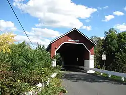 Carleton Bridge |
June 10, 1975 (#75000121) |
On Carleton Rd. over South Branch Ashuelot River 42°51′14″N 72°16′28″W |
East Swanzey | |
| 29 | George Cheever Farm |  George Cheever Farm |
January 14, 1988 (#86003238) |
Intersection of Nelson and Tolman Pond Rds. 42°57′20″N 72°06′29″W |
Harrisville | |
| 30 | Chesham Village District |  Chesham Village District |
December 29, 1986 (#86003102) |
Roughly bounded by Yellow Wings, Seaver, Chesham, and Marienfield Rds. 42°56′06″N 72°08′43″W |
Harrisville | |
| 31 | Cheshire County Courthouse |  Cheshire County Courthouse |
December 13, 1978 (#78000210) |
12 Court St. 42°56′03″N 72°16′48″W |
Keene | |
| 32 | Clymer House |  Clymer House |
January 14, 1988 (#86003239) |
31 Clymer Rd. 42°57′40″N 72°06′14″W |
Harrisville | |
| 33 | Colony House | 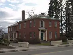 Colony House |
September 9, 2005 (#05000969) |
104 West St. 42°55′59″N 72°16′56″W |
Keene | |
| 34 | Colony's Block | 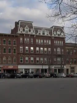 Colony's Block |
March 24, 1983 (#83001134) |
4-7 Central Square 42°56′02″N 72°16′40″W |
Keene | |
| 35 | Conant Public Library | 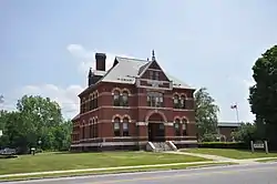 Conant Public Library |
August 27, 1987 (#87001420) |
Main St. 42°46′19″N 72°23′03″W |
Winchester | |
| 36 | Noah Cooke House | 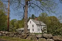 Noah Cooke House |
April 23, 1973 (#73000268) |
West of Keene on Daniels Hill Rd. 42°55′32″N 72°20′24″W |
Keene | |
| 37 | Coombs Covered Bridge | 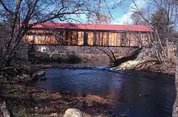 Coombs Covered Bridge |
November 21, 1976 (#76000122) |
North of Winchester off NH 10 42°50′17″N 72°21′43″W |
Winchester | Over Ashuelot River |
| 38 | Corey Farm | 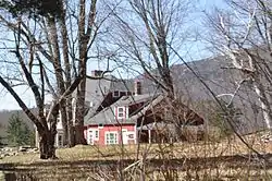 Corey Farm |
December 15, 1983 (#83004017) |
Parsons Rd. 42°53′01″N 72°02′59″W |
Dublin | |
| 39 | Derby Shop-Goodnow Pail Factory-Holman & Merriman Machine Shop-L. A. Carpenter Machine Shop-Streeter Shop | 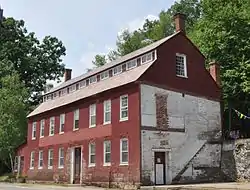 Derby Shop-Goodnow Pail Factory-Holman & Merriman Machine Shop-L. A. Carpenter Machine Shop-Streeter Shop |
December 11, 2007 (#07001260) |
63 Canal St. 42°47′17″N 72°28′30″W |
Hinsdale | |
| 40 | Dinsmoor-Hale House | 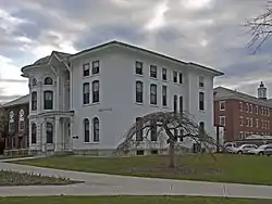 Dinsmoor-Hale House |
April 26, 1976 (#76000197) |
Main and Winchester Sts. 42°55′41″N 72°16′41″W |
Keene | |
| 41 | Drewsville Mansion |  Drewsville Mansion |
September 13, 1996 (#96000953) |
Old Cheshire Turnpike at the southern end of the Drewsville village common 43°07′36″N 72°23′34″W |
Walpole | |
| 42 | Dublin Lake Historic District |  Dublin Lake Historic District |
December 18, 1983 (#83004018) |
Lake, E. Lake, W. Lake, and Old Harrisville Rds. 42°54′30″N 72°05′00″W |
Dublin | Properties surrounding the pond |
| 43 | Dublin Town Hall |  Dublin Town Hall |
June 25, 1980 (#80000275) |
NH 101 42°54′21″N 72°03′39″W |
Dublin | |
| 44 | Dublin Village Historic District |  Dublin Village Historic District |
December 15, 1983 (#83004019) |
Old Common and Harrisville Rds. and Main and Church Sts. 42°54′22″N 72°03′37″W |
Dublin | |
| 45 | East Jaffrey Historic District | 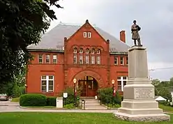 East Jaffrey Historic District |
June 14, 2002 (#02000642) |
Roughly along NH 124 through Jaffrey 42°49′40″N 72°03′17″W |
Jaffrey | |
| 46 | Moses Eaton Jr. House | 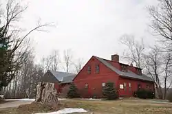 Moses Eaton Jr. House |
January 14, 1988 (#86003106) |
NH 137 42°56′04″N 72°00′57″W |
Harrisville | |
| 47 | Elliot Mansion | 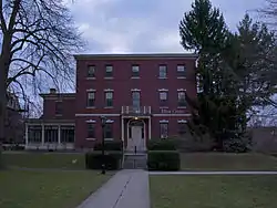 Elliot Mansion |
April 30, 1976 (#76000220) |
305 Main St. 42°55′33″N 72°16′41″W |
Keene | |
| 48 | Eveleth Farm | 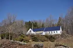 Eveleth Farm |
December 18, 1983 (#83004020) |
Burpee Rd. 42°52′20″N 72°04′24″W |
Dublin | |
| 49 | Far Horizons |  Far Horizons |
December 15, 1983 (#83004023) |
Learned Rd. 42°52′48″N 72°04′23″W |
Dublin | |
| 50 | Corban C. Farwell Homestead |  Corban C. Farwell Homestead |
January 14, 1988 (#86003253) |
Breed Rd. at Cricket Hill Rd. 42°57′09″N 72°07′50″W |
Harrisville | |
| 51 | Fasnacloich |  Fasnacloich |
January 14, 1988 (#86003245) |
Four Hill Rd., north of the Dublin town line 42°55′27″N 72°06′30″W |
Harrisville | |
| 52 | Faulkner & Colony Woolen Mill | .jpg.webp) Faulkner & Colony Woolen Mill |
March 25, 2020 (#100005161) |
222 West St. 42°55′57″N 72°17′14″W |
Keene | |
| 53 | Fisk Barn |  Fisk Barn |
December 18, 1983 (#83004024) |
Gerry Rd. 42°53′38″N 72°01′42″W |
Dublin | |
| 54 | Catherine Fiske Seminary For Young Ladies |  Catherine Fiske Seminary For Young Ladies |
May 3, 1976 (#76000196) |
251 Main St. 42°55′39″N 72°16′41″W |
Keene | |
| 55 | Fitzwilliam Common Historic District |  Fitzwilliam Common Historic District |
May 2, 1997 (#97000399) |
Junction of NH 119, Richmond Rd., and the Templeton Highway 42°46′45″N 72°08′47″W |
Fitzwilliam | |
| 56 | Foothill Farm |  Foothill Farm |
December 15, 1983 (#83004025) |
Old Troy Rd. 42°53′47″N 72°06′16″W |
Dublin | |
| 57 | Frost Farm |  Frost Farm |
December 15, 1983 (#83004026) |
Old Marlborough Rd. 42°53′54″N 72°06′37″W |
Dublin | Now Fairwood Bible Institute |
| 58 | Frost Farm |  Frost Farm |
December 18, 1983 (#83004027) |
Korpi Rd. 42°52′15″N 72°01′35″W |
Dublin | |
| 59 | Gilchrest |  Gilchrest |
January 14, 1988 (#86003105) |
NH 137 42°55′44″N 72°00′57″W |
Harrisville | |
| 60 | Gilsum Stone Arch Bridge |  Gilsum Stone Arch Bridge |
August 31, 1989 (#89001207) |
Surry Rd. over the Ashuelot River, west of its junction with NH 10 43°02′20″N 72°16′14″W |
Gilsum | |
| 61 | Glenchrest |  Glenchrest |
January 14, 1988 (#86003104) |
NH 137 42°55′38″N 72°00′54″W |
Harrisville | |
| 62 | Golden Rod Grange No. 114 |  Golden Rod Grange No. 114 |
March 17, 1994 (#94000169) |
Western side of NH 32, 0.1 mi (0.16 km) south of its junction with Eaton Rd. 42°52′20″N 72°16′57″W |
Swanzey | |
| 63 | James Gowing Farm |  James Gowing Farm |
December 18, 1983 (#83004028) |
Page Rd. 42°52′41″N 72°02′13″W |
Dublin | Now the Dublin Christian Academy |
| 64 | Joseph Gowing Farm |  Joseph Gowing Farm |
December 15, 1983 (#83004029) |
Page Rd. 42°52′53″N 72°02′13″W |
Dublin | |
| 65 | Grace United Methodist Church |  Grace United Methodist Church |
March 7, 1985 (#85000476) |
34 Court St. 42°56′07″N 72°16′48″W |
Keene | |
| 66 | Isaac Greenwood House |  Isaac Greenwood House |
December 18, 1983 (#83004034) |
Peterborough Rd. 42°54′26″N 72°02′34″W |
Dublin | |
| 67 | Moses Greenwood House |  Moses Greenwood House |
December 15, 1983 (#83004036) |
Pierce and Old County Rds. 42°54′16″N 72°02′33″W |
Dublin | |
| 68 | Harrisville Historic District | .jpg.webp) Harrisville Historic District |
September 17, 1971 (#71000072) |
Central Harrisville and its environs 42°56′52″N 72°05′49″W |
Harrisville and vicinity | National Historic Landmark; a picturesque mill town |
| 69 | Harrisville Rural District |  Harrisville Rural District |
February 18, 1987 (#86003078) |
Roughly along Venable, Old Harrisville, New Harrisville, and Bonds Corner Rds. 42°55′36″N 72°04′42″W |
Harrisville | |
| 70 | High Tops School | _(2).jpg.webp) High Tops School |
December 13, 1984 (#84000519) |
Reynolds and River Rds. 42°57′45″N 72°29′16″W |
Westmoreland | |
| 71 | Hutchinson House |  Hutchinson House |
February 2, 2015 (#14001240) |
400 Alstead Center Rd. 43°07′26″N 72°19′39″W |
Alstead | |
| 72 | Ivanov-Rinov House |  Ivanov-Rinov House |
December 18, 1983 (#83004038) |
88 Pierce Rd. 42°53′58″N 72°02′34″W |
Dublin | |
| 73 | Jaffrey Center Historic District |  Jaffrey Center Historic District |
June 11, 1975 (#75000122) |
Northwest of Jaffrey on NH 124 42°49′38″N 72°03′13″W |
Jaffrey | |
| 74 | Jaffrey Mills | 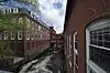 Jaffrey Mills |
August 10, 1982 (#82004992) |
41 Main St. 42°48′54″N 72°01′25″W |
Jaffrey | Converted to residences |
| 75 | Jewett-Kemp-Marlens House | 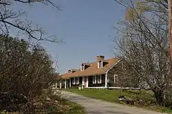 Jewett-Kemp-Marlens House |
May 30, 1997 (#97000506) |
North Rd., 2 mi (3.2 km) north of its junction with NH 123 43°09′26″N 72°17′36″W |
Alstead | |
| 76 | Jones Hall | 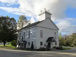 Jones Hall |
June 7, 1984 (#84002722) |
Church St. 43°06′59″N 72°11′59″W |
Marlow | |
| 77 | Kendall Cottage | 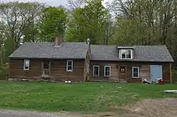 Kendall Cottage |
January 14, 1988 (#86003251) |
Northern side of Silver Lake Rd. 42°56′46″N 72°08′11″W |
Harrisville | |
| 78 | Knollwood |  Knollwood |
December 18, 1983 (#83004039) |
Windmill Hill Rd. 42°53′35″N 72°03′34″W |
Dublin | |
| 79 | Lattice Cottage |  Lattice Cottage |
December 15, 1983 (#83004040) |
Off Old Troy Rd. 42°53′31″N 72°05′38″W |
Dublin | |
| 80 | Lawrence Farm |  Lawrence Farm |
June 9, 2000 (#00000650) |
9 Lawrence Rd. 42°50′39″N 72°11′11″W |
Troy | |
| 81 | Learned Homestead |  Learned Homestead |
December 15, 1983 (#83004043) |
Upper Jaffrey Rd. 42°53′41″N 72°03′37″W |
Dublin | |
| 82 | Amos Learned Farm |  Amos Learned Farm |
December 15, 1983 (#83004041) |
NH 137 42°53′34″N 72°01′27″W |
Dublin | |
| 83 | Benjamin Learned House |  Benjamin Learned House |
December 18, 1983 (#83004042) |
Upper Jaffrey Rd. 42°53′46″N 72°03′37″W |
Dublin | |
| 84 | Markham House |  Markham House |
December 18, 1983 (#83004044) |
Snow Hill Rd. 42°54′11″N 72°04′06″W |
Dublin | |
| 85 | Benjamin Marshall House |  Benjamin Marshall House |
December 15, 1983 (#83004046) |
1541 Peterborough Rd. 42°54′05″N 72°01′28″W |
Dublin | |
| 86 | Micajah Martin Farm | 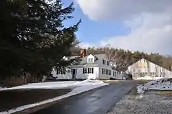 Micajah Martin Farm |
December 18, 1983 (#83004047) |
Old Peterborough Rd. 42°53′44″N 72°00′44″W |
Dublin | |
| 87 | Mason House |  Mason House |
December 15, 1983 (#83004049) |
Snow Hill Rd. 42°54′06″N 72°03′57″W |
Dublin | |
| 88 | Mason-Watkins House |  Mason-Watkins House |
March 11, 1982 (#82001670) |
RD # 2 42°59′12″N 72°20′18″W |
Surry | |
| 89 | McKenna Cottage |  McKenna Cottage |
December 18, 1983 (#83004051) |
Windmill Hill Rd. 42°53′37″N 72°02′58″W |
Dublin | |
| 90 | Moore Farm and Twitchell Mill Site |  Moore Farm and Twitchell Mill Site |
December 18, 1983 (#83004052) |
Off Page Rd. 42°51′58″N 72°02′04″W |
Dublin | |
| 91 | Asa Morse Farm |  Asa Morse Farm |
December 15, 1983 (#83004054) |
NH 101 42°54′47″N 72°05′39″W |
Dublin | |
| 92 | Capt. Thomas Morse Farm |  Capt. Thomas Morse Farm |
December 15, 1983 (#83004055) |
Old Marlborough Rd. 42°54′01″N 72°06′22″W |
Dublin | |
| 93 | Eli Morse Farm |  Eli Morse Farm |
April 11, 1983 (#83001135) |
Lake Rd. 42°53′43″N 72°05′08″W |
Dublin | |
| 94 | Eli Morse Sawmill Foundations | 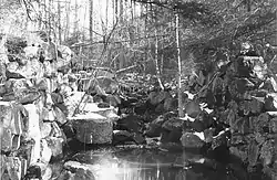 Eli Morse Sawmill Foundations |
December 18, 1983 (#83004056) |
Off Old Marlborough Rd. 42°53′57″N 72°05′31″W |
Dublin | |
| 95 | Mountain View Farm | 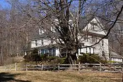 Mountain View Farm |
December 18, 1983 (#83004057) |
Upper Jaffrey Rd. 42°53′20″N 72°04′03″W |
Dublin | |
| 96 | Needham House | 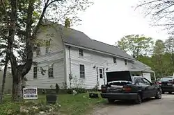 Needham House |
January 14, 1988 (#86003254) |
Meadow Rd. 42°55′45″N 72°09′07″W |
Harrisville | |
| 97 | Nelson Schoolhouse | 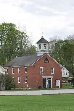 Nelson Schoolhouse |
April 23, 1973 (#73000251) |
Old Sullivan Rd. 42°59′22″N 72°07′38″W |
Nelson | |
| 98 | New Hampshire Conservatory of Music and the Arts |  New Hampshire Conservatory of Music and the Arts |
May 15, 1980 (#80000276) |
Central Sq. 42°46′24″N 72°22′59″W |
Winchester | |
| 99 | Old Patch Place |  Old Patch Place |
August 15, 1980 (#80000277) |
West of Fitzwilliam on Rhododendron Rd. 42°47′02″N 72°11′28″W |
Fitzwilliam | |
| 100 | Park Hill Meetinghouse | 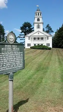 Park Hill Meetinghouse |
September 8, 1980 (#80000278) |
Park Hill 42°58′31″N 72°27′24″W |
Westmoreland | |
| 101 | Parsons Studio and Casino |  Parsons Studio and Casino |
December 18, 1983 (#83004058) |
Parsons Rd. 42°53′07″N 72°03′07″W |
Dublin | |
| 102 | Peck-Porter House | 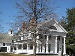 Peck-Porter House |
August 31, 2000 (#00001037) |
Main St., junction with Middle St. 43°04′41″N 72°25′37″W |
Walpole | |
| 103 | Ivory Perry Homestead | 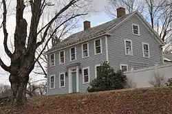 Ivory Perry Homestead |
December 15, 1983 (#83004061) |
Corner Valley and Dooe Rds. 42°52′38″N 72°00′01″W |
Dublin | |
| 104 | John Perry Homestead | 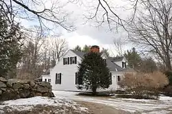 John Perry Homestead |
December 18, 1983 (#83004063) |
135 Dooe Rd. 42°52′45″N 72°00′18″W |
Dublin | |
| 105 | Rufus Piper Homestead | 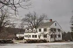 Rufus Piper Homestead |
December 15, 1983 (#83004065) |
Pierce Rd. 42°53′45″N 72°02′30″W |
Dublin | |
| 106 | Solomon Piper Farm |  Solomon Piper Farm |
December 18, 1983 (#83004067) |
227 Valley Rd. 42°52′22″N 72°00′05″W |
Dublin | |
| 107 | Point Comfort |  Point Comfort |
January 14, 1988 (#86003256) |
S. Skatutakee Rd. 42°56′10″N 72°05′01″W |
Harrisville | |
| 108 | Pottersville District |  Pottersville District |
December 29, 1986 (#86003096) |
Roughly intersection of Roxbury and Meadow Rds., and along Brown Rd. northeast of Chesham Rd. 42°55′44″N 72°08′41″W |
Harrisville | Properties primarily along Chesham Rd. from Meadow Rd to Brown Rd., then along Brown Rd. |
| 109 | Pumpelly Studio |  Pumpelly Studio |
December 15, 1983 (#83004069) |
Snow Hill Rd. 42°53′56″N 72°04′13″W |
Dublin | |
| 110 | Raubold House |  Raubold House |
January 14, 1988 (#86003242) |
Northern side of Chesham Rd. 42°56′43″N 72°06′09″W |
Harrisville | |
| 111 | Abijah Richardson, Sr. Homestead |  Abijah Richardson, Sr. Homestead |
December 18, 1983 (#83004070) |
359 Hancock Rd. 42°54′46″N 72°00′06″W |
Dublin | |
| 112 | Deacon Abijah Richardson House |  Deacon Abijah Richardson House |
December 15, 1983 (#83004071) |
334 Hancock Rd. 42°54′42″N 72°00′04″W |
Dublin | |
| 113 | John Richardson Homestead |  John Richardson Homestead |
December 18, 1983 (#83004072) |
Hancock Rd. 42°55′00″N 72°00′06″W |
Dublin | |
| 114 | Luke Richardson House |  Luke Richardson House |
December 15, 1983 (#83004073) |
204 Hancock Rd. 42°54′35″N 72°00′44″W |
Dublin | |
| 115 | Richmond Community Church |  Richmond Community Church |
March 24, 1983 (#83001136) |
Fitzwilliam Rd. 42°45′16″N 72°16′17″W |
Richmond | |
| 116 | Richmond School House No. 6 |  Richmond School House No. 6 |
November 25, 1980 (#80000279) |
NH 119 42°45′19″N 72°16′27″W |
Richmond | Now houses the local public library |
| 117 | Richmond Town Hall |  Richmond Town Hall |
December 19, 1979 (#79000273) |
NH 32 42°45′46″N 72°16′08″W |
Richmond | |
| 118 | James Robbe Jr. House | 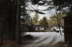 James Robbe Jr. House |
December 18, 1983 (#83004074) |
Old Peterborough Rd. 42°53′29″N 72°00′01″W |
Dublin | |
| 119 | Sawyer Tavern | 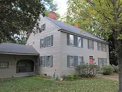 Sawyer Tavern |
May 15, 1980 (#80000280) |
63 Arch St. 42°56′21″N 72°19′00″W |
Keene | |
| 120 | Sawyers Crossing Covered Bridge | 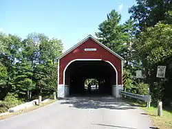 Sawyers Crossing Covered Bridge |
November 14, 1978 (#78000211) |
North of Swanzey off NH 32 42°53′10″N 72°17′12″W |
Swanzey | Over Ashuelot River |
| 121 | Second Rindge Meetinghouse, Horsesheds and Cemetery |  Second Rindge Meetinghouse, Horsesheds and Cemetery |
October 5, 1979 (#79003791) |
U.S. Route 202 and Rindge Common 42°44′59″N 72°00′37″W |
Rindge | |
| 122 | Shedd-Porter Memorial Library | 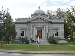 Shedd-Porter Memorial Library |
December 27, 2010 (#10001086) |
3 Main St. 43°08′56″N 72°21′40″W |
Alstead | |
| 123 | Silver Lake District |  Silver Lake District |
December 29, 1986 (#86003100) |
Roughly along Old Nelson, Eastside, and Westside Rds. 42°57′03″N 72°08′09″W |
Harrisville | Around Silver Lake |
| 124 | Silver Lake Farm |  Silver Lake Farm |
January 14, 1988 (#86003252) |
Between Silver Lake and Seaver Rds. near the intersection with Old Nelson Rd. 42°56′52″N 72°07′56″W |
Harrisville | |
| 125 | Slate Covered Bridge | 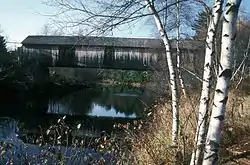 Slate Covered Bridge |
November 14, 1978 (#78000212) |
Off NH 10 42°50′51″N 72°20′29″W |
Westport | Over Ashuelot River |
| 126 | Smith-Mason Farm |  Smith-Mason Farm |
January 14, 1988 (#86003255) |
Northwest of the intersection of Meadow and Old Roxbury Roads 42°55′55″N 72°09′22″W |
Harrisville | |
| 127 | Spur House |  Spur House |
December 15, 1983 (#83004075) |
Off Old Common Rd. 42°54′32″N 72°04′05″W |
Dublin | |
| 128 | Stationmaster's House |  Stationmaster's House |
January 14, 1988 (#86003108) |
Jaquith Rd. 42°56′03″N 72°02′13″W |
Harrisville | |
| 129 | Stone Arch Bridge | 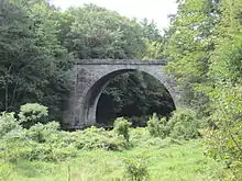 Stone Arch Bridge |
August 14, 2012 (#12000504) |
Mile 89.41 of the Cheshire Railroad over Branch River, between Route 101 and Swanzey Factory Road 42°54′51″N 72°15′11″W |
Keene | |
| 130 | Stone Farm |  Stone Farm |
December 18, 1983 (#83004076) |
Old Marlborough Rd. 42°53′41″N 72°08′54″W |
Dublin | |
| 131 | Stone-Darracott House |  Stone-Darracott House |
December 15, 1983 (#83004077) |
Old Marlborough Rd. 42°53′34″N 72°08′54″W |
Dublin | |
| 132 | Stonehenge |  Stonehenge |
December 18, 1983 (#83004079) |
Windmill Hill Rd. 42°53′41″N 72°03′01″W |
Dublin | |
| 133 | Capt. Richard Strong House |  Capt. Richard Strong House |
December 18, 1983 (#83004080) |
1471 Peterborough Rd. 42°54′14″N 72°01′46″W |
Dublin | |
| 134 | Richard Strong Cottage |  Richard Strong Cottage |
December 15, 1983 (#83004081) |
35 Gowing Lane 42°54′12″N 72°01′37″W |
Dublin | |
| 135 | Henry Strongman House |  Henry Strongman House |
December 15, 1983 (#83004082) |
1443 Peterborough Rd. 42°54′19″N 72°01′54″W |
Dublin | |
| 136 | William Strongman House |  William Strongman House |
December 18, 1983 (#83004083) |
85 Old County Rd. 42°54′19″N 72°02′20″W |
Dublin | |
| 137 | Third Fitzwilliam Meetinghouse |  Third Fitzwilliam Meetinghouse |
August 26, 1977 (#77000162) |
Village Green 42°46′46″N 72°08′41″W |
Fitzwilliam | |
| 138 | Todd Block |  Todd Block |
June 14, 1988 (#88000646) |
27-31 Main St. 42°47′12″N 72°29′33″W |
Hinsdale | |
| 139 | Townsend Farm |  Townsend Farm |
December 15, 1983 (#83004084) |
E. Harrisville Rd. 42°55′04″N 72°02′20″W |
Dublin | |
| 140 | Jabez Townsend House |  Jabez Townsend House |
January 14, 1988 (#86003107) |
Hancock and Cherry Hill Rds. 42°55′48″N 72°02′15″W |
Harrisville | |
| 141 | Troy Village Historic District |  Troy Village Historic District |
December 13, 2002 (#02001500) |
Encompassing the village center, mostly along NH 12 42°49′28″N 72°10′57″W |
Troy | |
| 142 | United Church of Christ in Keene |  United Church of Christ in Keene |
March 9, 1982 (#82001671) |
23 Central Sq. 42°56′04″N 72°16′43″W |
Keene | |
| 143 | Veterans' Memorial Hall | 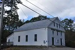 Veterans' Memorial Hall |
September 4, 1986 (#86002160) |
NH 32 42°45′53″N 72°16′09″W |
Richmond | |
| 144 | Mary Anne Wales House |  Mary Anne Wales House |
December 18, 1983 (#83004085) |
Snow Hill Rd. 42°54′14″N 72°04′01″W |
Dublin | |
| 145 | Walpole Academy | 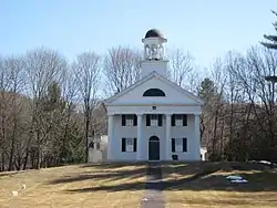 Walpole Academy |
May 21, 1975 (#75000230) |
Main St. 43°04′44″N 72°25′32″W |
Walpole | |
| 146 | Weldwood | 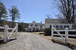 Weldwood |
December 15, 1983 (#83004086) |
Old Troy Rd. 42°53′17″N 72°06′25″W |
Dublin | |
| 147 | West Swanzey Covered Bridge | 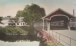 West Swanzey Covered Bridge |
February 29, 1980 (#80000281) |
Main St. 42°52′18″N 72°19′42″W |
West Swanzey | Over Ashuelot River |
| 148 | Wildwood Cottage |  Wildwood Cottage |
January 14, 1988 (#86003240) |
Bancroft Rd. 42°57′55″N 72°05′58″W |
Harrisville | |
| 149 | Willard Homestead |  Willard Homestead |
January 14, 1988 (#86003249) |
Sunset Hill Ave. 42°56′42″N 72°08′57″W |
Harrisville | |
| 150 | Winchester Town Hall |  Winchester Town Hall |
August 27, 1987 (#87001419) |
Main St. 42°46′22″N 72°23′02″W |
Winchester | |
| 151 | Windmill Hill |  Windmill Hill |
December 18, 1983 (#83004087) |
Windmill Hill Rd. 42°53′14″N 72°02′09″W |
Dublin | |
| 152 | Wood House |  Wood House |
December 15, 1983 (#83004088) |
NH 101 and NH 137 42°54′00″N 72°01′25″W |
Dublin | |
| 153 | Wyman Tavern |  Wyman Tavern |
April 3, 1972 (#72000106) |
339 Main St. 42°55′30″N 72°16′39″W |
Keene |
See also
| Wikimedia Commons has media related to National Register of Historic Places in Cheshire County, New Hampshire. |
References
- The latitude and longitude information provided in this table was derived originally from the National Register Information System, which has been found to be fairly accurate for about 99% of listings. Some locations in this table may have been corrected to current GPS standards.
- "National Register of Historic Places: Weekly List Actions". National Park Service, United States Department of the Interior. Retrieved on January 29, 2021.
- Numbers represent an alphabetical ordering by significant words. Various colorings, defined here, differentiate National Historic Landmarks and historic districts from other NRHP buildings, structures, sites or objects.
- "National Register Information System". National Register of Historic Places. National Park Service. April 24, 2008.
- The eight-digit number below each date is the number assigned to each location in the National Register Information System database, which can be viewed by clicking the number.
- "Archived copy". Archived from the original on 2014-03-28. Retrieved 2014-03-29.CS1 maint: archived copy as title (link)
| Topics | 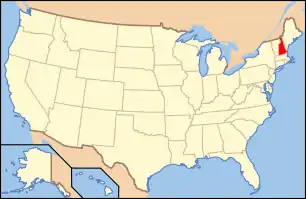 | |
|---|---|---|
| Lists by county | ||
| Other lists | ||
| ||
Municipalities and communities of Cheshire County, New Hampshire, United States | ||
|---|---|---|
| City | Map of New Hampshire highlighting Cheshire County | |
| Towns | ||
| CDPs | ||
| Other villages | ||
| ||
This article is issued from Wikipedia. The text is licensed under Creative Commons - Attribution - Sharealike. Additional terms may apply for the media files.