National Register of Historic Places listings in Tehama County, California
This is a list of the National Register of Historic Places listings in Tehama County, California.
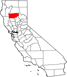
Location of Tehama County in California
This is intended to be a complete list of the properties and districts on the National Register of Historic Places in Tehama County, California, United States. Latitude and longitude coordinates are provided for many National Register properties and districts; these locations may be seen together in a Google map.[1]
There are 10 properties and districts listed on the National Register in the county.
- This National Park Service list is complete through NPS recent listings posted February 5, 2021.[2]
Current listings
| [3] | Name on the Register[4] | Image | Date listed[5] | Location | City or town | Description |
|---|---|---|---|---|---|---|
| 1 | Cone and Kimball Building | 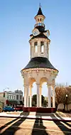 Cone and Kimball Building |
June 26, 1979 (#79000564) |
747 Main St. 40°10′42″N 122°14′05″W |
Red Bluff | |
| 2 | Herbert Kraft Memorial Free Library |  Herbert Kraft Memorial Free Library |
April 14, 2000 (#00000362) |
909 Jefferson 40°10′43″N 122°14′16″W |
Red Bluff | |
| 3 | Maywood Woman's Club | 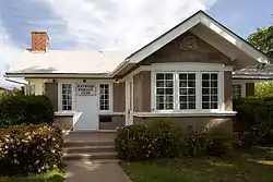 Maywood Woman's Club |
October 2, 1992 (#92001301) |
902 Marin St. 39°55′38″N 122°10′34″W |
Corning | |
| 4 | Molino Lodge Building |  Molino Lodge Building |
June 6, 1980 (#80000874) |
3rd and C Sts. 40°01′39″N 122°06′43″W |
Tehama | Masonic lodge building |
| 5 | Odd Fellows Building | 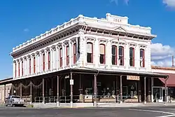 Odd Fellows Building |
December 12, 1976 (#76000537) |
342 Oak St. 40°10′36″N 122°14′03″W |
Red Bluff | |
| 6 | Old Bank of America Building |  Old Bank of America Building |
July 28, 1980 (#80000873) |
710 Main St. 40°10′41″N 122°14′02″W |
Red Bluff | |
| 7 | Park Headquarters, Lassen Volcanic National Park | 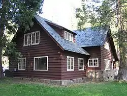 Park Headquarters, Lassen Volcanic National Park |
October 3, 1978 (#06000490) |
Off CA 36 40°20′45″N 121°36′27″W |
Mineral | |
| 8 | Saint Mary's Parish | 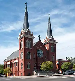 Saint Mary's Parish |
February 4, 1982 (#82002278) |
515 Main St. 40°10′32″N 122°13′58″W |
Red Bluff | |
| 9 | State Theatre | 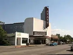 State Theatre |
April 17, 2002 (#02000372) |
333 Oak St. 40°10′35″N 122°14′03″W |
Red Bluff | |
| 10 | Sulphur Creek Archeological District | April 14, 1980 (#80000370) |
Address Restricted |
Mill Creek |
See also
| Wikimedia Commons has media related to National Register of Historic Places in Tehama County, California. |
References
- The latitude and longitude information provided in this table was derived originally from the National Register Information System, which has been found to be fairly accurate for about 99% of listings. Some locations in this table may have been corrected to current GPS standards.
- "National Register of Historic Places: Weekly List Actions". National Park Service, United States Department of the Interior. Retrieved on February 5, 2021.
- Numbers represent an alphabetical ordering by significant words. Various colorings, defined here, differentiate National Historic Landmarks and historic districts from other NRHP buildings, structures, sites or objects.
- "National Register Information System". National Register of Historic Places. National Park Service. July 9, 2010.
- The eight-digit number below each date is the number assigned to each location in the National Register Information System database, which can be viewed by clicking the number.
| Topics | |
|---|---|
| Lists by state |
|
| Lists by insular areas | |
| Lists by associated state | |
| Other areas | |
| Related | |
| |
Municipalities and communities of Tehama County, California, United States | ||
|---|---|---|
| Cities | Tehama County map | |
| CDPs | ||
| Unincorporated communities | ||
| Footnotes | ‡This populated place also has portions in an adjacent county or counties | |
| ||
This article is issued from Wikipedia. The text is licensed under Creative Commons - Attribution - Sharealike. Additional terms may apply for the media files.