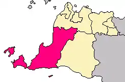
Pandeglang Regency
Pandeglang Regency (Sundanese: ᮊᮘᮥᮕᮒᮨᮔ᮪ ᮕᮔ᮪ᮓᮨᮌᮣᮀ) is a regency of Banten province, Indonesia. It is mainly located on the west and south coasts of the island of Java, and is the most westerly regency on Java Island. The regency has an area of 2,746.81 km2, and an official 2010 Census population of 1,149,610;[2] the most recent official estimate (for mid 2020) gives a population of 1,214,007.[3] The regency includes offshore islands such as Panaitan, Deli and Tinjil. The regency seat is the town of Pandeglang.
Pandeglang Regency
Kabupaten Pandeglang | |
|---|---|
| Other transcription(s) | |
| • Sundanese | ᮊᮘᮥᮕᮒᮨᮔ᮪ ᮕᮔ᮪ᮓᮨᮌᮣᮀ |
Coat of arms | |
 Pandeglang Regency facing the Java Sea and Sumatra in Banten | |
| Coordinates: 6°18′33″S 106°6′17″E | |
| Country | |
| Province | |
| Regency seat | Pandeglang |
| Government | |
| • Regent | Irna Narulita |
| Area | |
| • Total | 2,746.81 km2 (1,060.55 sq mi) |
| Population (2020)[1] | |
| • Total | 1,214,007 |
| • Density | 440/km2 (1,100/sq mi) |
| Time zone | UTC+7 (WIB) |
| Website | pandeglangkab.go.id |
Administrative districts
The Regency is divided into 35 districts (kecamatan), tabulated below with their areas and population totals from the 2010 Census[4] and the latest official estimates for mid 2018.[5] The table also includes the number of administrative villages (rural desa and urban kelurahan) in each district, and its postal codes.
| Name | Area in km2 | Population Census 2010[6] | Population Estimate mid 2018[7] | Number of villages | Post codes |
|---|---|---|---|---|---|
| Sumer (a) | 258.54 | 22,754 | 24,167 | 7 | 42283 |
| Cimanggu | 259.73 | 36,634 | 38,900 | 12 | 42284 |
| Cibaliung | 221.88 | 28,781 | 30,638 | 9 | 42285 |
| Cibitung | 180.72 | 21,180 | 22,451 | 10 | 42287 |
| Cikeusik (b) | 322.76 | 51,012 | 53,445 | 14 | 42286 |
| Cigeulis | 176.21 | 33,856 | 35,598 | 9 | 42282 |
| Panimbang (c) | 132.84 | 48,910 | 51,692 | 6 | 42281 |
| Sobang | 138.80 | 35,034 | 36,491 | 8 | 42280 |
| Munjul | 75.25 | 22,176 | 23,185 | 9 | 42275 |
| Angsana | 64.84 | 25,578 | 26,444 | 9 | 42277 |
| Sindangresmi | 65.20 | 21,259 | 22,258 | 9 | 42276 |
| Picung | 56.74 | 35,120 | 36,957 | 9 | 42275 |
| Bojong | 50.72 | 33,570 | 35,098 | 8 | 42274 |
| Saketi | 54.13 | 42,955 | 45,482 | 14 | 42278 |
| Cisata | 32.65 | 23,371 | 24,462 | 9 | 42273 |
| Pagelaran | 42.768 | 33,943 | 35,546 | 13 | 42265 |
| Patia | 45.48 | 27,242 | 28,425 | 10 | 42266 |
| Sukaresmi | 57.30 | 33,817 | 35,063 | 10 | 42267 |
| Labuan (d) | 15.66 | 53,861 | 57,022 | 9 | 42260 |
| Carita | 41.87 | 32,035 | 33,554 | 10 | 42264 |
| Jiput | 53.04 | 28,395 | 29,526 | 13 | 42263 |
| Cikedal | 26.00 | 30,395 | 31,973 | 10 | 42271 |
| Menes | 22.41 | 35,274 | 36,888 | 12 | 42262 |
| Pulosari | 31.33 | 27,486 | 28,970 | 9 | 42254 |
| Mandalawangi | 80.19 | 46,805 | 49,144 | 15 | 42261 |
| Cimanuk | 23.64 | 38,247 | 40,297 | 11 | 42270 |
| Cipeucang | 21.16 | 28,033 | 29,407 | 10 | 42272 |
| Banjar | 30.50 | 29,780 | 31,285 | 11 | 42252 |
| Kaduhejo | 33.57 | 34,474 | 36,132 | 10 | 42253 |
| Mekarjaya | 31.34 | 19,016 | 19,648 | 8 | 42279 |
| Pandeglang | 16.85 | 44,039 | 43,338 | 4 | 42211 -42219 |
| Majasari | 19.57 | 46,126 | 49,343 | 5 | 42221 -42217 |
| Cadasari | 26.20 | 31,425 | 32,904 | 11 | 42251 |
| Karangtanjung | 19.07 | 32,364 | 34,489 | 4 | 42213 |
| Koroncong | 17.86 | 17,643 | 18,789 | 12 | 42250 |
| Totals | 2,746.81 | 1,149,610 | 1,209,011 | 339 |
Notes: (a) including 32 islands in the strait between Java and Sumatra. (b) including the two small offshore islands of Pulau Deli and Pulau Tinjil.
(c) including the small offshore island of Pulau Liwungan. (d) including the small offshore island of Pulau Popole.
Tourism
The regency contains the Ujung Kulon National Park (famous for its single-horned Javan rhinoceros), Carita Beach, Tanjung Lesung Beach Resort and the public Bodur Beach (also in Tanjung Lesung).[8]
Special Economic Zone
Based on Government Regulation (PP) No. 26/2012, PT Jababeka Tbk has mandated to develop Special Economic Zone in Tanjung Lesung. Located 170 kilometers from Jakarta, through Jakarta–Tangerang Toll Road and then Tangerang–Merak Toll Road and small road to Tanjung Lesung needs 4 to 5 hours. So, the company will build 83 kilometers highway from Serang to Panimbang, because to build toll road will be difficult with the land acquisitions. An airstrip in Panimbang is also considered, because it only need 10 minutes to Tanjung Lesung. The company has got partners to make Cruise Port in 50 hectares area and will be built soon.[9]
Climate
Pandeglang has a tropical rainforest climate (Af) with heavy rainfall year-round. The following climate data is for the town of Pandeglang.
| Climate data for Pandeglang | |||||||||||||
|---|---|---|---|---|---|---|---|---|---|---|---|---|---|
| Month | Jan | Feb | Mar | Apr | May | Jun | Jul | Aug | Sep | Oct | Nov | Dec | Year |
| Average high °C (°F) | 29.5 (85.1) |
29.9 (85.8) |
30.6 (87.1) |
31.0 (87.8) |
31.3 (88.3) |
31.2 (88.2) |
31.2 (88.2) |
31.4 (88.5) |
31.8 (89.2) |
31.8 (89.2) |
31.3 (88.3) |
30.6 (87.1) |
31.0 (87.7) |
| Daily mean °C (°F) | 25.3 (77.5) |
25.6 (78.1) |
26.0 (78.8) |
26.2 (79.2) |
26.4 (79.5) |
26.1 (79.0) |
25.7 (78.3) |
25.8 (78.4) |
26.2 (79.2) |
26.4 (79.5) |
26.3 (79.3) |
26.0 (78.8) |
26.0 (78.8) |
| Average low °C (°F) | 21.2 (70.2) |
21.4 (70.5) |
21.4 (70.5) |
21.5 (70.7) |
21.6 (70.9) |
21.0 (69.8) |
20.3 (68.5) |
20.2 (68.4) |
20.6 (69.1) |
21.1 (70.0) |
21.4 (70.5) |
21.5 (70.7) |
21.1 (70.0) |
| Average rainfall mm (inches) | 327 (12.9) |
276 (10.9) |
249 (9.8) |
239 (9.4) |
216 (8.5) |
126 (5.0) |
129 (5.1) |
129 (5.1) |
163 (6.4) |
222 (8.7) |
267 (10.5) |
279 (11.0) |
2,622 (103.3) |
| Source: Climate-Data.org[10] | |||||||||||||
References
- Badan Pusat Statistik, Jakarta, 2020.
- http://banten.bps.go.id/pandeglang.htm%5B%5D
- Badan Pusat Statistik, Jakarta, 2020.
- Biro Pusat Statistik, Jakarta, 2011.
- Badan Pusat Statistik Sulawesi Utara, 2020.
- Biro Pusat Statistik, Jakarta, 2011.
- Badan Pusat Statistik, Jakarta, 2020.
- Dulangan (June 14, 2014). "Pantai Bodur di Tanjung Lesung". Archived from the original on February 26, 2014. Retrieved June 27, 2014.
- "Infrastructure Development Plan For Tanjung Lesung". Retrieved February 17, 2015.
- "Climate: Pandeglang". Climate-Data.org. Retrieved 12 November 2020.
External links
| Wikivoyage has a travel guide for Pandeglang. |
Places adjacent to Pandeglang Regency | ||||||||||
|---|---|---|---|---|---|---|---|---|---|---|
| ||||||||||
