Serang
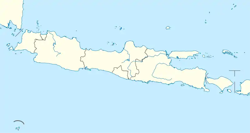
Serang municipality (Indonesian: Kota Serang, Sundanese: ᮞᮦᮛᮀ) is the capital of Banten province and was formerly also the administrative center of Serang Regency in Indonesia (the Regency's capital is now at Baros). The city is located towards the north of Banten province, on the island of Java. Before Banten province was formed in 2000 Serang was part of West Java province.
Serang
Paddy Field City ᮞᮦᮛᮀ | |
|---|---|
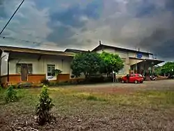 Serang railway station | |
 Seal | |
| Motto(s): (Self-reliant Serang) | |
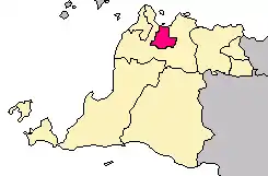 Location within Banten | |
| Coordinates: 6°7′12″S 106°9′1″E | |
| Country | |
| Province | |
| Established | 2 November 2007[1] |
| Government | |
| • Mayor | Syafrudin |
| • Vice Mayor | Subadri Usuludin |
| Area | |
| • Total | 266.74 km2 (102.99 sq mi) |
| Elevation | 25 m (82 ft) |
| Population (2017) | |
| • Total | 666,600 |
| • Density | 2,499/km2 (6,470/sq mi) |
| Time zone | UTC+7 (Indonesia Western Time) |
| Area code | (+62) 254 |
| Registration plate | A |
| Website | serangkota.go.id |

Serang has a tropical rainforest climate, with no dry season month.[2] It faces the Java Sea, which is home to Thousand Islands.
Serang was reported as having a population of 576,961 in the 2010 census,[3] making it the third most populous city in the province of Banten. The latest official population estimate is 666,600 (2017).[4] Serang is located approximately 15 km from the border of Jabodetabek and sometimes considered as amalgamated with the Greater Jakarta.
Culture
Religion
The majority of people in Serang and Banten Province embrace Islam, but other religions coexist peacefully.
Language
Compared with the majority in Banten Province who speak the Sundanese language, in addition to Sundanese language. Some residents local people in Serang speak the Javanese language with a dialect similar to the Cirebon dialect of Javanese. The reason for this is that many Javanese migrants arrived in early 1527 to build the Banten Sultanate, and remained to form the base of today's population.
Transportation
The city is served by Serang Station, operated by Indonesia's rail operator PT Kereta Api.
The Tangerang–Merak Toll Road, part of the Trans-Java toll road, passes through the city of Serang.
The road to the proposed Sunda Strait Bridge would start in Serang, pass through Merak in neighboring Cilegon city to cross over the Sunda Strait to Sumatra.
Administrative districts
Serang was formerly a part of Serang Regency. On 2 November 2007, the status of Serang was changed into a municipality (kota madya) independent of the Regency. Since that time, Serang City becomes a semi-enclave within Serang Regency, as the city borders the regency in the south, east, and west, while it borders with Java Sea in the north.
The City of Serang is divided into six districts (kecamatan), listed below with their populations at the 2017 Census:
- Curug (50,885)
- Walantaka (92,253)
- Cipocok Jaya (109,793)
- Serang (226,717)
- Taktakan (90,960)
- Kasemen (95,992)
Climate
Serang has a tropical rainforest climate (Af) with heavy rainfall year-round. Rain gets noticeably heavier from December to March.
| Climate data for Serang | |||||||||||||
|---|---|---|---|---|---|---|---|---|---|---|---|---|---|
| Month | Jan | Feb | Mar | Apr | May | Jun | Jul | Aug | Sep | Oct | Nov | Dec | Year |
| Average high °C (°F) | 30.4 (86.7) |
30.9 (87.6) |
31.4 (88.5) |
32.0 (89.6) |
32.3 (90.1) |
32.2 (90.0) |
32.3 (90.1) |
32.3 (90.1) |
32.8 (91.0) |
32.8 (91.0) |
32.4 (90.3) |
31.7 (89.1) |
32.0 (89.5) |
| Daily mean °C (°F) | 26.4 (79.5) |
26.7 (80.1) |
26.9 (80.4) |
27.3 (81.1) |
27.5 (81.5) |
27.1 (80.8) |
26.9 (80.4) |
26.8 (80.2) |
27.3 (81.1) |
27.5 (81.5) |
27.5 (81.5) |
27.2 (81.0) |
27.1 (80.8) |
| Average low °C (°F) | 22.5 (72.5) |
22.6 (72.7) |
22.5 (72.5) |
22.7 (72.9) |
22.8 (73.0) |
22.1 (71.8) |
21.6 (70.9) |
21.4 (70.5) |
21.8 (71.2) |
22.3 (72.1) |
22.7 (72.9) |
22.8 (73.0) |
22.3 (72.2) |
| Average precipitation mm (inches) | 305 (12.0) |
257 (10.1) |
197 (7.8) |
154 (6.1) |
132 (5.2) |
85 (3.3) |
86 (3.4) |
82 (3.2) |
82 (3.2) |
119 (4.7) |
162 (6.4) |
217 (8.5) |
1,878 (73.9) |
| Source: [5] | |||||||||||||
Emblem
The emblem of Serang consists of
- A hexagon with an image of the gerbang Kaibon and a star.
- The streamer at the foot of the emblem contains the motto of Serang city, Kota Serang Madani ("Self-reliant Serang").
References
- according to Law UU No. 32/2007
- http://www.weatherbase.com/weather/weather.php3?s=967370&refer=
- "Archived copy" (PDF). Archived from the original (PDF) on 13 November 2010. Retrieved 10 February 2012.CS1 maint: archived copy as title (link)
- "Statistik Daerah Kota Serang 2018". Indonesia Statistic for Serang city.
- https://en.climate-data.org/location/616435
| 2,000,000 and more | |
|---|---|
| 1,000,000–1,999,999 | |
| 500,000–999,999 | |
| 200,000–499,999 | |
