Val-des-Bois, Quebec
Val-des-Bois is a town and municipality in the Papineau Regional County Municipality in the Outaouais region of Quebec, Canada. The town is located on the eastern shores of the Du Lièvre River, 47 kilometers (29 mi) north of Buckingham.
Val-des-Bois | |
|---|---|
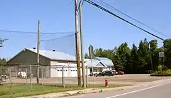 Municipal office | |
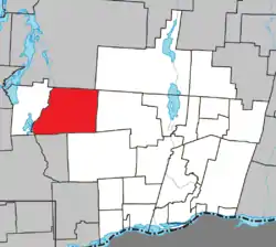 Location within Papineau RCM | |
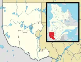 Val-des-Bois Location in western Quebec | |
| Coordinates: 45°55′N 75°36′W[1] | |
| Country | Canada |
| Province | Quebec |
| Region | Outaouais |
| RCM | Papineau |
| Constituted | January 1, 1885 |
| Government | |
| • Mayor | Roland Montpetit |
| • Federal riding | Argenteuil—Papineau—Mirabel |
| • Prov. riding | Papineau |
| Area | |
| • Total | 245.60 km2 (94.83 sq mi) |
| • Land | 225.42 km2 (87.04 sq mi) |
| Population (2016)[3] | |
| • Total | 865 |
| • Density | 3.8/km2 (10/sq mi) |
| • Pop 2011-2016 | |
| • Dwellings | 851 |
| Time zone | UTC−5 (EST) |
| • Summer (DST) | UTC−4 (EDT) |
| Postal code(s) | J0X 3C0 |
| Area code(s) | 819 |
| Highways | |
| Website | www |
The main local economic activity depends on cottage tourism.[4] The eastern half of the municipality is part of the Papineau-Labelle Wildlife Reserve.
Geography
As part of the Laurentian Highlands, its territory is dotted with lakes such Écho, de l'Argile, de l'Aqueduc, Vert, and Delphis. Echo Lake lies at an altitude of 243 meters (797 ft), while the surrounding relief rises to 472 meters (1,549 ft) above sea level.[5]
History
In 1873, the Township of Villeneuve was formed and named after Léonard-Vincent-Léon Villeneuve (1808-1873), member of Society of Saint-Sulpice, professor at the Petit Séminaire de Montréal (1838-1846), and pastor of Oka from 1871 to 1873.[4]
In 1878, the local post office was named "Val-des-Bois". In 1883, the parish of Notre-Dame-de-la-Garde was formed, and two years later, the United Township Municipality of Bowman-et-Villeneuve was established. In 1913, the townships separated, forming the Township Municipality of Bowman and the Township Municipality of Villeneuve.[4] In 1929, James Maclaren began construction on a dam at the High Falls of the Lièvre River, displacing 156 families because of the rising waters. The majority of them where German settlers, the average amount the families received from the MacLaren Co. were, depending on the acreage, between $1000.-- to $2000 each.[6]
In 1958, Villeneuve was renamed to Val-des-Bois (French for "Valley of the Woods"), in reference to the beautiful forest which decorated the banks of the Lièvre River.[4]
On 23 June 2010 a 5.0 earthquake struck the region, with its epicentre 8 km from Val-des-Bois, which was the closest settlement.[7]
Demographics
| Canada census – Val-des-Bois, Quebec community profile | |||
|---|---|---|---|
| 2016 | 2011 | ||
| Population: | 865 (-7.8% from 2011) | 938 (7.4% from 2006) | |
| Land area: | 225.42 km2 (87.04 sq mi) | 225.35 km2 (87.01 sq mi) | |
| Population density: | 3.8/km2 (9.8/sq mi) | 4.2/km2 (11/sq mi) | |
| Median age: | 58.4 (M: 58.4, F: 58.4) | 55.8 (M: 56.5, F: 55.3) | |
| Total private dwellings: | 851 | 1,003 | |
| Median household income: | $46,592 | $42,378 | |
| References: 2016[8] 2011[9] earlier[10] | |||
| Year | Pop. | ±% |
|---|---|---|
| 1986 | 544 | — |
| 1991 | 624 | +14.7% |
| 1996 | 668 | +7.1% |
| 2001 | 732 | +9.6% |
| 2006 | 873 | +19.3% |
| 2011 | 938 | +7.4% |
| 2016 | 865 | −7.8% |
| Source: Statistics Canada | ||
Mother tongue:[3]
- English as first language: 5.8%
- French as first language: 91.9%
- English and French as first language: 1.2%
- Other as first language: 0.6%
Local government
List of former mayors:
- Marcel Proulx (2001–2013)
- Daniel Rochon (2013-2015)
- Roland Montpetit (2015–present)
References
- Reference number 64777 of the Commission de toponymie du Québec (in French)
- Geographic code 80140 in the official Répertoire des municipalités (in French)
- "(Code 2480140) Census Profile". 2016 census. Statistics Canada. 2017.
- "Val-des-Bois (Municipalité)" (in French). Commission de toponymie du Québec. Retrieved 2008-10-28.
- "Villeneuve (Canton)" (in French). Commission de toponymie du Québec. Retrieved 2008-10-28.
- "Tracing their footsteps" by research-author Anne Schnurr
- http://earthquakescanada.nrcan.gc.ca/recent_eq/2010/20100623.1741/index-eng.php
- "2016 Community Profiles". 2016 Canadian Census. Statistics Canada. February 21, 2017. Retrieved 2020-01-30.
- "2011 Community Profiles". 2011 Canadian Census. Statistics Canada. July 5, 2013. Retrieved 2020-01-30.
- "2001 Community Profiles". 2001 Canadian Census. Statistics Canada. February 17, 2012.
External links
![]() Media related to Val-des-Bois at Wikimedia Commons
Media related to Val-des-Bois at Wikimedia Commons
Places adjacent to Val-des-Bois, Quebec | |
|---|---|
| Cities | |
|---|---|
| Municipalities | |
| Townships | |
| |
| Authority control |
|---|