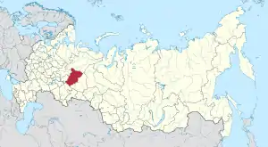
Perm Krai
Perm Krai (Russian: Пе́рмский край, tr. Permsky kray, IPA: [ˈpʲɛrmskʲɪj ˈkraj]) is a federal subject of Russia (a krai) that came into existence on December 1, 2005 as a result of the 2004 referendum on the merger of Perm Oblast and Komi-Permyak Autonomous Okrug. The city of Perm is the administrative center. The population of the krai was 2,635,276 according to the (2010 Census).[7]
Perm Krai | |
|---|---|
| Пермский край | |
 Coat of arms | |
 | |
| Coordinates: 59°14′N 56°08′E | |
| Country | Russia |
| Federal district | Volga[1] |
| Economic region | Urals[2] |
| Established | December 1, 2005[3] |
| Administrative center | Perm |
| Government | |
| • Body | Legislative Assembly[4] |
| • Governor[5] | Dmitry Makhonin |
| Area | |
| • Total | 160,600 km2 (62,000 sq mi) |
| Area rank | 24th |
| Population (2010 Census)[7] | |
| • Total | 2,635,276 |
| • Estimate (2018)[8] | 2,623,122 (−0.5%) |
| • Rank | 17th |
| • Density | 16/km2 (42/sq mi) |
| • Urban | 75.0% |
| • Rural | 25.0% |
| Time zone | UTC+5 (MSK+2 |
| ISO 3166 code | RU-PER |
| License plates | 59, 81, 159 |
| OKTMO ID | 57000000 |
| Official languages | Russian[10] |
| Website | http://www.perm.ru |
Komi-Permyak Okrug retained its autonomous status within Perm Krai during the transitional period of 2006–2008. It also retained a budget separate from that of the krai, keeping all federal transfers. Starting in 2009, Komi-Permyak Okrug's budget became subject to the budgeting law of Perm Krai. The transitional period was implemented in part because Komi-Permyak Okrug relies heavily on federal subsidies, and an abrupt cut would have been detrimental to its economy.
Geography
Perm Krai is located in the east of the East European Plain and the western slope of the Middle Ural Mountains. 99.8% of its area is in Europe, 0.2% in Asia.
- length from north to south – 645 kilometres (401 mi)
- length from west to east – 417.5 kilometres (259.4 mi)
The krai borders the Komi Republic in the north, Kirov Oblast in the northwest, the Udmurt Republic in the southwest, the Republic of Bashkortostan in the south, and Sverdlovsk Oblast in the east.
The krai borders stretch for over 2,200 kilometres (1,400 mi). The highest point is Mount Tulymsky Kamen at 1,496 metres (4,908 ft).
Rivers
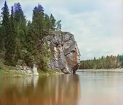

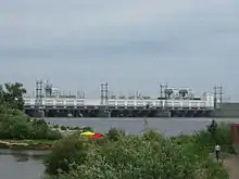
Rivers of Perm Krai belong to the Kama River Basin, the largest tributary of Volga River. There are more than 29,000 rivers in Perm Krai. The total length of all rivers is more than 90,000 kilometres (56,000 mi).
Only two rivers in Perm Krai have lengths exceeding 500 kilometres (310 mi). They are the Kama River at 1,805 kilometres (1,122 mi) and the Chusovaya River, 592 kilometres (368 mi).
There are about 40 rivers with lengths from 100 to 500 kilometres (62 to 311 mi). The longest of them are:
- Sylva River — 493 km (306 mi)
- Kolva River — 460 km (285 mi)
- Vishera River — 415 km (258 mi)
- Yayva River — 403 km (250 mi)
- Kosva River — 283 km (176 mi)
- Kosa River — 267 km (165 mi)
- Veslyana River — 266 km (165 mi)
- Inva River — 257 km (159 mi)
- Obva River — 247 km (153 mi)
There are also many small rivers, but some of them have historical significance, for example Yegoshikha River, in mouth of which city Perm was founded.
Climate
Perm Krai has a continental climate. Winters are long and snowy, with average temperatures in January varying from −18 °C (0 °F) in the northeast part of krai to −15 °C (5 °F) in southwest part. The record lowest recorded temperature was −53 °C (−63 °F) (in the north).
Minerals
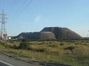
Perm Krai has an abundance of minerals. Oil, natural gas, gold, diamonds, chromites, peat, limestone and building materials are among the many natural resources extracted.[11]
Oil in its area was first discovered in 1929 near settlement Verhnechusovskie Gorodki. Currently there are known more than 180 oil and gas fields. Among them are developed: 89 oil, 2 gas and 18 both oil and gas fields. Most of them are small and extracted in central and southern districts of krai. The northern fields are less developed because the oil lies deep under salt layers.
Coal has been mined in Perm Krai for more than 200 years. For a long time it played an important role in the fuel and energy balance in the region. Maximum mining was in 1960 and reached 12 million tonnes, after it mining decrease and there are no exploration of new fields.
The Verkhnekamskoye deposit of potassium salts is one of the largest in the world. Its is approx. 1,800 km2 (690 sq mi), and the thickness of the salt layers reaches 514 m.
Flora and fauna
Forests cover about 71% of Perm Krai's area. Coniferous forests predominate, with deciduous forests more common in the south. There are 62 species of mammals, more than 270 species of birds, 39 species of fishes, 6 species of reptile and 9 species of amphibians.
Three nature reserves are located in Perm Krai: Basegi, Vishera, Preduralie.
Politics
During the Soviet period, the high authority in the oblast was shared between three persons: The first secretary of the Perm CPSU Committee (who in reality had the greatest authority), the chairman of the oblast Soviet (legislative power), and the Chairman of the oblast Executive Committee (executive power). Since 1991, CPSU lost all the power, and the head of the Oblast administration, and eventually the governor was appointed/elected alongside elected regional parliament.
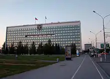
The Charter of Perm Krai is the fundamental law of the region. The Legislative Assembly of Perm Krai is the province's standing legislative (representative) body. The Legislative Assembly exercises its authority by passing laws, resolutions, and other legal acts and by supervising the implementation and observance of the laws and other legal acts passed by it. The highest executive body is the Oblast Government, which includes territorial executive bodies such as district administrations, committees, and commissions that facilitate development and run the day to day matters of the province. The Oblast administration supports the activities of the Governor who is the highest official and acts as guarantor of the observance of the oblast Charter in accordance with the Constitution of Russia.
Administrative divisions
Administratively, the krai is divided into thirty-three districts, fourteen cities of krai significance, and one closed administrative-territorial formation. Six administrative districts are grouped into Komi-Permyak Okrug, which is an administrative unit with special status formed within Perm Krai as a result of the 2005 merger of Perm Oblast and Komi-Permyak Autonomous Okrug, both of which used to be the federal subjects.
Municipally, the territories of all administrative districts and those of nine cities of krai significance are incorporated as municipal districts. The remaining five cities are incorporated as urban okrugs.
Law enforcement
| ГУ МВД России по Пермскому краю MVD's Directorate of Perm Krai | |
|---|---|
| Common name | Полиция Перми |
| Motto | служа закону, Служим народу by serving the law, we serve the people |
| Jurisdictional structure | |
| Operations jurisdiction | RUS |
| Governing body | MVD |
| General nature | |
| Operational structure | |
| Headquarters | Komsomolskiy Pr. 74, Perm |
| Elected officer responsible |
|
| Parent agency | MVD |
| Child agency |
|
| Notables | |
| Award |
|
| Website | |
| Official Website | |
The Directorate of the Ministry for Internal Affairs in Perm Krai (ГУ МВД России по Пермскому краю) or the Police of Perm (Полиция Перми) is the main law enforcement agency of the government of Perm Krai, Russia. It is answerable to the regional MVD and the governor of Perm Krai. The chief of police is Yuri Valyaev.
Economy
Nonferrous metallurgy is based on ore processing Verkhnekamskoye potash deposit containing magnesium and rare metals. The factories are located in Berezniki (Titanium Magnesium Plant Corporation VSMPO) and Solikamsk (JSC Solikamsk magnesium plant).
In engineering plays an important role military production. The largest center of engineering is Perm; manufactured aircraft and rocket engines, oil field and mining equipment, Petrol motive-powered saws, communication equipment, vessels, cable and other products. The largest enterprises are Motovilikha Plants and Perm Motors. Timber Complex edge based on the use of the richest forest resources of Prikamye. Logging facilities are located mainly in the north of the region.
Demographics
According to the 2010 Census, the population of Perm Krai is 2,635,276;[7] down from 2,819,421 recorded in the 2002 Census,[12] and further down from 3,099,994 recorded in the 1989 Census.[13]
Ethnic groups, as of the 2010 Census, are:[7] Russians (87.1%), Komi-Permyaks (3.2%), Tatars (4.6%), Bashkirs (1,3%), Ukrainians (0,6%), Udmurts (0,8%), Belarusians (0,3%), Germans (0,3%) and others. Additionally, 119,538 people were registered from administrative databases, and could not declare an ethnicity. It is estimated that the proportion of ethnicities in this group is the same as that of the declared group.[14]
There are about 40,740 Bashkirs is Perm Krai, according to the 2002 Census. Most of them live in Bardymsky District, in basin of Tulva River and belong to the Gaina tribe.
Tatars live in almost all settlements of Perm Krai. There are several different ethnographical groups of Tatar people. In this territory there were longtime active contacts between Tatars and Bashkirs, so in some cases it is difficult to delineate the ethnic groups, especially in such areas as Kuyedinsky District and Tulva River basin.[15][16]
Settlements
Vital Statistics for 2007: Source
- Birth Rate: 12.05 per 1000
- Death Rate: 15.70 per 1000
- Net Immigration: -1.0 per 1000
- NGR: -0.37% per Year
- PGR: -0.48% per Year
- Vital statistics for 2012
- Births: 38 847 (14.8 per 1000)
- Deaths: 37 278 (14.2 per 1000) [17]
- Total fertility rate: 1.91
Death rates in some of the remote and rural areas in Perm Krai are very high, never seen before during times other than major wars or natural calamities. Just five districts out of a total of 47 have a surplus of births over death in Perm Krai. The birth rate in Perm Krai is much higher compared to other European regions. For example, the birth rate for Germany was 8.3 per 1000 in 2007. Perm as a whole is having 50% higher birth rate, and even the district with the lowest birth rate is having 20% higher BR compared to Germany. In 2008, the birth rate in Perm Krai was 8% higher than that of 2007. Close to 35.5 thousand births were recorded with the heaviest increases in City of Perm (+11%) and Komi-Permyak Autonomous Okrug (+18%). Among the districts, Kudymkar City recorded a 46% rise in birth rates for 2008 compared to 2007, while Usolsky recorded a 31% rise and Kyshertsky recorded a 29% rise. In 13 of the districts, there were more births than deaths, among them Ordynsky, Karagaysky, Kudimkar, Chernushynsky, Chaykovsky & Permsky.[18]
Total fertility rate:[19][20]
1995 - 1,31 | 2000 - 1,26 | 2005 - 1,34 | 2006 - 1,34 | 2007 - 1,47 | 2008 - 1,57 | 2009 - 1,61 | 2010 - 1,77 | 2011 - 1,78 | 2012 - 1,91 | 2013 - 1,93 | 2014 - 1,98 | 2015 - 2,02 | 2016 - 1,99(e)
Demographics for 2007
| District | Population | Births | Deaths | BR | DR | NGR |
|---|---|---|---|---|---|---|
| Perm Krai | 2,718,227 | 32,747 | 42,680 | 12.05 | 15.70 | -0.37% |
| Bolshesosnovsky | 14,292 | 219 | 268 | 15.32 | 18.75 | -0.34% |
| Vereshchagynsky | 43,410 | 710 | 744 | 16.36 | 17.14 | -0.08% |
| Gornozavodsky | 27,885 | 396 | 582 | 14.20 | 20.87 | -0.65% |
| Yelovsky | 12,299 | 176 | 229 | 14.31 | 18.62 | -0.43% |
| Kochevsky | 12,356 | 181 | 196 | 14.65 | 15.86 | -0.12% |
| Ilyinsky | 20,311 | 278 | 408 | 13.69 | 20.09 | -0.64% |
| Karagaysky | 23,907 | 360 | 381 | 15.06 | 15.94 | -0.08% |
| Kishertsky | 14,578 | 158 | 280 | 10.84 | 19.21 | -0.83% |
| Krasnovishersky | 26,287 | 335 | 455 | 12.74 | 17.31 | -0.45% |
| Kuyedinsky | 30,576 | 446 | 489 | 14.59 | 15.99 | -0.14% |
| Kungursky | 46,370 | 727 | 720 | 15.68 | 15.53 | 0.01% |
| Kudymkarsky | 27,922 | 429 | 676 | 15.36 | 24.21 | -0.88% |
| Nitvensky | 45,552 | 656 | 858 | 14.40 | 18.84 | -0.44% |
| Oktyabrsky | 34,789 | 481 | 585 | 13.83 | 16.82 | -0.30% |
| Ordinsky | 16,185 | 247 | 241 | 15.26 | 14.89 | 0.04% |
| Osinsky | 32,074 | 410 | 550 | 12.78 | 17.15 | -0.44% |
| Okhansky | 17,180 | 202 | 359 | 11.76 | 20.90 | -0.91% |
| Ochyorsky | 24,651 | 366 | 455 | 14.85 | 18.46 | -0.36% |
| Permsky | 87,342 | 1,275 | 1,383 | 14.60 | 15.83 | -0.12% |
| Sivinsky | 16,797 | 297 | 266 | 17.68 | 15.84 | 0.18% |
| Solikamsky | 17,637 | 203 | 265 | 11.51 | 15.03 | -0.35% |
| Suksunsky | 20,925 | 294 | 349 | 14.05 | 16.68 | -0.26% |
| Uynsky | 12,631 | 180 | 212 | 14.25 | 16.78 | -0.25% |
| Usolsky | 13,788 | 176 | 299 | 12.76 | 21.69 | -0.88% |
| Chastinsky | 14,450 | 207 | 254 | 14.33 | 17.58 | -0.33% |
| Cherdynsky | 32,522 | 342 | 542 | 10.52 | 16.67 | -0.61% |
| Gaynsky | 16,106 | 214 | 268 | 13.29 | 16.64 | -0.33% |
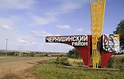
| Chernushinsky | 52,231 | 811 | 638 | 15.53 | 12.21 | 0.33% |
| Perm | 987,246 | 10,094 | 13,167 | 10.22 | 13.34 | -0.31% |
| Alexandrovsky | 34,554 | 427 | 662 | 12.36 | 19.16 | -0.68% |
| Berezniki | 165,950 | 1,822 | 2,484 | 10.98 | 14.97 | -0.40% |
| Gremyachinsky | 15,075 | 178 | 367 | 11.81 | 24.34 | -1.25% |
| Gubakhinsky | 40,086 | 448 | 826 | 11.18 | 20.61 | -0.92% |
| Dobryansky | 61,365 | 792 | 950 | 12.91 | 15.48 | -0.26% |
| Kizelovsky | 30,837 | 381 | 827 | 12.36 | 26.82 | -1.43% |
| Krasnokamsky | 40,393 | 816 | 1,264 | 20.20 | 31.29 | -0.64% |
| Kungur | 68,074 | 872 | 981 | 12.81 | 14.41 | -0.16% |
| Lysvensky | 82,921 | 1,016 | 1,598 | 12.25 | 19.27 | -0.70% |
| Solikamsk | 97,269 | 1,165 | 1,464 | 11.98 | 15.05 | -0.30% |
| Chaykovsky | 108,617 | 1,374 | 1,332 | 12.65 | 12.26 | 0.04% |
| Chusovskoy | 73,314 | 879 | 1,531 | 11.99 | 20.88 | -0.89% |
| Yurlinsky | 11,046 | 200 | 253 | 18.11 | 22.90 | -0.48% |
| Kosinsky | 7,716 | 130 | 160 | 16.85 | 20.74 | -0.38% |
| Yusvinsky | 22,626 | 288 | 475 | 12.73 | 20.99 | -0.82% |
| Kudymkar | 30,964 | 385 | 511 | 12.43 | 16.50 | -0.40% |
| Bardymsky | 27,529 | 361 | 537 | 13.11 | 19.51 | -0.64% |
| Beryozovsky | 17,901 | 230 | 281 | 12.85 | 15.70 | -0.28% |
Religion
As of a 2012 survey[22] 43% of the population of Perm Krai adheres to the Russian Orthodox Church, 5% declares to be generically unaffiliated Christian, 4% are Muslims, 2% are Rodnovers (Slavic folk religion), 1% are Old Believers, 1% Orthodox Christian believers who don't belong to churches or are members of non-Russian Orthodox churches, 8% follows other religion or did not give an answer to the survey. In addition, 24% of the population declares to be "spiritual but not religious" and 14% to be either atheist or not religious.[22]
Major attractions
Perm Krai is home of several museums:
- Perm State Art Galery
- Perm Museum of Local History
- Museum of Motovilikha Plants
- Architectural-Ethnographic Museum Khokhlovka and others.
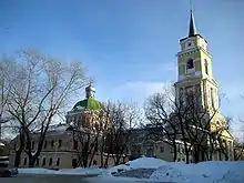
Numerous architectural monuments are located in the small town of Usolye, in north of Perm Krai. Particularly important are the Saviour Cathedral, with a separate bell tower, and House of Stroganov.
There are many theaters in Perm, including the Perm Opera and Ballet Theater, the Perm Academic Theater, the Puppet Theater, the Theater for Young Spectators, the Theater "Near Bridge", and others.
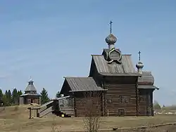
There are many temples and convents in Perm Krai. The most significant of them are: Belogorsky Convent located in 85 km from Perm, Sludskaya Church, Fedosievskaya Church, Perm Mosque and others.
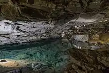
Ordinsky is home to the Orda underwater caves. Located near Orda village in Perm region, Ural, Orda Cave is also the biggest underwater gypsum crystal cave in the world.
See also
References
- Президент Российской Федерации. Указ №849 от 13 мая 2000 г. «О полномочном представителе Президента Российской Федерации в федеральном округе». Вступил в силу 13 мая 2000 г. Опубликован: "Собрание законодательства РФ", No. 20, ст. 2112, 15 мая 2000 г. (President of the Russian Federation. Decree #849 of May 13, 2000 On the Plenipotentiary Representative of the President of the Russian Federation in a Federal District. Effective as of May 13, 2000.).
- Госстандарт Российской Федерации. №ОК 024-95 27 декабря 1995 г. «Общероссийский классификатор экономических регионов. 2. Экономические районы», в ред. Изменения №5/2001 ОКЭР. (Gosstandart of the Russian Federation. #OK 024-95 December 27, 1995 Russian Classification of Economic Regions. 2. Economic Regions, as amended by the Amendment #5/2001 OKER. ).
- Федеральный конституционный закон №1-ФКЗ от 25 марта 2004 г «Об образовании в составе Российской Федерации нового субъекта Российской Федерации в результате объединения Пермской области и Коми-Пермяцкого автономного округа», в ред. федерального конституционного закона №1-ФКЗ от 12 апреля 2006 г. (Federal Constitutional Law #1-FKZ of March 25, 2004 On Establishment Within the Russian Federation of a New Federal Subject of the Russian Federation as a Result of the Merger of Perm Oblast and Komi-Permyak Autonomous Okrug, as amended by the Federal Constitutional Law #1-FKZ of April 12, 2006. ).
- Charter, Article 15.4
- Charter, Article 15.3
- Федеральная служба государственной статистики (Federal State Statistics Service) (May 21, 2004). "Территория, число районов, населённых пунктов и сельских администраций по субъектам Российской Федерации (Territory, Number of Districts, Inhabited Localities, and Rural Administration by Federal Subjects of the Russian Federation)". Всероссийская перепись населения 2002 года (All-Russia Population Census of 2002) (in Russian). Federal State Statistics Service. Retrieved November 1, 2011.
- Russian Federal State Statistics Service (2011). "Всероссийская перепись населения 2010 года. Том 1" [2010 All-Russian Population Census, vol. 1]. Всероссийская перепись населения 2010 года [2010 All-Russia Population Census] (in Russian). Federal State Statistics Service.
- "26. Численность постоянного населения Российской Федерации по муниципальным образованиям на 1 января 2018 года". Federal State Statistics Service. Retrieved January 23, 2019.
- "Об исчислении времени". Официальный интернет-портал правовой информации (in Russian). June 3, 2011. Retrieved January 19, 2019.
- Official throughout the Russian Federation according to Article 68.1 of the Constitution of Russia.
- Полезные ископаемые Archived October 6, 2008, at the Wayback Machine
- Russian Federal State Statistics Service (May 21, 2004). "Численность населения России, субъектов Российской Федерации в составе федеральных округов, районов, городских поселений, сельских населённых пунктов – районных центров и сельских населённых пунктов с населением 3 тысячи и более человек" [Population of Russia, Its Federal Districts, Federal Subjects, Districts, Urban Localities, Rural Localities—Administrative Centers, and Rural Localities with Population of Over 3,000] (XLS). Всероссийская перепись населения 2002 года [All-Russia Population Census of 2002] (in Russian).
- "Всесоюзная перепись населения 1989 г. Численность наличного населения союзных и автономных республик, автономных областей и округов, краёв, областей, районов, городских поселений и сёл-райцентров" [All Union Population Census of 1989: Present Population of Union and Autonomous Republics, Autonomous Oblasts and Okrugs, Krais, Oblasts, Districts, Urban Settlements, and Villages Serving as District Administrative Centers]. Всесоюзная перепись населения 1989 года [All-Union Population Census of 1989] (in Russian). Институт демографии Национального исследовательского университета: Высшая школа экономики [Institute of Demography at the National Research University: Higher School of Economics]. 1989 – via Demoscope Weekly.
- http://www.perepis-2010.ru/news/detail.php?ID=6936
- Статья о башкирах на сайте РОО "Хомай" Archived February 26, 2011, at the Wayback Machine
- ТАТАРЫ. Энциклопедия «Пермский край» Archived October 5, 2011, at the Wayback Machine
- http://www.gks.ru/free_doc/2012/demo/edn12-12.htm
- http://www.regnum.ru/news/1114845.html
- http://permstat.gks.ru/wps/wcm/connect/rosstat_ts/permstat/ru/statistics/population/
- http://www.gks.ru/bgd/regl/b12_50/Main.htm
- http://dmr.perm.ru/?/katalog.dirx2x79x143.205*xls%5B%5D
- "Arena: Atlas of Religions and Nationalities in Russia". Sreda, 2012.
- 2012 Arena Atlas Religion Maps. "Ogonek", № 34 (5243), 27/08/2012. Retrieved 21/04/2017. Archived.
Sources
- Законодательное Собрание Пермского края. №32-ПК 27 апреля 2007 г. «Устав Пермского края». (Legislative Assembly of Perm Krai. #32-PK April 27, 2007 Charter of Perm Krai. ).
External links
| Wikimedia Commons has media related to Perm Krai. |
- Official website of Perm Krai (in Russian)
- Perm Chamber of Commerce and Industry
- Perm State University
- Tourist Resources of Perm Krai
- Official Website in Russian
- Traffic police in Perm Krai
| Administrative districts |
| ||
|---|---|---|---|
| Administrative districts of Komi-Permyak Okrug | |||
| Closed administrative-territorial formations | |||
| Cities and towns (all levels) | |||
| Urban-type settlements | |||
| Authority control |
|---|