Saint-Jacques Parish, New Brunswick
Saint-Jacques is a civil parish in Madawaska County, New Brunswick, Canada.[2]
Saint-Jacques
St. Jacques | |
|---|---|
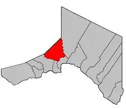 Location within Madawaska County. Map is missing northeastern portion of Parish. | |
| Coordinates: 47.43°N 68.385°W | |
| Country | |
| Province | |
| County | Madawaska |
| Erected | 1877 |
| Area | |
| • Land | 299.49 km2 (115.63 sq mi) |
| Population (2016)[1] | |
| • Total | 1,596 |
| • Density | 5.3/km2 (14/sq mi) |
| • Change 2006-2011 | |
| • Dwellings | 748 |
| Time zone | UTC-4 (AST) |
| • Summer (DST) | UTC-3 (ADT) |
The parish consists of two discontiguous portions separated by Saint-Joseph Parish. For governance purposes the southwestern portion is divided between the city of Edmundston[3] and the local service district of the parish of Saint-Jacques;[4] the northeastern portion is part of the LSD. Both city and LSD are members of the Northwest Regional Service Commission (NWRSC).[5]
Origin of name
The parish is named for the local Roman Catholic church.[6]
History
Saint-Jacques was erected in 1877 from Madawaska Parish;[7] the name was spelt without a hyphen.
In 1930 part of Saint-Jacques was included in the newly erected Saint-Joseph Parish.[8]
In 1941 the boundary was altered.[9]
In 1946 Saint-Jacques was affected by the major reorganisation of Madawaska County parish boundaries.[10]
In 1973 the hyphen was added to the parish's legal name.[11]
Delineation
Saint-Jacques Parish is defined in the Territorial Division Act[2] as being bounded:
- Beginning on the west side of the Madawaska River at the southeastern angle of lot No. 16 granted to Charles Hughes thence in a westerly direction along the southern limit of said lot No. 16 to the west limit of lots fronting on the west side of the Madawaska River thence in a southerly direction along the said west limit to the north limit of lots in the Second Tier north of the St. John River thence westerly along said northern limit to a point where it is intersected by the northeast limit of Tier Six Riceville [Settlement] thence in a northwesterly direction along said limit of said Tier Six to the northeast angle of lot No. 51 in said Tier Six thence southwesterly along the northern limit of said lot No. 51 to the southwest angle of lot No. 58 thence northwesterly along the southwest limit of said lot No. 58 to the eastern limit of Tier Three of Rang-des-Morneault[lower-alpha 1] thence northerly along said limit to the northeast angle of lot No. 17 in Tier Three granted to Jos. P. Nadeau thence westerly along the north limit of said limit No. 17 to the western limit of Tier Three thence northerly along said limit to the New Brunswick-Quebec boundary line thence in an easterly direction along said boundary line to the east limit of lots in Sweeney Settlement thence in a southerly direction and following the various courses of the east limit of Sweeney Settlement to the southeast angle of lot No. 2 in Sweeney Settlement, the front part of which is granted to Marcel Grandmaison thence northwesterly along the southwest limit of said lot No. 2 to the southwest angle of said lot No. 2 thence southerly along the east limit of Tier Three east of the Madawaska River to the northeast angle of lot No. 213 in Tier Three granted to Peter Plourde thence westerly along the northern limit of said lot No. 213 to the east limit of Tier Two thence southerly following the various courses of the east limit of Tier Two to the northeast angle of lot No. 214 in Tier Two granted to P. Couturier thence westerly along the northern limit of said lot No. 214 to the east limit of lots fronting on the east side of the Madawaska River thence southerly along said limit to the southeastern angle of lot No. 16 granted to Cyprien Michaud thence westerly along the southern limit of said lot No. 16 and its prolongation to the western shore of the Madawaska River thence following said shore in a northerly direction upstream to the place of beginning.
- Also:- Including all that portion of the County of Madawaska lying between the Green River and the Lake Branch of Green River.[lower-alpha 2]
Communities
Parish population total does not include incorporated municipalities (in bold) and communities within their respective boundaries (in italics).
|
|
Demographics
Population
| Canada census – Saint-Jacques Parish, New Brunswick community profile | |||
|---|---|---|---|
| 2016 | 2011 | 2006 | |
| Population: | 1,596 (-0.2% from 2011) | 1,599 (-0.5% from 2006) | 1,607 (-6.3% from 2001) |
| Land area: | 299.49 km2 (115.63 sq mi) | 299.80 km2 (115.75 sq mi) | 298.82 km2 (115.38 sq mi) |
| Population density: | 5.3/km2 (14/sq mi) | 5.4/km2 (14/sq mi) | |
| Median age: | 51.2 (M: 52.0, F: 50.2) | 46.5 (M: 47.3, F: 45.7) | 43.8 (M: 44.1, F: 43.4) |
| Total private dwellings: | 748 | 710 | 750 |
| Median household income: | $57,003 | $65,389 | $46,347 |
| References: 2016[14] 2011[15] 2006[16] earlier[17] | |||
|
|
| |||||||||||||||||||||||||||
| [18][1] | |||||||||||||||||||||||||||||
Language
| Canada Census Mother Tongue - Saint-Jacques Parish, New Brunswick[18][1] | ||||||||||||||||||
|---|---|---|---|---|---|---|---|---|---|---|---|---|---|---|---|---|---|---|
| Census | Total | French |
English |
French & English |
Other | |||||||||||||
| Year | Responses | Count | Trend | Pop % | Count | Trend | Pop % | Count | Trend | Pop % | Count | Trend | Pop % | |||||
2016 |
1,600 |
1,525 | 95.3% | 60 | 3.8% | 5 | 0.3% | 10 | 0.6% | |||||||||
2011 |
1,600 |
1,535 | 95.94% | 50 | 3.12% | 10 | 0.62% | 5 | 0.31% | |||||||||
2006 |
1,605 |
1,530 | 95.33% | 40 | 2.49% | 35 | 2.18% | 0 | 0.00% | |||||||||
2001 |
1,720 |
1,650 | 95.93% | 50 | 2.91% | 10 | 0.58% | 10 | 0.58% | |||||||||
1996 |
1,715 |
1,660 | n/a | 96.79% | 25 | n/a | 1.46% | 30 | n/a | 1.75% | 0 | n/a | 0.00% | |||||
See also
References
- "Census Profile, 2016 Census: Saint-Jacques, Parish [Census subdivision], New Brunswick". Statistics Canada. Retrieved September 23, 2019.
- "Chapter T-3 Territorial Division Act". Government of New Brunswick. Retrieved 13 November 2020.
- "New Brunswick Regulation 85-6 under the Municipalities Act (O.C. 85-45)". Government of New Brunswick. Retrieved 19 July 2020.
- "New Brunswick Regulation 84-168 under the Municipalities Act (O.C. 84-582)". Government of New Brunswick. Retrieved 19 July 2020.
- "Communities in each of the 12 Regional Service Commissions (RSC) / Les communautés dans chacune des 12 Commissions de services régionaux (CSR)" (PDF), Government of New Brunswick, July 2017, retrieved 2 February 2021
- Ganong, William F. (1896). A Monograph of the Place-Nomenclature of the Province of New Brunswick. Royal Society of Canada. p. 268.
- "41 Vic. c. 30 An Act to erect parts of the Parishes of Saint Leonard, Saint Basil, Madawaska, and Saint Francis, in the County of Madawaska, into three additional Parishes.". Acts of the General Assembly of Her Majesty's Province of New Brunswick. Passed in the Month of March 1877. Fredericton: Government of New Brunswick. 1877. pp. 125–128.
- "19 Geo. V c. 16 An Act to amend Chapter 2 of the Revised Statutes, 1927, Respecting the Division of the Province into Counties, Towns and Parishes, so far as relates to the Parishes of Saint Jacques and Madawaska, in the County of Madawaska.". Acts of the Legislative Assembly of New Brunswick Passed During the Session of 1929. Fredericton: Government of New Brunswick. 1929. pp. 38–41.
- "5 Geo. VI c. 55 An Act to amend Chapter 2 of The Revised Statutes, 1927, respecting the Division of the Province into Counties, Towns and Parishes, so far as it relates to the Parishes of St. Jacques and Baker Brook in the County of Madawaska.". Acts of the Legislative Assembly of New Brunswick Passed During the Session of 1941. Fredericton: Government of New Brunswick. 1941. pp. 144–145.
- "10 Geo. VI. c. 95 An Act to amend Chapter 2 of the Revised Statutes, 1927, respecting the division of the Province into Counties, Towns and Parishes, in so far as it relates to the County of Madawaska.". Acts of the Legislative Assembly of New Brunswick Passed During the Session of 1946. Fredericton: Government of New Brunswick. 1946. pp. 321–339.
- "Chapter T-3 Territorial Division Act". Revised Statutes of New Brunswick 1973 Volume IV. Fredericton: Government of New Brunswick. 1973. pp. 1–70. The original printed version is cited separately to distinguish it from the edited version available online.
- "Crown Grant Reference Map Viewer". GeoNB. Government of New Brunswick. Retrieved 26 August 2016.
- "Lake Branch". Canadian Geographical Names. Natural Resources Canada. Retrieved 26 August 2016.
- "2016 Community Profiles". 2016 Canadian Census. Statistics Canada. February 21, 2017. Retrieved 2019-09-23.
- "2011 Community Profiles". 2011 Canadian Census. Statistics Canada. July 5, 2013. Retrieved 2014-03-22.
- "2006 Community Profiles". 2006 Canadian Census. Statistics Canada. March 30, 2011. Retrieved 2014-03-22.
- "2001 Community Profiles". 2001 Canadian Census. Statistics Canada. February 17, 2012.
- Statistics Canada: 1996, 2001, 2006, 2011 census
Places adjacent to Saint-Jacques Parish, New Brunswick | |
|---|---|
| Subdivisions | |
|---|---|
| Cities | |
| Counties | |
| |
