Saint-Hilaire Parish, New Brunswick
Saint-Hilaire is a civil parish in Madawaska County, New Brunswick, Canada.[2]
Saint-Hilaire
St. Hilaire | |
|---|---|
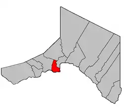 Location within Madawaska County. | |
| Coordinates: 47.3125°N 68.44°W | |
| Country | |
| Province | |
| County | Madawaska |
| Erected | 1877 |
| Area | |
| • Land | 41.90 km2 (16.18 sq mi) |
| Population (2016)[1] | |
| • Total | 478 |
| • Density | 11.4/km2 (30/sq mi) |
| • Pop 2011-2016 | |
| • Dwellings | 196 |
| Time zone | UTC-4 (AST) |
| • Summer (DST) | UTC-3 (ADT) |
For governance purposes it is part of the incorporated rural community of Haut-Madawaska,[3] which is a member of the Northwest Regional Service Commission (NWRSC).[4]
Origin of name
The parish takes its name from the local Roman Catholic church.[5]
History
Saint-Hilaire was erected as Saint Hilaire in 1877 from Madawaska and Saint-François Parishes.[6]
In 1930 Baker Brook Parish was erected from the western part of Saint-Hilaire.[7]
In 1946 Saint-Hilaire was affected by the major reorganisation of Madawaska County parish boundaries.[8]
In 1973 the hyphen was finally added to the legal name.[9]
Delineation
Saint-Hilaire Parish is defined in the Territorial Division Act[2] as being bounded:
- Beginning at a point in the International Boundary where it is intersected by the southeast prolongation of the southwest limit of lot No. 25 fronting on the St. John River granted to Alexander Ouellet, Jr., thence northwesterly along the said prolongation and said limit of said lot No. 25 to the rear line of lots fronting on the St. John River thence northeasterly along the northern limit of lots fronting on the St. John River to the southwest angle of lot No. 118 in Tier Two north of the St. John River granted to Vital Ouellet thence northerly along the western limit of said lot No. 118 to the north limit of lots in Tier Two north of the St. John River thence easterly along the said limit to a point where it is intersected by the northeast limit of Tier Six in Riceville [Settlement] thence northwesterly along said limit of Tier Six to the southeast angle of lot No. 19 granted to Onesime Gagnon thence southwesterly along the southeast limit of said lot No. 19 in Tier Six, lot No. 18, in Tier Five, lot No. 95 in Tier Four and lot No. 96 in Tier Three to the southwest limit of said Tier Three thence southeasterly along said limit to the southeast angle of lot No. 113 in Tier Two thence southwesterly along the southeast limit of said lot No. 113 to the north limit of lots fronting on the St. John River thence southeasterly along said limit to the northeast angle of lot No. 61 granted to Firmin M. Dechene thence southwesterly along the southeast limit of said lot No. 61 and its southern prolongation to the International Boundary thence in an easterly direction along said International Boundary to the place of beginning.
Communities
Parish population total does not include incorporated municipalities (in bold) and communities within their respective boundaries (in italics).
- Riceville
- Saint-Hilaire
- Albertine
Bodies of water
Bodies of water at least partly in the parish
- Saint John River
Demographics
Population
| Canada census – Saint-Hilaire Parish, New Brunswick community profile | |||
|---|---|---|---|
| 2016 | 2011 | 2006 | |
| Population: | 478 (-2.4% from 2011) | 490 (-7.7% from 2006) | 531 (+0.6% from 2001) |
| Land area: | 41.90 km2 (16.18 sq mi) | 41.55 km2 (16.04 sq mi) | 41.55 km2 (16.04 sq mi) |
| Population density: | 11.4/km2 (30/sq mi) | 11.8/km2 (31/sq mi) | 12.8/km2 (33/sq mi) |
| Median age: | 45.15 (M: 44.7, F: 45.5) | 45.5 (M: 43.0, F: 46.7) | 41.2 (M: 41.2, F: 41.2) |
| Total private dwellings: | 196 | 196 | 206 |
| Median household income: | $75,008 | $53,778 | |
| References: 2016[10] 2011[11] 2006[12] earlier[13] | |||
|
|
| |||||||||||||||||||||||||||
| [14][15][1] | |||||||||||||||||||||||||||||
Language
| Canada Census Mother Tongue - Saint-Hilaire Parish, New Brunswick 2011 language data for this area has been suppressed for data quality or confidentiality reasons.[14] | ||||||||||||||||||
|---|---|---|---|---|---|---|---|---|---|---|---|---|---|---|---|---|---|---|
| Census | Total | French |
English |
French & English |
Other | |||||||||||||
| Year | Responses | Count | Trend | Pop % | Count | Trend | Pop % | Count | Trend | Pop % | Count | Trend | Pop % | |||||
2011 |
n/a |
n/a | 0.00% | n/a | 0.00% | n/a | 0.00% | n/a | 0.00% | |||||||||
2006 |
525 |
525 | 100.00% | 0 | 0.00% | 0 | 0.00% | 0 | 0.00% | |||||||||
2001 |
525 |
485 | 92.38% | 30 | 5.71% | 0 | 0.00% | 10 | 1.90% | |||||||||
1996 |
585 |
540 | n/a | 92.31% | 35 | n/a | 5.98% | 10 | n/a | 1.71% | 0 | n/a | 0.00% | |||||
See also
References
- "Census Profile, 2016 Census Saint-Hilaire, Parish [Census subdivision], New Brunswick". Statistics Canada. Retrieved August 29, 2019.
- "Chapter T-3 Territorial Division Act". Government of New Brunswick. Retrieved 13 November 2020.
- "New Brunswick Regulation 2017-3 under the Municipalities Act (O.C. 2017-52)". Government of New Brunswick. Retrieved 19 July 2020.
- "Communities in each of the 12 Regional Service Commissions (RSC) / Les communautés dans chacune des 12 Commissions de services régionaux (CSR)" (PDF), Government of New Brunswick, July 2017, retrieved 2 February 2021
- Ganong, William F. (1896). A Monograph of the Place-Nomenclature of the Province of New Brunswick. Royal Society of Canada. p. 268.
- "41 Vic. c. 30 An Act to erect parts of the Parishes of Saint Leonard, Saint Basil, Madawaska, and Saint Francis, in the County of Madawaska, into three additional Parishes.". Acts of the General Assembly of Her Majesty's Province of New Brunswick. Passed in the Month of March 1877. Fredericton: Government of New Brunswick. 1877. pp. 125–128.
- "19 Geo. V c. 17 An Act to amend Chapter 2 of the Revised Statutes, 1927, respecting the division of the Province into Counties, Towns and Parishes, so far as relates to the Parish of Saint Hilaire in the County of Madawaska.". Acts of the Legislative Assembly of New Brunswick Passed During the Session of 1929. Fredericton: Government of New Brunswick. 1929. pp. 42–46.
- "10 Geo. VI. c. 95 An Act to amend Chapter 2 of the Revised Statutes, 1927, respecting the division of the Province into Counties, Towns and Parishes, in so far as it relates to the County of Madawaska.". Acts of the Legislative Assembly of New Brunswick Passed During the Session of 1946. Fredericton: Government of New Brunswick. 1946. pp. 321–339.
- "Chapter T-3 Territorial Division Act". Revised Statutes of New Brunswick 1973 Volume IV. Fredericton: Government of New Brunswick. 1973. pp. 1–70. The original printed version is cited separately to distinguish it from the updated version available online.
- "2016 Community Profiles". 2016 Canadian Census. Statistics Canada. February 21, 2017. Retrieved 2019-08-29.
- "2011 Community Profiles". 2011 Canadian Census. Statistics Canada. July 5, 2013. Retrieved 2014-03-22.
- "2006 Community Profiles". 2006 Canadian Census. Statistics Canada. March 30, 2011. Retrieved 2014-03-22.
- "2001 Community Profiles". 2001 Canadian Census. Statistics Canada. February 17, 2012.
- Statistics Canada: 1996, 2001, 2006, 2011 census
- "Corrections and updates: Population and dwelling count amendments, 2011 Census". Statistics Canada. February 14, 2013. Retrieved February 15, 2013.
Places adjacent to Saint-Hilaire Parish, New Brunswick | ||||||||||
|---|---|---|---|---|---|---|---|---|---|---|
| ||||||||||
| Subdivisions | |
|---|---|
| Cities | |
| Counties | |
| |