Saint-Orens-de-Gameville
Saint-Orens-de-Gameville (also referred to as Saint-Orens) is a commune in the Haute-Garonne department in the Occitanie region in southwestern France.
Saint-Orens-de-Gameville | |
|---|---|
 Town hall | |
.svg.png.webp) Coat of arms | |
Location of Saint-Orens-de-Gameville 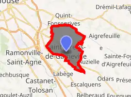
| |
 Saint-Orens-de-Gameville  Saint-Orens-de-Gameville | |
| Coordinates: 43°33′06″N 1°32′02″E | |
| Country | France |
| Region | Occitanie |
| Department | Haute-Garonne |
| Arrondissement | Toulouse |
| Canton | Castanet-Tolosan |
| Intercommunality | Toulouse Métropole |
| Government | |
| • Mayor (2020–2026) | Dominique Faure |
| Area 1 | 13.06 km2 (5.04 sq mi) |
| Population (2017-01-01)[1] | 11,830 |
| • Density | 910/km2 (2,300/sq mi) |
| Time zone | UTC+01:00 (CET) |
| • Summer (DST) | UTC+02:00 (CEST) |
| INSEE/Postal code | 31506 /31650 |
| Elevation | 144–219 m (472–719 ft) (avg. 190 m or 620 ft) |
| 1 French Land Register data, which excludes lakes, ponds, glaciers > 1 km2 (0.386 sq mi or 247 acres) and river estuaries. | |
Population
|
|
Its inhabitants are called Saint-Orennais.
References
- "Populations légales 2017". INSEE. Retrieved 6 January 2020.
| Wikimedia Commons has media related to Saint-Orens-de-Gameville. |
| Authority control |
|
|---|
This article is issued from Wikipedia. The text is licensed under Creative Commons - Attribution - Sharealike. Additional terms may apply for the media files.