Saint-Félix-Lauragais
Saint-Félix-Lauragais (Languedocien: Sant Felitz de Lauragués) is a commune in the Haute-Garonne department in southwestern France.
Saint-Félix-Lauragais | |
|---|---|
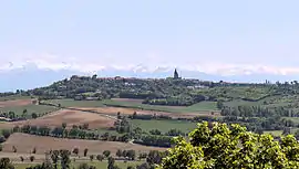 A general view of Saint-Félix-Lauragais | |
 Coat of arms | |
Location of Saint-Félix-Lauragais 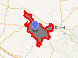
| |
 Saint-Félix-Lauragais  Saint-Félix-Lauragais | |
| Coordinates: 43°26′59″N 1°53′18″E | |
| Country | France |
| Region | Occitanie |
| Department | Haute-Garonne |
| Arrondissement | Toulouse |
| Canton | Revel |
| Intercommunality | Lauragais-Revel-Sorezois |
| Government | |
| • Mayor (2008–2014) | André Rey |
| Area 1 | 51.88 km2 (20.03 sq mi) |
| Population (2017-01-01)[1] | 1,271 |
| • Density | 24/km2 (63/sq mi) |
| Time zone | UTC+01:00 (CET) |
| • Summer (DST) | UTC+02:00 (CEST) |
| INSEE/Postal code | 31478 /31540 |
| Elevation | 178–341 m (584–1,119 ft) (avg. 321 m or 1,053 ft) |
| 1 French Land Register data, which excludes lakes, ponds, glaciers > 1 km2 (0.386 sq mi or 247 acres) and river estuaries. | |
History
The village was previously called Saint-Félix-de-Caraman or Carmaing. In 1167 the Cathars held a Council here, attended by many local figures and also by the Bogomil papa Nicetas, the Cathar bishop of (northern) France and a leader of the Cathars of Lombardy.
Population
| Year | Pop. | ±% |
|---|---|---|
| 1962 | 1,035 | — |
| 1968 | 1,192 | +15.2% |
| 1975 | 1,110 | −6.9% |
| 1982 | 1,188 | +7.0% |
| 1990 | 1,177 | −0.9% |
| 1999 | 1,301 | +10.5% |
| 2008 | 1,362 | +4.7% |
Sights
The Château de Saint-Félix-Lauragais is a 12th-century castle which is listed as a historical site by the French Ministry of Culture. [2]
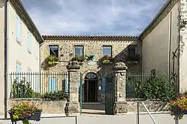 City Hall
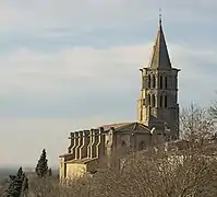 The church St.Felix
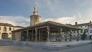 The covered market
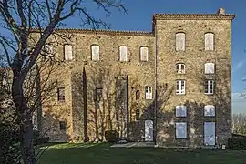 The castle
References
- "Populations légales 2017". INSEE. Retrieved 6 January 2020.
- Base Mérimée: Château, Ministère français de la Culture. (in French)
External links
| Wikimedia Commons has media related to Saint-Félix-Lauragais. |
- Saint-Félix-Lauragais at revel-lauragais.com (in French)
| Authority control |
|---|
This article is issued from Wikipedia. The text is licensed under Creative Commons - Attribution - Sharealike. Additional terms may apply for the media files.