Saint James Parish, New Brunswick
Saint James is a civil parish in Charlotte County, New Brunswick, Canada,[2] located north of St. Stephen. It includes two local service districts (LSDs), Western Charlotte and the parish of Saint James, both of which are members of the Southwest New Brunswick Service Commission (SNBSC).[3]
Saint James
St. James | |
|---|---|
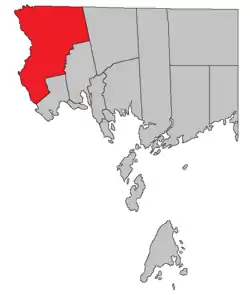 Location within Charlotte County. | |
| Country | |
| Province | |
| County | Charlotte County |
| Erected | 1823 |
| Area | |
| • Land | 556.62 km2 (214.91 sq mi) |
| Population (2016)[1] | |
| • Total | 1,186 |
| • Density | 2.1/km2 (5/sq mi) |
| • Pop 2011-2016 | |
| • Dwellings | 570 |
| Time zone | UTC-4 (AST) |
| • Summer (DST) | UTC-3 (ADT) |
The Census subdivision of the same name shares the parish's borders.[1]
Origin of name
Ganong believed the name suggested by other Saint names in the area.[4] Five of the original six mainland parishes of Charlotte County used names of major saints recognised by the Church of England: Andrew (Scotland), David (Wales), George (England), Patrick (Ireland), and Stephen, and Saint James was the first new mainland parish to be erected in the county.
History
Saint James was erected in 1823 from the northern part of Saint Stephen Parish and unassigned lands of the county to its north.[5]
Delineation
Saint James Parish is defined in the Territorial Division Act[2] as being bounded:
- South by Saint Stephen Parish and Saint David Parish; east by the northerly prolongation of the east line of Saint David Parish; north by the County line; and west by the St. Croix River.
Communities
Parish population total does not include incorporated municipalities (in bold).
|
|
|
Bodies of water and Islands
This is a list of rivers, lakes, streams, creeks, marshes and Islands that are at least partially in this parish
- Canoose Flowage
- Cranberry Lake
- Indian Pond
- King Brook Lake
- Moores Mills Lake
- Potters Lake
Demographics
Population
| Canada census – Saint James Parish, New Brunswick community profile | |||
|---|---|---|---|
| 2016 | 2011 | 2006 | |
| Population: | 1,186 (-4.4% from 2011) | 1,241 (-8.1% from 2006) | 1,350 (-5.6% from 2001) |
| Land area: | 556.62 km2 (214.91 sq mi) | 556.00 km2 (214.67 sq mi) | 555.99 km2 (214.67 sq mi) |
| Population density: | 2.1/km2 (5.4/sq mi) | 2.2/km2 (5.7/sq mi) | 2.4/km2 (6.2/sq mi) |
| Median age: | 47.7 (M: 47.8, F: 47.5) | 44.5 (M: 42.2, F: 46.5) | 41.7 (M: 41.2, F: 42.1) |
| Total private dwellings: | 570 | 590 | 612 |
| Median household income: | $45,184 | $51,753 | $36,461 |
| References: 2016[6] 2011[7] 2006[8] earlier[9] | |||
|
|
| |||||||||||||||||||||||||||
| [10][1] | |||||||||||||||||||||||||||||
Language
| Canada Census Mother Tongue - Saint James Parish, New Brunswick[10] | ||||||||||||||||||
|---|---|---|---|---|---|---|---|---|---|---|---|---|---|---|---|---|---|---|
| Census | Total | French |
English |
French & English |
Other | |||||||||||||
| Year | Responses | Count | Trend | Pop % | Count | Trend | Pop % | Count | Trend | Pop % | Count | Trend | Pop % | |||||
2011 |
1,235 |
1,200 | 97.17% | 25 | 2.02% | 0 | 0.00% | 10 | 0.81% | |||||||||
2006 |
1,340 |
1,325 | 98.88% | 15 | 1.12% | 0 | 0.00% | 0 | 0.00% | |||||||||
2001 |
1,395 |
1,380 | 98.92% | 15 | 1.08% | 0 | 0.00% | 0 | 0.00% | |||||||||
1996 |
1,390 |
1,380 | n/a | 99.28% | 10 | n/a | 0.72% | 0 | n/a | 0.00% | 0 | n/a | 0.00% | |||||
Access Routes
Highways and numbered routes that run through the parish, including external routes that start or finish at the parish limits:[11]
See also
References
- "Census Profile, 2016 Census: Saint James, Parish [Census subdivision], New Brunswick". Statistics Canada. Retrieved 7 September 2019.
- "Chapter T-3 Territorial Division Act". Government of New Brunswick. Retrieved 14 August 2020.
- "Communities in each of the 12 Regional Service Commissions (RSC) / Les communautés dans chacune des 12 Commissions de services régionaux (CSR)" (PDF), Government of New Brunswick, July 2017, retrieved 1 February 2021
- Ganong, William F. (1896). A Monograph of the Place-Nomenclature of the Province of New Brunswick. Royal Society of Canada. p. 268.
- "4 Geo. IV c. 11 An Act for erecting a part of the Parish of Saint Stephen and the Country adjacent, in the County of Charlotte, into a separate and distinct Town or Parish.". Acts of the General Assembly of His Majesty's Province of New-Brunswick, Passed in the Year 1823. Fredericton: Government of New Brunswick. 1823. pp. 14–16.
- "2016 Community Profiles". 2016 Canadian Census. Statistics Canada. 21 February 2017. Retrieved 7 September 2019.
- "2011 Community Profiles". 2011 Canadian Census. Statistics Canada. 5 July 2013. Retrieved 17 March 2014.
- "2006 Community Profiles". 2006 Canadian Census. Statistics Canada. 30 March 2011. Retrieved 17 March 2014.
- "2001 Community Profiles". 2001 Canadian Census. Statistics Canada. 17 February 2012.
- Statistics Canada: 1996, 2001, 2006, 2011 census
- Atlantic Canada Back Road Atlas ISBN 978-1-55368-618-7 Pages 4, 12
External links
Places adjacent to Saint James Parish, New Brunswick | |
|---|---|
| Subdivisions | |
|---|---|
| Cities | |
| Counties | |
| |