Dumbarton Parish, New Brunswick
Dumbarton is a civil parish in Charlotte County, New Brunswick, Canada,[2] located inland north of St. George and south of Harvey.
Dumbarton | |
|---|---|
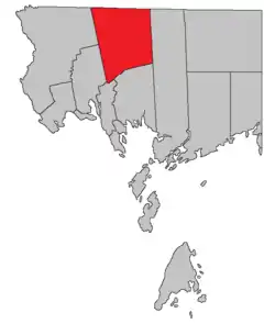 Location within Charlotte County. | |
| Country | |
| Province | |
| County | Charlotte County |
| Erected | 1856 |
| Area | |
| • Land | 374.43 km2 (144.57 sq mi) |
| Population (2016)[1] | |
| • Total | 335 |
| • Density | 0.9/km2 (2/sq mi) |
| • Change 2011-2016 | |
| • Dwellings | 195 |
| Time zone | UTC-4 (AST) |
| • Summer (DST) | UTC-3 (ADT) |
The local service district (LSD) and Census subdivision of the same name have the same boundaries as the parish.[3]
The LSD assesses for basic services,[lower-alpha 1] and is a member of the Southwest New Brunswick Service Commission (SNBSC).[5]
Origin of name
The parish may have been named for the town of Dumbarton, Scotland.,[6] although Ganong considered this uncertain.
History
Dumbarton was erected from northern Saint Patrick Parish in 1856.[7]
In 1881 the boundary with Saint Croix Parish was altered, transferring a small area to Saint Croix.[8]
Delineation
Dumbarton Parish is defined in the Territorial Division Act[2] as being bounded:
- West by Saint David Parish and Saint James Parish; north by the County line; east by the northern prolongation of the eastern boundary of Saint Patrick Parish; and south by Saint Patrick Parish;
Communities
Communities at least partly within the parish.[9]
|
|
|
Bodies of water
Bodies of water at least partly within the parish.[9]
|
|
Demographics
Population
| Canada census – Dumbarton Parish, New Brunswick community profile | |||
|---|---|---|---|
| 2016 | 2011 | 2006 | |
| Population: | 335 (-9.0% from 2011) | 368 (+3.4% from 2006) | 356 (-17.2% from 2001) |
| Land area: | 374.43 km2 (144.57 sq mi) | 375.08 km2 (144.82 sq mi) | 375.06 km2 (144.81 sq mi) |
| Population density: | 0.9/km2 (2.3/sq mi) | 1.0/km2 (2.6/sq mi) | 0.9/km2 (2.3/sq mi) |
| Median age: | 51.3 (M: 49.0, F: 52.1) | 48.4 (M: 47.8, F: 48.6) | 43.7 (M: 45.1, F: 43.5) |
| Total private dwellings: | 195 | 204 | 187 |
| Median household income: | $46,784 | $.N/A | $27,336 |
| Notes: 2011 income data for this area has been suppressed for data quality or confidentiality reasons. – References: 2016[10] 2011[11] 2006[12] earlier[13] | |||
|
|
| |||||||||||||||||||||||||||
| [14][1] | |||||||||||||||||||||||||||||
Language
| Canada Census Mother Tongue - Dumbarton Parish, New Brunswick[14] | ||||||||||||||||||
|---|---|---|---|---|---|---|---|---|---|---|---|---|---|---|---|---|---|---|
| Census | Total | English |
French |
English & French |
Other | |||||||||||||
| Year | Responses | Count | Trend | Pop % | Count | Trend | Pop % | Count | Trend | Pop % | Count | Trend | Pop % | |||||
2011 |
375 |
360 | 96.00% | 15 | 4.00% | 0 | 0.00% | 0 | 0.00% | |||||||||
2006 |
355 |
345 | 97.18% | 0 | 0.00% | 0 | 0.00% | 10 | 2.82% | |||||||||
2001 |
430 |
430 | 100.00% | 0 | 0.00% | 0 | 0.00% | 0 | 0.00% | |||||||||
1996 |
445 |
445 | n/a | 100.00% | 0 | n/a | 0.00% | 0 | n/a | 0.00% | 0 | n/a | 0.00% | |||||
Access Routes
Highways and numbered routes that run through the parish, including external routes that start or finish at the parish limits:[15]
See also
Notes
- Firefighting, policing, zoning, EMO, and dog control, along with administrative costs.[4]
References
- "Census Profile, 2016 Census Dumbarton, Parish [Census subdivision], New Brunswick". Statistics Canada. Retrieved 8 September 2019.
- "Chapter T-3 Territorial Division Act". Government of New Brunswick. Retrieved 1 August 2020.
- "New Brunswick Regulation 84-168 under the Municipalities Act (O.C. 84-582)". Government of New Brunswick. Retrieved 1 August 2020.
- "2019 Local Government Statistics for New Brunswick" (PDF). Department of Environment and Local Government. p. 59. Retrieved 2 August 2020.
- "Communities in each of the 12 Regional Service Commissions (RSC) / Les communautés dans chacune des 12 Commissions de services régionaux (CSR)" (PDF), Government of New Brunswick, July 2017, retrieved 1 February 2021
- Ganong, William F. (1896). A Monograph of the Place-Nomenclature of the Province of New Brunswick. Royal Society of Canada. p. 231.
- "19 Vic. c. 25 An Act to erect the upper part of the Parish of Saint Patrick, in the County of Charlotte, into a separate Town or Parish.". Acts of the General Assembly of Her Majesty's Province of New Brunswick, Passed in the Months of March, April, and May 1856. Fredericton: Government of New Brunswick. 1856. pp. 42–43.
- "44 Vic. c. 31 An Act to alter the Boundary Lines of the Parish of Saint Croix, in the County of Charlotte.". Acts of the General Assembly of Her Majesty's Province of New Brunswick. Passed in the Month of March 1881. Fredericton: Government of New Brunswick. 1881. pp. 66–67.
- "440" (PDF). Province of New Brunswick. Retrieved 2 August 2020."441" (PDF). Province of New Brunswick. Retrieved 2 August 2020."455" (PDF). Province of New Brunswick. Retrieved 2 August 2020."456" (PDF). Province of New Brunswick. Retrieved 2 August 2020."468" (PDF). Province of New Brunswick. Retrieved 2 August 2020."469" (PDF). Province of New Brunswick. Retrieved 2 August 2020."479" (PDF). Province of New Brunswick. Retrieved 2 August 2020.
- "2016 Community Profiles". 2016 Canadian Census. Statistics Canada. 21 February 2017. Retrieved 8 September 2019.
- "2011 Community Profiles". 2011 Canadian Census. Statistics Canada. 5 July 2013. Retrieved 15 March 2014.
- "2006 Community Profiles". 2006 Canadian Census. Statistics Canada. 30 March 2011. Retrieved 15 March 2014.
- "2001 Community Profiles". 2001 Canadian Census. Statistics Canada. 17 February 2012.
- Statistics Canada: 1996, 2001, 2006, 2011 census
- Atlantic Canada Back Road Atlas ISBN 978-1-55368-618-7 Pages 4, 12
Places adjacent to Dumbarton Parish, New Brunswick | |
|---|---|
| Subdivisions | |
|---|---|
| Cities | |
| Counties | |
| |