Saskatchewan Highway 56
Highway 56 is a highway in the Canadian province of Saskatchewan. It runs from Highway 1 near Indian Head to Highway 210 within the Echo Valley Provincial Park. Highway 56 is about 55 km (34 mi) long.[1]
| ||||
|---|---|---|---|---|
| Route information | ||||
| Length | 55.4 km[1] (34.4 mi) | |||
| Major junctions | ||||
| South end | ||||
| North end | ||||
| Location | ||||
| Rural municipalities | Indian Head, Abernethy, North Qu'Appelle | |||
| Highway system | ||||
Provincial highways in Saskatchewan
| ||||
.svg.png.webp)
Highway 56 passes near the Fishing Lakes, and so has access to many recreational areas.
Major intersections
From south to north:[2]
| Rural municipality | Location | km[1] | mi | Destinations | Notes |
|---|---|---|---|---|---|
| Indian Head No. 156 | Indian Head | 0.0 | 0.0 | Southern terminus | |
| ↑ / ↓ | | 24.2 | 15.0 | Crosses the Qu'Appelle River | |
| Abernethy No. 186 | Katepwa Beach | 26.9 | 16.7 | ||
| North Qu'Appelle No. 187 | Fort Qu'Appelle | 44.2 | 27.5 | ||
| Fort San | 49.0 | 30.4 | |||
| | 54.3 | 33.7 | |||
| Echo Valley Provincial Park | 54.8 | 34.1 | Crosses the Qu'Appelle River | ||
| 55.4 | 34.4 | Northern terminus | |||
| 1.000 mi = 1.609 km; 1.000 km = 0.621 mi | |||||
Photo gallery
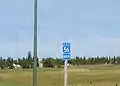 Highway 56
 Indian Head next 2 exits. Katepwa Point Provincial park Hwy 56 North Between Qu'Appelle and Regina.
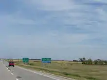 Shelter Belt Center Hwy 56 junction on Hwy 1 (Trans-Canada Hwy).
References
| Wikimedia Commons has media related to Saskatchewan Highway 56. |
- Google (February 12, 2018). "Highway 56 in Saskatchewan" (Map). Google Maps. Google. Retrieved February 12, 2018.
- MapArt (2007). Saskatchewan Road Atlas (Map) (2007 ed.). 1:540,000. Oshawa, ON: Peter Heiler Ltd. pp. 42–43. ISBN 1-55368-020-0.
This article is issued from Wikipedia. The text is licensed under Creative Commons - Attribution - Sharealike. Additional terms may apply for the media files.
