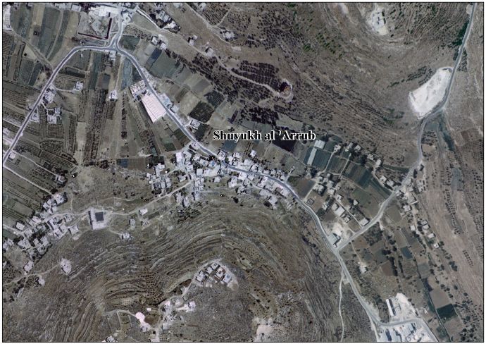
Shuyukh al-Arrub
Shuyukh al-Arrub (Arabic: شيوخ العروب) is a Palestinian village located eleven kilometers north-east of Hebron. The village is in the Hebron Governorate Southern West Bank. According to the Palestinian Central Bureau of Statistics, the village had a population of 1,550 inhabitants in 2007.[2] The primary health care facilities for the village are designated by the Ministry of Health as level 2.[3]
Shuyukh al-Arrub | |
|---|---|
| Arabic transcription(s) | |
| • Arabic | شيوخ العروب |
 Shuyukh al-Arrub Location of Shuyukh al-Arrub within Palestine | |
| Coordinates: 31°36′57″N 35°08′51″E | |
| Palestine grid | 163/113 |
| State | State of Palestine |
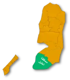
| Governorate | Hebron |
| Government | |
| • Type | Village council |
| Population (2007) | |
| • Total | 1,550 |
| Name meaning | Birket el Arrub, the well of Arrub[1] |
Location
Shuyukh al-Arrub is located 11 km north of Hebron City. It is bordered by Kuziba and Irqan Turad to the east, Beit Fajjar to the north, Halhul and Sa'ir to the south and Al 'Arrub Camp to the west.[4]
History
In 892 AH (1487 CE), Qansuh Al Yahyawi, a Mamluk, renewed the water supply from Ain al-Arrub.[5]
In the 1850s, people from Ash Shuyukh settled the area.[6]
In 1883, the PEF's Survey of Western Palestine (SWP) described Birket el 'Arrub as: "one of the main reservoirs supplying the aqueduct to Jerusalem. There are two channels, one from Birket Kufin, one from 'Ain Kueiziba, which join [here]."[7]
Modern era
In the wake of the 1948 Arab–Israeli War, and after the 1949 Armistice Agreements, Shuyukh al-Arrub came under Jordanian rule.
The Jordanian census of 1961 found 242 inhabitants in Shuyukh Arrub.[8]
Since the 1967 Six Day War, Shuyukh al-Arrub has been under Israeli occupation.
References
- Arrub, from personal name meaning a woman who loves her husband, according to Palmer, 1881, p. 392
- 2007 PCBS Census Palestinian Central Bureau of Statistics. p.118.
- West Bank Health care at the Library of Congress Web Archives (archived 2006-03-13)
- Shuyukh Al 'Arrub village profile, ARIJ, p. 3
- Mayer, 1933, p. 180
- Shuyukh Al 'Arrub village profile, ARIJ, p. 4
- Conder and Kitchener, 1883, SWP II, pp. 325-6
- Government of Jordan, Department of Statistics, 1964, p. 23
Bibliography
- Conder, C.R.; Kitchener, H. H. (1883). The Survey of Western Palestine: Memoirs of the Topography, Orography, Hydrography, and Archaeology. 3. London: Committee of the Palestine Exploration Fund.
- Government of Jordan, Department of Statistics (1964). First Census of Population and Housing. Volume I: Final Tables; General Characteristics of the Population (PDF).
- Mayer, L.A. (1933). Saracenic Heraldry: A Survey. Oxford: Oxford University Press.
- Palmer, E.H. (1881). The Survey of Western Palestine: Arabic and English Name Lists Collected During the Survey by Lieutenants Conder and Kitchener, R. E. Transliterated and Explained by E.H. Palmer. Committee of the Palestine Exploration Fund.
External links
- Survey of Western Palestine, Map 21: IAA, Wikimedia commons
- Shuyukh Al 'Arrub village (fact sheet), Applied Research Institute–Jerusalem (ARIJ)
- Shuyukh Al 'Arrub village profile, ARIJ
- Shuyukh Al 'Arrub village aerial photo, ARIJ
- The priorities and needs for development in Shuyukh al 'Arrub based on the community and local authorities' assessment, ARIJ
| Cities |
|  |
|---|---|---|
| Towns |
| |
| Villages |
| |
| Refugee camps | ||