Idhna
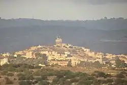
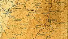
Idhna (Arabic: إذنا) is a Palestinian town in the southern West Bank, located in the Hebron Governorate, 13 kilometers west of Hebron and about one kilometer east of the Green Line. According to the Palestinian Central Bureau of Statistics, the town had a population of approximately 19,012 inhabitants in 2007.[2]
Idhna | |
|---|---|
| Arabic transcription(s) | |
| • Arabic | إذنا |
| • Latin | Idna (official) |
 Idhna | |
 | |
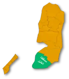
 Idhna Location of Idhna within Palestine | |
| Coordinates: 31°33′31″N 34°58′34″E | |
| Palestine grid | 147/107 |
| State | State of Palestine |
| Governorate | Hebron |
| Government | |
| • Type | Municipality |
| Area | |
| • Total | 21,526 dunams (25.5 km2 or 9.8 sq mi) |
| Population (2007) | |
| • Total | 19,012 |
| • Density | 750/km2 (1,900/sq mi) |
| Name meaning | "Lower"[1] |
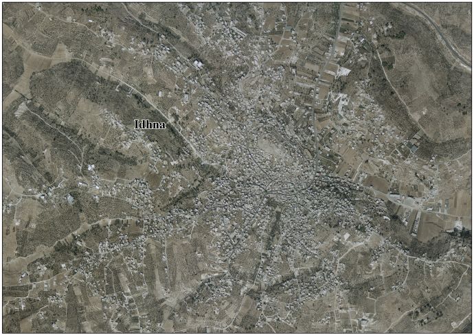
Idhna is physically divided into southern and northern parts by the Wadi al-Feranj.[3] Idhna's primary source of income is agriculture and the town's total land area is 21,526 dunams (215 km²), of which 2,809 dunams (28 km²) are built up area.[4] Idhna is governed by a municipal council of thirteen members and six departments.[5]
History
Idhna's site was inhabited since Canaanite times (the Bronze Age), evident from ancient remains found in the town. The town is identified with the biblical city of Dannah, mentioned in Joshua 15:49.[6] Hebrews, Byzantines and Arabs succeeded in gaining control of the town and coins, statues, tombs and pottery dating from these various rulers were found in the town.[7]
Ottoman era
Idhna was incorporated into the Ottoman Empire in 1517 with all of Palestine, and in 1596 it appeared in the tax registers as being in the nahiya of Halil in the liwa of Quds. It had a population of 68 households, all Muslim. They paid a fixed tax rate of 33,3% on agricultural products, including wheat, barley, olives, vineyards, fruit trees, goats and/or beehives; a total of 19,000 akçe. All of the revenue went to a waqf.[8]
Edward Robinson, who visited Idhna in 1838, recorded that the town's two parts were led by a sheikh and the inhabitants of each part followed and backed their respective sheikh in internal quarrels. Adjacent to Idhna are the ruins of the original village which is totally covered by cultivable fields. Marble tesserae (mosaic stones) were found on the site.[3][9] Idhna was further noted as a Muslim village located between the mountains and the plain of Gaza, but subject to the government of el-Khuhlil.[10]
Victor Guérin visited Idna in June 1863 and described a village with almost 500 inhabitants, divided into two districts, each ruled by a sheikh. Many houses, especially a small Bordj, had substructures of stone, which, to all appearances, were dating back to antiquity.[11]
An Ottoman village list of about 1870 showed that Idna had 22 houses and a population of 108, though the population count included only men.[12][13]
In 1883 the PEF's Survey of Western Palestine (SWP) described Idhna as "a small village on the south slope of a hill [ ] divided by a small depression into two."[14] SWP further found that near the town were several large caves with niches for lamps or skulls.[15]
British Mandate era
In the 1922 census of Palestine, conducted by the British Mandate authorities, Idna had a population of 1,300, all Muslim,[16] increasing in the 1931 census to 1,719, still all Muslim, in 317 houses.[17]
In the 1945 statistics the population of Idna was 2,190, all Muslims,[18] who owned 34,002 dunams of land according to an official land and population survey.[19] 528 dunams were plantations and irrigable land, 14,481 for cereals,[20] while 153 dunams were built-up (urban) land.[21]
Jordanian era
In the wake of the 1948 Arab–Israeli War, and after the 1949 Armistice Agreements, Idna came under Jordanian rule.
The Jordanian census of 1961 found 3,568 inhabitants in Idna.[22]
1967, aftermath
Since the Six-Day War in 1967, Idhna has been under Israeli occupation. The population in the 1967 census conducted by the Israeli authorities was 3,713.[23]
On 25 April 2015 Mahmoud Abu Jheisha, 20 years old, from Idhna was shot dead in Hebron after he had been accused of stabbing an Israeli soldier.[24][25]
References
- Palmer, 1881, p. 394
- 2007 PCBS Census Archived 2010-12-10 at the Wayback Machine Palestinian Central Bureau of Statistics. p.118.
- Robinson and Smith, 1856, pp. 69-70
- Demolitions, threats of demolitions and evictions in Idhna town - Hebron Governorate Archived 2007-05-28 at the Wayback Machine Land Research Center. 24 February 2007
- Municipality of Idna Archived 2016-03-04 at the Wayback Machine Idna Municipality.
- Bromiley, 1979, pp. 319, 866
- History of Idna Idna Municipality.
- Hütteroth and Abdulfattah, 1977, p. 124.
- Robinson and Smith, 1841, vol 2, p. 425
- Robinson and Smith, 1841, vol 3, Appendix 2, p. 117
- Guérin, 1869, pp. 364-5
- Socin, 1879, p. 155
- Hartmann, 1883, p. 142, noted 60 houses
- Conder and Kitchener, 1883, SWP III, p. 305
- Conder and Kitchener, 1883, SWP III, p. 330
- Barron, 1923, Table V, Sub-district of Hebron, p. 10
- Mills, 1932, p. 32.
- Government of Palestine, Department of Statistics, 1945, p. 23
- Government of Palestine, Department of Statistics. Village Statistics, April, 1945. Quoted in Hadawi, 1970, p. 50
- Government of Palestine, Department of Statistics. Village Statistics, April, 1945. Quoted in Hadawi, 1970, p. 93
- Government of Palestine, Department of Statistics. Village Statistics, April, 1945. Quoted in Hadawi, 1970, p. 143
- Government of Jordan, Department of Statistics, 1964, p. 13
- Perlmann, Joel (November 2011 – February 2012). "The 1967 Census of the West Bank and Gaza Strip: A Digitized Version" (PDF). Levy Economics Institute. Retrieved 24 June 2016.
- Ma'an 25/4/2015
- "Use of Live Ammunition against Palestinians". Al-Haq | Defending Human rights in Palestine since 1979. Retrieved 2020-02-21.
Bibliography
- Barron, J.B., ed. (1923). Palestine: Report and General Abstracts of the Census of 1922. Government of Palestine.
- Bromiley, G.W. (1979). The International Standard Bible Encyclopedia: E-J. Wm. B. Eerdmans Publishing. ISBN 0-8028-3781-6.
- Conder, C.R.; Kitchener, H.H. (1883). The Survey of Western Palestine: Memoirs of the Topography, Orography, Hydrography, and Archaeology. 3. London: Committee of the Palestine Exploration Fund.
- Government of Jordan, Department of Statistics (1964). First Census of Population and Housing. Volume I: Final Tables; General Characteristics of the Population (PDF).
- Government of Palestine, Department of Statistics (1945). Village Statistics, April, 1945.
- Guérin, V. (1869). Description Géographique Historique et Archéologique de la Palestine (in French). 1: Judee, pt. 2. Paris: L'Imprimerie Nationale.
- Hadawi, S. (1970). Village Statistics of 1945: A Classification of Land and Area ownership in Palestine. Palestine Liberation Organization Research Center.
- Hartmann, M. (1883). "Die Ortschaftenliste des Liwa Jerusalem in dem türkischen Staatskalender für Syrien auf das Jahr 1288 der Flucht (1871)". Zeitschrift des Deutschen Palästina-Vereins. 6: 102–149.
- Hütteroth, Wolf-Dieter; Abdulfattah, Kamal (1977). Historical Geography of Palestine, Transjordan and Southern Syria in the Late 16th Century. Erlanger Geographische Arbeiten, Sonderband 5. Erlangen, Germany: Vorstand der Fränkischen Geographischen Gesellschaft. ISBN 3-920405-41-2.
- Mills, E., ed. (1932). Census of Palestine 1931. Population of Villages, Towns and Administrative Areas. Jerusalem: Government of Palestine.
- Palmer, E.H. (1881). The Survey of Western Palestine: Arabic and English Name Lists Collected During the Survey by Lieutenants Conder and Kitchener, R. E. Transliterated and Explained by E.H. Palmer. Committee of the Palestine Exploration Fund.
- Robinson, E.; Smith, E. (1841). Biblical Researches in Palestine, Mount Sinai and Arabia Petraea: A Journal of Travels in the year 1838. 2. Boston: Crocker & Brewster.
- Robinson, E.; Smith, E. (1841). Biblical Researches in Palestine, Mount Sinai and Arabia Petraea: A Journal of Travels in the year 1838. 3. Boston: Crocker & Brewster.
- Robinson, E.; Smith, E. (1856). Biblical Researches in Palestine and the Adjacent Regions. 2. Boston: Crocker and Brewster.
- Socin, A. (1879). "Alphabetisches Verzeichniss von Ortschaften des Paschalik Jerusalem". Zeitschrift des Deutschen Palästina-Vereins. 2: 135–163.
External links
- Welcome To Idna
- Idhna, Welcome to Palestine
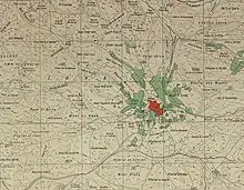
- Survey of Western Palestine, Map 21: IAA, Wikimedia commons
- "Idna Municipality Official Website" (in Arabic).
- Idhna Town (Fact Sheet), Applied Research Institute–Jerusalem (ARIJ)
- Idhna Town Profile, ARIJ
- Idhna aerial photo, ARIJ
- The priorities and needs for development in Idhna town based on the community and local authorities’ assessment, ARIJ
- Idhna, Idna
| Cities |
|  |
|---|---|---|
| Towns |
| |
| Villages |
| |
| Refugee camps | ||