Tarrama
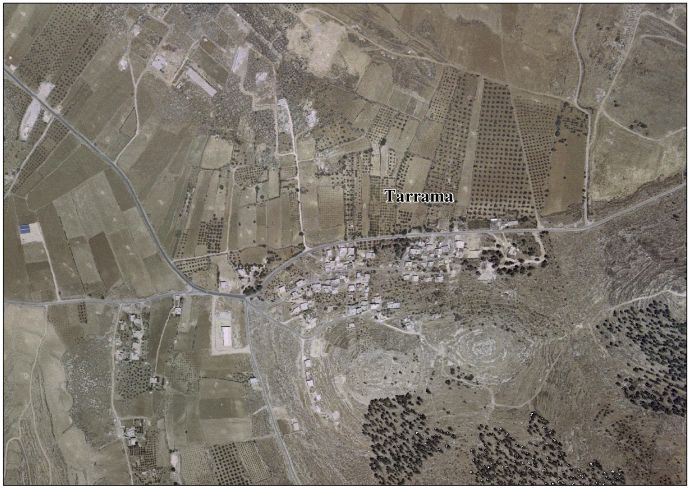
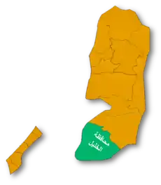
Tarrama (Arabic: طرّامة, also known as Khirbet al-Tarramah) is a Palestinian village situated on a hilltop with an elevation of 879 meters (2,884 ft) in the southern West Bank, part of the Hebron Governorate. Located just south of Dura, nearby localities include at-Tabaqa to the north, Fawwar to the east, Khursa to the west, and Deir Razih to the south.
Tarrama | |
|---|---|
Local Development Committee | |
| Arabic transcription(s) | |
| • Arabic | طرّامة |
| • Latin | Khirbet al-Tarramah (official) |
 Tarrama Location of Tarrama within Palestine | |
| Coordinates: 31°28′51″N 35°01′57″E | |
| Palestine grid | 153/098 |
| State | State of Palestine |
| Governorate | Hebron |
| Government | |
| • Type | Local Development Committee |
| Area | |
| • Total | 210 dunams (0.2 km2 or 0.08 sq mi) |
| Population (2007) | |
| • Total | 631 |
| • Density | 3,200/km2 (8,200/sq mi) |
Its total land area is 210 dunams and the village is provided with electricity and telephone lines.[1]
History
Khirbet Tarrama has been suggested as a possible site of the "Jezreel" mentioned as a town in the territory of Judah in the Bible.[2]
Ceramics from the Byzantine era have been found here.[3]
Ottoman era
In 1863, Victor Guérin visited.[4] In 1883, the PEF's Survey of Western Palestine (SWP) noted of Khurbet Terrama: "This ruin, not on the map, was found by Guerin about half an hour north of Khurbet Deir Razi. It was on the top of a terraced hill, and contains the remains of an old fort, with caves cut in the rock, one of which is pierced with columbaria."[5]
British Mandate era
At the time of the 1931 census of Palestine, conducted by the British Mandate authorities, the population of Kh. Tarama was counted under Dura.[6]
Jordanian era
In the wake of the 1948 Arab–Israeli War, and after the 1949 Armistice Agreements, Tarrama came under Jordanian rule.
In 1961, there were 161 residents here.[7]
Post-1967
After the Six-Day War in 1967, Tarrama has been under Israeli occupation.
During the 1970s, the Israeli Military unsuccessfully attempted to establish a military air field on Tarrama's lands to serve the al-Majnouna camp.[1]
Most of its inhabitants belong to the Awlad Muhammad extended family,[1] but over 10% were Palestinian refugees in 1997.[8]
The population increased to 404 by 1997.[9]
In 2007, Tarrama had a population of 630, according to the Palestinian Central Bureau of Statistics census.[10]
References
- Background to Tarrama Land Research Center. 19 February 2009.
- "Jezreel". Encyclopædia Britannica. 2009. Encyclopædia Britannica Online. 5 March 2009.
- Dauphin, 1998, p. 962
- Guérin, 1869, p. 372: "nous atteignons le sommet d'une colline qui s'élève comme par gradins successifs et dont les terres sont soutenues par plusieurs murs d'appui. Un dernier mur d'enceinte, qui a été démoli, mais dont les traces sont reconnaissables, environnait jadis la plate-forme supérieure, où sont épars des amas de gros blocs disjoints, ayant appartenu à une assez puissante construction, presque entièrement détruite, qui semble avoir eu une destination militaire. On y remarque aussi plusieurs cavernes pratiquées dans le roc, une, entre autres, dont les parois sônt percées intérieurement d'une foule de petites niches semblables à des trous de pigeonnier. Ces ruines me sont désignées sous le nom de Khirbet Terrama."
- Conder and Kitchener, 1883, SWP III, p. 369
- Mills, 1932, p. 32
- Government of Jordan, Department of Statistics, 1964, p. 22
- Palestinian Population by Locality and Refugee Status Archived 2008-11-19 at the Wayback Machine Palestinian Central Bureau of Statistics (PCBS).
- Welcome to Khirbet al-Tarramah Palestine Remembered.
- 2007 PCBS Census Palestinian Central Bureau of Statistics. p.119.
Bibliography
- Conder, C.R.; Kitchener, H.H. (1883). The Survey of Western Palestine: Memoirs of the Topography, Orography, Hydrography, and Archaeology. 3. London: Committee of the Palestine Exploration Fund.
- Dauphin, Claudine (1998). La Palestine byzantine, Peuplement et Populations. BAR International Series 726 (in French). III : Catalogue. Oxford: Archeopress. ISBN 0-860549-05-4.
- Government of Jordan, Department of Statistics (1964). First Census of Population and Housing. Volume I: Final Tables; General Characteristics of the Population (PDF).
- Guérin, V. (1869). Description Géographique Historique et Archéologique de la Palestine (in French). 1: Judee, pt. 3. Paris: L'Imprimerie Nationale.
- Mills, E., ed. (1932). Census of Palestine 1931. Population of Villages, Towns and Administrative Areas. Jerusalem: Government of Palestine.
External links
- Welcome to Khirbet al-Tarramah
- Tarrama village (fact sheet), Applied Research Institute–Jerusalem (ARIJ)
- Tarrama village profile, ARIJ
- Tarrama aerial photo, ARIJ
- The priorities and needs for development in Tarrama village based on the community and local authorities' assessment, ARIJ
| Cities |
|  |
|---|---|---|
| Towns |
| |
| Villages |
| |
| Refugee camps | ||