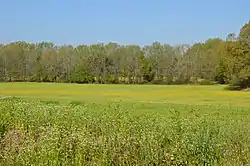
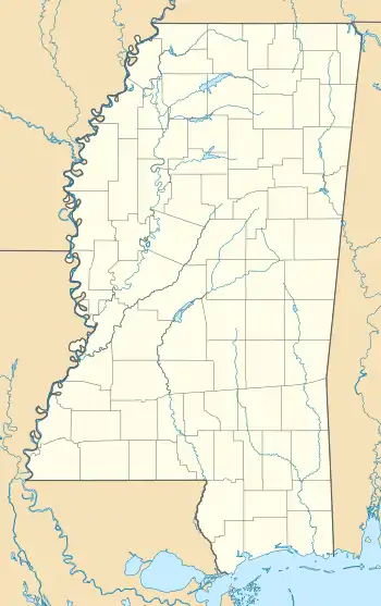
Siege and Battle of Corinth Sites
The Siege and Battle of Corinth Sites are a National Historic Landmark District encompassing surviving elements of three significant American Civil War engagements in and near Corinth, Mississippi. Included are landscape and battlefield features of the Siege of Corinth (April 29 to June 10, 1862), the Second Battle of Corinth (October 3-4, 1862), and the lesser Battle of Hatchie's Bridge on October 5, 1862. The district includes features located in both Alcorn County, Mississippi and Hardeman County, Tennessee, with some of the former preserved as part of Shiloh National Military Park. It was designated a landmark in 1991.[1][2][3]
Siege and Battle of Corinth | |
 Union field fortifications along Harper Road, north of Corinth | |
  | |
| Nearest city | Corinth, Mississippi |
|---|---|
| Coordinates | 34°57′12″N 88°31′10″W |
| NRHP reference No. | 91001050 |
| Significant dates | |
| Added to NRHP | May 6, 1991[1] |
| Designated NHLD | May 6, 1991[2] |
History

The city of Corinth grew as a railroad town in the 1850s around the railroad crossing point of the Memphis and Charleston Railroad (opened 1857) and the Mobile and Ohio Railroad (opened 1861). This railroad junction, whose planning began in the mid-1850s, made Corinth a key economic junction point in the southern United States, and made it of critical military importance when the American Civil War broke out. Following the bloody Union victory at Shiloh in early April 1862, Confederate forces withdrew to Corinth, which they heavily fortified with earthworks and other defenses, in order to protect the critical railroad lines. The month-long Siege of Corinth followed, in which Union forces again compelled the Confederates to retreat. Confederate reinforcements from the west made an attempt to recapture Corinth in the Second Battle of Corinth, but were repulsed with significant casualties. During their retreat, the Confederates were attacked in the Battle of Hatchie's Bridge, near Pocahontas, Tennessee, by Union forces headed to support those at Corinth.[3]
Landmarked sites
The landmark district includes a number of discontiguous resources associated with these military movements and actions. Most of these are located in or near Corinth, and include earthworks, rifle pits, and other defensive features erected both by the Confederates (before the siege) and also the Union (after its capture). A few buildings occupied by military commanders are included, as is the actual railroad junction that was the key element of interest.[3]
The district includes the following separate areas:[3]
- First Phase Battle of Corinth, 157 acres (64 ha)
- Battery F (previously listed), 1 acre (0.40 ha)
- Battery Robinette (previously listed), 20 acres (8.1 ha)
- Fish Pond House, 708 Kilpatrick Street
- Curlee House, also known as "Veranda House", 705 Jackson Street (previously listed)
- Oak Home, 808 Jackson Street
- Duncan House, 810 Polk Street
- Railroad Crossover, 1 acre (0.40 ha)
- Confederate Earthworks between the Mobile and Ohio Railroad and the Purdy Road, 133 acres (54 ha)
- Harper Road Union Earthworks (previously listed), 3 acres (1.2 ha)
- Confederate Rifle Pit, less than 1 acre (0.40 ha)
- Corinth National Cemetery (previously listed), 16 acres (6.5 ha)
- Union Siege Line A: Maj. Gen. William T. Sherman's and Brig. Gen. Thomas A. Davies' Divisions, 105 acres (42 ha).
- Union Siege Line B: Army of the Tennessee (Brig. Gen. Thomas McKean's and Brig. Gen. T.W. Sherman's Divisions); Army of the Ohio (Brig. Gen. T.J. Wood's and William Nelson's Divisions), 36.5 acres (14.8 ha)
- Union Siege Line C: Army of the Mississippi (Paine's Division), 6 acres (2.4 ha)
- Davis Bridge (Battle of the Hatchie), a 5-acre (2.0 ha) area of the larger battlefield, which is also individually listed
The following National Register listings are also related to the military actions in some way, but are not part of the landmarked area:
- Battle of Corinth, Confederate Assault Position on Shiloh Road, excluded from landmark due to a loss of integrity
- Battery Williams, excluded from landmark due to a loss of integrity
- Midtown Corinth Historic District, includes four buildings listed above: Duncan House, Oak Home, the Fish Pond House, and Veranda House (a.k.a. "Curlee House"))[4]
See also
| Wikimedia Commons has media related to Siege and Battle of Corinth Sites. |
References
- "National Register Information System". National Register of Historic Places. National Park Service. March 13, 2009.
- "Siege and Battle of Corinth Sites". National Historic Landmark summary listing. National Park Service. Archived from the original on 2011-06-06. Retrieved 2007-10-24.
- Paul Hawke; Cecil McKithan; Tom Hensley; Jack Elliott & Edwin C. Bearss (January 8, 1991). "National Register of Historic Places Registration: Siege and Battle of Corinth Sites". National Park Service. Cite journal requires
|journal=(help) and Accompanying 15 photos, from 19 90. (1.70 MB) - John Linn Hopkins (June 1, 1993). "National Register of Historic Places Registration: Midtown Corinth Historic District". National Park Service. Retrieved October 18, 2016. without "attached map", but with 31 photos (see photo captions pages 68-70 of text document)
External links
| Wikimedia Commons has media related to Siege and Battle of Corinth Sites. |
- Corinth Interpretative Center, a National Park Service site. Includes a map of the NHL Siege and Battle of Corinth Sites, but the map is poorly scanned.
- "The Siege and Battle of Corinth: A New Kind of War", a National Park Service Teaching with Historic Places (TwHP) lesson plan