Simunjan District
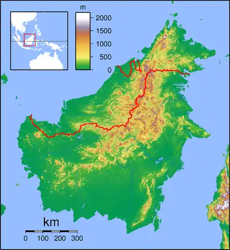
The Simunjan District is a district in the Samarahan division of Sarawak, Malaysia,[1][2] located between Serian and Sri Aman. It borders Sebuyau and Samarahan and lies approximately 51.4 kilometres (32 mi) east-south-east of the state capital Kuching.
Simunjan District | |
|---|---|
 Simunjan District | |
| Coordinates: 1.38333°N 110.75°E | |
| Country | |
| State | |
| Administrative Division | Simunjan |
| Elevation | 54 m (177 ft) |
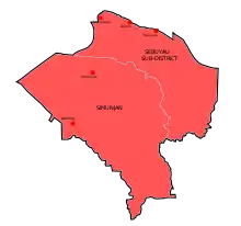
Map of Simunjan District
Most of its inhabitants are made up of the Malay and the Iban people.
Famous persons
- Sapok Biki - Malaysian boxer who won a gold medal during the 1998 Commonwealth Games in Kuala Lumpur is a Simunjan native.
Climate
Simunjan has a tropical rainforest climate (Af) with heavy to very heavy rainfall year-round.
| Climate data for Simunjan | |||||||||||||
|---|---|---|---|---|---|---|---|---|---|---|---|---|---|
| Month | Jan | Feb | Mar | Apr | May | Jun | Jul | Aug | Sep | Oct | Nov | Dec | Year |
| Average high °C (°F) | 29.9 (85.8) |
30.2 (86.4) |
31.1 (88.0) |
32.0 (89.6) |
32.4 (90.3) |
32.2 (90.0) |
32.1 (89.8) |
32.0 (89.6) |
31.8 (89.2) |
31.7 (89.1) |
31.4 (88.5) |
30.7 (87.3) |
31.5 (88.6) |
| Daily mean °C (°F) | 26.2 (79.2) |
26.4 (79.5) |
26.9 (80.4) |
27.4 (81.3) |
27.8 (82.0) |
27.5 (81.5) |
27.2 (81.0) |
27.2 (81.0) |
27.2 (81.0) |
27.2 (81.0) |
27.0 (80.6) |
26.6 (79.9) |
27.1 (80.7) |
| Average low °C (°F) | 22.5 (72.5) |
22.6 (72.7) |
22.8 (73.0) |
22.9 (73.2) |
23.2 (73.8) |
22.8 (73.0) |
22.4 (72.3) |
22.5 (72.5) |
22.6 (72.7) |
22.7 (72.9) |
22.6 (72.7) |
22.5 (72.5) |
22.7 (72.8) |
| Average rainfall mm (inches) | 471 (18.5) |
358 (14.1) |
284 (11.2) |
272 (10.7) |
246 (9.7) |
188 (7.4) |
180 (7.1) |
254 (10.0) |
275 (10.8) |
308 (12.1) |
349 (13.7) |
445 (17.5) |
3,630 (142.8) |
| Source: Climate-Data.org[3] | |||||||||||||
Neighbouring settlements
Neighbouring settlements include:
- Kampung Sageng 0 kilometres (0.0 mi) north
- Kampung Lintang 0 kilometres (0.0 mi) north
- Kampung Sungai Jong 1.9 kilometres (1.2 mi) south
- Kampung Jagong 1.9 kilometres (1.2 mi) west
- Kampung Segunduk 2.6 kilometres (1.6 mi) southeast
- Kampung Lobang Empat 4.1 kilometres (2.5 mi) southeast
- Kampung Malanjok 5.2 kilometres (3.2 mi) southeast
- Kampung Dundong 5.6 kilometres (3.5 mi) west
- Kampung Sabang 6.7 kilometres (4.2 mi) northwest
- Kampung Lingkau 6.7 kilometres (4.2 mi) southeast
- Kampung Sungai Ba 2.0 kilometres (1.2 mi) west
References
- M. Mohizah, S. Julia and W. K. Soh (2006). A Sarawak Gazetteer (PDF). Kuala Lumpur: Sarawak Forestry Department Malaysia and Forest Research Institute Malaysia. ISBN 983-2181-86-0. OCLC 85818866. Archived from the original (PDF) on 22 July 2011. Retrieved 1 January 2011.
- "Simunjan, Malaysia". Geonames. 9 August 2010. Retrieved 27 December 2010.
- "Climate: Simunjan". Climate-Data.org. Retrieved 29 October 2020.
External links
 Simunjan travel guide from Wikivoyage
Capital: Kuching | |
| History | |
| Topics |
|
| Society |
|
| Administrative divisions | |
| |
This article is issued from Wikipedia. The text is licensed under Creative Commons - Attribution - Sharealike. Additional terms may apply for the media files.