South Dakota Highway 37
South Dakota Highway 37 (SD 37) is a state route that runs across eastern South Dakota. It begins at the Nebraska border northeast of Niobrara, Nebraska, as a continuation of Nebraska Highway 14. It runs to the North Dakota border north of Hecla, where it continues as North Dakota Highway 1. It is 242 miles (389 km) in length.
| ||||
|---|---|---|---|---|
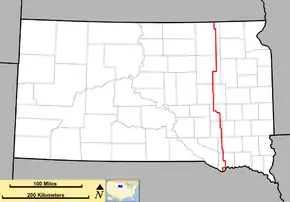 Route of SD 37 (in red) | ||||
| Route information | ||||
| Defined by SDCL §31-4-158 | ||||
| Maintained by SDDOT | ||||
| Length | 242 mi (389 km) | |||
| Existed | 1926–present | |||
| Major junctions | ||||
| South end | ||||
| North end | ||||
| Location | ||||
| Counties | ||||
| Highway system | ||||
| ||||

History
South Dakota 37 was in place by 1926, and largely has used the same alignment since. The only significant exception was in northeast South Dakota, where SD 37 originally went westward from Groton to Bath, then north via Columbia to Houghton, where it continued to Hecla. This segment was rerouted to the current alignment by 1929.
On the south end, the road ended at the Missouri River at Running Water. A seasonal ferry was in place to carry traffic across the river. A direct connection via bridge did not open until 1998 when the Chief Standing Bear Memorial Bridge was completed.
In the early and mid-1930s, the segment between Huron and Tripp was co-numbered as U.S. Route 281. This concurrency was dropped by 1936, when US 281 was realigned further west.
The segment between Huron and Mitchell was upgraded to a 4-lane expressway, and was largely completed by 2004. A minor rerouting around the west end of Mitchell occurred, resulting in a 2-mile (3.2 km) concurrency with Interstate 90.
Legal definition
The route of SD 37 is defined in South Dakota Codified Laws § 31-4-158.[1]
Major intersections
| County | Location | mi | km | Destinations | Notes |
|---|---|---|---|---|---|
| Bon Homme | | Western terminus of SD 52 | |||
| | Eastern end of SD 50 concurrency | ||||
| | Western end of SD 50 concurrency | ||||
| | |||||
| Hutchinson | | ||||
| | |||||
| Parkston | |||||
| Davison | | ||||
| Mitchell | Eastern end of I‑90 concurrency, Exit 332; I‑90 Bus. is a continuation north of the I‑90 interchange | ||||
| Western end of I‑90 concurrency, Exit 330; southern end of I‑90 Bus. concurrency | |||||
| Northern end of I‑90 Bus. concurrency | |||||
| Sanborn | | Eastern end of SD 34 concurrency | |||
| | Western end of SD 34 concurrency | ||||
| | Western terminus of SD 224 | ||||
| Beadle | Huron | ||||
| Beadle–Spink county line | | ||||
| Spink | | Western end of US 212 concurrency | |||
| Doland | Eastern end of US 212 concurrency | ||||
| | Southern end of SD 20 concurrency | ||||
| Conde | Northern end of SD 20 concurrency | ||||
| Brown | Groton | ||||
| | Eastern end of SD 10 concurrency | ||||
| | Western end of SD 10 concurrency | ||||
1.000 mi = 1.609 km; 1.000 km = 0.621 mi
| |||||
Related route
| |
|---|---|
| Location | Tripp |
South Dakota Highway 37A (SD 37A) is a north–south state highway in the U.S. state of South Dakota. SD 37A's southern terminus is at SD 37 in Tripp, and the northern terminus is at US 18 north of Tripp.
The entire route is in Hutchinson County.
| Location | mi | km | Destinations | Notes | |
|---|---|---|---|---|---|
| Tripp | 0.000 | 0.000 | Southern terminus | ||
| | Northern terminus | ||||
| 1.000 mi = 1.609 km; 1.000 km = 0.621 mi | |||||
References
- "South Dakota Codified Law". Retrieved November 3, 2012.
External links
| Wikimedia Commons has media related to South Dakota Highway 37. |