Grade I listed buildings in Derbyshire
There are over 9000 Grade I listed buildings in England. This page is a list of these buildings in the county of Derbyshire, sub-divided by district.
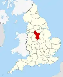
Derbyshire shown in England
Amber Valley
| Name | Location | Type | Completed [note 1] | Date designated | Grid ref.[note 2] Geo-coordinates | Notes | Entry number [note 3] | Image |
|---|---|---|---|---|---|---|---|---|
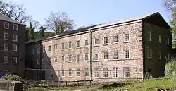
| North Mill | Belper | Mill | Earlier than 1803 | 3 February 1966 | SK3454248081 53°01′44″N 1°29′11″W | Built by William Strutt; one of the oldest surviving examples of an industrialised iron-framed 'fire-proof' building in the world. Part of the Derwent Valley Mills World Heritage Site. | 1186846 | |
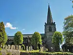
| Church of St Mary | Crich | Anglican church | 12th-century core | 13 February 1967 | SK3480154660 53°05′17″N 1°28′55″W | 1068597 | ||
| Church of St Mary | Denby | Parish church | Early 13th century | 13 February 1967 | SK3986346495 53°00′51″N 1°24′26″W | 1109129 | ||
| Church of St Alkmund | Duffield | Parish church | Early 14th century | 13 February 1967 | SK3495142770 52°58′52″N 1°28′51″W | 1109116 | ||
| Church of St Clement | Horsley | Parish church | Early 14th century | 13 February 1967 | SK3753844498 52°59′47″N 1°26′32″W | 1109138 | ||
| Church of All Saints | Kedleston Park, Kedleston | Church | 1727 | 13 February 1967 | SK3121940307 52°57′33″N 1°32′12″W | 1335331 | ||
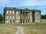
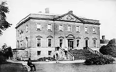
| Kedleston Hall | Kedleston Park, Kedleston | Country house | 1758–65 | 25 September 1951 | SK3127140296 52°57′33″N 1°32′09″W | 1311507 | ||
| The Boathouse | Kedleston Park, Kedleston | Boathouse | c.1770 | 13 February 1967 | SK3110340795 52°57′49″N 1°32′18″W | 1109090 |  The Boathouse | |
| The North Lodge | Kedleston | Gate | 18th century | 13 February 1967 | SK3216241222 52°58′03″N 1°31′21″W | 1109091 | 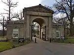 The North Lodge | |
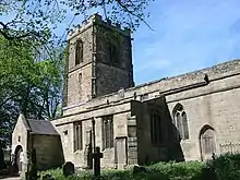
| Church of St Michael | Kirk Langley | Parish church | Early 14th century | 13 February 1967 | SK2864538854 52°56′47″N 1°34′31″W | 1109095 | ||
| Church of All Saints | Mackworth | Parish church | Early 14th century | 13 February 1967 | SK3202337751 52°56′10″N 1°31′30″W | 1158642 | ||
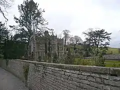
| Gatehouse to Mackworth Castle | Mackworth | Fortified manor house | c.1495–1500 | 13 February 1967 | SK3133237828 52°56′13″N 1°32′07″W | 1158635 | 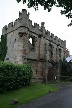 Gatehouse to Mackworth Castle | |
| Church of St Matthew | Pentrich | Parish church | 12th century | 13 February 1967 | SK3894852575 53°04′08″N 1°25′13″W | 1109151 | ||
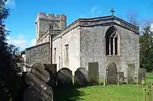
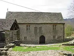
| The Ruins of South Wingfield Manor House, incorporating Manor Farmhouse and an aisled outbuilding to the south | South Wingfield | Manor house | 1439–53 | 25 September 1951 | SK3744054742 53°05′19″N 1°26′33″W | 1109156 |  The Ruins of South Wingfield Manor House, incorporating Manor Farmhouse and an aisled outbuilding to the south | |
| Church of All Saints | Mugginton, Weston Underwood | Parish church | 11th century | 13 February 1967 | SK2832942872 52°58′57″N 1°34′46″W | 1109067 | ||
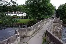
| The Bridge and Cascade | Kedleston Park, Weston Underwood | Bridge | 1770–71 | 13 February 1967 | SK3126840716 52°57′46″N 1°32′09″W | 1335352 | 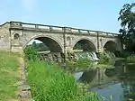 The Bridge and Cascade |


Bolsover
| Name | Location | Type | Completed [note 1] | Date designated | Grid ref.[note 2] Geo-coordinates |
Entry number [note 3] | Image |
|---|---|---|---|---|---|---|---|
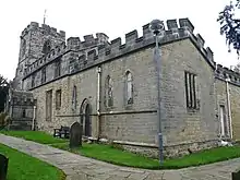
| Church of St John the Baptist | Ault Hucknall | Parish church | 11th century | 8 July 1966 | SK4674165234 53°10′56″N 1°18′07″W |
1109001 | |
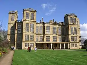
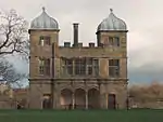
| Hardwick Hall | Hardwick Park, Ault Hucknall | Country house | 1590–97 | 11 July 1951 | SK4630563733 53°10′07″N 1°18′32″W |
1051617 | |
| Hardwick Old Hall | Hardwick Park, Ault Hucknall | Country house | Early 16th century | 11 July 1951 | SK4614863697 53°10′06″N 1°18′40″W |
1052337 | 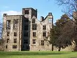 Hardwick Old Hall |
| Barlborough Hall | Barlborough | Country house | 1583 | 19 November 1951 | SK4777078257 53°17′57″N 1°17′05″W |
1108972 | |
| Bolsover Castle | Old Bolsover | Castle | 17th century | 23 March 1989 | SK4702970718 53°13′53″N 1°17′49″W |
1108976 | |
| Church of All Saints | Steetley, Whitwell | Church | 12th century | 26 August 1965 | SK5435778727 53°18′10″N 1°11′09″W |
1366579 | |
| Church of St Lawrence | Whitwell | Parish church | 12th century | 26 August 1965 | SK5262476830 53°17′09″N 1°12′44″W |
1108938 |


Chesterfield
| Name | Location | Type | Completed [note 1] | Date designated | Grid ref.[note 2] Geo-coordinates |
Entry number [note 3] | Image |
|---|---|---|---|---|---|---|---|
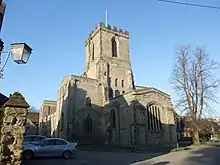
| Church of St Mary and All Saints | Chesterfield | Parish church | Medieval | 15 July 1971 | SK3851371171 53°14′10″N 1°25′28″W |
1334708 |
City of Derby
| Name | Location | Type | Completed [note 1] | Date designated | Grid ref.[note 2] Geo-coordinates |
Entry number [note 3] | Image |
|---|---|---|---|---|---|---|---|
| Bakewell's Gates at the Silk Mill Industrial Museum | City of Derby | Gate | 1728 | 20 June 1952 | SK3508936242 52°55′21″N 1°28′46″W |
1229981 | 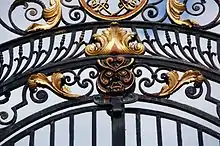 Bakewell's Gates at the Silk Mill Industrial Museum |
| Cathedral Church of All Saints | City of Derby | Church | Early 16th century | 20 June 1952 | SK3523436506 52°55′29″N 1°28′38″W |
1228277 | |
| Church of St Mary | Chaddesden | Church | 1357 | 20 June 1952 | SK3817836895 52°55′41″N 1°26′01″W |
1215913 | |
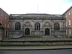
| County Hall | City of Derby | County hall | 1660 | 20 June 1952 | SK3501236482 52°55′29″N 1°28′50″W |
1279174 | |
| Darley Abbey Mills (South Complex) Long Mill, Middle Mill, East Mill, West Mill, engine house and chimney, tollhouse, bobbin shop and drying shed | Darley Abbey | Mill | Pre-1850 | 13 February 1967 | SK3517738550 52°56′35″N 1°28′41″W |
1279399 | .jpg.webp) Darley Abbey Mills (South Complex) Long Mill, Middle Mill, East Mill, West Mill, engine house and chimney, tollhouse, bobbin shop and drying shed |
| St Helen's House including attached former school buildings and front wall | City of Derby | Townhouse | c.1726 | 20 June 1952 | SK3503336787 52°55′38″N 1°28′49″W |
1228285 | 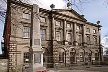 St Helen's House including attached former school buildings and front wall |
| St Mary's Bridge Chapel | City of Derby | Chapel | 14th century | 20 June 1952 | SK3533836759 52°55′37″N 1°28′33″W |
1215878 | |
| The Homestead with gatepiers | Spondon | House | 1740 | 10 November 1967 | SK4003435920 52°55′09″N 1°24′22″W |
1229478 | 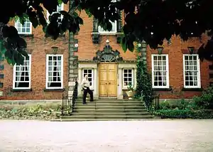 The Homestead with gatepiers |
| 41 Friar Gate | City of Derby | House | c.1770 | 20 June 1952 | SK3466436450 52°55′28″N 1°29′09″W |
1287620 |
.jpg.webp)

Derbyshire Dales
| Name | Location | Type | Completed [note 1] | Date designated | Grid ref.[note 2] Geo-coordinates |
Entry number [note 3] | Image |
|---|---|---|---|---|---|---|---|
| Old Grammar School | Ashbourne | Former school | 1586 | 15 June 1951 | SK1769846526 53°00′57″N 1°44′16″W |
1207596 |  Old Grammar School |
| Parish Church of St Oswald | Ashbourne | Parish church | Mainly c.1200 | 15 June 1951 | SK1762846439 53°00′54″N 1°44′19″W |
1207715 | |
| The Mansion including coach house wall | Ashbourne | House | c.1685 | 15 June 1951 | SK1772946509 53°00′56″N 1°44′14″W |
1335139 |  The Mansion including coach house wall |
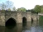
| Bakewell Bridge | Bakewell | Bridge | c.1300 | 13 March 1951 | SK2194968652 53°12′52″N 1°40′22″W |
1148112 | |
| Church of All Saints | Bakewell | Parish church | 18th century | 13 March 1951 | SK2155668483 53°12′47″N 1°40′43″W |
1316489 | |
| Cross situated 12 metres to south of porch of Church of All Saints | Bakewell | Cross | Early 10th century | 7 January 1970 | SK2154568457 53°12′46″N 1°40′44″W |
1316491 |  Cross situated 12 metres to south of porch of Church of All Saints |
| Holme Bridge | Bakewell | Packhorse bridge | 1664 | 13 March 1951 | SK2154668988 53°13′03″N 1°40′44″W |
1247518 | |
| Holme Hall | Bakewell | Country house | 1626–28 | 13 March 1951 | SK2154769106 53°13′07″N 1°40′44″W |
1246166 | |
| The Great Cross and railed enclosure | Bakewell | Cross | Early 9th century | 13 January 1951 | SK2157068465 53°12′46″N 1°40′42″W |
1316492 | 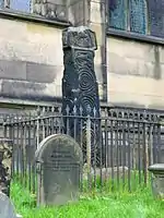 The Great Cross and railed enclosure |
| Baslow Bridge | Baslow and Bubnell | Bridge | Early 17th century | 12 July 1967 | SK2510472369 53°14′52″N 1°37′31″W |
1088195 | .jpg.webp) Baslow Bridge |
| Church of All Saints | Bradbourne | Church | 12th century | 13 September 1967 | SK2080752756 53°04′18″N 1°41′27″W |
1109479 | |
| Church of All Saints | Brailsford | Parish church | 12th century | 13 September 1967 | SK2449241274 52°58′06″N 1°38′12″W |
1109734 | |
| Ednaston Manor and attached walls and terracing | Brailsford | Country house | 1912–19 by Lutyens | 13 September 1967 | SK2384642276 52°58′38″N 1°38′47″W |
1109745 |  |
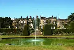
| Chatsworth House | Chatsworth | Country house | 1687–89 | 29 September 1951 | SK2602270104 53°13′38″N 1°36′42″W |
1373871 | |
| Bridge on main approach to Chatsworth House | Chatsworth | Bridge | 1759–74 | 12 July 1967 | SK2571870176 53°13′41″N 1°36′58″W |
1049093 |  Bridge on main approach to Chatsworth House |
| Conduit House, Cascade and adjoining statues | Chatsworth | Cascade and bridge | c.1696 | 12 July 1967 | SK2630470050 53°13′37″N 1°36′27″W |
1088181 | 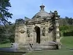 Conduit House, Cascade and adjoining statues |
| Egyptian statue [now indoors] | Chatsworth | Statue | Egyptian c.1570–1304 BC | 19 June 1987 | SK2613070181 53°13′41″N 1°36′36″W)] |
1067714 | .jpg.webp) Egyptian statue [now indoors] |
| Egyptian statue [now indoors] | Chatsworth | Statue | Egyptian c.1570–1304 BC | 19 June 1987 | SK2614070182 53°13′41″N 1°36′36″W)] |
1334742 | |
| Former stables at Chatsworth House | Chatsworth | Former stables | 1758–63 by James Paine | 12 July 1967 | SK2619670269 53°13′44″N 1°36′33″W |
1088184 |  Former stables at Chatsworth House |
| Series of herms and altars laid out in a Y to the east of the Ring Pond | Chatsworth | Herms | c.1730 | 19 June 1987 | SK2616969906 53°13′32″N 1°36′34″W |
1334743 | .jpg.webp) Series of herms and altars laid out in a Y to the east of the Ring Pond |
| Temple of Flora | Chatsworth | Temple | 1693–95 | 12 July 1967 | SK2607270232 53°13′43″N 1°36′39″W |
1088176 | 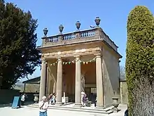 Temple of Flora |
| Cromford Mill | Cromford | Mill | 1771 | 22 June 1950 | SK2985156982 53°06′33″N 1°33′20″W |
1248010 | |
| Church of St Mary | Cromford | Parish church | 1792–97 | 22 June 1950 | SK2996657116 53°06′37″N 1°33′14″W |
1248052 | |
| Church of St Andrew | Cubley | Parish church | Late 15th century | 13 September 1967 | SK1649337692 52°56′11″N 1°45′22″W |
1203949 | |
| Church of St Cuthbert | Doveridge | Parish church | Late 12th century | 13 September 1967 | SK1138534102 52°54′15″N 1°49′56″W |
1274523 | |
| Church of St Peter | Edensor | Parish church | 12th century | 12 July 1967 | SK2506769901 53°13′32″N 1°37′34″W |
1088158 | |
| Churchyard cross 6 metres east of church porch | Eyam | Cross | Early 9th century | 29 September 1951 | SK2178576398 53°17′03″N 1°40′29″W |
1100263 | 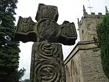 Churchyard cross 6 metres east of church porch |
| Church of St Giles | Great Longstone | Parish church | 13th century | 12 July 1967 | SK2002171910 53°14′38″N 1°42′05″W |
1109899 | |
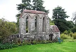
| Padley Chapel | Upper Padley, Grindleford | Chapel | 14th and 15th century | 29 September 1951 | SK2467878954 53°18′25″N 1°37′52″W |
1335033 | |
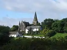
| Church of All Saints | Hassop | Roman Catholic church | 1816–17 | 12 July 1967 | SK2234472322 53°14′51″N 1°40′00″W |
1253035 | |
| Church of St Michael and All Angels | Bank Top, Hathersage | Church | 14th century | 12 July 1967 | SK2339881854 53°19′59″N 1°39′00″W |
1109793 | |
| Holy Trinity Church | Kirk Ireton | Parish church | 12th century | 13 September 1967 | SK2689850211 53°02′55″N 1°36′01″W |
1335168 | |
| Church of St Michael | Kniveton | Church | 12th century | 13 September 1967 | SK2099850395 53°03′01″N 1°41′18″W |
1146435 | |
| Church of St Chad | Longford | Church | 15th century | 13 September 1967 | SK2148038322 52°56′31″N 1°40′55″W |
1109790 | |
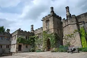
| Haddon Hall | Nether Haddon | Fortified manor house | Mainly 14th and 15th century | 29 September 1951 | SK2350566337 53°11′37″N 1°38′59″W |
1334982 | |
| Church of St Mary and St Barlok | Norbury Hollow, Norbury and Roston | Church | Early 15th century | 13 September 1967 | SK1254942395 52°58′44″N 1°48′52″W |
1109764 | 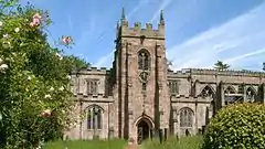 Church of St Mary and St Barlok |
| The Old Manor and attached garden wall | Norbury Hollow | Country house | Late 17th century | 5 February 1952 | SK1252542357 52°58′42″N 1°48′54″W |
1281200 | 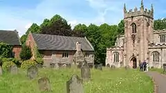 The Old Manor and attached garden wall |
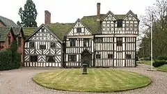
| Somersal Herbert Hall | Somersal Herbert | Country house | Early 16th century | 5 February 1982 | SK1356935231 52°54′52″N 1°47′59″W |
1274325 | |
| Snitterton Hall | Snitterton, South Darley | Country house | Late 16th century | 22 June 1950 | SK2784760341 53°08′22″N 1°35′07″W |
1248141 | |
| Sudbury Hall and attached stable block | Sudbury | Country house | 1660–70 | 5 February 1952 | SK1586832111 52°53′10″N 1°45′56″W |
1273995 |  Sudbury Hall and attached stable block |
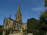
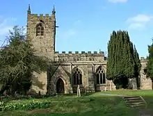
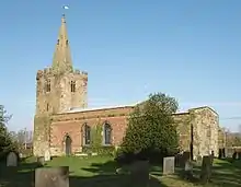
| Church of St Michael | Taddington | Church | 14th century | 12 July 1967 | SK1412871159 53°14′14″N 1°47′23″W |
1109887 | 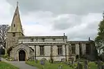 Church of St Michael |
| Church of St Leonard | Thorpe | Church | Early 12th century | 13 September 1984 | SK1562850160 53°02′55″N 1°46′06″W |
1203690 | .jpg.webp) Church of St Leonard |
| Church of St John the Baptist | Tideswell | Church | 14th century | 12 July 1967 | SK1525675774 53°16′43″N 1°46′22″W |
1215255 | |
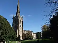
| Church of St Mary | Wirksworth | Church | Early English to Perpendicular | 24 October 1950 | SK2874853942 53°04′55″N 1°34′20″W |
1335090 | |
| Remains of Chapel of St Mary and St John the Baptist to south of Stydd Hall | Yeaveley | Chapel | Early 13th century | 13 September 1967 | SK1719839963 52°57′24″N 1°44′44″W |
1109732 | |
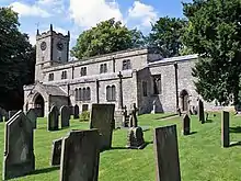
| Church of All Saints | Youlgreave | Parish church | Late 12th century | 12 July 1967 | SK2120564372 53°10′34″N 1°41′03″W |
1109853 |


.jpg.webp)

.jpg.webp)
Erewash
| Name | Location | Type | Completed [note 1] | Date designated | Grid ref.[note 2] Geo-coordinates |
Entry number [note 3] | Image |
|---|---|---|---|---|---|---|---|
| Church of All Saints | Breadsall | Parish church | 12th century | 10 November 1967 | SK3710839799 52°57′15″N 1°26′57″W |
1328833 | |
| Church of St Michael | Breaston | Parish church | 11th century | 10 November 1967 | SK4600733506 52°53′49″N 1°19′03″W |
1087960 | |
| Dale Abbey ruins | Dale Abbey | Ruined abbey | c.1200–1538 | 10 November 1967 | SK4374938740 52°56′39″N 1°21′01″W |
1140435 | 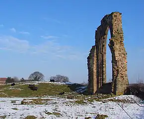 Dale Abbey ruins |
| Cat and Fiddle Mill | Dale Abbey | Corn mill | 1788 | 2 September 1952 | SK4379339778 52°57′13″N 1°20′59″W |
1205307 | 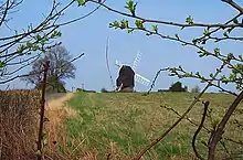 Cat and Fiddle Mill |
| Church of All Saints and Vergers Farmhouse | Dale Abbey | Parish church | Late 12th century | 10 November 1967 | SK4373638586 52°56′34″N 1°21′02″W |
1140436 | 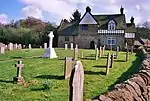 Church of All Saints and Vergers Farmhouse |
| Church of St Chad | Draycott and Church Wilne | Parish church | Early 13th century | 10 November 1967 | SK4489131838 52°52′56″N 1°20′04″W |
1281336 | .jpg.webp) Church of St Chad |
| Church of All Saints | Kirk Hallam | Parish church | 14th century | 26 September 1963 | SK4585740550 52°57′37″N 1°19′08″W |
1205580 | |
| Church of St Matthew | Morley | Parish church | 12th century | 10 November 1967 | SK3966240935 52°57′52″N 1°24′39″W |
1205838 | 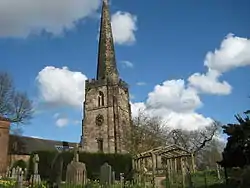 Church of St Matthew |
| Church of St Giles | Sandiacre | Parish church | 11th century | 10 November 1967 | SK4800437265 52°55′50″N 1°17′14″W |
1204475 | |
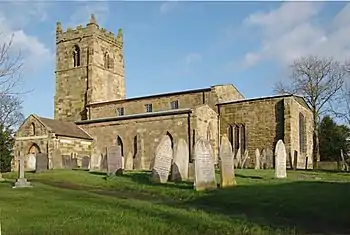
| Church of All Saints | Sawley | Church | 11th century | 22 October 1962 | SK4724631365 52°52′40″N 1°17′58″W |
1204277 |
High Peak
| Name | Location | Type | Completed [note 1] | Date designated | Grid ref.[note 2] Geo-coordinates |
Entry number [note 3] | Image |
|---|---|---|---|---|---|---|---|
| The Crescent | Buxton | Townhouse | 1780–88 | 25 January 1951 | SK0580673572 53°15′33″N 1°54′52″W |
1257876 | |
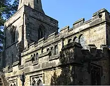
| Peveril Castle curtain walls and fragmentary foundations | Castleton | Castle | Late 11th century | 17 April 1985 | SK1493382606 53°20′25″N 1°46′38″W |
1250966 | 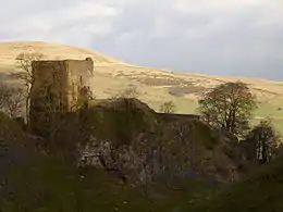 Peveril Castle curtain walls and fragmentary foundations |
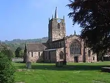
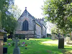
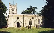
| Church of St Peter | Hope | Parish church | Early 14th century | 21 April 1967 | SK1722983470 53°20′52″N 1°44′34″W |
1121945 |

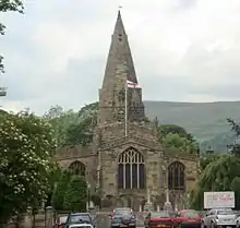
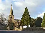
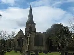
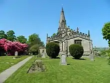
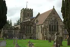
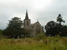
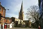
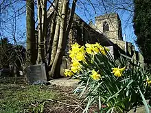
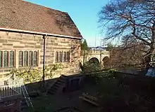
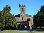
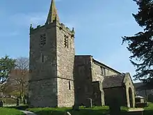
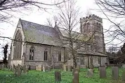
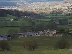
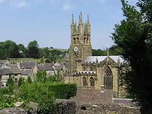
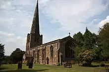
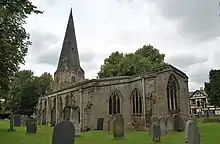
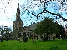
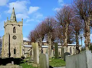
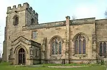
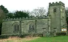
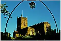
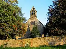
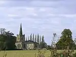
North East Derbyshire
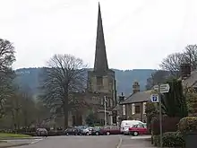
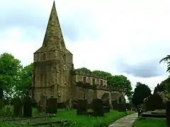
.jpg.webp)

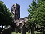
_-_geograph.org.uk_-_343396.jpg.webp)
South Derbyshire
| Name | Location | Type | Completed [note 1] | Date designated | Grid ref.[note 2] Geo-coordinates |
Entry number [note 3] | Image |
|---|---|---|---|---|---|---|---|
| Church of All Saints | Aston-on-Trent | Parish church | 12th century | 10 November 1967 | SK4148929348 52°51′36″N 1°23′07″W |
1281625 | |
| Church of St Wilfrid | Barrow-upon-Trent | Parish church | Mid-13th century | 10 November 1967 | SK3529328385 52°51′07″N 1°28′38″W |
1096559 | |
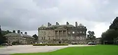
| Calke Abbey | Calke Park, Calke | Country house | 18th century | 2 September 1952 | SK3677322593 52°47′59″N 1°27′22″W |
1031839 | |
| Church of St Michael and All Angels | Church Broughton | Parish church | 12th century | 19 January 1967 | SK2053333767 52°54′03″N 1°41′46″W |
1205179 | |
| Church of St Wilfrid | Egginton | Church | 1690 | 19 January 1967 | SK2675527849 52°50′51″N 1°36′15″W |
1334567 | |
| Church of St Bartholomew | Elvaston | Parish church | 13th century | 10 November 1967 | SK4070432975 52°53′34″N 1°23′47″W |
1096395 | |
| Church of St Helen | Etwall | Parish church | Late 12th century | 19 January 1967 | SK2688831991 52°53′05″N 1°36′07″W |
1096573 | |
| Church of St Saviour | Foremark | Parish church | 1662 | 19 January 1967 | SK3297526472 52°50′05″N 1°30′43″W |
1045861 | |
| Foremarke Hall | Foremark | Country house | Early 18th century | 2 September 1952 | SK3328526512 52°50′06″N 1°30′27″W |
1096531 | |
| Church of St Mary | Marston on Dove | Parish church | 13th century | 19 January 1967 | SK2331429633 52°51′49″N 1°39′19″W |
1334544 | |
| Aisled barn attached to north of stables at Melbourne Hall | Melbourne | Barn | Early 18th century | 18 February 1971 | SK3893625052 52°49′18″N 1°25′25″W |
1281386 | |
| Church of St Michael and St Mary | Melbourne | Parish church | c.1133–early 13th century | 10 November 1967 | SK3890024994 52°49′16″N 1°25′27″W |
1204556 | |
| Covered seat to east of Fountain Pond in Melbourne Hall gardens | Melbourne | Garden seat | c.1704 | 10 November 1967 | SK3923624854 52°49′11″N 1°25′09″W |
1096377 | |
| Covered seat to west of Fountain Pond in Melbourne Hall gardens | Melbourne | Garden seat | c.1704 | 10 November 1967 | SK3912624888 52°49′12″N 1°25′15″W |
1262770 | |
| Five flights of steps between terraces at Melbourne Hall gardens | Melbourne | Steps | c.1704 | 10 November 1967 | SK3908024992 52°49′16″N 1°25′17″W |
1096411 | |
| Garden walls attached to south front of Melbourne Hall with attached railings and wall to east | Melbourne | Garden wall | Late 17th century | 10 November 1967 | SK3895624974 52°49′15″N 1°25′24″W |
1334648 | 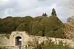 Garden walls attached to south front of Melbourne Hall with attached railings and wall to east |
| Muniment Room in Melbourne Hall gardens | Melbourne | Pavilion | Early 17th century | 10 November 1967 | SK3901625044 52°49′17″N 1°25′21″W |
1281353 | |
| Pair of cherubs to north of statue of Mercury in Melbourne Hall gardens | Melbourne | Statue | c.1700 | 10 November 1967 | SK3911525034 52°49′17″N 1°25′16″W |
1334595 | 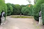 Pair of cherubs to north of statue of Mercury in Melbourne Hall gardens |
| Pair of cherubs to south of statue of Mercury in Melbourne Hall gardens | Melbourne | Statue | c.1700 | 10 November 1967 | SK3911424946 52°49′14″N 1°25′16″W |
1096412 | |
| Pair of pedestals supporting fruit bowl vase in Melbourne Hall gardens | Melbourne | Vase | Late 17th century | 10 November 1967 | SK3899825013 52°49′16″N 1°25′22″W |
1096409 | |
| Pair of pedestals with lead slaves in Melbourne Hall gardens | Melbourne | Statue | c.1700 | 10 November 1967 | SK3904325010 52°49′16″N 1°25′19″W |
1334634 | |
| Pedestal and Four Seasons Vase in Melbourne Hall gardens | Melbourne | Vase | 1705 | 10 November 1967 | SK3915124785 52°49′09″N 1°25′14″W |
1281182 | .jpg.webp) Pedestal and Four Seasons Vase in Melbourne Hall gardens |
| Pedestal with statue of Andromeda in Melbourne Hall gardens | Melbourne | Statue | c.1700 | 10 November 1967 | SK3918725027 52°49′17″N 1°25′12″W |
1334616 | .jpg.webp) Pedestal with statue of Andromeda in Melbourne Hall gardens |
| Pedestal with statue of Mercury in Melbourne Hall gardens | Melbourne | Statue | c.1700 | 10 November 1967 | SK3911624990 52°49′16″N 1°25′16″W |
1204240 | |
| Pedestal with statue of Perseus in Melbourne Hall gardens | Melbourne | Statue | c.1700 | 10 November 1967 | SK3918524950 52°49′14″N 1°25′12″W |
1096374 | |
| Pedestal with vase to south-west of Fountain Pond in Melbourne Hall garden | Melbourne | Vase | Early 18th century | 10 November 1967 | SK3918824853 52°49′11″N 1°25′12″W |
1096378 | |
| Stone fountain to north of lower terrace in Melbourne Hall gardens | Melbourne | Fountain | c.1704 | 10 November 1967 | SK3911625042 52°49′17″N 1°25′16″W |
1204272 |  Stone fountain to north of lower terrace in Melbourne Hall gardens |
| Stone fountain to south of lower terrace in Melbourne Hall gardens | Melbourne | Fountain | c.1704 | 10 November 1967 | SK3911424937 52°49′14″N 1°25′16″W |
1204317 | |
| Tea rooms to north of Melbourne Hall and attached walls | Melbourne | Country house | Early 18th century | 10 November 1967 | SK3899625066 52°49′18″N 1°25′22″W |
1334633 | .jpg.webp) Tea rooms to north of Melbourne Hall and attached walls |
| The Birdcage Arbour in Melbourne Hall gardens | Melbourne | Summerhouse | c.1705–10 | 10 November 1967 | SK3921924988 52°49′16″N 1°25′10″W |
1096375 | 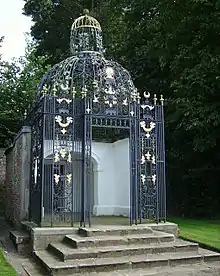 The Birdcage Arbour in Melbourne Hall gardens |
| Three pairs of vases flanking central path of upper terrace in Melbourne Hall gardens | Melbourne | Vase | Early 18th century | 11 March 1987 | SK3903224995 52°49′16″N 1°25′20″W |
1204146 | |
| Two pairs of cherubs to north-west of the Grand Basin in Melbourne Hall gardens | Melbourne | Statue | c.1700 | 10 November 1967 | SK3914125032 52°49′17″N 1°25′14″W |
1096372 | 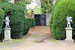 Two pairs of cherubs to north-west of the Grand Basin in Melbourne Hall gardens |
| Two pairs of cherubs to south-west of the Grand Basin in Melbourne Hall gardens | Melbourne | Statue | c.1700 | 10 November 1967 | SK3914424944 52°49′14″N 1°25′14″W |
1334615 | |
| Vase and pedestal to north-west of the Four Seasons Vase in Melbourne Hall gardens | Melbourne | Vase | Late 18th century | 10 November 1967 | SK3913624812 52°49′10″N 1°25′15″W |
1096380 | |
| Church of St Andrew | Radbourne | Parish church | 13th century | 19 January 1967 | SK2860135993 52°55′14″N 1°34′34″W |
1204062 | |
| Radbourne Hall | Radbourne | House | c.1865 | 2 September 1952 | SK2866435654 52°55′03″N 1°34′31″W |
1334517 | |
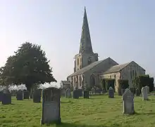
| Church of St Wystan | Repton | Parish church | 9th century | 19 January 1967 | SK3030127154 52°50′28″N 1°33′06″W |
1334560 | |
| Market Cross | Repton | Market cross | Medieval | 2 September 1952 | SK3037227016 52°50′23″N 1°33′02″W |
1096537 |  Market Cross |
| Priory Gateway, precinct walls, the tithe barn and the Lodge, Repton School | Repton | Gate | 13th century | 19 January 1967 | SK3034827110 52°50′26″N 1°33′03″W |
1055800 | 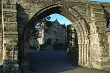 Priory Gateway, precinct walls, the tithe barn and the Lodge, Repton School |
| Remains of Priory Church and the Chapter Block, Repton School | Repton | Church remains | 13th century | 19 January 1967 | SK3037827186 52°50′29″N 1°33′02″W |
1096512 | |
| Repton Hall with Prior Overton's Tower, Repton School | Repton | House | c.1680 | 2 September 1952 | SK3031527254 52°50′31″N 1°33′05″W |
1057669 | |
| The Old Priory, attached walls and gate piers, Repton School | Repton | Former priory | Late 12th century | 2 September 1952 | SK3033827191 52°50′29″N 1°33′04″W |
1055755 | |
| Church of St James | Smisby | Parish church | 13th century | 19 January 1967 | SK3479619130 52°46′07″N 1°29′09″W |
1096467 | |
| Church of St Michael | Stanton by Bridge | Parish church | 11th century | 10 November 1967 | SK3673527150 52°50′26″N 1°27′22″W |
1088339 | |
| Swarkestone Bridge and Causeway | Stanton by Bridge | Bridge | Late 13th or early 14th century | 10 November 1967 | SK3703027810 52°50′48″N 1°27′06″W |
1088337 | 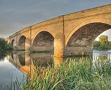 Swarkestone Bridge and Causeway |
| The Grandstand, Cuttle and Gate 200 metres north of Swarkestone Hall | Swarkestone | Pavilion | c.1630 | 10 November 1967 | SK3748428614 52°51′13″N 1°26′41″W |
1088345 | |
| Church of St Andrew | Twyford and Stenson | Parish church | 12th century | 19 January 1967 | SK3274128551 52°51′12″N 1°30′55″W |
1039117 | |
| Church of St Mary | Weston-on-Trent | Parish church | 13th century | 10 November 1967 | SK3976527597 52°50′40″N 1°24′40″W |
1205737 |
Notes
- The date given is the date used by Historic England as significant for the initial building or that of an important part in the structure's description.
- Sometimes known as OSGB36, the grid reference is based on the British national grid reference system used by the Ordnance Survey.
- The "List Entry Number" is a unique number assigned to each listed building and scheduled monument by Historic England.
See also
- Category:Grade I listed buildings in Derbyshire
- Grade II* listed buildings in Amber Valley
- Grade II* listed buildings in Bolsover (district)
- Grade II* listed buildings in Chesterfield
- Grade II* listed buildings in Derby
- Grade II* listed buildings in Derbyshire Dales
- Grade II* listed buildings in Erewash
- Grade II* listed buildings in High Peak
- Grade II* listed buildings in North East Derbyshire
- Grade II* listed buildings in South Derbyshire
References
External links
![]() Media related to Grade I listed buildings in Derbyshire at Wikimedia Commons
Media related to Grade I listed buildings in Derbyshire at Wikimedia Commons
This article is issued from Wikipedia. The text is licensed under Creative Commons - Attribution - Sharealike. Additional terms may apply for the media files.