Tabalong River
Tabalong River (Indonesian: Sungai Tabalong or Batang Tabalong) is a river traversing the Tabalong Regency, in the province of South Kalimantan, Indonesia.[1][2] The river flows into Negara River. It is a confluence of two tributaries: Left Tabalong dan Right Tabalong rivers.
| Tabalong River Batang Tabalong, Batang Tabalong, Sungai Tabalon | |
|---|---|
 | |
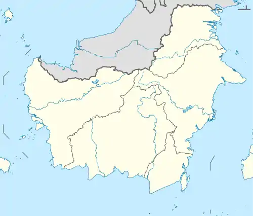 River mouth location in Kalimantan | |
| Physical characteristics | |
| Source | confluence of Left Tabalong River and Right Tabalong River |
| • location | Tabalong Regency |
| Mouth | Negara River |
• location | Amuntai |
| Length | 45 km (28 mi) |
| Width | |
| • average | 80 m (260 ft) |
| Depth | |
| • average | 3.5 m (11 ft) |
| Basin features | |
| River system | Tabalong |
| Tributaries | |
| • left | Bentot River; Anyar River |
The river has a length of 45 km, width of 80 meter and average depth of 3.5 meter.[3]
Geography
| Tabalong River | ||||||||||||||||||||||||||||||||||||||||||||||||||||||||||||
|---|---|---|---|---|---|---|---|---|---|---|---|---|---|---|---|---|---|---|---|---|---|---|---|---|---|---|---|---|---|---|---|---|---|---|---|---|---|---|---|---|---|---|---|---|---|---|---|---|---|---|---|---|---|---|---|---|---|---|---|---|
| Climate chart (explanation) | ||||||||||||||||||||||||||||||||||||||||||||||||||||||||||||
| ||||||||||||||||||||||||||||||||||||||||||||||||||||||||||||
| ||||||||||||||||||||||||||||||||||||||||||||||||||||||||||||
The river flows in the southeast area of Borneo island with predominantly tropical rainforest climate (designated as Af in the Köppen-Geiger climate classification).[5] The annual average temperature in the area is 24 °C. The warmest month is June, when the average temperature is around 26 °C, and the coldest is January, at 22 °C.[4] The average annual rainfall is 2982 mm. The wettest month is December, with an average of 392 mm rainfall, and the driest is September, with 101 mm rainfall.[6]
Use
Tabalong River provides a large swamp land, which can be used to grow rice during the dry season. However, in wet season, the discharge of the river and its tributaries increases so high, that it often threatened the harvest and caused flooding in the nearby villages.[7][8] Therefore, the local government builds flood gates to control the flow and prevent floods.[9]
The abundance of water during the wet season is actually useful to fill up the pools for fishery.[10]
References
- Sungai Tabalon at Geonames.org (cc-by); Last updated 17 January 2012; Database dump downloaded 27 November 2015
- Sungai Tabalong: Indonesia. National Geospatial-Intelligence Agency, Bethesda, MD, USA
- (in Indonesian)Pilih sungai? Pilih jalan raya?. Yusni Anani. 21 Agustus 2009
- "NASA Earth Observations Data Set Index". NASA. 30 January 2016.
- Peel, M C; Finlayson, B L; McMahon, T A (2007). "Updated world map of the Köppen-Geiger climate classification". Hydrology and Earth System Sciences. 11 (5): 1633–1644. doi:10.5194/hess-11-1633-2007.
- "NASA Earth Observations: Rainfall (1 month – TRMM)". NASA/Tropical Rainfall Monitoring Mission. 30 January 2016.
- (in Indonesian)Debit Sungai Meningkat, BPBD Tabalong Lakukan Pemantauan di Lokasi-lokasi ini. Tribun News – Hulu Sungai Utara. Penulis: Dony Usman, Editor: Didik Trio. 2 Maret 2018.
- (in Indonesian)Air Sungai Tabalong di Desa Solan Tiba-tiba Meluap, Warga Panik, Beberapa Rumah Alami Kerusakan. Tribun News banjarmasinpost.co.id – Tabalong. Penulis: Dony Usman, Editor: Elpianur Achmad. 28 November 2018.
- (in Indonesian)Sawah Sering Kebanjiran, HSU Bangun Pintu Air di Tabalong Mati. Tribun News – Hulu Sungai Utara. Penulis: Reni Kurnia Wati, Editor: Didik Trio. 22 Juli 2018.
- (in Indonesian)Musim Hujan, Jadi Momen Warga Haur Gading Kembangkan Bibit Ikan. Tribun News – Hulu Sungai Utara. Penulis: Reni Kurnia Wati, Editor: Didik Trio. 19 November 2018