Belayan River
Belayan River is a river of Borneo, Indonesia, 1300 km northeast of the capital Jakarta.[2] It is a tributary of the Mahakam River.[3]
| Belayan River | |
|---|---|
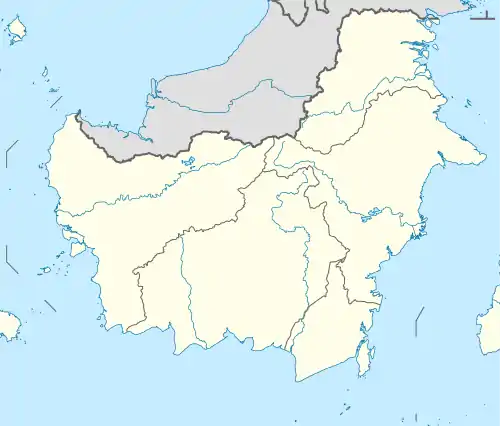 River mouth location 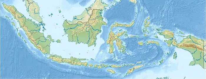 Belayan River (Indonesia) | |
| Location | |
| Country | Indonesia |
| Physical characteristics | |
| Source | |
| • location | East Kalimantan |
| Mouth | |
• location | Mahakam River |
Hydrology

The river traverses 3 districts in the upstream area of Kutai Kartanegara Regency, namely Kenohan, Kembang Janggut, and Tabang.[4] The high flow rate during flooding constantly eroded the land on the river banks, causing damages to the houses built next to it.[5] Belayan flows into Mahakam River near Muhuran, Kotabangun, and Bukit Tinjawang.[6]
Geography
| Belayan River | ||||||||||||||||||||||||||||||||||||||||||||||||||||||||||||
|---|---|---|---|---|---|---|---|---|---|---|---|---|---|---|---|---|---|---|---|---|---|---|---|---|---|---|---|---|---|---|---|---|---|---|---|---|---|---|---|---|---|---|---|---|---|---|---|---|---|---|---|---|---|---|---|---|---|---|---|---|
| Climate chart (explanation) | ||||||||||||||||||||||||||||||||||||||||||||||||||||||||||||
| ||||||||||||||||||||||||||||||||||||||||||||||||||||||||||||
| ||||||||||||||||||||||||||||||||||||||||||||||||||||||||||||
The river flows in the eastern area of Borneo island with predominantly tropical rainforest climate (designated as Af in the Köppen-Geiger climate classification).[8] The annual average temperature in the area is 23 °C. The warmest month is March, when the average temperature is around 24 °C, and the coldest is January, at 22 °C.[7] The average annual rainfall is 2780 mm. The wettest month is December, with an average of 351 mm rainfall, and the driest is August, with 138 mm rainfall.[9]
Uses
Belayan river is vital for the population along its banks for transportation, water source for daily life, and also for occupation for some inhabitants,[10] such as fish and gold.[4] The river is important for the people of three districts: Kenohan, Kembang Janggut, and Tabang, even for centuries was the only access route to those three districts.[4] At the upstream of Belayan there are some villages of Dayak Kenyak tribe, such as Ritan Baru, Tabang District, which can be reached about 1 or 2 days by boat or ferry from Samarinda.[11] It took about two days and one night to travel from Tabang to Tenggarong using river transportation.[10] The local Dayak tribe is known for wood sculptures and other handicrafts.[10]
Along the river there are many ports to transport coals from the mines in Kutai Kartanegara for export.[10]
Due to sedimentation, Belayan river needs to be dredged regularly, so that it flows steadily to the downstream and doesn't cause much flooding.[12]
Ecology
Belayan River is a habitat of Mahakam or Irrawaddy dolphin (Orcaella brevirostris), one of the river animals in the IUCN Red List of Threatened Species,[10] and also of little egret (Egretta garzetta).[10]
References
- Sungai Belayan in Chinese. English Chinese Web Dictionary.
- Rand McNally, The New International Atlas, 1993.
- Sungai Belayan at Geonames.org (cc-by); Last updated 17 January 2012; Database dump downloaded 27 November 2015
- Sungai Belayan, Urat Nadi Warga Hulu Kukar. STV Samarinda. 21 March 2018.
- Air Sungai Belayan terus Menggerus Tanah, 30 Rumah sudah Dibongkar. Penulis: Rahmad Taufik. Editor: Adhinata Kusuma. Sumber: Tribun Kaltim. 22 November 2018.
- Sungai Belayan. MapCarta
- "NASA Earth Observations Data Set Index". NASA. 30 January 2016.
- Peel, M C; Finlayson, B L; McMahon, T A (2007). "Updated world map of the Köppen-Geiger climate classification". Hydrology and Earth System Sciences. 11. doi:10.5194/hess-11-1633-2007.
- "NASA Earth Observations: Rainfall (1 month – TRMM)". NASA/Tropical Rainfall Monitoring Mission. 30 January 2016.
- Sungai Belayan, Anak Sungai Mahakam Dalam Bingkai Imaji. Yunaidi Joepoet. Ransel Kosong. Oktober 2013.
- Guide recommendations for Sungai Mahakam and Kutai?. Trip Advisor. 22 February 2014, 10:47 pm
- Sungai Belayan akan Dikeruk. Koran Kaltim. 8 August 2017.
Further reading
- (in Indonesian) Konsepsi pola penatagunaan hutan secara mikro, daerah aliran sungai Belayan, propinsi Dati I Kalimantan Timur. Banjarbaru, 1980.