Thuwa
Thuwa (Aymara for spit out, belch out,[2] also spelled Togua, Towa) is a 5,063-metre-high (16,611 ft) mountain in the Bolivian Andes. It is located in the Potosí Department, Daniel Campos Province, Llica Municipality. Thuwa lies between the Uyuni salt flat in the east and the Napa or Thuwa salt flat (Salar de Togua) in the west. The highest neighboring mountains are Jaruma in the north and Mancha in the east. The smaller mountain at the north-western slope of Thuwa is named Wiraqucha Qullu (Huirajocha Kkollu). The plain west of the mountain is named Thuwa Pampa (Towa Pampa, Pampa de Togua).[1][3]
| Thuwa | |
|---|---|
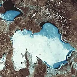 Satellite image of the Uyuni salt flat (center) and Thuwa (lower left) | |
| Highest point | |
| Elevation | 5,063 m (16,611 ft) [1] |
| Coordinates | 20°28′15″S 68°24′08″W |
| Geography | |
 Thuwa Location in Bolivia | |
| Location | Bolivia, Potosí Department |
| Parent range | Andes |
References
- Bolivian IGM map 1:250,000 Estancia Sinalaco 5932-IV
- Radio San Gabriel, "Instituto Radiofonico de Promoción Aymara" (IRPA) 1993, Republicado por Instituto de las Lenguas y Literaturas Andinas-Amazónicas (ILLLA-A) 2011, Transcripción del Vocabulario de la Lengua Aymara, P. Ludovico Bertonio 1612 (Spanish-Aymara-Aymara-Spanish dictionary) see: Tos del pecho
- "Llica". INE, Bolivia. Retrieved October 10, 2014.
Capital: Potosí | ||
| Provinces |  | |
| Municipalities (and seats) |
| |
This article is issued from Wikipedia. The text is licensed under Creative Commons - Attribution - Sharealike. Additional terms may apply for the media files.