Tornado outbreak of April 2–3, 1982
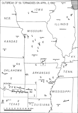
From April 2–3, 1982, a major tornado outbreak resulted in over 60 tornadoes and 30 fatalities, primarily over portions of Northeast Texas and Southwest Arkansas, as well as Southeastern Oklahoma.[nb 2] Three of the tornadoes were rated F4, and one officially was recorded as an F5 near Broken Bow, Oklahoma, all on April 2. Beginning on April 2, a series of tornado-producing supercells formed across portions of northeastern Texas and southeastern Oklahoma. One produced an F5 tornado, the first since April 4, 1977, which crossed mostly rural areas near Speer and Broken Bow, and deposited a motel sign from Broken Bow 30 miles (48 km) away in Arkansas.[nb 3] The F5 resulted in no fatalities, but an F4 tornado in Paris, Texas, resulted in 10 fatalities and 170 injuries.[11][12] Additionally, the Storm Prediction Center, known then as the Severe Local Storms Unit, issued its first tornado watch to contain the wording Particularly Dangerous Situation (PDS).[13]
 Overview of the outbreak on April 2, 1982 | |
| Type | Tornado outbreak |
|---|---|
| Duration | April 2–3, 1982 |
| Tornadoes confirmed | 63 confirmed[1] |
| Max. rating1 | F5 tornado |
| Duration of tornado outbreak2 | 1 day, 1 hour, and 55 minutes |
| Highest gust | 78 kn (90 mph; 144 km/h) in Illinois on April 3[2] |
| Largest hail | 3 in (7.6 cm) in Texas on April 2[3] |
| Damage | $390.5 million (1982 USD)[nb 1][4] $1.03 billion (2021 USD) |
| Casualties | 30 fatalities, 433 injuries |
| Areas affected | Midwestern and Southern United States, primarily the Ark-La-Tex region (Red River Valley/Piney Woods) |
Part of the tornadoes of 1982 1Most severe tornado damage; see Fujita scale 2Time from first tornado to last tornado | |
Outbreak statistics
| State | Total | County | County total |
|---|---|---|---|
| Arkansas | 14 | Faulkner | 2 |
| Fulton | 2 | ||
| Hempstead | 5 | ||
| Howard | 3 | ||
| Little River | 1 | ||
| St. Francis | 1 | ||
| Mississippi | 3 | Neshoba | 3 |
| Missouri | 1 | Howell | 1 |
| Texas | 11 | Fannin | 1 |
| Lamar | 10 | ||
| Totals | 30 | ||
| All deaths were tornado-related | |||
List of tornadoes
| FU | F0 | F1 | F2 | F3 | F4 | F5 | Total |
|---|---|---|---|---|---|---|---|
| 0 | 8 | 26 | 14 | 11 | 3 | 1 | 63 |
| "FU" denotes unclassified but confirmed tornadoes. | |||||||
April 2 event
| F# | Location | County / Parish | State | Start coord. |
Time (UTC) | Path length | Max. width | Summary | Refs. |
|---|---|---|---|---|---|---|---|---|---|
| F0 | Hot Springs area | Garland | AR | 34.50°N 93.05°W | 20:00–? | 0.1 miles (0.16 km) | 10 yards (9.1 m) | A short-lived tornado damaged a few thousand trees and utility lines. | [16][17] |
| F1 | SW of Earlham | Madison | IA | 41.45°N 94.17°W | 20:10–? | 0.5 miles (0.80 km) | 50 yards (46 m) | A brief tornado unroofed a garage, destroyed two sheds, and damaged two windmills and a farmhouse. An 80-foot-tall (24 m) radio tower was downed, shingles were torn loose, and windows were smashed as well. | [18][19] |
| F2 | Silo | Bryan | OK | 34.05°N 95.48°W | 20:25–? | 0.5 miles (0.80 km) | 30 yards (27 m) | This tornado damaged a total of 16 mobile homes and houses. One person received minor injuries. | [20][10][21] |
| F1 | E of Pink Hill to ESE of Levasy | Jackson | MO | 39.05°N 94.18°W | 20:30–? | 6.8 miles (10.9 km) | 300 yards (270 m) | This tornado sheared treetops. Nearby, a home and several buildings were damaged. | [22][23] |
| F1 | SE of Emet | Johnston | OK | 34.18°N 96.52°W | 20:30–? | 0.5 miles (0.80 km) | 10 yards (9.1 m) | A pickup truck, a barn, and several other structures were damaged or destroyed. | [24][20] |
| F1 | SSE of Levasy | Jackson | MO | 39.13°N 94.13°W | 20:32–? | 2 miles (3.2 km) | 700 yards (640 m) | This multiple-vortex tornado destroyed a couple of barns, a garage, and poles. | [25][23] |
| F0 | NW of Gerty | Hughes | OK | 34.87°N 96.33°W | 20:40–? | 0.1 miles (0.16 km) | 10 yards (9.1 m) | Trees in the countryside were downed near Allen. | [26][20] |
| F2 | NNE of Sequoyah | Rogers | OK | 36.40°N 95.55°W | 20:45–? | 1 mile (1.6 km) | 50 yards (46 m) | A school and several businesses incurred damage. | [27][20][10] |
| F1 | Baxter Springs | Cherokee | KS | 37.02°N 94.73°W | 20:50–? | 0.2 miles (0.32 km) | 17 yards (16 m) | Mobile homes and other structures received damage, as well as roofing, windows, and electrical lines. | [28][19] |
| F3 | N of Marietta | Love | OK | 33.97°N 97.12°W | 20:50–? | 0.5 miles (0.80 km) | 30 yards (27 m) | This tornado derailed 24 freight cars, most of which were unfilled. Outbuildings and trees were also damaged nearby. Grazulis did not list this tornado as significant (F2 or stronger). | [29][20][14] |
| F2 | ENE of Pryor Creek | Mayes | OK | 36.33°N 95.27°W | 21:00–? | 0.5 miles (0.80 km) | 10 yards (9.1 m) | This tornado flipped a mobile home. Grazulis did not list the tornado as significant (F2 or stronger). | [30][20][14] |
| F2 | NE of Bokchito | Bryan | OK | 34.03°N 96.13°W | 21:05–? | 0.5 miles (0.80 km) | 10 yards (9.1 m) | This tornado damaged seven homes near Bokchito. | [31][20][10] |
| F0 | NE of Iconium | St. Clair | MO | 38.12°N 93.53°W | 21:07–? | 0.3 miles (0.48 km) | 50 yards (46 m) | A brief touchdown failed to produce any damage. | [32][23] |
| F3 | WNW of Boswell to N of Soper | Choctaw | OK | 34.07°N 95.95°W | 21:10–? | 8 miles (13 km) | 100 yards (91 m) | Farms and outbuildings sustained $100,000 in losses. | [33][20][10] |
| F0 | E of Green Ridge | MO | MO | 38.62°N 93.40°W | 21:15–? | 0.3 miles (0.48 km) | 50 yards (46 m) | No damage was reported. | [34][23] |
| F3 | N of Ector to N of Brookston | Fannin, Lamar | TX | 33.63°N 96.28°W | 21:20–21:55 | 32 miles (51 km) | 150 yards (140 m) | 1 death – This tornado developed near Ravenna and tracked eastward at 50 mph (80 km/h) through Allen Chapel and Allen Point. The most extensive damage occurred in these two communities; an elderly woman in the area was killed, and her husband sustained injuries. Along its entire path, the tornado destroyed numerous frame houses, mobile homes, barns, and rural outbuildings. | [35][36][37][12][10] |
| F1 | SSW of Waverly | Lafayette | MO | 39.17°N 93.55°W | 21:25–? | 1.3 miles (2.1 km) | 50 yards (46 m) | This tornado felled trees in an orchard. | [38][23] |
| F2 | N of Bonham | Fannin | TX | 33.65°N 96.17°W | 21:25–? | 1 mile (1.6 km) | 30 yards (27 m) | Trees were damaged near Lake Bonham. Grazulis did not list this tornado as significant (F2 or stronger). | [39][37][12][14] |
| F2 | WSW of Keo | Lonoke | AR | 34.60°N 92.02°W | 21:45–? | 1 mile (1.6 km) | 100 yards (91 m) | This was the first member of a long-tracked tornado family whose parent thunderstorm traveled as far as Forrest City. Two homes and a cropdusting firm were destroyed or damaged. Two people were injured. A 100-mile-long (160 km) swath of scattered damage was reported in association with the parent thunderstorm. | [17][10][40] |
| F5 | SSW of Hamden to S of Eagletown | Choctaw, McCurtain | OK | 34.13°N 95.57°W | 21:50–? | 53 miles (85 km) | 500 yards (460 m) | See section on this tornado – 29 people were injured. | [41][42][20][10][43][44] |
| F2 | Slovak area | Prairie | AR | 34.65°N 91.58°W | 22:00–? | 2.5 miles (4.0 km) | 17 yards (16 m) | This short-lived tornado damaged rural shops, roofs, outbuildings, machinery, and electrical transmission towers. | [17][45][46] |
| F4 | ESE of Toco to NE of Detroit | Lamar, Red River | TX | 33.65°N 95.63°W | 22:00–22:30 | 23 miles (37 km) | 250 yards (230 m) | 10 deaths – See section on this tornado – 170 people were injured. | [47][48][49][45][12][4] |
| F1 | SSW of Paris | Lamar | TX | 33.63°N 95.58°W | 22:05–? | 1 mile (1.6 km) | 50 yd (46 m) | This tornado coincided with and may have been related to outflow from the previous tornado. A small structure was destroyed on the outskirts of Paris. | [49][50] |
| F2 | ESE of Detroit to ENE of Bagwell | Red River | TX | 33.63°N 95.22°W | 22:30–? | 5 miles (8.0 km) | 100 yd (91 m) | Some businesses and homes were unroofed. Trees were torn apart as well. | [51][52][45] |
| F1 | N of Clarksville | Red River | TX | 33.65°N 95.05°W | 22:40–22:42 | 2 miles (3.2 km) | 1,050 yd (960 m) | This was a large tornado, yet only minor damage was reported. | [53][52] |
| F3 | NE of Clarksville to NW of Ogden, AR | Red River (TX), Bowie (TX), McCurtain (OK), Little River (AR) | TX, OK, AR | 33.63°N 95.03°W | 22:40–? | 52 miles (84 km) | 400 yd (370 m) | 1 death – See section on this tornado – Four people were injured. | [52][54][17][45] |
| F2 | Brinkley | Monroe | AR | 34.88°N 91.18°W | 22:49–? | 0.1 miles (0.16 km) | 10 yd (9.1 m) | Twenty transmission towers were downed. Several homes, farms, and a cemetery were damaged as well. | [17][45][55] |
| F2 | Forrest City | St. Francis | AR | 35.02°N 90.77°W | 23:15–? | 1.6 miles (2.6 km) | 60 yd (55 m) | 1 death – This tornado damaged or destroyed a dozen homes, seven mobile homes, six businesses, and a school. 13 people were injured. | [56][45][17] |
| F4 | WSW of Stringtown to ESE of Wallaceburg | Sevier, Howard, Hempstead | AR | 33.93°N 94.28°W | 23:20–? | 45 miles (72 km) | 200 yd (180 m) | 3 deaths – This powerful tornado proceeded generally eastward at 25 mph (40 km/h) and affected several rural communities. 15 homes, two mobile homes, 16 chicken coops, and various outbuildings were damaged or destroyed, along with many trees. All of the deaths occurred in the community of Buck Range, near Nashville. 23 (possibly 27) people were injured. | [17][57] |
Speer–Messer–Golden–Broken Bow, Oklahoma
| F5 tornado | |
|---|---|
| Max. rating1 | F5 tornado |
| Casualties | 0 fatalities, 29 injuries |
| 1Most severe tornado damage; see Fujita scale | |
This powerful, multiple-vortex tornado touched down near Speer, tracked east-southeastward through the rural community of Messer, and traversed the Hugo Reservoir.[20] A newly constructed home near Messer was obliterated, with only strips of carpet tacking left unmoved. At the time the tornado was assigned a rating of F5 based on this damage and is still listed as an F5 in official records. Photographs of the bare concrete slab suggested, however, that the home was improperly anchored: only F3-level winds may have been needed to produce the observable effects on the structure.[10] Further on, the tornado attained a peak width of 1 1⁄2 mi (2.4 km; 2,600 yd; 2,400 m) and produced F4-level damage to ranch-style homes near Golden. In all, the tornado destroyed approximately 35 homes and yielded losses of $8 million, though it missed densely populated areas.[10][43] The tornado also destroyed chicken coops, mobile homes, and a church, along with agricultural implements, electrical lines, and tracts of timber. Up to 40 barns were wrecked as well.[20] As it passed just south of Broken Bow, the tornado struck the Tri-A-Nite Motel;[44] signage from the motel was later found 30 mi (48 km) distant, in Arkansas.[10] Near Messer, the tornado hurled a 2-by-4-inch (51 by 102 mm) board into and pierced a tree.[20] 29 injuries occurred along the path.[4]
Paris–Reno–Blossom, Texas
| F4 tornado | |
|---|---|
| Max. rating1 | F4 tornado |
| Casualties | 10 fatalities, 170 injuries |
| 1Most severe tornado damage; see Fujita scale | |
This destructive tornado, the deadliest of the outbreak, headed eastward through the northern section of Paris. It extensively damaged or destroyed more than 465 residences and left approximately 1,000 people homeless in town.[49] Of the 10 deaths in Paris, two occurred at a trailer park; the rest of the fatalities were mainly in unsheltered locations. Debris from the trailer park was dispersed for hundreds of yards.[45][49] Most of the damage in Paris was rated F2 or F3 on the Fujita scale, but a few CBS homes sustained low-end F4-level damage. These homes, however, were dubiously constructed, so the official rating may have been too high.[57][49] Large, well-built apartments with numerous interior walls were unroofed as the "ragged funnel cloud" left behind $50 million in losses at Paris.[58] 92 homes and other structures were heavily damaged or destroyed in the neighbouring communities of Reno and Blossom.[49] The tornado attained a peak width of 300 yd (270 m; 0.17 mi; 0.27 km).
White Rock–Beaver Dam, Texas/Ashdown, Arkansas
| F3 tornado | |
|---|---|
| Max. rating1 | F3 tornado |
| Casualties | 1 fatality, 4 injuries |
| 1Most severe tornado damage; see Fujita scale | |
This intense, long-tracked tornado first destroyed barns, outbuildings, trees, and electrical lines as it struck White Rock. Brick-built homes in the area were wrecked as well.[45][52] The tornado tracked to the north of Annona, Avery, and English. The tornado then entered Bowie County and destroyed five homes in Beaver Dam. Two minor injuries occurred nearby. The tornado then widened to 400 yd (370 m) as it neared the Red River. Upon crossing the river into Oklahoma, it produced a 4-mile-long (6.4 km) swath of damaged trees through McCurtain County. Some outbuildings were also damaged as the tornado passed through southeastern Oklahoma.[54][45] In Arkansas, the tornado destroyed 17 homes, a paper mill, a granary, and an orchard. One of the homes dated to the early nineteenth century.[17] One person died and two others were injured near Ashdown before the tornado dissipated.[59][45]
See also
Notes
- All losses are in 1982 USD unless otherwise noted.
- An outbreak is generally defined as a group of at least six tornadoes (the number sometimes varies slightly according to local climatology) with no more than a six-hour gap between individual tornadoes. An outbreak sequence, prior to (after) the start of modern records in 1950, is defined as a period of no more than two (one) consecutive days without at least one significant (F2 or stronger) tornado.[5][6][7][8][9]
- Tornado researcher Thomas P. Grazulis contested the official F5 rating, having concluded that the basis for it was unsound.[10]
- All dates are based on the local time zone where the tornado touched down; however, all times are in Coordinated Universal Time and dates are split at midnight CST/CDT for consistency.
- Prior to 1994, only the average widths of tornado paths were officially listed.[15]
References
- National Weather Service (30 September 2019). Grazulis, Thomas P.; Grazulis, Doris (eds.). Tornado History Project: Maps and Statistics. Tornado History Project (Report). The Tornado Project of Environmental Films. Retrieved 11 October 2020.
- National Weather Service (September 2020). Events reported between 04/01/1982 and 04/03/1982 (3 days). Storm Events Database (Report). National Centers for Environmental Information. Retrieved 2 January 2020.
- National Weather Service (September 2020). Events reported between 04/01/1982 and 04/03/1982 (3 days). Storm Events Database (Report). National Centers for Environmental Information. Retrieved 2 January 2020.
- National Weather Service (December 2019). Events reported between 04/01/1982 and 04/03/1982 (3 days). Storm Events Database (Report). National Centers for Environmental Information. Retrieved 19 March 2020.
- Schneider, Russell S.; Brooks, Harold E.; Schaefer, Joseph T. (2004). Tornado Outbreak Day Sequences: Historic Events and Climatology (1875-2003) (PDF). 22nd Conference on Severe Local Storms. Hyannis, Massachusetts: American Meteorological Society. Retrieved 17 September 2019.
- Hagemeyer, Bartlett C. (September 1997). "Peninsular Florida Tornado Outbreaks". Weather and Forecasting. Boston: American Meteorological Society. 12 (3): 400. Bibcode:1997WtFor..12..399H. doi:10.1175/1520-0434(1997)012<0399:PFTO>2.0.CO;2.

- Hagemeyer 1997, p. 401
- Hagemeyer, Bartlett C.; Spratt, Scott M. (2002). Written at Melbourne, Florida. Thirty Years After Hurricane Agnes: the Forgotten Florida Tornado Disaster (PDF). 25th Conference on Hurricanes and Tropical Meteorology. San Diego, California: American Meteorological Society. Archived from the original (PDF) on 16 October 2008. Retrieved 24 November 2019.
- Grazulis, Thomas P. (2001). The Tornado: Nature's Ultimate Windstorm. Norman: University of Oklahoma Press. p. 206. ISBN 978-0-8061-3538-0.
- Grazulis, Thomas P. (July 1993). Significant Tornadoes 1680–1991: A Chronology and Analysis of Events. St. Johnsbury, Vermont: The Tornado Project of Environmental Films. p. 1235. ISBN 1-879362-03-1.
- Ferguson, Edward W.; Schaefer, Joseph T.; Weiss, Steven J.; Wilson, Larry F.; Ostby, Frederick P. (1983). "Tornado 1982: A Near-Record Year". Monthly Weather Review. 111 (8): 1665–1678. Bibcode:1983MWRv..111.1665F. doi:10.1175/1520-0493(1983)111<1665:TANRY>2.0.CO;2. ISSN 1520-0493.
- "Remembering The Paris Tornado: April 2, 1982". National Weather Service Weather Forecast Office Dallas/Fort Worth, TX. Fort Worth, Texas: National Weather Service. 15 October 2008. Archived from the original on 13 June 2010. Retrieved 17 March 2020.
- Edwards, Roger; Fred Ostby. "Time Line of SELS and SPC". Historical SELS and SPC Images. Storm Prediction Center. Retrieved 18 March 2020.
- Grazulis 1993, pp. 1235–8
- Brooks, Harold E. (April 2004). "On the Relationship of Tornado Path Length and Width to Intensity". Weather and Forecasting. Boston: American Meteorological Society. 19 (2): 310. Bibcode:2004WtFor..19..310B. doi:10.1175/1520-0434(2004)019<0310:OTROTP>2.0.CO;2. Retrieved 11 September 2019.
- National Weather Service (April 2020). Arkansas Event Report: F0 Tornado. Storm Events Database (Report). National Centers for Environmental Information. Retrieved 4 August 2020.
- National Weather Service (April 1982). "Storm Data and Unusual Weather Phenomena". Storm Data. Asheville, North Carolina: National Climatic Data Center. 24 (4): 11.
- National Weather Service (April 2020). Iowa Event Report: F1 Tornado. Storm Events Database (Report). National Centers for Environmental Information. Retrieved 4 August 2020.
- Storm Data 1982, p. 17
- Storm Data 1982, p. 26
- National Weather Service (December 2019). Oklahoma Event Report: F2 Tornado. Storm Events Database (Report). National Centers for Environmental Information. Retrieved 22 March 2020.
- National Weather Service (April 2020). Missouri Event Report: F1 Tornado. Storm Events Database (Report). National Centers for Environmental Information. Retrieved 4 August 2020.
- Storm Data 1982, p. 21
- National Weather Service (April 2020). Oklahoma Event Report: F1 Tornado. Storm Events Database (Report). National Centers for Environmental Information. Retrieved 4 August 2020.
- National Weather Service (April 2020). Missouri Event Report: F1 Tornado. Storm Events Database (Report). National Centers for Environmental Information. Retrieved 4 August 2020.
- National Weather Service (April 2020). Oklahoma Event Report: F0 Tornado. Storm Events Database (Report). National Centers for Environmental Information. Retrieved 4 August 2020.
- National Weather Service (April 2020). Oklahoma Event Report: F2 Tornado. Storm Events Database (Report). National Centers for Environmental Information. Retrieved 4 August 2020.
- National Weather Service (April 2020). Kansas Event Report: F1 Tornado. Storm Events Database (Report). National Centers for Environmental Information. Retrieved 4 August 2020.
- National Weather Service (April 2020). Oklahoma Event Report: F3 Tornado. Storm Events Database (Report). National Centers for Environmental Information. Retrieved 4 August 2020.
- National Weather Service (April 2020). Oklahoma Event Report: F2 Tornado. Storm Events Database (Report). National Centers for Environmental Information. Retrieved 4 August 2020.
- National Weather Service (April 2020). Oklahoma Event Report: F2 Tornado. Storm Events Database (Report). National Centers for Environmental Information. Retrieved 4 August 2020.
- National Weather Service (April 2020). Missouri Event Report: F0 Tornado. Storm Events Database (Report). National Centers for Environmental Information. Retrieved 4 August 2020.
- National Weather Service (April 2020). Oklahoma Event Report: F3 Tornado. Storm Events Database (Report). National Centers for Environmental Information. Retrieved 4 August 2020.
- National Weather Service (April 2020). Missouri Event Report: F0 Tornado. Storm Events Database (Report). National Centers for Environmental Information. Retrieved 4 August 2020.
- National Weather Service (April 2020). Texas Event Report: F3 Tornado. Storm Events Database (Report). National Centers for Environmental Information. Retrieved 4 August 2020.
- National Weather Service (April 2020). Texas Event Report: F3 Tornado. Storm Events Database (Report). National Centers for Environmental Information. Retrieved 4 August 2020.
- Storm Data 1982, p. 29
- National Weather Service (April 2020). Missouri Event Report: F1 Tornado. Storm Events Database (Report). National Centers for Environmental Information. Retrieved 4 August 2020.
- National Weather Service (April 2020). Texas Event Report: F2 Tornado. Storm Events Database (Report). National Centers for Environmental Information. Retrieved 4 August 2020.
- National Weather Service (December 2019). Arkansas Event Report: F2 Tornado. Storm Events Database (Report). National Centers for Environmental Information. Retrieved 24 March 2020.
- National Weather Service (April 2020). Oklahoma Event Report: F5 Tornado. Storm Events Database (Report). National Centers for Environmental Information. Retrieved 4 August 2020.
- National Weather Service (April 2020). Oklahoma Event Report: F5 Tornado. Storm Events Database (Report). National Centers for Environmental Information. Retrieved 4 August 2020.
- Fujita, Ted, ed. (April 1982). Written at Chicago. "Red River Region of the April 2, 1982 Tornado Outbreak". Outstanding Storms of the Month. Storm Data. Asheville, North Carolina: National Climatic Data Center. 24 (4): 6.
- Fujita 1982, p. 7
- Grazulis 1993, p. 1236
- National Weather Service (February 2020). Arkansas Event Report: F2 Tornado. Storm Events Database (Report). National Centers for Environmental Information. Retrieved 4 June 2020.
- National Weather Service (April 2020). Texas Event Report: F4 Tornado. Storm Events Database (Report). National Centers for Environmental Information. Retrieved 4 August 2020.
- National Weather Service (April 2020). Texas Event Report: F4 Tornado. Storm Events Database (Report). National Centers for Environmental Information. Retrieved 4 August 2020.
- Storm Data 1982, pp. 29–30
- National Weather Service (February 2020). Texas Event Report: F1 Tornado. Storm Events Database (Report). National Centers for Environmental Information. Retrieved 5 June 2020.
- National Weather Service (February 2020). Texas Event Report: F2 Tornado. Storm Events Database (Report). National Centers for Environmental Information. Retrieved 5 June 2020.
- Storm Data 1982, p. 30
- National Weather Service (February 2020). Texas Event Report: F1 Tornado. Storm Events Database (Report). National Centers for Environmental Information. Retrieved 5 June 2020.
- Storm Data 1982, p. 27
- National Weather Service (February 2020). Arkansas Event Report: F2 Tornado. Storm Events Database (Report). National Centers for Environmental Information. Retrieved 5 June 2020.
- National Weather Service (February 2020). Arkansas Event Report: F2 Tornado. Storm Events Database (Report). National Centers for Environmental Information. Retrieved 5 June 2020.
- Grazulis 1993, p. 1237
- Grazulis 1993, pp. 1236–7
- National Weather Service (February 2020). Arkansas Event Report: F3 Tornado. Storm Events Database (Report). National Centers for Environmental Information. Retrieved 5 June 2020.