Trail, Oregon
Trail is a census-designated place and unincorporated community in Jackson County, Oregon, United States. As of the 2010 census it had a population of 702.[2] It has a post office with a ZIP code of 97541.[1][3]
Trail, Oregon | |
|---|---|
 An aerial image of Trail and the Rogue River | |
 Trail  Trail | |
| Coordinates: 42°38′54″N 122°48′38″W | |
| Country | United States |
| State | Oregon |
| County | Jackson |
| Area | |
| • Total | 6.88 sq mi (17.83 km2) |
| • Land | 6.80 sq mi (17.61 km2) |
| • Water | 0.08 sq mi (0.21 km2) |
| Elevation | 1,430 ft (440 m) |
| Population (2010) | |
| • Total | 702 |
| • Density | 103/sq mi (39.9/km2) |
| Time zone | UTC-8 (Pacific (PST)) |
| • Summer (DST) | UTC-7 (PDT) |
| ZIP code | 97541 |
| FIPS code | 41-74400 |
| GNIS feature ID | 1151362 |
Trail lies at the intersection of Oregon Route 227 and Oregon Route 62, just north of Shady Cove and west of Lost Creek Lake, a reservoir of the Rogue River. Trail is located around the mouth of Trail Creek at the Rogue River.[4]
Climate
This region experiences warm (but not hot) and dry summers, with no average monthly temperatures above 71.6 °F. According to the Köppen Climate Classification system, Trail has a warm-summer Mediterranean climate, abbreviated "Csb" on climate maps.[5]
References
- "Trail". Geographic Names Information System. United States Geological Survey. November 28, 1980. Retrieved December 8, 2013.
- "Geographic Identifiers: 2010 Census Summary File 1 (G001): Trail CDP, Oregon". American Factfinder. U.S. Census Bureau. Archived from the original on February 13, 2020. Retrieved October 30, 2018.
- Zip Code Lookup
- "Trail, OR". Google Maps. Retrieved December 8, 2013.
- Climate Summary for Trail, Oregon
Municipalities and communities of Jackson County, Oregon, United States | ||
|---|---|---|
| Cities | 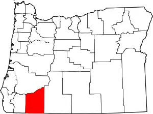 Jackson County map | |
| CDPs | ||
| Other unincorporated communities | ||
| Ghost towns | ||
| ||
This article is issued from Wikipedia. The text is licensed under Creative Commons - Attribution - Sharealike. Additional terms may apply for the media files.