Rogue Elk, Oregon
Rogue Elk is an unincorporated community in Jackson County, Oregon, United States.[1] It lies along Oregon Route 62 and the Rogue River between Shady Cove and Prospect.[2] Elk Creek enters the river at Rogue Elk.[2]
Rogue Elk, Oregon | |
|---|---|
 Rogue Elk  Rogue Elk | |
| Coordinates: 42°39′44″N 122°45′34″W | |
| Country | United States |
| State | Oregon |
| County | Jackson |
| Elevation | 1,486 ft (453 m) |
| Time zone | UTC-8 (Pacific (PST)) |
| • Summer (DST) | UTC-7 (PDT) |
| GNIS feature ID | 1159019[1] |
| Coordinates and elevation from Geographic Names Information System[1] | |
Rogue Elk County Park is by the river. This 33-acre (13 ha) park offers river access, fishing, rafting, swimming, and picnicking. It has riverfront campsites as well as sites for recreational vehicles (RVs) with hookups for water and electricity. Amenities include restrooms, showers, barbecues, a playground, and a two-lane boat ramp, which is open year-round. The campground is generally open from mid-March to late October.[3]
References
- "Rogue Elk". Geographic Names Information System. United States Geological Survey. May 22, 1986. Retrieved January 8, 2017.
- Oregon Atlas & Gazetteer (7th ed.). Yarmouth, Maine: DeLorme. 2008. p. 61. ISBN 0-89933-347-8.
- "Jackson County Parks: Rogue Elk". Jackson County, Oregon. Retrieved January 9, 2017.
Municipalities and communities of Jackson County, Oregon, United States | ||
|---|---|---|
| Cities | 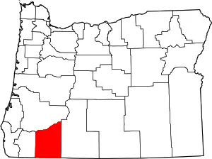 Jackson County map | |
| CDPs | ||
| Other unincorporated communities | ||
| Ghost towns | ||
| ||
This article is issued from Wikipedia. The text is licensed under Creative Commons - Attribution - Sharealike. Additional terms may apply for the media files.