Ruch, Oregon
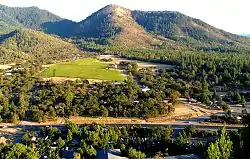
Ruch is an unincorporated community and census-designated place (CDP) in Jackson County, Oregon, United States. It is located on Oregon Route 238, southeast of Grants Pass. As of the 2010 census it had a population of 840.[1]
Ruch, Oregon | |
|---|---|
 | |
 Ruch  Ruch | |
| Coordinates: 42°14′14″N 123°2′29″W | |
| Country | United States |
| State | Oregon |
| County | Jackson |
| Area | |
| • Total | 6.73 sq mi (17.44 km2) |
| • Land | 6.73 sq mi (17.44 km2) |
| • Water | 0.0 sq mi (0.0 km2) |
| Elevation | 1,527 ft (465 m) |
| Population (2010) | |
| • Total | 840 |
| • Density | 125/sq mi (48.2/km2) |
| Time zone | UTC-8 (Pacific (PST)) |
| • Summer (DST) | UTC-7 (PDT) |
| ZIP code | 97530 |
| Area code(s) | 458 and 541 |
| FIPS code | 41-64150 |
| GNIS feature ID | 1148830 |
Ruch was named for Casper M. Ruch, who bought a tract of land where the community now stands in 1896. He built a blacksmith shop, a store and a house. When he was appointed postmaster of the new post office in 1897 and allowed to name it, he named it after himself. The post office closed in 1939.[2]
There are two structures listed on the National Register of Historic Places in Ruch—McKee Bridge and Star Ranger Station.
The Ruch area is home to several Oregon wineries and is in the Applegate Valley AVA, a sub-appellation of the Rogue Valley AVA (American Viticultural Area). A small elementary school, Ruch Elementary, is located near the center of the community. The school serves Kindergarten - 8th grade with the Cougars as their mascot.
The Applegate River runs through the southwest edge of the valley.
Climate
Ruch has a warm-summer Mediterranean climate (Csb) according to the Köppen climate classification system.
| Climate data for Ruch | |||||||||||||
|---|---|---|---|---|---|---|---|---|---|---|---|---|---|
| Month | Jan | Feb | Mar | Apr | May | Jun | Jul | Aug | Sep | Oct | Nov | Dec | Year |
| Record high °F (°C) | 69 (21) |
81 (27) |
84 (29) |
91 (33) |
102 (39) |
109 (43) |
109 (43) |
111 (44) |
106 (41) |
102 (39) |
77 (25) |
71 (22) |
111 (44) |
| Average high °F (°C) | 49.3 (9.6) |
55.6 (13.1) |
60.1 (15.6) |
65.1 (18.4) |
74.3 (23.5) |
81.7 (27.6) |
90.3 (32.4) |
89.6 (32.0) |
83.7 (28.7) |
70.8 (21.6) |
54.9 (12.7) |
47.6 (8.7) |
68.6 (20.3) |
| Average low °F (°C) | 29.9 (−1.2) |
30.6 (−0.8) |
33 (1) |
35.4 (1.9) |
41.1 (5.1) |
46.6 (8.1) |
50.5 (10.3) |
49.6 (9.8) |
44 (7) |
37.8 (3.2) |
33.6 (0.9) |
29.9 (−1.2) |
38.5 (3.6) |
| Record low °F (°C) | 8 (−13) |
2 (−17) |
18 (−8) |
20 (−7) |
25 (−4) |
30 (−1) |
34 (1) |
32 (0) |
22 (−6) |
17 (−8) |
12 (−11) |
−3 (−19) |
−3 (−19) |
| Average precipitation inches (mm) | 4.17 (106) |
2.55 (65) |
2.82 (72) |
1.77 (45) |
1.17 (30) |
0.73 (19) |
0.38 (9.7) |
0.45 (11) |
0.79 (20) |
1.6 (41) |
3.76 (96) |
4.68 (119) |
24.87 (632) |
| Average snowfall inches (cm) | 2.8 (7.1) |
2.8 (7.1) |
1.6 (4.1) |
0.1 (0.25) |
0 (0) |
0 (0) |
0 (0) |
0 (0) |
0 (0) |
0 (0) |
0.6 (1.5) |
3.8 (9.7) |
11.7 (30) |
| Average precipitation days | 14 | 11 | 13 | 11 | 7 | 5 | 2 | 2 | 4 | 7 | 14 | 14 | 104 |
| Source: [3] | |||||||||||||
References
- "Geographic Identifiers: 2010 Census Summary File 1 (G001): Ruch CDP, Oregon". American Factfinder. U.S. Census Bureau. Archived from the original on February 13, 2020. Retrieved October 30, 2018.
- McArthur, Lewis A.; McArthur, Lewis L. (2003) [1928]. Oregon Geographic Names (7th ed.). Portland, Oregon: Oregon Historical Society Press. p. 830. ISBN 978-0875952772.
- "RUCH, OR (357391)". Western Regional Climate Center. Retrieved November 26, 2015.
External links
Municipalities and communities of Jackson County, Oregon, United States | ||
|---|---|---|
| Cities | 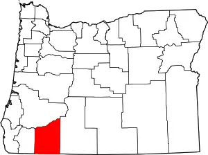 Jackson County map | |
| CDPs | ||
| Other unincorporated communities | ||
| Ghost towns | ||
| ||