McKee Bridge, Oregon
McKee Bridge is an unincorporated community in Jackson County, Oregon, United States.[1] It lies south of Ruch along Upper Applegate Road off Oregon Route 238.[2] The Applegate River flows by the community, in the Rogue River – Siskiyou National Forest.[2]
McKee Bridge, Oregon | |
|---|---|
_(jacDA0033).jpg.webp) Pedestrian bridge over the Applegate River at McKee Bridge | |
 McKee Bridge  McKee Bridge | |
| Coordinates: 42.128°N 123.076°W | |
| Country | United States |
| State | Oregon |
| County | Jackson |
| Elevation | 1,676 ft (511 m) |
| Time zone | UTC-8 (Pacific (PST)) |
| • Summer (DST) | UTC-7 (PDT) |
| ZIP code | 97530 |
| Area code(s) | 458 and 541 |
| GNIS feature ID | 1135061[1] |
| Coordinates and elevation from Geographic Names Information System[1] | |
A covered bridge called McKee Bridge crosses the river at this point.[3] McKee Picnic Ground, a national forest site, is at the west end of the bridge along the river.[3]
References
- "McKee Bridge". Geographic Names Information System. United States Geological Survey. November 1, 1991. Retrieved January 8, 2017.
- Oregon Atlas & Gazetteer (7th ed.). Yarmouth, Maine: DeLorme. 2008. p. 68. ISBN 0-89933-347-8.
- "Applegate River (McKee) Covered Bridge" (PDF). Oregon Department of Transportation. Retrieved January 8, 2017.
Municipalities and communities of Jackson County, Oregon, United States | ||
|---|---|---|
| Cities | 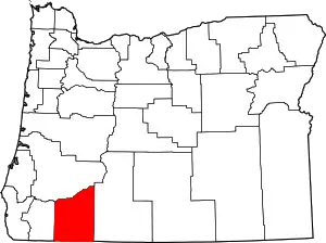 Jackson County map | |
| CDPs | ||
| Other unincorporated communities | ||
| Ghost towns | ||
| ||
This article is issued from Wikipedia. The text is licensed under Creative Commons - Attribution - Sharealike. Additional terms may apply for the media files.