Starvation Heights, Oregon
Starvation Heights is an unincorporated community in Jackson County, in the U.S. state of Oregon.[1] It is about 4 miles (6 km) north of the community of Rogue River, and 9 miles (14 km) east-northeast of Grants Pass.[2] It lies along East Evans Creek Road off Interstate 5 and Oregon Route 99.[2]
Starvation Heights, Oregon | |
|---|---|
 Starvation Heights  Starvation Heights | |
| Coordinates: 42°29′07″N 123°10′05″W | |
| Country | United States |
| State | Oregon |
| County | Jackson |
| Elevation | 1,332 ft (406 m) |
| Time zone | UTC-8 (Pacific (PST)) |
| • Summer (DST) | UTC-7 (PDT) |
| Area code(s) | 458 and 541 |
| GNIS feature ID | 1136786[1] |
| Coordinates and elevation from Geographic Names Information System[1] | |
It was named before 1883 for its poor and infertile soil, a granite-like mix which supported only scrub vegetation. The neighboring rise is slightly lower in elevation, but had rich soil. Failed farmers were said to be "starved out" when they moved on.[3]
References
- "Starvation Heights". Geographic Names Information System. United States Geological Survey. November 20, 1980. Retrieved January 9, 2017.
- Oregon Atlas & Gazetteer (7th ed.). Yarmouth, Maine: DeLorme. 2008. p. 61. ISBN 978-0-89933-347-2.
- Sund, Cheryl Martin (2009). Rogue River: Images of America. Arcadia Publishing. p. 14. ISBN 978-0-7385-7091-4. Retrieved August 15, 2011 – via Google Books.
Municipalities and communities of Jackson County, Oregon, United States | ||
|---|---|---|
| Cities | 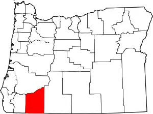 Jackson County map | |
| CDPs | ||
| Other unincorporated communities | ||
| Ghost towns | ||
| ||
This article is issued from Wikipedia. The text is licensed under Creative Commons - Attribution - Sharealike. Additional terms may apply for the media files.