Tuscarawas Township, Stark County, Ohio
Tuscarawas Township is one of the seventeen townships of Stark County, Ohio, United States. The 2000 census found 6,093 people in the township.[3]
Tuscarawas Township, Stark County, Ohio | |
|---|---|
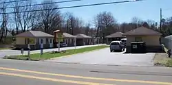 an old Motor Lodge on the Lincoln Highway | |
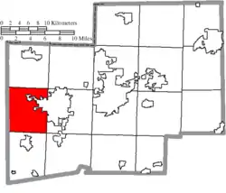 Location of Tuscarawas Township in Stark County | |
| Coordinates: 40°47′26″N 81°35′7″W | |
| Country | United States |
| State | Ohio |
| County | Stark |
| Area | |
| • Total | 30.3 sq mi (78.4 km2) |
| • Land | 30.2 sq mi (78.3 km2) |
| • Water | 0.0 sq mi (0.0 km2) |
| Elevation | 1,070 ft (326 m) |
| Population (2000) | |
| • Total | 6,093 |
| • Density | 201.4/sq mi (77.8/km2) |
| Time zone | UTC-5 (Eastern (EST)) |
| • Summer (DST) | UTC-4 (EDT) |
| ZIP code | 44666, 44647, 44618 |
| Area code(s) | 330 |
| FIPS code | 39-77910[2] |
| GNIS feature ID | 1086991[1] |
Geography
Located in the western part of the county, it borders the following townships:
- Lawrence Township - north
- Jackson Township - northeast corner
- Perry Township - east
- Bethlehem Township - southeast corner
- Sugar Creek Township - south
- Sugar Creek Township, Wayne County - west
- Baughman Township, Wayne County - northwest
Part of the city of Massillon is located in eastern Tuscarawas Township.
Name and history
Statewide, the only other Tuscarawas Township is located in Coshocton County. In 1833, Tuscarawas Township consisted of 1 gristmill, 5 saw mills, 1 fulling mill, 2 tanneries, and 2 stores.[4]
Government
The township is governed by a three-member board of trustees, who are elected in November of odd-numbered years to a four-year term beginning on the following January 1. Two are elected in the year after the presidential election and one is elected in the year before it. There is also an elected township fiscal officer,[5] who serves a four-year term beginning on April 1 of the year after the election, which is held in November of the year before the presidential election. Vacancies in the fiscal officership or on the board of trustees are filled by the remaining trustees.
References
- "US Board on Geographic Names". United States Geological Survey. 2007-10-25. Retrieved 2008-01-31.
- "U.S. Census website". United States Census Bureau. Retrieved 2008-01-31.
- Stark County, Ohio — Population by Places Estimates Ohio State University, 2007. Accessed 15 May 2007.
- Kilbourn, John (1833). The Ohio Gazetteer, or, a Topographical Dictionary. Scott and Wright. pp. 448. Retrieved 12 December 2013.
- §503.24, §505.01, and §507.01 of the Ohio Revised Code. Accessed 4/30/2009.
External links
Municipalities and communities of Stark County, Ohio, United States | ||
|---|---|---|
| Cities | 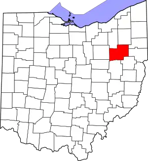 Map of Ohio highlighting Stark County | |
| Villages | ||
| Townships | ||
| CDPs | ||
| Unincorporated communities | ||
| Footnotes | ‡This populated place also has portions in an adjacent county or counties | |
| ||
| Authority control |
|
|---|