Williams Lake, British Columbia
Williams Lake is a city in the Central Interior of British Columbia, in the central part of a region known as the Cariboo. Williams Lake is the second largest city, by population of metropolitan area, in the Cariboo after neighbouring Quesnel.[3] The city is famous for its Williams Lake Stampede, the second largest professional rodeo in Canada after only the Calgary Stampede.[4]
Williams Lake | |
|---|---|
| City of Williams Lake | |
 Williams Lake's welcome sign | |
| Nickname(s): BC's Stampede Capital, Mural Capital of the Cariboo Chilcotin | |
 Williams Lake Location in British Columbia | |
| Coordinates: 52°07′46″N 122°08′18″W | |
| Country | |
| Province | |
| Region | Cariboo |
| Regional district | Cariboo Regional District |
| Incorporated | 1929 |
| Government | |
| • Governing body | Williams Lake City Council |
| • Mayor | Walt Cobb |
| • City Manager | CAO Milo Macdonald |
| Area | |
| • Land | 33.13 km2 (12.79 sq mi) |
| • Census agglomeration | 2,656.73 km2 (1,025.77 sq mi) |
| • Population centre | 40.36 km2 (15.58 sq mi) |
| Elevation | 586 m (1,923 ft) |
| Population (2016) | |
| • Total | 10,753 |
| • Density | 327.0/km2 (847/sq mi) |
| • Census agglomeration | 18,277 |
| • Census agglomeration density | 7.0/km2 (18/sq mi) |
| • Population centre | 10,508 |
| • Population centre density | 307.4/km2 (796/sq mi) |
| Time zone | UTC−08:00 (PST) |
| • Summer (DST) | UTC−07:00 (PDT) |
| Forward sortation area | V2G |
| Area code(s) | 250 / 778 / 236 |
| Highways | |
| Website | williamslake |
History
Williams Lake is named in honour of Secwepemc chief William, whose counsel prevented the Shuswap from joining the Tsilhqot'in in their uprising against the settler population.[5]
.jpg.webp)
The story of Williams Lake (called T'exelc by local First Nations communities of the region) begins as much as 4000 years ago.[6] The story of Williams Lake written by those coming into the region from outside begins in 1860 during the Cariboo Gold Rush when Gold Commissioner Philip Henry Nind and William Pinchbeck, a constable with the British Columbia Provincial Police, arrived from Victoria to organize a local government and maintain law and order.
At the time, two pack trails led to the goldfields, one from the Douglas Road and the other through the Fraser Canyon. They met at Williams Lake, which made it a good choice for settlers and merchants. By 1861, Commissioner Nind had built a government house and had requested the funds to build a jail. With the centre of local government being at Williams Lake, the miners and businessmen all had to travel there to conduct their business and soon the town had a post office, a courthouse, a roadhouse and the jail that Nind had requested. Meanwhile, William Pinchbeck had not been idle and had built his own roadhouse, saloon and store. Eventually he would own most of the valley.[7]
In 1863, the town was excited by the news of the construction of Cariboo Road, believing it would pass through their already established and important trading centre. However, the roadbuilder Gustavus Blin Wright rerouted the original trail so that it bypassed Williams Lake and went through 150 Mile House instead.[8]
The Williams Lake by-pass doomed the city and accusations flew that Gustavus Blin Wright had changed the route for his own personal benefit as he owned a roadhouse at Deep Creek along the new route. Regardless of Wright's motives, Williams Lake was forgotten and wouldn't be reborn until over half a century later in 1919 with the construction of the Pacific Great Eastern Railway, later BC Rail and now CN Rail.[9]
On July 5, 1867, the Roman Catholic Church established St. Joseph's Mission halfway between Williams Lake and 150 Mile House. In 1891, the mission opened an Indian residential school, called St. Joseph's School. The school became one of the most notorious Indian residential schools over the 90 years it operated. A St. Joseph's School reunion in 2013 in Williams Lake led to the creation of Orange Shirt Day, a memorial to the victims of the Canadian Indian residential school system that is observed nationally. A memorial monument to the victims of the school was also erected in 2013, in Boitanio Park.[10][11][12][13][14]
In July 2017, the province of British Columbia declared a state of emergency with more than 200 fires burning, mostly in the central region of the province. Residents from Williams Lake along with other communities in central British Columbia such as Ashcroft and 100 Mile House were given evacuation orders and most of those affected went to either Prince George or Kamloops.[15]
Demography
Below is the ethnic origin of people from Williams Lake. Note that percentages total more than 100% due to multiple responses e.g. German-East Indian, Norwegian-Irish-Polish.[16]
| Ethnic Origin | Population | Percent of 18,615 |
|---|---|---|
| English | 5,870 | 31.5% |
| Irish | 3,380 | 18.2% |
| Scottish | 4,520 | 24.3% |
| Welsh | 480 | 2.6% |
| misc. British Isles, n.i.e. | 260 | 1.4% |
| French | 2,330 | 12.5% |
| Métis | 640 | 3.4% |
| North American Indian | 2,740 | 14.7% |
| American | 490 | 2.6% |
| Canadian | 4,850 | 26.1% |
| Jamaican | 20 | 0.1% |
| Brazilian | 10 | 0.1% |
| Mexican | 90 | 0.5% |
| Austrian | 210 | 1.1% |
| Belgian | 65 | 0.3% |
| Dutch (Netherlands)[17] | 1,120 | 6.0% |
| Flemish | 10 | 0.1% |
| German | 3,725 | 20.0% |
| Swiss | 215 | 1.2% |
| Finnish | 150 | 0.8% |
| Danish | 230 | 1.2% |
| Iceland | 90 | 0.5% |
| Norwegian | 830 | 4.5% |
| Swedish | 695 | 3.7% |
| misc. Scandinavian, n.i.e.[18] | 85 | 0.5% |
| Lithuanian | 15 | 0.1% |
| Czech | 120 | 0.6% |
| Czechoslovakian | 40 | 0.2% |
| Slovak | 25 | 0.1% |
| Hungarian (Magyar) | 260 | 1.4% |
| Polish | 590 | 3.2% |
| Romanian | 110 | 0.6% |
| Russian | 485 | 2.6% |
| Ukrainian | 980 | 5.3% |
| Croatian | 20 | 0.1% |
| Greek | 45 | 0.2% |
| Italian | 465 | 2.5% |
| Portuguese | 30 | 0.2% |
| Spanish | 115 | 0.6% |
| Yugoslav, n.i.e. | 70 | 0.4% |
| Basque | 20 | 0.1% |
| Gypsy (Roma) | 10 | 0.1% |
| Jewish | 65 | 0.3% |
| misc. European, n.i.e. | 30 | 0.2% |
| Black | 25 | 0.1% |
| Ghanaian | 10 | 0.1% |
| South African | 50 | 0.3% |
| misc. African, n.i.e. | 10 | 0.1% |
| Lebanese | 10 | 0.1% |
| Maghrebi origins | 15 | 0.1% |
| Maghrebi, n.i.e. | 15 | 0.1% |
| misc. Arab, n.i.e. | 10 | 0.1% |
| East Indian | 625 | 3.4% |
| Gujarati | 20 | 0.1% |
| Punjabi | 105 | 0.6% |
| misc. South Asian, n.i.e. | 25 | 0.1% |
| Chinese | 150 | 0.8% |
| Filipino | 25 | 0.1% |
| Indonesian | 10 | 0.1% |
| Japanese | 75 | 0.4% |
| Korean | 10 | 0.1% |
| Malaysian | 50 | 0.3% |
| Australians | 35 | 0.2% |
| New Zealander | 15 | 0.1% |
| Canada 2016 Census | Population | % of Total Population | |
|---|---|---|---|
| Visible minority group Source:[19] |
South Asian | 405 | 3.9% |
| Chinese | 20 | 0.2% | |
| Black | 40 | 0.4% | |
| Filipino | 80 | 0.8% | |
| Latin American | 10 | 0.1% | |
| Arab | 0 | 0% | |
| Southeast Asian | 20 | 0.2% | |
| West Asian | 0 | 0% | |
| Korean | 60 | 0.6% | |
| Japanese | 30 | 0.3% | |
| Other visible minority | 20 | 0.2% | |
| Mixed visible minority | 55 | 0.5% | |
| Total visible minority population | 745 | 7.2% | |
| Aboriginal group Source:[20] | First Nations | 1,595 | 15.4% |
| Métis | 430 | 4.2% | |
| Inuit | 0 | 0% | |
| Total Aboriginal population | 2,045 | 19.8% | |
| White | 7,535 | 73% | |
| Total population | 10,325 | 100% | |
Economy
The primary industries in Williams Lake are forestry, logging, sawmilling, mining and ranching.
Timber has a long history in Williams Lake, dating back to the 1950s when many independent sawmills such as the Jacobson Brothers operated in town. In the 1990s and 2000s, the independent sawmills sold their businesses or merged to become larger operations. Currently, West Fraser Timber and Tolko Industries operate sawmills in Williams Lake.[21][22][23]
The Gibraltar Mine is the second-largest open-pit copper mine in Canada, operated by Taseko Mines, and it is located just north of Williams Lake and employs many residents.[24]
Climate
Williams Lake has a humid continental climate with warm summers. Spring is the driest time of year, and summer and winter are the wettest seasons respectively. Williams Lake receives about 2,000 hours of bright sunshine per year, which is more than most of the province. It is also located in the rain shadow of the coastal mountains.
The lowest temperature ever recorded in Williams Lake was −42.8 °C (−45 °F) on 22 January 1943,[25] and the highest temperature ever recorded was 41.1 °C (106 °F) on 16 & 17 July 1941.[26] Williams Lake – along with Billings,[27] and nearby McLeese Lake[28] – holds the record for the highest maximum temperature ever recorded in the province during the month of September. This occurred on September 4, 1988.
The Williams Lake Airport weather station is at an elevation of 939.7 m (3,083 ft) while the Williams Lake River weather station is at 585.2 m (1,920 ft), a difference of 354.5 m (1,163 ft). Thus the average temperature is significantly warmer in the city proper than the airport.
| Climate data for Williams Lake (Williams Lake River), 1981–2010 normals, extremes 1939–2002[lower-alpha 1] | |||||||||||||
|---|---|---|---|---|---|---|---|---|---|---|---|---|---|
| Month | Jan | Feb | Mar | Apr | May | Jun | Jul | Aug | Sep | Oct | Nov | Dec | Year |
| Record high °C (°F) | 16.0 (60.8) |
16.0 (60.8) |
22.5 (72.5) |
31.7 (89.1) |
38.0 (100.4) |
37.2 (99.0) |
41.1 (106.0) |
37.5 (99.5) |
39.0 (102.2) |
30.0 (86.0) |
18.0 (64.4) |
17.2 (63.0) |
41.1 (106.0) |
| Average high °C (°F) | −1.9 (28.6) |
2.6 (36.7) |
9.2 (48.6) |
14.7 (58.5) |
19.7 (67.5) |
23.0 (73.4) |
25.8 (78.4) |
25.9 (78.6) |
21.0 (69.8) |
12.6 (54.7) |
3.5 (38.3) |
−2.2 (28.0) |
12.8 (55.0) |
| Daily mean °C (°F) | −5.9 (21.4) |
−2.5 (27.5) |
2.6 (36.7) |
7.3 (45.1) |
12.1 (53.8) |
15.6 (60.1) |
17.9 (64.2) |
17.5 (63.5) |
13.1 (55.6) |
6.7 (44.1) |
−0.2 (31.6) |
−6.0 (21.2) |
6.5 (43.7) |
| Average low °C (°F) | −9.9 (14.2) |
−7.5 (18.5) |
−4.0 (24.8) |
−0.2 (31.6) |
4.3 (39.7) |
8.1 (46.6) |
10.0 (50.0) |
9.2 (48.6) |
5.2 (41.4) |
0.8 (33.4) |
−3.9 (25.0) |
−9.7 (14.5) |
0.2 (32.4) |
| Record low °C (°F) | −42.8 (−45.0) |
−38.3 (−36.9) |
−30.0 (−22.0) |
−17.8 (0.0) |
−5.0 (23.0) |
−1.7 (28.9) |
2.0 (35.6) |
−2.2 (28.0) |
−7.0 (19.4) |
−25.0 (−13.0) |
−37.0 (−34.6) |
−41.7 (−43.1) |
−42.8 (−45.0) |
| Average precipitation mm (inches) | 31.7 (1.25) |
12.9 (0.51) |
15.3 (0.60) |
20.7 (0.81) |
35.6 (1.40) |
57.6 (2.27) |
60.5 (2.38) |
46.6 (1.83) |
37.5 (1.48) |
36.6 (1.44) |
36.7 (1.44) |
34.3 (1.35) |
425.9 (16.77) |
| Average rainfall mm (inches) | 7.9 (0.31) |
3.7 (0.15) |
9.6 (0.38) |
18.5 (0.73) |
35.5 (1.40) |
57.6 (2.27) |
60.5 (2.38) |
46.6 (1.83) |
37.4 (1.47) |
34.9 (1.37) |
19.2 (0.76) |
3.9 (0.15) |
335.3 (13.20) |
| Average snowfall cm (inches) | 23.8 (9.4) |
9.2 (3.6) |
5.7 (2.2) |
2.2 (0.9) |
0.1 (0.0) |
0.0 (0.0) |
0.0 (0.0) |
0.0 (0.0) |
0.1 (0.0) |
1.7 (0.7) |
17.5 (6.9) |
30.4 (12.0) |
90.6 (35.7) |
| Average precipitation days (≥ 0.2 mm) | 8.4 | 5.6 | 6.6 | 8.4 | 12.1 | 15.0 | 13.6 | 11.8 | 9.9 | 12.5 | 10.2 | 9.4 | 123.4 |
| Average rainy days (≥ 0.2 mm) | 2.2 | 2.2 | 4.8 | 7.9 | 12.1 | 15.0 | 13.6 | 11.8 | 9.9 | 12.2 | 6.6 | 1.9 | 100.2 |
| Average snowy days (≥ 0.2 cm) | 7.2 | 3.7 | 2.2 | 1.0 | 0.1 | 0.0 | 0.0 | 0.0 | 0.1 | 0.7 | 4.9 | 8.1 | 27.9 |
| Source: Environment Canada[29][30][31] | |||||||||||||
| Climate data for Williams Lake Airport, 1981–2010 normals, extremes 1960–present | |||||||||||||
|---|---|---|---|---|---|---|---|---|---|---|---|---|---|
| Month | Jan | Feb | Mar | Apr | May | Jun | Jul | Aug | Sep | Oct | Nov | Dec | Year |
| Record high humidex | 12.2 | 19.6 | 18.2 | 28.0 | 33.9 | 32.2 | 36.2 | 36.4 | 35.6 | 26.8 | 16.1 | 10.6 | 36.4 |
| Record high °C (°F) | 12.8 (55.0) |
12.8 (55.0) |
18.9 (66.0) |
28.8 (83.8) |
34.5 (94.1) |
33.6 (92.5) |
34.4 (93.9) |
33.8 (92.8) |
35.8 (96.4) |
27.1 (80.8) |
16.7 (62.1) |
12.2 (54.0) |
35.8 (96.4) |
| Average high °C (°F) | −2.7 (27.1) |
0.8 (33.4) |
5.8 (42.4) |
11.0 (51.8) |
16.0 (60.8) |
19.5 (67.1) |
22.5 (72.5) |
22.2 (72.0) |
17.2 (63.0) |
9.7 (49.5) |
1.4 (34.5) |
−3.5 (25.7) |
10.0 (50.0) |
| Daily mean °C (°F) | −6.7 (19.9) |
−4.1 (24.6) |
0.3 (32.5) |
4.9 (40.8) |
9.6 (49.3) |
13.3 (55.9) |
16.0 (60.8) |
15.3 (59.5) |
10.6 (51.1) |
4.6 (40.3) |
−2.3 (27.9) |
−7.3 (18.9) |
4.5 (40.1) |
| Average low °C (°F) | −10.7 (12.7) |
−8.9 (16.0) |
−5.2 (22.6) |
−1.3 (29.7) |
3.2 (37.8) |
7.0 (44.6) |
9.3 (48.7) |
8.3 (46.9) |
4.0 (39.2) |
−0.6 (30.9) |
−5.9 (21.4) |
−11.0 (12.2) |
−1.0 (30.2) |
| Record low °C (°F) | −42.2 (−44.0) |
−34.6 (−30.3) |
−31.7 (−25.1) |
−16.7 (1.9) |
−5.8 (21.6) |
−4.0 (24.8) |
0.0 (32.0) |
−1.7 (28.9) |
−8.9 (16.0) |
−28.6 (−19.5) |
−41.6 (−42.9) |
−42.8 (−45.0) |
−42.8 (−45.0) |
| Record low wind chill | −46.8 | −45.3 | −39.9 | −21.8 | −12.0 | −4.1 | 0.0 | −2.8 | −11.0 | −35.2 | −49.6 | −52.2 | −52.2 |
| Average precipitation mm (inches) | 33.1 (1.30) |
18.6 (0.73) |
17.9 (0.70) |
22.2 (0.87) |
39.1 (1.54) |
58.6 (2.31) |
52.7 (2.07) |
46.1 (1.81) |
41.8 (1.65) |
41.0 (1.61) |
42.2 (1.66) |
37.6 (1.48) |
450.7 (17.74) |
| Average rainfall mm (inches) | 4.6 (0.18) |
2.0 (0.08) |
3.9 (0.15) |
13.2 (0.52) |
36.0 (1.42) |
58.3 (2.30) |
52.7 (2.07) |
46.1 (1.81) |
41.2 (1.62) |
32.6 (1.28) |
14.2 (0.56) |
2.9 (0.11) |
307.6 (12.11) |
| Average snowfall cm (inches) | 36.9 (14.5) |
21.1 (8.3) |
17.5 (6.9) |
10.2 (4.0) |
3.3 (1.3) |
0.3 (0.1) |
0.0 (0.0) |
0.0 (0.0) |
0.6 (0.2) |
9.4 (3.7) |
33.0 (13.0) |
44.5 (17.5) |
176.8 (69.6) |
| Average precipitation days (≥ 0.2 mm) | 12.0 | 8.7 | 8.7 | 9.1 | 12.6 | 14.8 | 13.1 | 10.8 | 10.5 | 11.9 | 12.5 | 12.8 | 137.4 |
| Average rainy days (≥ 0.2 mm) | 1.8 | 1.4 | 2.7 | 6.2 | 12.0 | 14.8 | 13.0 | 10.8 | 10.5 | 10.2 | 4.6 | 1.5 | 89.4 |
| Average snowy days (≥ 0.2 cm) | 11.1 | 8.0 | 6.8 | 4.4 | 1.8 | 0.1 | 0.1 | 0.0 | 0.0 | 3.4 | 9.7 | 12.3 | 58.0 |
| Average relative humidity (%) | 75.1 | 62.1 | 47.2 | 41.0 | 40.8 | 44.0 | 41.6 | 41.1 | 45.6 | 56.7 | 72.8 | 77.4 | 53.8 |
| Mean monthly sunshine hours | 58.6 | 97.4 | 154.6 | 198.0 | 248.8 | 242.4 | 283.5 | 273.4 | 199.2 | 123.8 | 60.3 | 45.8 | 1,985.8 |
| Percent possible sunshine | 22.8 | 34.9 | 42.1 | 47.5 | 51.2 | 48.5 | 56.3 | 60.1 | 52.3 | 37.4 | 22.8 | 18.9 | 41.2 |
| Source: Environment Canada[32] | |||||||||||||
Education
Williams Lake is served by Cariboo-Chilcotin School District 27. It has five public elementary schools teaching up to grade 6 and three StrongStart BC centres. These are Cataline Elementary (Cataline Strong Start Centre), Chilcotin Road Elementary, Marie Sharpe Elementary (Marie Sharpe StrongStart Centre), Mountview Elementary (Mountview StrongStart Centre), Nesika Elementary. There is also SD 27 OR#1 Wildwood, a StrongStart Outreach Centre. One secondary school, Lake City Secondary School, which was formed by an merger of Columneetza Secondary School and Williams Lake Secondary School in 2013, teaches grade 7 to 12 students. Alternative education provision is met by the Graduation Routes Other Ways (GROW) centre and the Skyline Alternate School program. The GROW Centre offers grades 10–12 for adults.[33][34] Anne Stevenson Secondary School was closed in 2003 due to falling numbers of students.[34]
There are three independent schools in Williams Lake: Sacred Heart Catholic School (K-7), Maranatha Christian School (K-12) and Cariboo Adventist Academy (K-12).[33]
Colleges and universities
Thompson Rivers University has a campus in Williams Lake and offers a wide variety of programs and courses including university transfers, certificate and diploma programs, health and safety certification, trades and technology, and university and career preparation.[35] The Cariboo Chilcotin Elder College is a local affiliate of Thompson Rivers University that offers programs and opportunities for people who are 50 years of age and older and interested in participating in the programs, courses and special events run by the college.[36]
Sports and recreation
- The Williams Lake Stampeders are the local ice hockey team, playing in the Central Interior Hockey League; their arena is the Cariboo Memorial Complex
- The Williams Lake TimberWolves resumed play in September 2009 in the British Columbia Hockey League (BCHL). Due to financial obligations, the BCHL has suspended the Williams Lake franchise indefinitely.
Transportation
Williams Lake is located on the junction of Highway 97 and Highway 20. CN Rail offers freight service north and south of Williams Lake. Local public transportation consists of the BC Transit and HandyDART bus service.
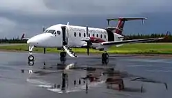
The Williams Lake Airport is located 4.2 nautical miles (7.8 km; 4.8 mi)[37] northeast of the city. It was opened in 1956 by Transport Canada and on January 1, 1997 the ownership of the airport was transferred to the City of Williams Lake. The airport is served by Pacific Coastal Airlines, and Central Mountain Air with daily flights to Vancouver. There was a small seaplane base at Williams Lake Water Aerodrome but it is no longer in operation.
Local attractions
Williams Lake Stampede
Held annually, on the Canada Day long weekend, the Williams Lake Stampede features Canadian Professional Rodeo Association[38] action including bull riding, barrel racing, Bareback riding, tie-down roping, steer wrestling, team roping and chuckwagon races. The Williams Lake Stampede plays host to many top cowboys and international rodeo competitors from Canada and the United States, most of which continue on the circuit to the Calgary Stampede, the following weekend.
The Stampede festivities also include a parade of floats from local organizations, such as 4-H groups, native bands, community service groups, the stampede royalty and local merchants. There is also a carnival with rides and games located near the stampede grounds.
Scout Island
Scout Island, which is 9.69 ha (23.9 acres) in size, is both a park and a nature area. It consists of a beach, picnic area, boat launch and several trails through mainly natural environment. Scout Island is actually two islands that are connected to the west end of Williams Lake by a causeway.
Located on the island is the Nature House, which provides a view of the marsh next to the island. It is run by the Williams Lake Field Naturalists and provides information, displays and programs dealing with the local environment.
The island is leased to Williams Lake by the owners, the Nature Trust of British Columbia.[39]
Media
Television
- Shaw TV – local Community Access Channel (only available on Shaw Cable)
Radio
- AM 570 – CKWL, Country, "Country 570" formerly "The Wolf"
- FM 97.5 – CFFM-FM, Rock, "The GOAT," formerly "The Rush" and earlier "The Max".
- "The Goat" and "Country 570" are owned by Vista Radio and use www.MyCaribooNow.com website
- FM 92.1 – CBYK, CBC Radio One
- FM 94.3 – CISK Sikh Radio
- FM 95.1 – VOAR Christian Radio (broadcasting from Newfoundland)
- FM 96.1 – VF2235, First Nations community radio, "Canadian First Nations Radio or CFNR"
- FM 100.7 – CJLJ-FM, community radio[40]
Other radio services
There was a Loran-C station at Williams Lake.
Publications
- Williams Lake Tribune[41] (owned by Black Press)
- Cariboo Advisor[42] (owned by Black Press)
- Welcome to Williams Lake[43] local news site
Notable people
- Rick Hansen - athlete and disabilities activist
- Trevor Mack - filmmaker
- Carey Price - hockey player
- Kayla Moleschi - rugby player, Olympian
- Amrik Virk - politician, government official
Surrounding communities
Places adjacent to Williams Lake, British Columbia | ||||||||||
|---|---|---|---|---|---|---|---|---|---|---|
| ||||||||||
Bibliography
- Cariboo-Chilcotin Pioneer People and Places Irene Stangoe ISBN 1-895811-12-0
References
- Canada, Government of Canada, Statistics. "Statistics Canada: 2011 Census Profile". www12.statcan.gc.ca. Retrieved January 8, 2018.
- "Facts & Figures - Williams Lake, BC - Official Website". www.williamslake.ca. Retrieved January 8, 2018.
- "Population and dwelling counts, 2016 Census". Statistics Canada. Retrieved October 28, 2019.
- "Williams Lake". GoldRushTrail.ca. Retrieved October 28, 2019.
- Stangoe, Irene (1994). Cariboo Chilcotin Pioneer People and Places. Heritage House. p. 32. ISBN 1-895811-12-0.
- T'exelc. "Williams Lake Indian Band". T'exelc. Retrieved February 13, 2018.
- Stangoe, Irene (1994). Cariboo Chilcotin Pioneer People and Places. Heritage House. pp. 10–14. ISBN 1-895811-12-0.
- "The Colonial Period 1858–1871". Royal BC Museum. Archived from the original on May 20, 2013. Retrieved July 7, 2014.
- Hello BC -- Cariboo Chilcotin Coast. "Railway History". An overview of railway history in the Cariboo Chilcotin Coast region, including the building of the Pacific Great Eastern from Vancouver to Fort Nelson. Destination BC Corp. Retrieved February 14, 2018.
- "Legacy plans set". Williams Lake Tribune. 83 (34): 1–2. April 25, 2013. Retrieved September 23, 2020.
- Darlington, Esther (July 10, 2013). "The tainted legacy of St. Joseph's Mission". Ashcroft-Cache Creek Journal. Retrieved September 23, 2020.
- Birchwater, Sage (June 14, 2016). "Indian residential schools: Canada's sad legacy". Williams Lake Tribune. Black Press Media. Retrieved September 23, 2020.
- Dyok, Rebecca (June 28, 2019). "New Museum Exhibit Showcases St. Joseph's Mission Residential School". My Cariboo Now. Retrieved September 23, 2020.
- "Orange Shirt Day". Indian Residential School History and Dialogue Centre. University of British Columbia. Retrieved September 23, 2020.
- Duran, Estefania. "B.C. year in review 2017: wildfires devastate the province like never before". BC Year in Review 2017 Wildfires. Global News. Retrieved February 13, 2018.
- "File Not Found". www12.statcan.ca. Retrieved January 8, 2018.
- Not including Frisians or Flemish
- May include Sami and Kven
- "Community Profiles from the 2011 Census, Statistics Canada – Census Subdivision". 2.statcan.gc.ca. December 6, 2010. Archived from the original on July 7, 2014. Retrieved April 13, 2013.
- "Aboriginal Peoples – Data table". 2.statcan.ca. October 6, 2010. Archived from the original on September 28, 2013. Retrieved April 13, 2013.
- "1969 Casual Country: An industry comes of age". Williams Lake Tribune. Black Press Media. July 12, 2018. Retrieved December 18, 2020.
- "Tolko, Lakeview, Williams Lake". Tolko. Retrieved December 18, 2020.
- "Williams Lake Lumber". West Fraser. Retrieved December 18, 2020.
- Tremblay, Richard (May 10, 2018). "Gibraltar Mine celebrates people in mining". Williams Lake Tribune. Black Press Media. Retrieved December 18, 2020.
- "January 1943". Environment Canada. Retrieved April 23, 2016.
- "July 1941". Environment Canada. Retrieved April 23, 2016.
- Canada, Environment and Climate Change. "Canadian Climate Normals 1981-2010 Station Data - Climate - Environment and Climate Change Canada". climate.weather.gc.ca. Retrieved January 8, 2018.
- Canada, Environment and Climate Change. "Canadian Climate Normals 1981-2010 Station Data - Climate - Environment and Climate Change Canada". climate.weather.gc.ca. Retrieved January 8, 2018.
- "Canadian Climate Normals 1981–2010 Station Data – Williams Lake River". Environment Canada. Retrieved July 7, 2014.
- "Williams Lake". Environment Canada. Retrieved April 23, 2016.
- Daily Data Report for August 2018 - Climate - Environment and Climate Change Canada
- "Canadian Climate Normals 1981–2010 Station Data – Williams Lake Airport". Environment Canada. Retrieved July 7, 2014.
- School information – District 027 – Cariboo-Chilcotin, British Columbia Ministry of Education, 2011-09-30. Retrieved 2012-05-07.
- School district profile, British Columbia Ministry of Education. Retrieved 2012-05-07.
- Thompson Rivers University. "Williams Lake Campus: Thompson Rivers University". Thompson Rivers University Williams Lake Campus. Retrieved February 14, 2018.
- Cariboo Chilcotin Elder College. "Cariboo Chilcotin Elder College". Cariboo Chilcotin Elder College. Retrieved February 14, 2018.
- Canada Flight Supplement. Effective 0901Z 16 July 2020 to 0901Z 10 September 2020.
- "Rodeo Canada - Official Home of the Canadian Professional Rodeo Association". www.rodeocanada.com. Retrieved January 8, 2018.
- "Scout Island - Williams Lake, BC - Official Website". www.williamslake.ca. Retrieved January 8, 2018.
- (CRTC), Government of Canada, Canadian Radio-television and Telecommunications Commission. "ARCHIVED - Developmental community radio station in Williams Lake". www.crtc.gc.ca. Retrieved January 8, 2018.
- "Home - Williams Lake Tribune". Williams Lake Tribune. Retrieved January 8, 2018.
- "Home - Williams Lake Tribune". Williams Lake Tribune. Retrieved January 8, 2018.
- marketing, Williams Lake web design and social media. "Social media marketing and web design Williams Lake". www.welcometowilliamslake.ca. Retrieved January 8, 2018.
Notes
- Extreme high and low temperatures are from the Williams Lake climate station (January 1939 to August 1947), and Williams Lake River (August 1980 to June 2002).
External links
| Wikimedia Commons has media related to Williams Lake, British Columbia. |
| Subdivisions | 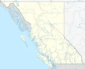 | |
|---|---|---|
| Communities | ||
| Metro areas and agglomerations | ||
| Cities |
| |
| ||