Woodland, Minnesota
Woodland is a city in Hennepin County, Minnesota, United States, with lake shore property on Lake Minnetonka. The population was 437 at the 2010 census.[6] The first settlers arrived in 1857, when Woodland was part of Minnetonka Township. The land was formally platted in 1882 and developed through the 1890s. Woodland was incorporated as the independent village of Maplewoods in December 1948. It was renamed "Woodland" in 1949.[7]
Woodland | |
|---|---|
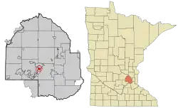 Location of Woodland within Hennepin County, Minnesota | |
| Coordinates: 44°57′6″N 93°30′32″W | |
| Country | United States |
| State | Minnesota |
| County | Hennepin |
| Incorporated | 1948 |
| Government | |
| • Mayor | Vince Suerth |
| Area | |
| • Total | 1.17 sq mi (3.02 km2) |
| • Land | 0.58 sq mi (1.49 km2) |
| • Water | 0.59 sq mi (1.53 km2) |
| Elevation | 951 ft (290 m) |
| Population | |
| • Total | 437 |
| • Estimate (2019)[3] | 486 |
| • Density | 843.75/sq mi (325.89/km2) |
| Time zone | UTC-6 (Central (CST)) |
| • Summer (DST) | UTC-5 (CDT) |
| ZIP code | 55391 |
| Area code(s) | 952 |
| FIPS code | 27-71500[4] |
| GNIS feature ID | 0654355[5] |
| Website | www.cityofwoodlandmn.org |
Geography
According to the United States Census Bureau, the city has a total area of 0.62 square miles (1.61 km2), of which 0.58 square miles (1.50 km2) is land and 0.04 square miles (0.10 km2) is water.[8] County 101 serves as a main route.
Demographics
| Historical population | |||
|---|---|---|---|
| Census | Pop. | %± | |
| 1950 | 411 | — | |
| 1960 | 449 | 9.2% | |
| 1970 | 544 | 21.2% | |
| 1980 | 526 | −3.3% | |
| 1990 | 496 | −5.7% | |
| 2000 | 480 | −3.2% | |
| 2010 | 437 | −9.0% | |
| 2019 (est.) | 486 | [3] | 11.2% |
| U.S. Decennial Census[9] | |||
2010 census
As of the census[2] of 2010, there were 437 people, 169 households, and 138 families living in the city. The population density was 753.4 inhabitants per square mile (290.9/km2). There were 189 housing units at an average density of 325.9 per square mile (125.8/km2). The racial makeup of the city was 98.2% White, 0.2% African American, 0.5% Asian, 0.2% from other races, and 0.9% from two or more races. Hispanic or Latino of any race were 2.3% of the population.
There were 169 households, of which 29.6% had children under the age of 18 living with them, 74.6% were married couples living together, 4.7% had a female householder with no husband present, 2.4% had a male householder with no wife present, and 18.3% were non-families. 16.0% of all households were made up of individuals, and 7.1% had someone living alone who was 65 years of age or older. The average household size was 2.59 and the average family size was 2.89.
The median age in the city was 51.8 years. 22.9% of residents were under the age of 18; 4.9% were between the ages of 18 and 24; 11.4% were from 25 to 44; 41.9% were from 45 to 64; and 18.8% were 65 years of age or older. The gender makeup of the city was 49.7% male and 50.3% female.
2000 census
As of the census[4] of 2000, there were 480 people, 173 households, and 144 families living in the city. The population density was 840.7 people per square mile (325.1/km2). There were 188 housing units at an average density of 329.3 per square mile (127.3/km2). The racial makeup of the city was 97.71% White, 0.42% Asian, 0.62% from other races, and 1.25% from two or more races. Hispanic or Latino of any race were 1.04% of the population.
There were 173 households, out of which 38.7% had children under the age of 18 living with them, 76.3% were married couples living together, 5.8% had a female householder with no husband present, and 16.2% were non-families. 13.3% of all households were made up of individuals, and 4.0% had someone living alone who was 65 years of age or older. The average household size was 2.77 and the average family size was 3.06.
In the city, the population was spread out, with 28.1% under the age of 18, 5.0% from 18 to 24, 18.3% from 25 to 44, 36.7% from 45 to 64, and 11.9% who were 65 years of age or older. The median age was 44 years. For every 100 females, there were 92.8 males. For every 100 females age 18 and over, there were 93.8 males.
The median income for a household in the city was $153,881, and the median income for a family was $175,000. Males had a median income of $100,000 versus $46,250 for females. The per capita income for the city was $95,495. About 3.8% of families and 4.6% of the population were below the poverty line, including 6.4% of those under age 18 and none of those age 65 or over.
References
- "2019 U.S. Gazetteer Files". United States Census Bureau. Retrieved July 26, 2020.
- "U.S. Census website". United States Census Bureau. Retrieved 2012-11-13.
- "Population and Housing Unit Estimates". United States Census Bureau. May 24, 2020. Retrieved May 27, 2020.
- "U.S. Census website". United States Census Bureau. Retrieved 2008-01-31.
- "US Board on Geographic Names". United States Geological Survey. 2007-10-25. Retrieved 2008-01-31.
- "2010 Census Redistricting Data (Public Law 94-171) Summary File". American FactFinder. U.S. Census Bureau, 2010 Census. Retrieved 23 April 2011.
- https://woodlandmn.org/woodland-history/
- "US Gazetteer files 2010". United States Census Bureau. Retrieved 2012-11-13.
- "Census of Population and Housing". Census.gov. Retrieved June 4, 2015.
Municipalities and communities of Hennepin County, Minnesota, United States | ||
|---|---|---|
| Cities |
| 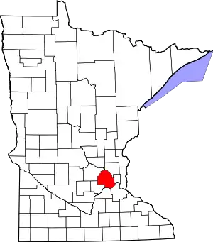 Map of Minnesota highlighting Hennepin County |
| Unincorporated areas | ||
| Footnotes | ‡This populated place also has portions in an adjacent county or counties | |
| ||