Xiangning County
Xiangning County (simplified Chinese: 乡宁县; traditional Chinese: 鄉寧縣; pinyin: Xiāngníng Xiàn; lit. 'countryside peace') is a county in the southwest of Shanxi province, China, bordering Shaanxi province across the Yellow River to the west.[1] It is under the administration of the prefecture-level city of Linfen.[1][2] The county spans an area of 2,029 square kilometres (783 sq mi),[2] and is home to a population of 240,000 people as of 2013.[1]
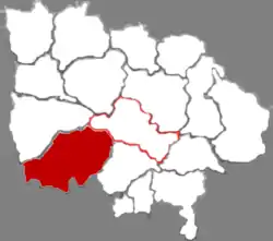
Xiangning County
乡宁县 Siangning | |
|---|---|
.jpg.webp) | |
 | |
| Country | People's Republic of China |
| Province | Shanxi |
| Prefecture-level city | Linfen |
| Area | |
| • Total | 2,029 km2 (783 sq mi) |
| Population (2013) | |
| • Total | 240,000 |
| • Density | 120/km2 (310/sq mi) |
| Time zone | UTC+8 (China Standard) |
| Website | xiangning.gov.cn |
History
During the Spring and Autumn period, Marquis E of Jin lived in what is now present-day Xiangning County.[2]
In the Warring States period, the area had been occupied by both the Han and Zhao states.[2]
During the Northern Wei Dynasty, the area was initially named Changping (Chinese: 昌平), and was later changed to Pingchang (Chinese: 平昌).[2] Eventually, the name was changed to Changning (simplified Chinese: 昌宁; traditional Chinese: 昌寧), but in 923 was changed to Xiangning (simplified Chinese: 乡宁; traditional Chinese: 鄉寧), its present-day name.[2]
From 1958 to 1961, Xiangning County was briefly merged with neighboring Ji County.[2]
Geography
The county is located in the Lüliang Mountains of the Loess Plateau, and has a largely hilly terrain with an average elevation of about 900 metres (3,000 ft).[1] The county's highest point is Gaotian Mountain (Chinese: 高天山), which reaches 1,820.5 metres (5,973 ft) in altitude; the county's lowest point is along the banks of the Yellow River, at 385.1 metres (1,263 ft) in altitude.[2]
38.2% of the county is forested.[2]
Administrative divisions
Xiangning County is divided into five towns and five townships.[3] These are then divided into 182 village-level divisions.[2]
The county's five towns are Changning, Guanghua, Taitou, Guantou, and Xibo.[3]
The county's five townships are Shuanghe Township, Guanwangmiao Township, Weizhuang Township, Xijiaokou Township, and Zaoling Township.[3]
Economy
The county is home to a large coal field, which covers 1,600 square kilometres (620 sq mi) of the county's area.[2] Said coal field is estimated to have 15.3 billion tons of coal in reserve.[2]
Xiangning also has a number of tourist sights, such as the Xiangning Thousand Buddha Cave, Yunqiu Mountain (simplified Chinese: 云丘山; traditional Chinese: 雲丘山), and a number of temples and pagodas.[2]
Major agricultural products from Xiangning include Zanthoxylum, apples, walnuts, Chinese yams, Elaeagnus mollis, and wine.[2]
Transportation
National Highway 209 and National Highway 309 both run through the county, as well as three provincial highways.[2]
References
- 乡宁县概况地图. xzqh.org (in Chinese). 2016-10-18. Archived from the original on 2019-05-13. Retrieved 2020-11-26.
- 乡宁县情概况 (in Chinese). Xiangning County People's Government. 2017-09-28. Archived from the original on 2020-10-11. Retrieved 2020-11-26.
- 2020年统计用区划代码 (in Chinese). National Bureau of Statistics of China. 2020. Archived from the original on 2020-11-26. Retrieved 2020-11-26.