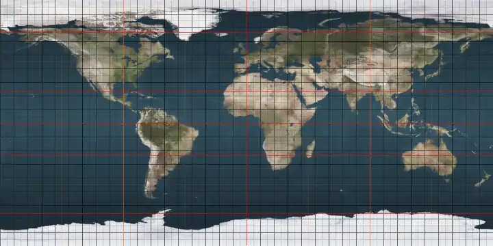
115th meridian west

The meridian 115° west of Greenwich is a line of longitude that extends from the North Pole across the Arctic Ocean, North America, the Pacific Ocean, the Southern Ocean, and Antarctica to the South Pole.

115°
115th meridian west

The 115th meridian west forms a great circle with the 65th meridian east.

Between the equator and the 60th parallel south it forms the eastern boundary of the South Pacific Nuclear-Weapon-Free Zone and the western boundary of the Latin American Nuclear-Weapon-Free Zone.

From Pole to Pole

Starting at the North Pole and heading south to the South Pole, the 115th meridian west passes through:

Co-ordinates Country, territory or sea Notes
90°0′N 115°0′W Arctic Ocean
77°58′N 115°0′W  Canada Northwest TerritoriesBrock Island
77°55′N 115°0′W Ballantyne Strait
77°19′N 115°0′W Unnamed waterbody Passing just west of Emerald Isle, Northwest Territories,  Canada at 76°47′N 114°50′W
76°28′N 115°0′W  Canada Northwest TerritoriesMelville Island
74°58′N 115°0′W M'Clure Strait
73°18′N 115°0′W  Canada Northwest TerritoriesVictoria Island
70°36′N 115°0′W Prince Albert Sound
70°17′N 115°0′W  Canada Northwest TerritoriesVictoria Island
Nunavut — from 70°0′N 115°0′W on Victoria Island
68°52′N 115°0′W Dolphin and Union Strait
70°17′N 115°0′W  Canada Nunavut - mainland
68°10′N 115°0′W Coronation Gulf
67°48′N 115°0′W  Canada Nunavut
Northwest Territories — from 66°16′N 115°0′W, passing through the Great Slave Lake
Alberta — from 60°0′N 115°0′W
British Columbia — from 50°34′N 115°0′W
49°0′N 115°0′W  United States Montana
Idaho — from 46°58′N 115°0′W
Nevada — from 42°0′N 115°0′W, passing just east of Las Vegas at 36°10′N 115°8′W
California — from 35°17′N 115°0′W
32°42′N 115°0′W  Mexico Baja California
Sonora — for about 12 km from 32°18′N 115°0′W
Baja California — from 32°11′N 115°0′W
Sonora — for about 2 km from 31°59′N 115°0′W
Baja California — from 31°56′N 115°0′W
29°23′N 115°0′W Pacific Ocean Sebastián Vizcaíno Bay, passing just east of Cedros Island,  Mexico at 38°10′N 115°9′W
27°50′N 115°0′W  Mexico Baja California Sur
27°43′N 115°0′W Pacific Ocean Passing just west of Clarion Island,  Mexico at 18°21′N 114°47′W
60°0′S 115°0′W Southern Ocean
74°2′S 115°0′W Antarctica Unclaimed territory

See also

This article is issued from Wikipedia. The text is licensed under Creative Commons - Attribution - Sharealike. Additional terms may apply for the media files.