30th parallel north

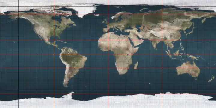
The 30th parallel north is a circle of latitude that is 30 degrees north of the Earth's equatorial plane. It stands one-third of the way between the equator and the North Pole and crosses Africa, Asia, the Pacific Ocean, North America and the Atlantic Ocean.

30°
30th parallel north

It is the approximate southern border of the horse latitudes in the Northern Hemisphere, meaning that much of the land area touching the 30th parallel is arid or semi-arid. If there is a source of wind from a body of water the area would more likely be humid subtropical.

At this latitude the sun is visible for 14 hours, 5 minutes during the summer solstice and 10 hours, 13 minutes during the winter solstice, and the nighttime duration lasts 9 hours, 55 minutes during the summer solstice and 13 hours, 47 minutes during the winter solstice.[1] On 21 June, the maximum altitude of the sun is 83.44 degrees and 36.56 degrees on 21 December.

At this latitude:

  • One degree of longitude = 96.49 km or 59.95 mi
  • One minute of longitude = 1.61 km or 1.00 mi
  • One second of longitude = 26.80 m or 87.93 ft

Around the world

Starting at the Prime Meridian and heading eastwards, the parallel 30° north passes through:

Co-ordinates Country, territory or sea Notes
30°0′N 0°0′E  Algeria
30°0′N 9°28′E  Libya
30°0′N 24°56′E  Egypt Passing just south of Cairo
30°0′N 34°32′E  Israel Passing just north of Kibbutz Lotan
30°0′N 35°11′E  Jordan
30°0′N 38°0′E  Saudi Arabia Passing through Sakakah
30°0′N 43°38′E  Iraq
30°0′N 47°9′E  Kuwait Mainland and Warbah Island
30°0′N 48°9′E Persian Gulf
30°0′N 48°16′E  Iraq
30°0′N 48°27′E  Iran
30°0′N 48°40′E Persian Gulf
30°0′N 49°33′E  Iran For about 2 km
30°0′N 49°34′E Persian Gulf
30°0′N 50°9′E  Iran
30°0′N 61°0′E  Afghanistan
30°0′N 66°19′E  Pakistan Balochistan
Punjab
30°0′N 73°33′E  India Rajasthan
Punjab
Haryana
Uttar Pradesh
Uttarakhand
30°0′N 80°43′E    Nepal
30°0′N 82°30′E  People's Republic of China Tibet
Sichuan
Chongqing
Hubei
Hunan
Hubei
Anhui
Jiangxi
Anhui
Zhejiang — passing just north of Ningbo
30°0′N 121°38′E East China Sea Hangzhou Bay
30°0′N 121°50′E  People's Republic of China Zhejiang (islands of Jintang, Zhoushan and Mount Putuo)
30°0′N 122°24′E East China Sea Hangzhou Bay
30°0′N 129°55′E  Japan Island of Kuchinoshima
30°0′N 129°55′E Pacific Ocean
30°0′N 115°48′W  Mexico Baja California
30°0′N 114°32′W Gulf of California
30°0′N 112°44′W  Mexico Sonora
Chihuahua
30°0′N 104°41′W  United States Texas — passes through Houston as well as through the George Bush Intercontinental Airport
Louisiana — passes through New Orleans[2]
30°0′N 89°27′W Gulf of Mexico
30°0′N 88°50′W  United States Louisiana - Chandeleur Islands
30°0′N 88°50′W Gulf of Mexico
30°0′N 85°30′W  United States Florida
30°0′N 84°22′W Gulf of Mexico Apalachee Bay
30°0′N 83°51′W  United States Florida — passes just north of St. Augustine
30°0′N 81°19′W Atlantic Ocean
30°0′N 16°02′W  Portugal Passes just south of the Savage Islands
30°0′N 9°43′W  Morocco
30°0′N 5°8′W  Algeria

See also

References

This article is issued from Wikipedia. The text is licensed under Creative Commons - Attribution - Sharealike. Additional terms may apply for the media files.